Local events in Mount Vernon
16 events in the next 90 days from 4 public calendars. All local events in Mount Vernon
Checked October 20; the events page is refreshed daily.
Deep dives about Mount Vernon
Long reads built from maps, newspapers and public records. All deep dives
Notable people from Mount Vernon
Ohioans tied to this place, each with a sourced profile. All notable Ohioans
History from Mount Vernon
People and inventions tied to this place, each with its sources. All people · All inventions
How Mount Vernon began
Mount Vernon was laid out in 1805 by Joseph Walker, Thomas B. Patterson and Benjamin Butler on the Kokosing River (then called Owl Creek), and named for George Washington's Virginia estate. It became the seat of newly formed Knox County in 1808, grew as a mill town and later a Pennsylvania Railroad junction, and by the late 1800s and 1900s was a manufacturing center for glass (PPG's Works #11) and, since the mid-20th century, natural-gas compressors (Ariel Corporation). It is the birthplace and burial place of Daniel Decatur Emmett, composer of "Dixie," and home to the restored 1851 Woodward Opera House, said to be the oldest surviving 19th-century theater of its kind in the country. Today Mount Vernon (population about 17,000) is a regional retail and manufacturing hub anchored by Ariel Corporation, Mount Vernon Nazarene University, and Ariel-Foundation Park, built on the old glassworks site along the Kokosing.
Settled 1805, platted 1805, incorporated February 22, 1830; incorporated anew as a town by an act of February 26, 1845, by Joseph Walker, Thomas B. Patterson and Benjamin Butler.
Where the name comes from
The town was named for Mount Vernon, George Washington's Virginia estate on the Potomac River, following a pattern common among Ohio's early-1800s settlements.
Before the town
The Kokosing River that runs through Mount Vernon was known to Euro-American settlers as Owl Creek; the older name Kokosing derives from an Algonquian-language word for "river of little owls," reflecting long Native use of the valley. The Owl Creek Trail (also called the Old War Trace), used chiefly by Wyandot and Delaware (Lenape) travelers through the 1700s and early 1800s, ran along the creek/river corridor connecting the Upper Sandusky area through Caledonia, Mount Gilead and Fredericktown to Mount Vernon and on to Newcomerstown by way of the Walhonding (White Woman) River. Prehistoric mound-building people, identified by archaeologists as belonging to the Adena culture (roughly 800 BC to AD 100), left at least three earthworks recorded in Knox County; the best documented, McLaughlin Mound (also called Cemetery Mound), sits inside Mound View Cemetery on the edge of Mount Vernon. It is about 5.5 feet high and 75 feet across; a 19th-century excavation found a skeleton with a copper crescent at the neck, bear teeth along one arm, and shell ornaments at the hips, along with burned bone consistent with the Adena practice of cremating remains inside a wooden structure before covering it with earth. No specific historic Native village site within the city limits of Mount Vernon itself is documented in the sources checked; land in this part of Knox County passed to the United States under the Treaty of Greenville (1795) and subsequent cessions covering the Ohio interior, opening it to survey and settlement by 1805.
Nations recorded here: Wyandot, Lenape (Delaware), Adena culture.
- McLaughlin Mound (Cemetery Mound) (mound) — Mound View Cemetery, Mount Vernon, Adena culture, roughly 800 BC to AD 100 (en.wikipedia.org)
- Owl Creek Trail (Old War Trace) (trail) — along Owl Creek/Kokosing River, through Mount Vernon toward Upper Sandusky and Newcomerstown, 18th century to early 19th century (hmdb.org)
Timeline
- — The Treaty of Greenville cedes most of the future Knox County area to the United States, opening it to eventual survey and settlement.
- — Joseph Walker, Thomas B. Patterson and Benjamin Butler lay out the town of Mount Vernon on the Kokosing (Owl Creek), naming it for George Washington's estate.
- — Knox County is organized, named for Revolutionary War general and first U.S. Secretary of War Henry Knox, with Mount Vernon as county seat.
- — Daniel Decatur Emmett, future composer of "Dixie," is born in Mount Vernon on October 29.
- — Mount Vernon attorney Henry Curtis encourages his friend Bishop Philander Chase to bring Kenyon College from Worthington to the countryside that becomes Gambier.
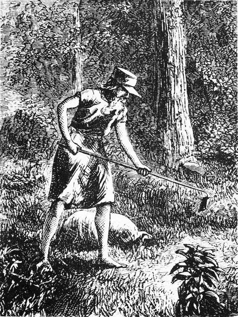
- — John Chapman ("Johnny Appleseed"), who had held property in the area, sells his local land and moves further west.
- — Mount Vernon is incorporated (February 22).
- — The Woodward Opera House, built by Dr. Ebenezer Woodward, opens in December with a lecture on electricity; it later hosts performers including the Snowden Family and Dan Emmett, and speakers including Governor William McKinley.
- — The Knox County Courthouse, a Greek Revival building, is completed on High Street.
- — The first train on what becomes the Pennsylvania Railroad runs through Mount Vernon, on the Columbus, Akron & Cleveland line.
- — McLaughlin (Cemetery) Mound is excavated, revealing a burial with copper, bear-tooth and shell ornaments and evidence of ceremonial burning typical of Adena practice.
- — Daniel Decatur Emmett dies in Mount Vernon on June 28 and is buried in Mound View Cemetery.
- — Pittsburgh Plate Glass (PPG) builds its Works #11 glass plant on the Kokosing River in Mount Vernon; the same year, the C.A.&C. railroad depot on South Main Street (later the Pennsylvania Depot) is built.
- — A major flood in January forces the evacuation of about 500 homes in Mount Vernon and causes roughly $5 million in damage.
- — The PPG glass plant on the Kokosing closes after about 40 years of operation, leaving its brick structures to stand vacant.
- — McLaughlin Mound and the C.A.&C./Pennsylvania Depot are both listed on the National Register of Historic Places.
- — The Woodward Opera House is listed on the National Register of Historic Places, spurring a restoration effort that begins in earnest in 1994.
- — The Ariel Foundation, funded by Ariel Corporation, purchases the former 75-acre PPG glassworks site, leading to creation of Ariel-Foundation Park (opened 2015) and its renaming.
- — The restored Woodward Opera House reopens February 9 after a roughly $22.5 million restoration, with a concert by Kathy Mattea.
Stories
The Mount Vernon man who wrote the Confederacy's anthem
Daniel Decatur Emmett was born in Mount Vernon in 1815 and spent much of his life touring as a blackface minstrel performer, eventually co-founding the Virginia Minstrels. In 1859, while working in New York for Bryant's Minstrels, he wrote "Dixie's Land," a walk-around tune meant as show-closing entertainment. Within two years the song had been adopted across the South as an unofficial Confederate anthem, an outcome the lifelong Ohio Unionist never intended and reportedly regretted. Emmett eventually returned to his hometown, retiring there in 1888 and dying in Mount Vernon in 1904 at age 88. He was buried in Mound View Cemetery. He is remembered locally as a composer whose most famous work escaped his own politics and control.
The opera house that outlived the opera
Dr. Ebenezer Woodward built an opera house above street-level storefronts on Main and Vine Streets, opening it in December 1851 with a public lecture on electricity. Over the following decades it hosted touring performers, including the Snowden Family singers and Mount Vernon's own Dan Emmett, along with political speakers such as future president William McKinley while he served as Ohio's governor. Competition from motion-picture theaters drove the Woodward to close in the early 1920s, and the upper floors sat largely unused for the better part of a century while storefronts continued below. Its listing on the National Register of Historic Places in 1975 planted the idea of restoration, which gathered momentum with the 1994 formation of the Knox Partnership for Arts and Culture. A roughly $22.5 million restoration, drawing on state and federal grants along with local donors, brought the theater back into use, and it reopened in February 2019 with a concert by Grammy-winning singer Kathy Mattea — nearly 168 years after its first electricity lecture.
From glassworks to greenspace on the Kokosing
In 1907, Pittsburgh Plate Glass built its Works #11 plant on the banks of the Kokosing River in Mount Vernon, a massive brick complex that turned out glass products for roughly forty years. The plant closed permanently in the 1970s, and its buildings stood abandoned and crumbling for decades along the riverfront. Starting in 2012, Mount Vernon-based Ariel Corporation — the world's largest maker of separable reciprocating gas compressors — worked with the Community Foundation of Mount Vernon and Knox County to redevelop the site. The Ariel Foundation's purchase of the 75-acre former glassworks property in 2013 led to the 250-acre Ariel-Foundation Park, which opened in 2015 and folded in the old quarry pits as lakes, the brick smokestack as a climbable observation tower, and broken glass slag repurposed into a blue "River of Glass" installation. The park now bears the names of the two entities, industrial and philanthropic, that built and then remade the site.
Photographs
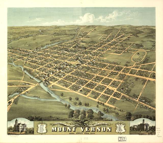
Photo: A. Ruger / Merchant's Lithographing Company; Library of Congress, public domain · Wikimedia Commons
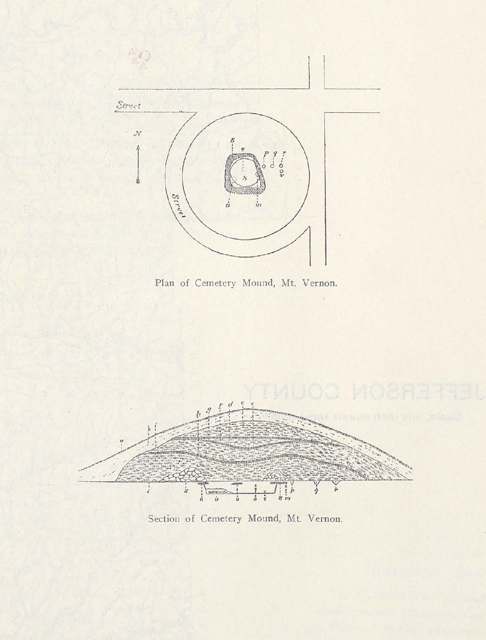
Photo: Ohio State Archeological and Historical Society / William C. Mills, public domain · Wikimedia Commons

Photo: Mark Spearman, CC BY 2.0 · Wikimedia Commons
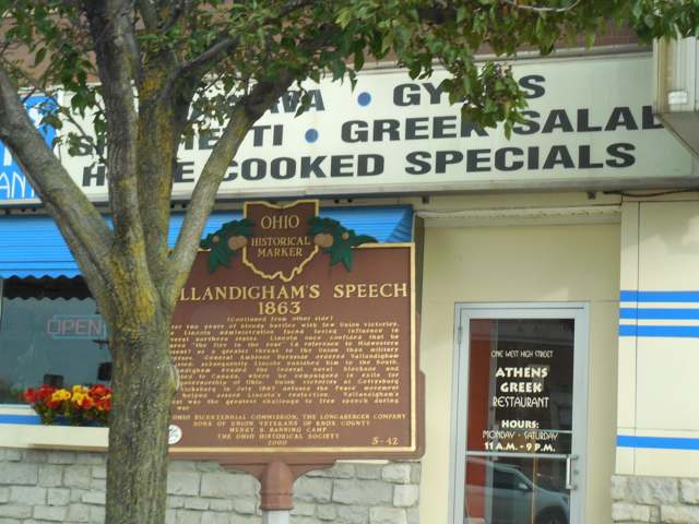
Photo: Doug Kerr, CC BY-SA 2.0 · Wikimedia Commons
Local history sources: en.wikipedia.org · en.wikipedia.org · en.wikipedia.org · en.wikipedia.org · en.wikipedia.org · en.wikipedia.org · knoxhistory.org · hmdb.org · thewoodward.org · historic-structures.com · atlasobscura.com · knoxpages.com · archive.org · commons.wikimedia.org · commons.wikimedia.org · commons.wikimedia.org · commons.wikimedia.org
Historic places
4 places in Mount Vernon on the National Register of Historic Places. Press a pin or a name for its whole record.
-
Knox County CourthouseBuilding · Mount Vernon · listed 1973
- Address
- High St.
- Where
- Mount Vernon, Knox County · ZIP 43050
- What it is
- Building
- Listed on the National Register
- 1973
- NRIS reference number
- 73001484
- Coordinates
- 40.39377, -82.48225
National Register file (NPS) ↗ Search Wikipedia ↗ Street map and directions ↗ On the Cracked Buckeye map
-
Pennsylvania DepotBuilding · Mount Vernon
- Address
- S. Main St.
- Where
- Mount Vernon, Knox County · ZIP 43050
- What it is
- Building
- Latest NPS certification action
- 1972
- NRIS reference number
- 09000100
- Coordinates
- 40.39057, -82.48683
National Register file (NPS) ↗ Search Wikipedia ↗ Street map and directions ↗ On the Cracked Buckeye map
-
Round HillBuilding · Mount Vernon · listed 1976
- Address
- E. Pleasant and N. McKenzie Sts.
- Where
- Mount Vernon, Knox County · ZIP 43050
- What it is
- Building
- Listed on the National Register
- 1976
- NRIS reference number
- 76001460
- Coordinates
- 40.39884, -82.48000
National Register file (NPS) ↗ Search Wikipedia ↗ Street map and directions ↗ On the Cracked Buckeye map
-
Woodward Opera HouseBuilding · Mount Vernon · listed 1975
- Address
- Main and Vine Sts.
- Where
- Mount Vernon, Knox County · ZIP 43050
- What it is
- Building
- Listed on the National Register
- 1975
- NRIS reference number
- 75001448
- Coordinates
- 40.39251, -82.48588
National Register file (NPS) ↗ Search Wikipedia ↗ Street map and directions ↗ On the Cracked Buckeye map
Source: National Park Service, National Register of Historic Places point file. The listing year is shown where NPS's certification date agrees with the listing's reference number. Listing recognizes significance; it does not restrict a private owner.
Water
Wells drawing groundwater from the buried-valley aquifer along the Kokosing River near Mount Vernon The water here
- Mount Vernon City99% of residentsBuried Valley Aquifer (Kokosing River valley wells)
- Colonial Terrace Mhc Llc0% of residentsGroundwater wells (2 wells)
- Westgate Mobile Home Community0% of residentsBuried Valley Aquifer (Kokosing River valley wells)
- Knox County Water and Wastewater0% of residentsGroundwater wells (4 wells)
- Grandview MHP A0% of residentsGroundwater wells (1 wells)
Hospitals, fire stations and more
Inside Mount Vernon's boundary: 1 hospital, 5 health centers, 2 dialysis centers, 2 nursing homes, 2 fire and EMS stations, 2 colleges, 1 high-hazard dam, 7 public schools, 2 private schools, 1 library, 3 museums, 2 police stations, 2 public charging sites, 6 Toxics Release Inventory facilities, 1 station or terminal and 10 spill cases. Press a pin or a name for its whole record and its source.
Hospitals (1)
-
Knox Community HospitalGeneral hospital · Mount Vernon
- What it is
- General hospital
- Address
- 1330 Coshocton Avenue, Mount Vernon, OH 43050
- County
- Knox County
- Beds
- 117
- Helipad
- Yes
- Ownership
- Non-profit
- Medicare overall rating
- 3 of 5 stars
- Emergency department (Medicare)
- Yes
- Phone
- (740) 393-9623
- Medicare ID
- 360040
Medicare Care Compare ↗ Where HIFLD got this record ↗ HIFLD hospitals (source) ↗ Street map and directions ↗
Source: HIFLD hospitals inventory via FEMA (closed hospitals it still lists left out, hospitals opened since added), with Medicare Care Compare ratings matched by name and address.
Community health centers (5)
-
Behavioral Health of Mount Vernon Health CenterHealth center · Mount Vernon
- Run by
- a federally qualified health center
- Setting
- Clinic
- City
- Mount Vernon
- Coordinates
- 40.39140, -82.48684
Find a Health Center (HRSA) ↗ HRSA data (source) ↗ Street map and directions ↗
-
KCCHC Administration SiteHealth center · Mount Vernon
- Run by
- a federally qualified health center
- Setting
- Clinic
- City
- Mount Vernon
- Coordinates
- 40.39285, -82.48818
Find a Health Center (HRSA) ↗ HRSA data (source) ↗ Street map and directions ↗
-
KCCHC Walk-In ClinicHealth center · Mount Vernon
- Run by
- a federally qualified health center
- Setting
- Clinic
- City
- Mount Vernon
- Coordinates
- 40.39403, -82.48830
Find a Health Center (HRSA) ↗ HRSA data (source) ↗ Street map and directions ↗
-
KCHD/KCCHC MainHealth center · Mount Vernon
- Run by
- a federally qualified health center
- Setting
- Clinic
- City
- Mount Vernon
- Coordinates
- 40.40382, -82.43649
Find a Health Center (HRSA) ↗ HRSA data (source) ↗ Street map and directions ↗
-
Mount Vernon Health CenterHealth center · Mount Vernon
- Run by
- a federally qualified health center
- Setting
- Clinic
- City
- Mount Vernon
- Coordinates
- 40.39281, -82.48841
Find a Health Center (HRSA) ↗ HRSA data (source) ↗ Street map and directions ↗
Source: HRSA health center service delivery sites, active, September 2026 (school-based sites left out). Health centers see patients whether or not they have insurance, with fees on a sliding scale.
Dialysis centers (2)
-
Davita Apple Valley DialysisDialysis · Mount Vernon
- Address
- 1485 Coshocton Road, Mount Vernon, OH 43050
- Dialysis stations
- 9
- Medicare star rating
- 3 of 5 stars
- Services
- in-center hemodialysis, peritoneal dialysis, home hemodialysis training
- Ownership
- for profit
- Chain
- DaVita
- Medicare certified since
- 2013-12-10
- Phone
- (740) 392-3436
- Medicare ID
- 362802
Medicare Care Compare ↗ CMS dialysis facility list (source) ↗ Street map and directions ↗
-
Fmc - Knox County Kidney CenterDialysis · Mount Vernon
- Address
- 14 Wood Lake Trail, Mount Vernon, OH 43050
- Dialysis stations
- 14
- Medicare star rating
- 4 of 5 stars
- Services
- in-center hemodialysis, peritoneal dialysis
- Ownership
- for profit
- Chain
- Fresenius Medical Care
- Medicare certified since
- 1998-05-11
- Phone
- (740) 393-1624
- Medicare ID
- 362599
Medicare Care Compare ↗ CMS dialysis facility list (source) ↗ Street map and directions ↗
Source: CMS dialysis facility list, September 2026, geocoded with the Census Bureau batch geocoder (an address it could not place sits at its ZIP center).
Nursing homes (2)
-
Country Club Retirement Center Abuse citation2 of 5 stars · Mount Vernon
- Address
- 1350 Yauger Road, Mount Vernon, OH 43050
- Certified beds
- 76
- Residents on an average day
- 70
- Medicare overall rating
- 2 of 5 stars
- Health inspections
- 2 of 5 stars
- Staffing
- 2 of 5 stars
- Quality measures
- 4 of 5 stars
- Penalties since 2023
- none
- Abuse citation (CMS icon)
- Yes
- Ownership
- For profit - Limited Liability company
- Chain
- COUNTRY CLUB REHABILITATION CAMPUS
- Continuing care retirement community
- Yes
- Takes
- Medicare and Medicaid
- Phone
- (740) 397-2350
- Medicare ID
- 365815
Medicare Care Compare ↗ CMS nursing home data (source) ↗ Street map and directions ↗
-
Ohio Eastern Star Hlth Care Ctr The2 of 5 stars · Mount Vernon
- Address
- 1451 Gambier Road, Mount Vernon, OH 43050
- Certified beds
- 86
- Residents on an average day
- 70
- Medicare overall rating
- 2 of 5 stars
- Health inspections
- 3 of 5 stars
- Staffing
- 1 of 5 stars
- Quality measures
- 3 of 5 stars
- Penalties since 2023
- none
- Ownership
- Non profit - Corporation
- Continuing care retirement community
- Yes
- Takes
- Medicare and Medicaid
- Phone
- (740) 397-1706
- Medicare ID
- 366076
Medicare Care Compare ↗ CMS nursing home data (source) ↗ Street map and directions ↗
Source: CMS Care Compare nursing home provider and penalties files; Medicare star ratings run 1 to 5.
Fire and EMS stations (2)
-
Mount Vernon Fire Department Station 491Mount Vernon
- Address
- 200 West Gambier Street, Mount Vernon, OH 43050
- Coordinates
- 40.39150, -82.48864
USGS National Map structures (source) ↗ Street map and directions ↗
-
Mount Vernon Fire Department Station 492Mount Vernon
- Address
- 215 Ames Street, Mount Vernon, OH 43050
- Coordinates
- 40.37380, -82.48179
USGS National Map structures (source) ↗ Street map and directions ↗
Source: USGS National Map structures (most Ohio records last updated 2019 to 2022), checked against the Columbus and Cleveland station lists. The department that answers a call is set by jurisdiction and mutual aid, not by distance.
Colleges (2)
-
Knox County Career CenterPublic career school · Mount Vernon
- What it is
- Public career school
- City
- Mount Vernon
- Students, 2023-24 (12-month count)
- 204
- IPEDS unit ID
- 375373
College Navigator (NCES) ↗ IPEDS data (source) ↗ Street map and directions ↗
-
Mount Vernon Nazarene UniversityPrivate nonprofit college · Mount Vernon
- What it is
- Private nonprofit college
- City
- Mount Vernon
- Students, 2023-24 (12-month count)
- 2,615
- Tuition and fees, in state
- $35,524
- Graduation rate
- 64% of bachelor's students, within six years (a class of 330)
- IPEDS unit ID
- 204194
College Navigator (NCES) ↗ IPEDS data (source) ↗ Street map and directions ↗
Source: NCES IPEDS 2024 directory, 2023-24 enrollment and tuition, graduation rates for the 2017 (four-year) and 2020 (two-year) entering classes.
High-hazard dams (1)
-
Knox Cattle Company Dam UnsatisfactoryTributary To Center Run · condition: unsatisfactory
- Hazard class
- High: a failure would probably cost a life
- Condition
- Unsatisfactory (assessed 03/13/2025)
- River or stream
- Tributary To Center Run
- Purpose
- Recreation
- Type
- Earth
- Height
- 20 ft
- Storage
- 30 acre-feet
- Completed
- 1945
- Owner type
- Private
- County
- Knox County
- Nearest town (NID)
- Mt. Vernon
- Last inspection
- 08/28/2024
- Emergency action plan
- No
- NID ID
- OH01856
National Inventory of Dams record ↗ National Inventory of Dams (source) ↗ Street map and directions ↗
Source: U.S. Army Corps of Engineers National Inventory of Dams, August 2026. "High hazard" rates what a failure would cost downstream, not how likely one is; the condition is the state's assessment.
Public schools (7)
-
Dan Emmett Elementary School4 of 5 stars · Mount Vernon
- Address
- 108 Mansfield Ave, Mount Vernon, OH 43050
- School district
- Mount Vernon City School District
- Kind (NCES)
- Regular School
- Students, 2023-24
- 251
- Teachers (full-time equivalent)
- 16.3
- Report card, 2025-26
- 4 of 5 stars
- Performance index
- 87.7%
- Ohio building IRN
- 008029
- NCES school ID
- 391001201352
NCES school record ↗ Ohio School Report Card ↗ Street map and directions ↗
-
East Elementary School5 of 5 stars · Mount Vernon
- Address
- 714 E Vine St, Mount Vernon, OH 43050
- School district
- Mount Vernon City School District
- Kind (NCES)
- Regular School
- Students, 2023-24
- 230
- Teachers (full-time equivalent)
- 13.7
- Report card, 2025-26
- 5 of 5 stars
- Performance index
- 94.6%
- Ohio building IRN
- 009258
- NCES school ID
- 391001201353
NCES school record ↗ Ohio School Report Card ↗ Street map and directions ↗
-
Knox County Career CenterMount Vernon
- Address
- 306 Martinsburg Rd, Mount Vernon, OH 43050
- Kind (NCES)
- Career and Technical School
- Students, 2023-24
- 470
- Teachers (full-time equivalent)
- 46
- NCES school ID
- 390511404070
-
Mount Vernon High School4 of 5 stars · Mount Vernon
- Address
- 300 Yellow Jacket Drive, Mount Vernon, OH 43050
- School district
- Mount Vernon City School District
- Kind (NCES)
- Regular School
- Students, 2023-24
- 990
- Teachers (full-time equivalent)
- 53.55
- Report card, 2025-26
- 4 of 5 stars
- Performance index
- 81.6%
- Four-year graduation rate
- 97.2%
- Ohio building IRN
- 025932
- NCES school ID
- 391001201356
NCES school record ↗ Ohio School Report Card ↗ Street map and directions ↗
-
Mount Vernon Middle School4 of 5 stars · Mount Vernon
- Address
- 302 Yellow Jacket Drive, Mount Vernon, OH 43050
- School district
- Mount Vernon City School District
- Kind (NCES)
- Regular School
- Students, 2023-24
- 836
- Teachers (full-time equivalent)
- 53.7
- Report card, 2025-26
- 4 of 5 stars
- Performance index
- 81.9%
- Ohio building IRN
- 061457
- NCES school ID
- 391001201357
NCES school record ↗ Ohio School Report Card ↗ Street map and directions ↗
-
Pleasant Street Elementary School3.5 of 5 stars · Mount Vernon
- Address
- 305 E Pleasant St, Mount Vernon, OH 43050
- School district
- Mount Vernon City School District
- Kind (NCES)
- Regular School
- Students, 2023-24
- 339
- Teachers (full-time equivalent)
- 20.3
- Report card, 2025-26
- 3.5 of 5 stars
- Performance index
- 77.2%
- Ohio building IRN
- 061465
- NCES school ID
- 391001201358
NCES school record ↗ Ohio School Report Card ↗ Street map and directions ↗
-
Twin Oak Elementary School4.5 of 5 stars · Mount Vernon
- Address
- 8888 Martinsburg Rd, Mount Vernon, OH 43050
- School district
- Mount Vernon City School District
- Kind (NCES)
- Regular School
- Students, 2023-24
- 375
- Teachers (full-time equivalent)
- 20.3
- Report card, 2025-26
- 4.5 of 5 stars
- Performance index
- 90.3%
- Ohio building IRN
- 040477
- NCES school ID
- 391001201359
NCES school record ↗ Ohio School Report Card ↗ Street map and directions ↗
Source: NCES EDGE public school locations 2024-25 and Common Core of Data 2023-24 (type, students, teachers); Ohio School Report Cards 2025-26 (Department of Education and Workforce), matched by name within the district.
Private schools (2)
-
Christian Star AcademyPrivate, conservative Christian · Mount Vernon
- Address
- 7 E Sugar St, Mount Vernon, OH 43050
- Kind
- conservative Christian
- Students, 2023-24
- 10
- Teachers (full-time equivalent)
- 1
- Students per teacher
- 10
- Phone
- (740) 393-0251
- NCES private school ID
- A9105173
-
St Vincent De Paul SchoolPrivate, Catholic · Mount Vernon
- Address
- 206 E Chestnut St, Mount Vernon, OH 43050
- Kind
- Catholic
- Students, 2023-24
- 179
- Teachers (full-time equivalent)
- 15.9
- Students per teacher
- 11.2579
- Phone
- (740) 393-3611
- NCES private school ID
- 01059701
Source: NCES Private School Survey 2023-24.
Public libraries (1)
-
Mt Vernon & Knox County, Public Library OfCentral library · Mt. Vernon
- Address
- 201 N. Mulberry St., Mt. Vernon, OH 43050
- What it is
- Central library
- Library system
- Mt Vernon & Knox County, Public Library Of
- Open
- 2,992 hours a year, 52 weeks
- Building
- 20,000 sq ft
- System's visits, FY2024
- 337,376
- System's loans, FY2024
- 392,438
- People the system serves
- 56,248
- Phone
- (740) 392-2665
IMLS Public Libraries Survey (source) ↗ Street map and directions ↗
Source: IMLS Public Libraries Survey FY2024 (outlets and their systems). Any Ohio resident can get a free card at any Ohio public library.
Museums, historical societies, gardens and zoos (3)
-
B&O Depot RestorationHistorical society · Mount Vernon
- What it is
- Historical society
- City
- Mount Vernon
- Coordinates
- 40.39264, -82.48418
Search Wikipedia ↗ IMLS Museum Data Files (source) ↗ Street map and directions ↗
The museum list is IMLS's 2018 file; a museum may have closed or moved since.
-
Schnormeier GalleryArt museum · Mount Vernon
- What it is
- Art museum
- City
- Mount Vernon
- Coordinates
- 40.37070, -82.47305
Search Wikipedia ↗ IMLS Museum Data Files (source) ↗ Street map and directions ↗
The museum list is IMLS's 2018 file; a museum may have closed or moved since.
-
Science Play-Space InitiativeScience or technology museum · Mount Vernon
- What it is
- Science or technology museum
- City
- Mount Vernon
- Coordinates
- 40.39102, -82.48599
Search Wikipedia ↗ IMLS Museum Data Files (source) ↗ Street map and directions ↗
The museum list is IMLS's 2018 file; a museum may have closed or moved since.
Source: IMLS Museum Data Files, 2018.
Police stations (2)
-
Knox County Sheriff's OfficeMount Vernon
- Address
- 11540 Upper Gilchrist Road, Mount Vernon, OH 43050
- Coordinates
- 40.40149, -82.43152
USGS National Map structures (source) ↗ Street map and directions ↗
-
Mount Vernon Police DepartmentMount Vernon
- Address
- 5 North Gay Street, Mount Vernon, OH 43050-3241
- Coordinates
- 40.39428, -82.48442
USGS National Map structures (source) ↗ Street map and directions ↗
Source: USGS National Map structures, police stations, corrected and completed by hand (September 2026). The department that answers a call is set by jurisdiction, not by distance.
Public EV charging (2)
-
MV PKG GARAGE GARAGE STATION12 Level 2 · Mount Vernon
- Address
- 40-49 Public Square, Mount Vernon, OH 43050
- Ports
- 2 Level 2
- Plugs
- J1772
- Network
- ChargePoint Network
- Hours
- 24 hours daily
- Phone
- 888-758-4389
Station Locator (NREL) ↗ Alternative Fuels Data Center (source) ↗ Street map and directions ↗
-
RE AT MV - PH1 PHASE 12 Level 2 · Mount Vernon
- Address
- 11810 Upper Gilchrist Rd, Mount Vernon, OH 43050
- Ports
- 2 Level 2
- Plugs
- J1772
- Network
- ChargePoint Network
- Hours
- 24 hours daily
- Phone
- 888-758-4389
Station Locator (NREL) ↗ Alternative Fuels Data Center (source) ↗ Street map and directions ↗
Source: NREL Alternative Fuels Data Center station list (May 2026), public and open stations, the posts at one address counted as one site.
Facilities reporting toxic releases (6)
-
Ajax-SuperiorToxics Release Inventory · Mount Vernon
- Address
- N Sandusky St, Mount Vernon, OH 43050
- County
- Knox County
- Status
- Reports to the Toxics Release Inventory (active)
- EPA program ID
- 43050JXSPRNORTH
- EPA registry ID
- 110008057397
EPA facility record ↗ EPA Facility Registry Service (source) ↗ Street map and directions ↗
-
American National Can Company - Mt. VernonToxics Release Inventory · Mount Vernon
- Address
- 201 West Madison Street, Mount Vernon, OH 43050
- County
- Knox County
- Status
- Reports to the Toxics Release Inventory (active)
- EPA program ID
- 43050MRCNNWESTM
- EPA registry ID
- 110009424382
EPA facility record ↗ EPA Facility Registry Service (source) ↗ Street map and directions ↗
-
Jervis B Webb CoToxics Release Inventory · Mount Vernon
- Address
- 11 Mount Vernon Avenue, Mount Vernon, OH 43050
- County
- Knox County
- Status
- Reports to the Toxics Release Inventory (active)
- EPA program ID
- 43050JRVSBMTVER
- EPA registry ID
- 110002109021
EPA facility record ↗ EPA Facility Registry Service (source) ↗ Street map and directions ↗
-
Kelsey-Hayes Co.Toxics Release Inventory · Mount Vernon
- Address
- 8405 Blackjack Rd., Mount Vernon, OH 43050
- County
- Knox County
- Status
- Reports to the Toxics Release Inventory (active)
- EPA program ID
- 43050KLSYHBLACK
- EPA registry ID
- 110002109030
EPA facility record ↗ EPA Facility Registry Service (source) ↗ Street map and directions ↗
-
Prestress Services Industries, Llc - Mount Vernon BranchToxics Release Inventory · Mount Vernon
- Address
- 410 Howard Stret, Mount Vernon, OH 43050
- County
- Knox County County
- Status
- Reports to the Toxics Release Inventory (open)
- EPA program ID
- 4305WPRSTR41HWA
- EPA registry ID
- 110063999259
EPA facility record ↗ EPA Facility Registry Service (source) ↗ Street map and directions ↗
-
Siemens Energy IncToxics Release Inventory · Mount Vernon
- Address
- 105 N Sandusky St, Mount Vernon, OH 43050
- County
- Knox County
- Status
- Reports to the Toxics Release Inventory (active)
- EPA program ID
- 43050RLLSR105NS
- EPA registry ID
- 110000381596
EPA facility record ↗ EPA Facility Registry Service (source) ↗ Street map and directions ↗
Source: EPA Facility Registry Service, Toxics Release Inventory reporters. Reporting a release is required of large users of listed chemicals; it is not by itself a violation.
Stations and terminals (1)
-
Knox Area TransitIntercity bus stop · Greyhound Lines
- What it is
- Intercity bus stop
- Operator
- Greyhound Lines
- City
- Mount Vernon
- Coordinates
- 40.38664, -82.48669
BTS Intermodal Passenger Connectivity Database (source) ↗ Street map and directions ↗
Source: BTS Intermodal Passenger Connectivity Database and National Transit Map (2025). Bus stops are counted on the card and drawn on the full map.
Spills reported since 2021 (10)
-
Sludge (Non-Sewage)2025-09-02 · Clinton Twp
- Reported
- 2025-09-02
- What spilled
- Sludge (Non-Sewage)
- Where
- Clinton Twp, Muskingum County
- Ohio EPA district office
- CDO
- Ohio EPA case number
- 2509EPA0001479
Ohio EPA spill reports (source) ↗ Street map and directions ↗
-
Oil Transformer Non Pcb2025-04-29 · Mount Vernon
- Reported
- 2025-04-29
- What spilled
- Oil Transformer Non Pcb
- Largest amount reported
- 26 gallons
- Where
- Mount Vernon, Knox County
- Ohio EPA district office
- CDO
- Ohio EPA case number
- 2504EPA0000660
Ohio EPA spill reports (source) ↗ Street map and directions ↗
-
Sand / Silica / Silicon Dioxide (Sio2)2024-03-24 · Mount Vernon
- Reported
- 2024-03-24
- What spilled
- Sand / Silica / Silicon Dioxide (Sio2)
- Where
- Mount Vernon, Knox County
- Ohio EPA district office
- CDO
- Ohio EPA case number
- 2403EPA0000459
Ohio EPA spill reports (source) ↗ Street map and directions ↗
-
Fuel Diesel / Diesel Fuel (Vehicle On Or Off Road)2023-11-02 · Mount Vernon
- Reported
- 2023-11-02
- What spilled
- Fuel Diesel / Diesel Fuel (Vehicle On Or Off Road)
- Largest amount reported
- 25 gallons
- Where
- Mount Vernon, Knox County
- Ohio EPA district office
- CDO
- Ohio EPA case number
- 2311EPA0001875
Ohio EPA spill reports (source) ↗ Street map and directions ↗
-
Chemical(S) Unk2023-03-28 · Mount Vernon
- Reported
- 2023-03-28
- What spilled
- Chemical(S) Unk
- Where
- Mount Vernon, Knox County
- Ohio EPA district office
- CDO
- Ohio EPA case number
- 2303EPA0000468
Ohio EPA spill reports (source) ↗ Street map and directions ↗
-
Lime Sludge / Lime Slurry2022-07-22 · Mount Vernon
- Reported
- 2022-07-22
- What spilled
- Lime Sludge / Lime Slurry
- Where
- Mount Vernon, Knox County
- Ohio EPA district office
- CDO
- Ohio EPA case number
- 2207EPA0001115
Ohio EPA spill reports (source) ↗ Street map and directions ↗
-
Material White Reached water2022-03-19 · Mount Vernon
- Reported
- 2022-03-19
- What spilled
- Material White
- Reached a waterway
- 99 - Unnamed
- Where
- Mount Vernon, Knox County
- Ohio EPA district office
- CDO
- Ohio EPA case number
- 2203EPA0000370
Ohio EPA spill reports (source) ↗ Street map and directions ↗
-
Sheen Rainbow / Hydrocarbon Reached water2022-02-17 · Mount Vernon
- Reported
- 2022-02-17
- What spilled
- Sheen Rainbow / Hydrocarbon
- Reached a waterway
- 42 - Kokosing River
- Where
- Mount Vernon, Knox County
- Ohio EPA district office
- CDO
- Ohio EPA case number
- 2202EPA0000184
Ohio EPA spill reports (source) ↗ Street map and directions ↗
-
Ferrous Chloride / Iron Chloride (Fecl2)2021-12-08 · Mount Vernon
- Reported
- 2021-12-08
- What spilled
- Ferrous Chloride / Iron Chloride (Fecl2)
- Largest amount reported
- 150 gallons
- Where
- Mount Vernon, Knox County
- Ohio EPA district office
- CDO
- Ohio EPA case number
- 2112EPA0001833
Ohio EPA spill reports (source) ↗ Street map and directions ↗
-
Oil Transformer Non Pcb2021-07-28 · Mount Vernon
- Reported
- 2021-07-28
- What spilled
- Oil Transformer Non Pcb
- Largest amount reported
- 60 gallons
- Where
- Mount Vernon, Knox County
- Ohio EPA district office
- CDO
- Ohio EPA case number
- 2107EPA0001144
Ohio EPA spill reports (source) ↗ Street map and directions ↗
Source: Ohio EPA emergency response spill reports, 2021 to September 2026, one point per case where Ohio EPA placed it. A report is what the caller or responder recorded; amounts are often blank or estimated.
Its ZIP codes
Each ZIP code that touches Mount Vernon, with the share of its residents who live here and the same headline figures as the ZIP page.
| ZIP | Share | Water | Radon | Home value | Schools | Flood |
|---|---|---|---|---|---|---|
| 43050 Mount Vernon | 57% | Wells drawing groundwater from the buried-valley aquifer along the Kokosing River near Mount Vernon | 7.0 pCi/L average radon | Median year built 1956 | Mount Vernon City · 4.5 stars overall | 9.8% of residents in the 1% floodplain |
Local government
Who holds office in Mount Vernon, how its elections and ballot issues came out, and the state auditor's record.
Ballot issues
| Date | Issue | For | Against | Result |
|---|---|---|---|---|
| 2024-11-05 | Issue: Referendum On Ordinance (By Petition) MOUNT VERNON CITY | 2,335 | 4,468 | Failed (34.32% for) |
| 2024-11-05 | Issue: Referendum On Resolution (By Petition) MOUNT VERNON CITY | 2,577 | 4,471 | Failed (36.56% for) |
Elections for office
| Date | Office | Candidates and votes |
|---|---|---|
| 2025-11-04 | Treasurer (unofficial count) | David M. Stuller (REP) 1,410, 100.0% |
| 2025-11-04 | President of Council (unofficial count) | Bruce E. Hawkins (REP) 1,469, 100.0% |
| 2025-11-04 | Member of Council, Ward 4 (unofficial count) | LeNan C. Hager (REP) 307, 100.0% |
| 2025-11-04 | Member of Council, Ward 3 (unofficial count) | Write-In: Taylor Jacklin 225, 43.02%; Write-In: Jennifer Shoman 154, 29.45%; Write-In: Gregory Yashnyk 125, 23.9% |
| 2025-11-04 | Member of Council, Ward 2 (unofficial count) | John P. Ruckman (REP) 188, 100.0% |
| 2025-11-04 | Member of Council, Ward 1 (unofficial count) | James Neil Mahan (REP) 296, 100.0% |
| 2025-11-04 | Member of Council at Large (unofficial count) | Amber Keener (REP) 910, 24.53%; Dale Miller (DEM) 1,048, 28.25%; Mel Severns (REP) 1,114, 30.03%; Write-In: Alan Reed 5, 0.13% |
| 2025-11-04 | Auditor (unofficial count) | Daniel Brinkman (REP) 1,386, 100.0% |
| 2023-11-07 | President of Council | Bruce E. Hawkins (REP) 3,512, 100.0% |
| 2023-11-07 | Member of Council, Ward 4 | Michael R. Miller (REP) 848, 100.0% |
| 2023-11-07 | Member of Council, Ward 3 | Tammy Woods (REP) 1,049, 100.0% |
| 2023-11-07 | Member of Council, Ward 2 | John P. Ruckman (REP) 619, 100.0% |
| 2023-11-07 | Member of Council, Ward 1 | James Mahan (REP) 829, 100.0% |
| 2023-11-07 | Member of Council at Large | Amber Keener (REP) 2,511, 32.88%; Janis Seavolt (REP) 2,686, 35.17%; Mel Severns (REP) 2,440, 31.95% |
| 2023-11-07 | Mayor | Matthew T. Starr (REP) 3,607, 100.0% |
| 2023-11-07 | Director of Law | Peter Robert Broeren Jr. (REP) 3,321, 100.0% |
| 2023-11-07 | Auditor | Terry Scott (REP) 3,515, 100.0% |
| 2021-11-02 | Treasurer | David M. Stuller (REP) 1,620, 100.0% |
| 2021-11-02 | President of Council | Bruce E. Hawkins (REP) 1,689, 100.0% |
| 2021-11-02 | Member of Council, Ward 4 | Michael P. Hillier (REP) 284, 60.3%; Write-In: Mike Miller 184, 39.07% |
| 2021-11-02 | Member of Council, Ward 3 | Tammy Woods (REP) 584, 100.0% |
| 2021-11-02 | Member of Council, Ward 2 | John Francis (REP) 239, 100.0% |
| 2021-11-02 | Member of Council, Ward 1 | Joshua Kirby (REP) 361, 100.0% |
| 2021-11-02 | Member of Council at Large | Amber L. Keener (REP) 1,250, 25.58%; Janis Seavolt (REP) 1,336, 27.34%; Mel Severns (REP) 1,324, 27.1%; Julia Warga (DEM) 976, 19.98% |
| 2019-11-05 | President of Council | Bruce E. Hawkins (REP) 2,055, 100.0% |
Winners in bold. Results from the county board of elections' official canvass unless marked.
Auditor of State record
- No fiscal caution, watch or emergency on the Auditor of State's lists.
- Financial Health Indicators (the Auditor of State's 17 measures; critical / cautionary / positive): 2018 1 / 3 / 12; 2019 0 / 2 / 14; 2020 0 / 2 / 14; 2021 0 / 2 / 14; 2022 2 / 2 / 11; 2023 2 / 2 / 12.
- OPERS Examination, 2025, released 2026-05-19
- Financial Audit, 2023, released 2025-06-17
The county
Knox County: 8 ZIP codes, 28 cities, villages and townships, 62,928 people.
Nearby places
Rain and snow
How much has actually fallen on Mount Vernon, day by day, from 1893 to now. Daily totals, not averages.
- rain, last 30 days
- 1.25 in
- 2026-09-30 to 2026-10-29
- rain so far in 2026
- 40.0 in
- about normal for the date
- snow so far in 2026
- 21.8 in
- a normal year brings 32.5 in
- a normal year
- 48.1 in
- average of 30 years, 1991-2020
| Month | Rain (in) | Snow (in) | Days counted |
|---|---|---|---|
| October 2026 | 1.25 | — | 29 |
| September 2026 | 6.10 | — | 30 |
| August 2026 | 6.61 | — | 31 |
| July 2026 | 3.51 | — | 31 |
| June 2026 | 3.69 | — | 30 |
| May 2026 | 7.01 | — | 31 |
| April 2026 | 3.46 | — | 30 |
| March 2026 | 5.35 | 0.9 | 31 |
| February 2026 | 1.46 | 5.2 | 28 |
| January 2026 | 1.53 | 15.6 | 31 |
| December 2025 | 2.46 | 9.3 | 31 |
| November 2025 | 2.23 | 1.2 | 30 |
| Wettest year | 2011 — 72.9 in |
|---|---|
| Driest year | 1963 — 25.1 in |
| Snowiest year | 2003 — 67.8 in |
| Wettest day on record | 14 September 1979 — 4.93 in |
| Heaviest snowfall in a day | 21 December 1960 — 10.79 in |
| Deepest snow on the ground | 31 December 1926 — 20.98 in |
Mostly estimated. Only 18% of these days come from a gauge standing inside Mount Vernon - the rest are worked out from the nearest gauges around it, so read them as close estimates rather than readings.
48,853 days of records, 1893-01-01 to 2026-10-29. Source: NOAA NCEI GHCN-Daily, 3,240 gauges in and around Ohio. A day is "gauged" when a gauge standing inside the boundary reported it, and the value is the mean of those gauges. Otherwise it is interpolated by inverse distance from every gauge reporting within 50 miles. Nothing is carried forward, back-filled or smoothed. Against NOAA nClimDiv county monthly precipitation over 136,848 complete county-months (checked 2026-10-31): correlation 0.9515, median absolute difference 0.217 in a month. Built 2026-10-31 from the Cracked Buckeye precipitation archive. Snow is the softer number — snowfall is measured by hand with a ruler, no agency publishes a gridded county snowfall series, and blowing snow defeats every observer.
Environmental permits and filings
What Ohio EPA has on file for Mount Vernon: permits, inspections, violations, cleanups and the state loans behind sewer and water work. Every line links to the agency's own document.
- facilities and sites on file
- 119
- those placed on the map inside Mount Vernon
| Program | Facilities and sites |
|---|---|
| Wastewater and stormwater discharge | 38 |
| Hazardous waste | 17 |
| Air pollution | 13 |
| Wetland and stream fill | 11 |
| Sewer and water-line construction | 10 |
| State sewer loans | 9 |
| Public drinking water | 6 |
| Contaminated-site cleanup | 5 |
| Site assessment | 3 |
| Voluntary cleanup | 2 |
| Beneficial Use | 1 |
| Cessation Of Regulated Operations | 1 |
| 3 smaller programs |
| Date | Facility or site | What |
|---|---|---|
| MOUNT VERNON WWTP PHOSPHORUS & SOLIDS IMPROVEMENTS | Wetland and stream fill permit | |
| CITY OF MOUNT VERNON | Sewer and water-line construction permit | |
| AMG INDUSTRIES INC | Wastewater and stormwater discharge permit | |
| MOUNT VERNON CITY PWS | Public drinking water plan | |
| MOUNT VERNON WWTP PHOSPHORUS & SOLIDS IMPROVEMENTS | Wetland and stream fill permit | |
| MOUNT VERNON WWTP PHOSPHORUS & SOLIDS IMPROVEMENTS | Wetland and stream fill permit | |
| MOUNT VERNON WWTP PHOSPHOROUS AND SOLIDS EXP | Wetland and stream fill permit | |
| KNOX COUNTY WATER AND WASTEWATER PWS | Public drinking water compliance letter | |
| LANNINGS FOODS PWS | Public drinking water notice of violation | |
| LIBERTY CROSSING | Wastewater and stormwater discharge permit | |
| KNOX COUNTY WATER AND WASTEWATER PWS | Public drinking water compliance letter | |
| MOUNT VERNON WWTP PHOSPHOROUS AND SOLIDS EXP | Wetland and stream fill permit | |
| MT VERNON WTP | Beneficial Use inspection | |
| MT VERNON WTP | Beneficial Use letter on director's orders | |
| MOUNT VERNON CITY PWS | Public drinking water plan | |
| ARIEL CORPORATION | Wastewater and stormwater discharge permit | |
| ARIEL CORP - BJ1 | Wastewater and stormwater discharge permit | |
| ARIEL CORP | Wastewater and stormwater discharge permit | |
| UPHAM-LORD | Wastewater and stormwater discharge permit | |
| LANNINGS FOODS PWS | Public drinking water violation resolved | |
| GILCHRIST ESTATES - PHASE II | Wastewater and stormwater discharge permit | |
| UNITED AGGREGATES INC | Composting inspection | |
| KNOX COUNTY WATER AND WASTEWATER PWS | Public drinking water technical help | |
| KNOX COUNTY WATER AND WASTEWATER PWS | Public drinking water report | |
| KNOX COUNTY WATER AND WASTEWATER PWS | Public drinking water inspection |
Source: Ohio EPA eDocument portal (edocpub.epa.ohio.gov), indexed 2026-10-14. Facilities are placed on the map from Ohio EPA's own map layers, EPA's Facility Registry, coordinates written in the filings, or a geocoded street address. A permit filed under a private person's name (most are household septic systems) is counted but never named, placed or linked; licenses for individual workers and open-burning notices are left out entirely.
Quick answers
What county is Mount Vernon, Ohio in?
Mount Vernon is a city in Knox County, Ohio, with 16,936 residents.
When was Mount Vernon, Ohio founded?
Mount Vernon was settled 1805; laid out 1805; incorporated February 22, 1830; incorporated anew as a town by an act of February 26, 1845. Founders on record: Joseph Walker, Thomas B. Patterson and Benjamin Butler. Source
How did Mount Vernon, Ohio get its name?
The town was named for Mount Vernon, George Washington's Virginia estate on the Potomac River, following a pattern common among Ohio's early-1800s settlements. Source
What ZIP code is Mount Vernon, Ohio?
Most of Mount Vernon is in ZIP code 43050.
Where does Mount Vernon, Ohio get its water?
The main water source for Mount Vernon (Mount Vernon City): Wells drawing groundwater from the buried-valley aquifer along the Kokosing River near Mount Vernon.
Cite this page
Cite this page as:
Cracked Buckeye, "Mount Vernon, Knox County", https://crackedbuckeye.com/place/mount-vernon/, built 2026-10-31, accessed [date].
How to cite · Report a correction · Built 2026-10-31
