Local events in Marietta
54 events in the next 90 days from 7 public calendars. All local events in Marietta
Checked October 20; the events page is refreshed daily.
Lakes near Marietta
The history under the water: the valley before, the dam, the stories. All Ohio lakes
Deep dives about Marietta
Long reads built from maps, newspapers and public records. All deep dives
- Marietta: Campus Martius, the Conus and Mound Cemetery48 Ohio Company men led by Rufus Putnam landed at Marietta on April 7, 1788, building Campus Martius beside Hopewell earthworks dated about 100 BC to AD 500.
- Ohio's Road to StatehoodFrom the French and Indian War through St. Clair's defeat to a one-vote loss of Black suffrage, Ohio's path to statehood in 1803 was neither clean nor certain.
- The Adena, Ohio's first mound buildersOhio's Adena culture raised the state's first burial mounds around 800 BC. It is named for Thomas Worthington's Chillicothe estate.
- The First Europeans in OhioMarquette saw the Ohio's mouth in 1673, but the first European known by name to live in Ohio was a French trader on the Cuyahoga around 1742.
- The Hopewell CultureOhio's Hopewell people built moon-aligned earthworks around AD 90-430, moved Yellowstone obsidian 1,500 miles, and left a 2023 UNESCO World Heritage Site.
- The Mound Builder MythOhio's earthworks were long blamed on a vanished 'lost race,' a myth that helped justify Indian Removal and outlived its 1894 federal debunking.
Notable people from Marietta
Ohioans tied to this place, each with a sourced profile. All notable Ohioans
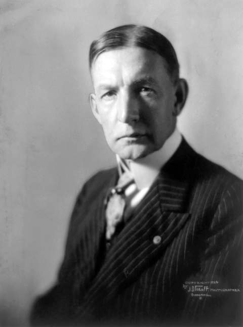 Charles G. Dawes1865-1951Marietta-born banker who drew up the 1924 Dawes Plan for German reparations, sha...
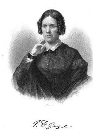 Frances Dana Gage1808-1884McConnelsville reformer who presided over the 1851 Akron women's rights conventi...
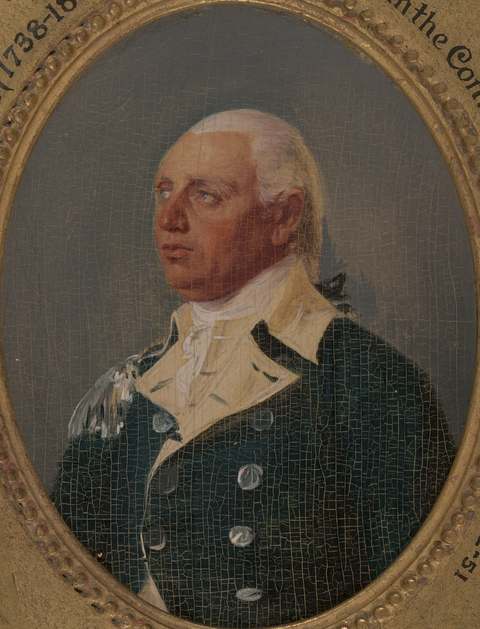 Rufus Putnam1738-1824Revolutionary War engineer who co-founded the Ohio Company of Associates and led...
History from Marietta
People and inventions tied to this place, each with its sources. All people · All inventions
Videos about Marietta
Short videos we made from the old maps and records. All videos
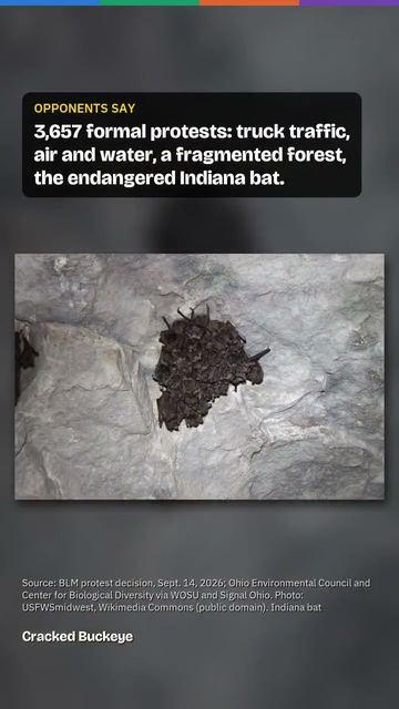
How Marietta began
Marietta was founded April 7, 1788, when 48 pioneers of the Ohio Company of Associates, led by General Rufus Putnam, landed at the mouth of the Muskingum River -- the first permanent American settlement in the Northwest Territory, established under the Northwest Ordinance of 1787. It was named for Marie Antoinette, Queen of France, in gratitude for French aid in the Revolution. The settlers built the Campus Martius stockade and, across the Muskingum, occupied the ground beside the Army's Fort Harmar; the site sat atop a large Hopewell earthwork complex the settlers largely preserved rather than leveled. Marietta grew into a river trading, shipbuilding and, later, oil town, and remains the seat of Washington County and home to Marietta College, founded in 1835.
Settled April 7, 1788, incorporated 1788 (settlement); Washington County proclaimed July 27, 1788, by Ohio Company of Associates, led by General Rufus Putnam.
Where the name comes from
Named for Marie Antoinette, Queen of France, in honor of French aid to the American cause in the Revolutionary War.
Before the town
Marietta sits on top of one of Ohio's major Hopewell ceremonial complexes, the Marietta Earthworks, built between about 100 BC and AD 500 at the confluence of the Muskingum and Ohio rivers. The complex included a large enclosure with four platform mounds -- the Quadranaou and the Capitolium (a stepped mound aligned to the winter solstice sunset) among them -- and the Sacra Via, a 680-by-150-foot ceremonial roadway lined with earthen embankments that ran from the enclosure down to the Muskingum River; the Sacra Via was largely destroyed in 1882 when its earth was dug for brick-making. The Conus, a 30-foot conical burial mound, is the only earthwork that survives intact; the town's founders laid out Mound Cemetery around its base in 1801 specifically to protect it, and Captain Jonathan Hart made the first recorded investigation of the earthworks in 1786, followed by Rufus Putnam and Manasseh Cutler. In the historic era the United States Army built Fort Harmar in 1785 directly across the Muskingum from the future townsite, primarily to keep American squatters out of Native land north and west of the Ohio River; it was there, on January 9, 1789, that U.S. commissioners signed the Treaty of Fort Harmar with the Haudenosaunee, Ojibwe, Odawa, Potawatomi, Sauk, Wyandot and Lenape (the Shawnee and Miami refused to attend). The treaty largely restated the boundary lines already set by the 1784 Treaty of Fort Stanwix and 1785 Treaty of Fort McIntosh, and many Native leaders regarded it as illegitimate because it did nothing to remove the American settlements already spreading north of the Ohio River; the treaty's failure to resolve that dispute helped touch off the Northwest Indian War the following years, a conflict that reached Washington County directly when a war party attacked the Big Bottom settlement upriver in January 1791. Fort Harmar itself was abandoned by the Army in 1790 and torn down in 1791 as Marietta's population spread across the river onto its former ground.
Nations recorded here: Wyandot, Lenape (Delaware), Shawnee, Haudenosaunee (Iroquois), Ojibwe, Odawa, Potawatomi, Hopewell culture.
- Marietta Earthworks (Quadranaou, Capitolium, Sacra Via) (earthwork) — downtown Marietta, between Third and Fifth streets, about 100 BC to AD 500 (Hopewell) (en.wikipedia.org)
- Conus Mound, Mound Cemetery (mound) — Mound Cemetery, Fifth Street, Marietta, about 100 BC to AD 500 (Hopewell); cemetery laid out around it in 1801 (en.wikipedia.org)
- Fort Harmar (other) — west bank of the Muskingum River at its mouth, opposite the Marietta townsite, built 1785, abandoned 1790, demolished 1791 (en.wikipedia.org)
- Treaty of Fort Harmar site (treaty) — Fort Harmar, mouth of the Muskingum River, signed January 9, 1789 (en.wikipedia.org)
Timeline
- — Colonel John Doughty, under orders from Colonel Josiah Harmar, builds Fort Harmar on the west bank of the Muskingum's mouth, the first U.S. Army post in the future Northwest Territory.
- — On April 7, forty-eight pioneers of the Ohio Company of Associates, led by General Rufus Putnam, land at the mouth of the Muskingum River and found Marietta, the first permanent American settlement in the Northwest Territory.
- — Governor Arthur St. Clair arrives to inaugurate the territorial government and, on July 27, proclaims the bounds of Washington County, the Northwest Territory's first county.
- — The first court in the Northwest Territory convenes September 2 inside the Campus Martius stockade.
- — U.S. commissioners and representatives of seven Native nations sign the Treaty of Fort Harmar at the fort across the river from Marietta on January 9.
- — Marietta's founders lay out Mound Cemetery around the base of the Conus mound to preserve it.
- — Marietta shipyards build twenty-nine ocean-going vessels, starting with the 110-ton brig St. Clair, captained by Commodore Abraham Whipple; President Jefferson's 1807 Embargo Act largely ends the trade.
- — Marietta College is chartered, growing out of the Muskingum Academy that Rufus Putnam had helped start in 1797.
- — The Hippodrome theater opens on Putnam Street May 9 with the silent film 'Daddy Long Legs'; it is remodeled and renamed the Colony in 1949.
Stories
A stockade over a stockade of the ancients
When the Ohio Company's pioneers landed in April 1788, they found themselves camped inside an earthwork complex already seventeen centuries old: a walled enclosure, four flat-topped mounds, and a long ceremonial roadway running down to the Muskingum, all built by Hopewell people between roughly 100 BC and AD 500. Rather than plow the earthworks under, the settlers built streets and public squares around them, and Rufus Putnam and the missionary-scientist Manasseh Cutler made some of the first recorded investigations of the mounds in 1786, before the town was even founded. The largest platform mound, the Capitolium, later had the Washington County Library built on its summit in 1916, preserving it in the process, while the Sacra Via roadway was less fortunate -- much of its earth was dug out and sold for brick-making in 1882. The one earthwork that survived essentially whole is the 30-foot conical burial mound the settlers called the Conus: in 1801 the town laid out Mound Cemetery specifically around its base, and today it is the resting place of more Revolutionary War officers than any other single cemetery in the country, among them Generals Rufus Putnam and Benjamin Tupper, Commodore Abraham Whipple, and Colonel William Stacy.
Ocean-going ships built five hundred miles from the sea
For a dozen years around 1800, Marietta was an improbable seaport. Using timber from the surrounding forest and the shipbuilding know-how its New England settlers had brought with them, local yards launched twenty-nine ocean-going vessels between 1800 and 1812, floating them down the Ohio and Mississippi to the Gulf of Mexico and out into the Atlantic trade. The first was the 110-ton brig St. Clair, captained by Revolutionary War naval veteran Commodore Abraham Whipple; by the summer of 1807, eight shipyards were working at once, with two ships, three brigs and two schooners under construction simultaneously. That same year, President Thomas Jefferson's trade embargo shut off the export markets the industry depended on -- shipbuilder Abner Lord wrote bitterly in his family Bible that Jefferson's 'cruel policy' had been 'destructive to our interest & living' -- and deep-water shipbuilding in Marietta never fully recovered, though a handful of vessels went up again in the mid-1840s. The same years brought a different kind of boat to the Marietta waterfront: the steamboat, first seen locally around 1807 as a startling novelty, 'propelled by unseen power,' and within decades the source of a second, longer-lived boat-building era on the Muskingum and Ohio.
Photographs
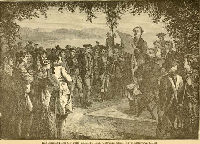
Photo: John Clark Ridpath, 1893 (Internet Archive Book Images), no known copyright restrictions · Wikimedia Commons
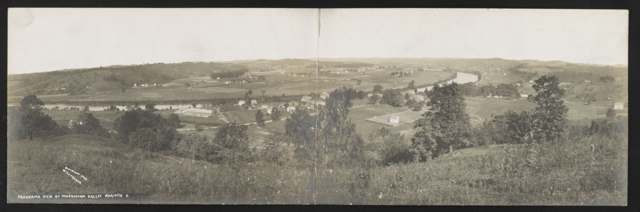
Photo: Harry P. Fischer, H. P. Fischer's Studio, Marietta, public domain · Wikimedia Commons
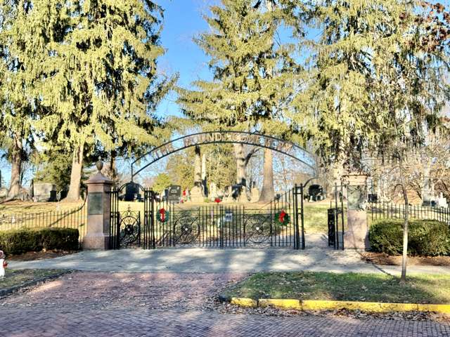
Photo: Warren LeMay, CC BY-SA 2.0 · Wikimedia Commons
Local history sources: en.wikipedia.org · en.wikipedia.org · en.wikipedia.org · en.wikipedia.org · en.wikipedia.org · en.wikipedia.org · ohiohistorycentral.org · mariettatimes.com · en.wikipedia.org
Historic places
12 places in Marietta on the National Register of Historic Places, 1 of them National Historic Landmark. Press a pin or a name for its whole record.
-
W.P. SNYDER, JR. (steamboat) LandmarkStructure · Marietta · listed 1970
- Address
- On Muskingum River at Sacra Via
- Where
- Marietta, Washington County · ZIP 45750
- What it is
- Structure
- Listed on the National Register
- 1970
- National Historic Landmark
- Yes
- NRIS reference number
- 70000522
- Coordinates
- 39.42032, -81.46339
National Register file (NPS) ↗ Search Wikipedia ↗ Street map and directions ↗ On the Cracked Buckeye map
-
Becker Lumber and Manufacturing CompanyBuilding · Marietta · listed 1987
- Address
- 121 Pike St.
- Where
- Marietta, Washington County · ZIP 45750
- What it is
- Building
- Listed on the National Register
- 1987
- NRIS reference number
- 87000988
- Coordinates
- 39.41538, -81.44324
National Register file (NPS) ↗ Search Wikipedia ↗ Street map and directions ↗ On the Cracked Buckeye map
-
Colony TheatreBuilding · Marietta · listed 2001
- Address
- Roughly bounded by Marion, Montgomery, Ohio, Greene, Butler, 2nd through 9th Sts., and Ohio and Muskingum Rs.
- Where
- Marietta, Washington County · ZIP 45750
- What it is
- Building
- Listed on the National Register
- 2001
- NRIS reference number
- 01000903
- Coordinates
- 39.41590, -81.45347
National Register file (NPS) ↗ Search Wikipedia ↗ Street map and directions ↗ On the Cracked Buckeye map
-
Erwin Hall, Marietta CollegeBuilding · Marietta · listed 1973
- Address
- 5th St. on Marietta College campus
- Where
- Marietta, Washington County · ZIP 45750
- What it is
- Building
- Listed on the National Register
- 1973
- NRIS reference number
- 73001547
- Coordinates
- 39.41697, -81.45034
National Register file (NPS) ↗ Search Wikipedia ↗ Street map and directions ↗ On the Cracked Buckeye map
-
First Unitarian Church Of MariettaBuilding · Marietta · listed 1973
- Address
- 232 3rd St.
- Where
- Marietta, Washington County · ZIP 45750
- What it is
- Building
- Listed on the National Register
- 1973
- NRIS reference number
- 73001548
- Coordinates
- 39.41606, -81.45300
National Register file (NPS) ↗ Search Wikipedia ↗ Street map and directions ↗ On the Cracked Buckeye map
-
Kaiser, John, HouseBuilding · Marietta · listed 1993
- Address
- 300 Bellevue St.
- Where
- Marietta, Washington County · ZIP 45750
- What it is
- Building
- Listed on the National Register
- 1993
- NRIS reference number
- 93001392
- Coordinates
- 39.41556, -81.46630
National Register file (NPS) ↗ Search Wikipedia ↗ Street map and directions ↗ On the Cracked Buckeye map
-
MISSISSIPPI IIIStructure · Marietta · listed 1983
- Address
- 237 Front St.
- Where
- Marietta, Washington County · ZIP 45750
- What it is
- Structure
- Listed on the National Register
- 1983
- NRIS reference number
- 83002066
- Coordinates
- 39.41256, -81.44973
National Register file (NPS) ↗ Search Wikipedia ↗ Street map and directions ↗ On the Cracked Buckeye map
-
Mound Cemetery MoundSite · Marietta · listed 1973
- Address
- 5th and Scammel Sts.
- Where
- Marietta, Washington County · ZIP 45750
- What it is
- Site
- Listed on the National Register
- 1973
- NRIS reference number
- 73001549
- Coordinates
- 39.42034, -81.44246
National Register file (NPS) ↗ Search Wikipedia ↗ Street map and directions ↗ On the Cracked Buckeye map
-
Ohio Company Land OfficeBuilding · Marietta · listed 1970
- Address
- Washington and 2nd Sts., Campus Martius Museum
- Where
- Marietta, Washington County · ZIP 45750
- What it is
- Building
- Listed on the National Register
- 1970
- NRIS reference number
- 70000523
- Coordinates
- 39.42126, -81.46140
National Register file (NPS) ↗ Search Wikipedia ↗ Street map and directions ↗ On the Cracked Buckeye map
-
Putnam, Rufus, HouseBuilding · Marietta · listed 1970
- Address
- Campus Martius Museum, corner of 2nd and Washington Sts.
- Where
- Marietta, Washington County · ZIP 45750
- What it is
- Building
- Listed on the National Register
- 1970
- NRIS reference number
- 70000524
- Coordinates
- 39.42153, -81.46129
National Register file (NPS) ↗ Search Wikipedia ↗ Street map and directions ↗ On the Cracked Buckeye map
-
St. Mary's School, OldBuilding · Marietta · listed 1989
- Address
- 132 S. Fourth St.
- Where
- Marietta, Washington County · ZIP 45750
- What it is
- Building
- Listed on the National Register
- 1989
- NRIS reference number
- 89001457
- Coordinates
- 39.41446, -81.44683
National Register file (NPS) ↗ Search Wikipedia ↗ Street map and directions ↗ On the Cracked Buckeye map
-
Wilcox-Mills HouseBuilding · Marietta · listed 1973
- Address
- 301 5th St.
- Where
- Marietta, Washington County · ZIP 45750
- What it is
- Building
- Listed on the National Register
- 1973
- NRIS reference number
- 73001550
- Coordinates
- 39.41778, -81.45115
National Register file (NPS) ↗ Search Wikipedia ↗ Street map and directions ↗ On the Cracked Buckeye map
Source: National Park Service, National Register of Historic Places point file. The listing year is shown where NPS's certification date agrees with the listing's reference number. Listing recognizes significance; it does not restrict a private owner.
Water
Seven active wells drawing from the sand-and-gravel aquifer along the Ohio/Muskingum River valleys near Marietta The water here
- Marietta City66% of residentsOhio/Muskingum River valley sand-and-gravel aquifer (own wells)
- Putnam Community Water Association17% of residentsGroundwater wells (2 wells)
- Reno Water and Sewer 111% of residentsOhio/Muskingum River valley sand-and-gravel aquifer (own wells)
- Highland Ridge W and S Association Inc3% of residentsMuskingum River valley aquifer (Oak Grove wellfield)
- Warren Comm W and S Assn 21% of residentsMuskingum River valley aquifer (Oak Grove wellfield)
- Reno Water and Sewer 21% of residentsOhio/Muskingum River valley sand-and-gravel aquifer (own wells)
- Reno Water and Sewer - Kardex1% of residentsOhio/Muskingum River valley sand-and-gravel aquifer (own wells)
Hospitals, fire stations and more
Inside Marietta's boundary: 2 hospitals, 1 health center, 1 dialysis center, 3 nursing homes, 3 fire and EMS stations, 2 colleges, 5 public schools, 2 private schools, 4 libraries, 7 museums, 3 police stations, 2 public charging sites, 1 Superfund site, 5 Toxics Release Inventory facilities, 1 station or terminal and 11 spill cases. Press a pin or a name for its whole record and its source.
Hospitals (2)
-
Marietta Memorial Hospital Trauma level IIIGeneral hospital · Marietta
- What it is
- General hospital
- Address
- 401 Matthew Street, Marietta, OH 45750
- County
- Washington County
- Beds
- 221
- Trauma center
- Level IIi
- Helipad
- Yes
- Ownership
- Non-profit
- Medicare overall rating
- 3 of 5 stars
- Emergency department (Medicare)
- Yes
- Phone
- (740) 374-1411
- Medicare ID
- 360147
Medicare Care Compare ↗ Hospital's website ↗ Where HIFLD got this record ↗ HIFLD hospitals (source) ↗ Street map and directions ↗
-
Selby General HospitalCritical access hospital · Marietta
- What it is
- Critical access hospital
- Address
- 1106 Colegate Drive, Marietta, OH 45750
- County
- Washington County
- Beds
- 35
- Ownership
- Non-profit
- Medicare overall rating
- not rated
- Emergency department (Medicare)
- Yes
- Phone
- (740) 568-2040
- Medicare ID
- 361319
Medicare Care Compare ↗ Hospital's website ↗ Where HIFLD got this record ↗ HIFLD hospitals (source) ↗ Street map and directions ↗
Source: HIFLD hospitals inventory via FEMA (closed hospitals it still lists left out, hospitals opened since added), with Medicare Care Compare ratings matched by name and address.
Community health centers (1)
-
Hopewell Health Centers--Marietta ClinicHealth center · Marietta
- Run by
- a federally qualified health center
- Setting
- Clinic
- City
- Marietta
- Coordinates
- 39.42134, -81.43521
Find a Health Center (HRSA) ↗ HRSA data (source) ↗ Street map and directions ↗
Source: HRSA health center service delivery sites, active, September 2026 (school-based sites left out). Health centers see patients whether or not they have insurance, with fees on a sliding scale.
Dialysis centers (1)
-
Fmc - Dialysis Specialists Of MariettaDialysis · Marietta
- Address
- 14-16 Acme Street, Marietta, OH 45750
- Dialysis stations
- 16
- Medicare star rating
- 3 of 5 stars
- Services
- in-center hemodialysis
- Ownership
- for profit
- Chain
- Fresenius Medical Care
- Medicare certified since
- 1997-01-03
- Phone
- (740) 376-0045
- Medicare ID
- 362571
Medicare Care Compare ↗ CMS dialysis facility list (source) ↗ Street map and directions ↗
Source: CMS dialysis facility list, September 2026, geocoded with the Census Bureau batch geocoder (an address it could not place sits at its ZIP center).
Nursing homes (3)
-
Arbors at Marietta2 of 5 stars · Marietta
- Address
- 400 Seventh Street, Marietta, OH 45750
- Certified beds
- 133
- Residents on an average day
- 125
- Medicare overall rating
- 2 of 5 stars
- Health inspections
- 2 of 5 stars
- Staffing
- 3 of 5 stars
- Quality measures
- 4 of 5 stars
- Penalties since 2023
- 1 fine totalling $79,853, 1 payment denial (latest 2024-01-12)
- Ownership
- For profit - Corporation
- Chain
- ARBORS AT OHIO
- Takes
- Medicare and Medicaid
- Phone
- (740) 373-3597
- Medicare ID
- 365687
Medicare Care Compare ↗ CMS nursing home data (source) ↗ Street map and directions ↗
-
Harmar Place Nursing and Rehabilitation1 of 5 stars · Marietta
- Address
- 401 Harmar Street, Marietta, OH 45750
- Certified beds
- 86
- Residents on an average day
- 72
- Medicare overall rating
- 1 of 5 stars
- Health inspections
- 1 of 5 stars
- Staffing
- 2 of 5 stars
- Quality measures
- 4 of 5 stars
- Penalties since 2023
- 2 fines totalling $202,275 (latest 2025-05-16)
- Ownership
- Non profit - Corporation
- Chain
- UNITED CHURCH HOMES
- Takes
- Medicare and Medicaid
- Phone
- (740) 376-5600
- Medicare ID
- 366001
Medicare Care Compare ↗ CMS nursing home data (source) ↗ Street map and directions ↗
-
Waterview Pointe Nursing & Rehabilitation4 of 5 stars · Marietta
- Address
- 117 Bartlett Street, Marietta, OH 45750
- Certified beds
- 80
- Residents on an average day
- 69
- Medicare overall rating
- 4 of 5 stars
- Health inspections
- 4 of 5 stars
- Staffing
- 4 of 5 stars
- Quality measures
- 3 of 5 stars
- Penalties since 2023
- none
- Ownership
- For profit - Corporation
- Chain
- FOUNDATIONS HEALTH SOLUTIONS
- Takes
- Medicare and Medicaid
- Phone
- (740) 434-5900
- Medicare ID
- 366478
Medicare Care Compare ↗ CMS nursing home data (source) ↗ Street map and directions ↗
Source: CMS Care Compare nursing home provider and penalties files; Medicare star ratings run 1 to 5.
Fire and EMS stations (3)
-
Marietta Fire Department Station 1Marietta
- Address
- 301 Putnam Street, Marietta, OH 45750
- Coordinates
- 39.41684, -81.45344
USGS National Map structures (source) ↗ Street map and directions ↗
-
Marietta Fire Department Station 3Marietta
- Address
- 1114 Glendale Road, Marietta, OH 45750
- Coordinates
- 39.43233, -81.43718
USGS National Map structures (source) ↗ Street map and directions ↗
-
Marietta Fire Department Station 4Marietta
- Address
- 701 Lancaster Street, Marietta, OH 45750
- Coordinates
- 39.41746, -81.46894
USGS National Map structures (source) ↗ Street map and directions ↗
Source: USGS National Map structures (most Ohio records last updated 2019 to 2022), checked against the Columbus and Cleveland station lists. The department that answers a call is set by jurisdiction and mutual aid, not by distance.
Colleges (2)
-
Marietta CollegePrivate nonprofit college · Marietta
- What it is
- Private nonprofit college
- City
- Marietta
- Students, 2023-24 (12-month count)
- 1,334
- Tuition and fees, in state
- $38,974
- Graduation rate
- 58% of bachelor's students, within six years (a class of 272)
- IPEDS unit ID
- 203845
College Navigator (NCES) ↗ IPEDS data (source) ↗ Street map and directions ↗
-
Washington State College of OhioPublic community or technical college · Marietta
- What it is
- Public community or technical college
- City
- Marietta
- Students, 2023-24 (12-month count)
- 2,612
- Tuition and fees, in state
- $4,128
- Tuition and fees, out of state
- $4,152
- Graduation rate
- 32% (all programs, within 150% of normal time) (a class of 218)
- IPEDS unit ID
- 206446
College Navigator (NCES) ↗ IPEDS data (source) ↗ Street map and directions ↗
Source: NCES IPEDS 2024 directory, 2023-24 enrollment and tuition, graduation rates for the 2017 (four-year) and 2020 (two-year) entering classes.
Public schools (5)
-
Marietta Elementary School2.5 of 5 stars · Marietta
- Address
- 242 N 7th St, Marietta, OH 45750
- School district
- Marietta City School District
- Kind (NCES)
- Regular School
- Students, 2023-24
- 622
- Teachers (full-time equivalent)
- 34
- Report card, 2025-26
- 2.5 of 5 stars
- Performance index
- 69.4%
- Ohio building IRN
- 015297
- NCES school ID
- 391001901244
NCES school record ↗ Ohio School Report Card ↗ Street map and directions ↗
-
Marietta High School4 of 5 stars · Marietta
- Address
- 208 Davis Ave, Marietta, OH 45750
- School district
- Marietta City School District
- Kind (NCES)
- Regular School
- Students, 2023-24
- 1,028
- Teachers (full-time equivalent)
- 58
- Report card, 2025-26
- 4 of 5 stars
- Performance index
- 73.3%
- Four-year graduation rate
- 98.4%
- Ohio building IRN
- 022798
- NCES school ID
- 391001901246
NCES school record ↗ Ohio School Report Card ↗ Street map and directions ↗
-
Phillips School1 of 5 stars · Marietta
- Address
- 300 Pike St, Marietta, OH 45750
- School district
- Marietta City School District
- Kind (NCES)
- Regular School
- Students, 2023-24
- 223
- Teachers (full-time equivalent)
- 16
- Report card, 2025-26
- 1 of 5 stars
- Ohio building IRN
- 029819
- NCES school ID
- 391001901249
NCES school record ↗ Ohio School Report Card ↗ Street map and directions ↗
-
Tiger Blue Sky AcademyMarietta
- Address
- 111 Academy Dr, Marietta, OH 45750
- Kind (NCES)
- Regular School
- Students, 2023-24
- 0
- NCES school ID
- 391001906216
-
Washington School1 of 5 stars · Marietta
- Address
- 401 Washington St, Marietta, OH 45750
- School district
- Marietta City School District
- Kind (NCES)
- Regular School
- Students, 2023-24
- 226
- Teachers (full-time equivalent)
- 15
- Report card, 2025-26
- 1 of 5 stars
- Ohio building IRN
- 039578
- NCES school ID
- 391001901252
NCES school record ↗ Ohio School Report Card ↗ Street map and directions ↗
Source: NCES EDGE public school locations 2024-25 and Common Core of Data 2023-24 (type, students, teachers); Ohio School Report Cards 2025-26 (Department of Education and Workforce), matched by name within the district.
Private schools (2)
-
St Mary SchoolPrivate, Catholic · Marietta
- Address
- 320 Marion St, Marietta, OH 45750
- Kind
- Catholic
- Students, 2023-24
- 174
- Teachers (full-time equivalent)
- 13
- Students per teacher
- 13.3846
- Phone
- (740) 374-8181
- NCES private school ID
- 01060386
-
Veritas Classical AcademyPrivate, religious, independent · Marietta
- Address
- Po Box 982, Marietta, OH 45750
- Kind
- religious, independent
- Students, 2023-24
- 103
- Teachers (full-time equivalent)
- 3.5
- Students per teacher
- 29.4286
- Phone
- (740) 704-9712
- NCES private school ID
- A2302384
Source: NCES Private School Survey 2023-24.
Public libraries (4)
-
Lafayette Plaza Public LibraryBranch · Marietta
- Address
- 478 Pike Street, Marietta, OH 45750
- What it is
- Branch
- Library system
- Washington County Public Library
- Open
- 2,288 hours a year, 52 weeks
- Building
- 1,740 sq ft
- System's visits, FY2024
- 113,464
- System's loans, FY2024
- 555,089
- People the system serves
- 59,711
- Phone
- (740) 236-4201
IMLS Public Libraries Survey (source) ↗ Street map and directions ↗
-
Local History BranchBranch · Marietta
- Address
- 418 Washington St, Marietta, OH 45750
- What it is
- Branch
- Library system
- Washington County Public Library
- Open
- 2,288 hours a year, 52 weeks
- Building
- 2,496 sq ft
- System's visits, FY2024
- 113,464
- System's loans, FY2024
- 555,089
- People the system serves
- 59,711
- Phone
- (740) 376-2172
IMLS Public Libraries Survey (source) ↗ Street map and directions ↗
-
Sprinter BookmobileBookmobile stop · Marietta
- Address
- 478 Pike St, Marietta, OH 45750
- What it is
- Bookmobile stop
- Library system
- Washington County Public Library
- Open
- 1,404 hours a year, 52 weeks
- System's visits, FY2024
- 113,464
- System's loans, FY2024
- 555,089
- People the system serves
- 59,711
- Phone
- (740) 373-1057
IMLS Public Libraries Survey (source) ↗ Street map and directions ↗
-
Washington County Public LibraryCentral library · Marietta
- Address
- 615 Fifth St., Marietta, OH 45750
- What it is
- Central library
- Library system
- Washington County Public Library
- Open
- 2,756 hours a year, 52 weeks
- Building
- 16,875 sq ft
- System's visits, FY2024
- 113,464
- System's loans, FY2024
- 555,089
- People the system serves
- 59,711
- Phone
- (740) 373-1057
IMLS Public Libraries Survey (source) ↗ Street map and directions ↗
Source: IMLS Public Libraries Survey FY2024 (outlets and their systems). Any Ohio resident can get a free card at any Ohio public library.
Museums, historical societies, gardens and zoos (7)
-
Anderson Hancock PlanetariumScience or technology museum · Marietta
- What it is
- Science or technology museum
- City
- Marietta
- Coordinates
- 39.41172, -81.44470
Search Wikipedia ↗ IMLS Museum Data Files (source) ↗ Street map and directions ↗
The museum list is IMLS's 2018 file; a museum may have closed or moved since.
-
Campus Martius MuseumMuseum · Marietta
- What it is
- Museum
- City
- Marietta
- Coordinates
- 39.42116, -81.46067
Search Wikipedia ↗ IMLS Museum Data Files (source) ↗ Street map and directions ↗
The museum list is IMLS's 2018 file; a museum may have closed or moved since.
-
Children'S Toy And Doll MuseumChildren's museum · Marietta
- What it is
- Children's museum
- City
- Marietta
- Coordinates
- 39.41724, -81.44375
Search Wikipedia ↗ IMLS Museum Data Files (source) ↗ Street map and directions ↗
The museum list is IMLS's 2018 file; a museum may have closed or moved since.
-
Historic Harmar Bridge CompanyHistorical society · Marietta
- What it is
- Historical society
- City
- Marietta
- Coordinates
- 39.41128, -81.45880
Search Wikipedia ↗ IMLS Museum Data Files (source) ↗ Street map and directions ↗
The museum list is IMLS's 2018 file; a museum may have closed or moved since.
-
Marietta Natural History SocietyHistorical society · Marietta
- What it is
- Historical society
- City
- Marietta
- Coordinates
- 39.42306, -81.44821
Search Wikipedia ↗ IMLS Museum Data Files (source) ↗ Street map and directions ↗
The museum list is IMLS's 2018 file; a museum may have closed or moved since.
-
Ohio River MuseumMuseum · Marietta
- What it is
- Museum
- City
- Marietta
- Coordinates
- 39.42182, -81.46352
Search Wikipedia ↗ IMLS Museum Data Files (source) ↗ Street map and directions ↗
The museum list is IMLS's 2018 file; a museum may have closed or moved since.
-
Washington County Historical Society Of OhioHistorical society · Marietta
- What it is
- Historical society
- City
- Marietta
- Coordinates
- 39.42306, -81.44821
Search Wikipedia ↗ IMLS Museum Data Files (source) ↗ Street map and directions ↗
The museum list is IMLS's 2018 file; a museum may have closed or moved since.
Source: IMLS Museum Data Files, 2018.
Police stations (3)
-
Marietta College Police DepartmentMarietta
- Address
- 127 1 / 2 North 7th Street, Marietta, OH 45750
- Coordinates
- 39.41686, -81.44631
USGS National Map structures (source) ↗ Street map and directions ↗
-
Marietta Police DepartmentMarietta
- Address
- 301 Putnam Street, Marietta, OH 45750
- Coordinates
- 39.41674, -81.45332
USGS National Map structures (source) ↗ Street map and directions ↗
-
Washington County Sheriff's OfficeMarietta
- Address
- 309 4th Street, Marietta, OH 45750
- Coordinates
- 39.41738, -81.45280
USGS National Map structures (source) ↗ Street map and directions ↗
Source: USGS National Map structures, police stations, corrected and completed by hand (September 2026). The department that answers a call is set by jurisdiction, not by distance.
Public EV charging (2)
-
Washington County Public Library1 Level 2 · Marietta
- Address
- 478 Pike St, Marietta, OH 45750
- Ports
- 1 Level 2
- Plugs
- J1772
- Network
- Non-Networked
- Hours
- Business hours
- Price
- Free
- Phone
- 740-373-1057
Station Locator (NREL) ↗ Alternative Fuels Data Center (source) ↗ Street map and directions ↗
-
Washington County Public Library1 Level 2 · Marietta
- Address
- 615 5th St, Marietta, OH 45750
- Ports
- 1 Level 2
- Plugs
- J1772
- Network
- Non-Networked
- Hours
- 24 hours daily
- Price
- Free
- Phone
- 740-373-1057
Station Locator (NREL) ↗ Alternative Fuels Data Center (source) ↗ Street map and directions ↗
Source: NREL Alternative Fuels Data Center station list (May 2026), public and open stations, the posts at one address counted as one site.
Superfund sites (1)
-
Marietta Well Field/Unknown SourceSuperfund program · Marietta
- Address
- State Road 60 North of Route #7, Marietta, OH 45750
- County
- Washington County
- Status
- Superfund program site, not on the National Priorities List
- EPA program ID
- OHD986966430
- EPA registry ID
- 110071231836
EPA facility record ↗ EPA Facility Registry Service (source) ↗ Street map and directions ↗
Source: EPA Facility Registry Service, Superfund (SEMS) and National Priorities List sites. Many program sites were assessed and needed no cleanup.
Facilities reporting toxic releases (5)
-
Broughton Foods, LlcToxics Release Inventory · Marietta
- Address
- 1701 Greene Street, Marietta, OH 45750
- County
- Washington County
- Status
- Reports to the Toxics Release Inventory (active)
- EPA program ID
- 45750BRGHT2107T
- EPA registry ID
- 110056619333
EPA facility record ↗ EPA Facility Registry Service (source) ↗ Street map and directions ↗
-
Cytec Industries, Inc.Toxics Release Inventory · Marietta
- Address
- 1405 Greene St, Marietta, OH 45750
- County
- Washington County
- Status
- Reports to the Toxics Release Inventory (active)
- EPA program ID
- 45750MRCNC1405G
- EPA registry ID
- 110000617057
EPA facility record ↗ EPA Facility Registry Service (source) ↗ Street map and directions ↗
-
Richard H Gorsuch Generating StationToxics Release Inventory · Marietta
- Address
- State Route 7 South, Marietta, OH 45750
- County
- Washington County
- Status
- Reports to the Toxics Release Inventory (active)
- EPA program ID
- 45750GRSCHRTE7S
- EPA registry ID
- 110000850525
EPA facility record ↗ EPA Facility Registry Service (source) ↗ Street map and directions ↗
-
The Airolite CompanyToxics Release Inventory · Marietta
- Address
- 114 Westview Ave., Marietta, OH 45750
- County
- Washington County
- Status
- Reports to the Toxics Release Inventory (active)
- EPA program ID
- 45750THRLT114WE
- EPA registry ID
- 110000493617
EPA facility record ↗ EPA Facility Registry Service (source) ↗ Street map and directions ↗
-
Vanguard Paints & Finishes IncToxics Release Inventory · Marietta
- Address
- 1409 Greene St, Marietta, OH 45750
- County
- Washington County County
- Status
- Reports to the Toxics Release Inventory (open)
- EPA program ID
- 45750VNGRD1409G
- EPA registry ID
- 110000395340
EPA facility record ↗ EPA Facility Registry Service (source) ↗ Street map and directions ↗
Source: EPA Facility Registry Service, Toxics Release Inventory reporters. Reporting a release is required of large users of listed chemicals; it is not by itself a violation.
Stations and terminals (1)
-
K-martIntercity bus stop · Greyhound Lines
- What it is
- Intercity bus stop
- Operator
- Greyhound Lines
- City
- Marietta
- Coordinates
- 39.40995, -81.42715
BTS Intermodal Passenger Connectivity Database (source) ↗ Street map and directions ↗
Source: BTS Intermodal Passenger Connectivity Database and National Transit Map (2025). Bus stops are counted on the card and drawn on the full map.
Spills reported since 2021 (11)
-
Oil Transformer Non Pcb2024-12-30 · Marietta
- Reported
- 2024-12-30
- What spilled
- Oil Transformer Non Pcb
- Largest amount reported
- 30 gallons
- Where
- Marietta, Washington County
- Ohio EPA district office
- SEDO
- Ohio EPA case number
- 2412EPA0002092
Ohio EPA spill reports (source) ↗ Street map and directions ↗
-
Natural Gas2023-09-21 · Marietta
- Reported
- 2023-09-21
- What spilled
- Natural Gas
- Where
- Marietta, Washington County
- Ohio EPA district office
- SEDO
- Ohio EPA case number
- 2309EPA0001653
Ohio EPA spill reports (source) ↗ Street map and directions ↗
-
Fuel Diesel / Diesel Fuel (Vehicle On Or Off Road)2022-11-02 · Marietta
- Reported
- 2022-11-02
- What spilled
- Fuel Diesel / Diesel Fuel (Vehicle On Or Off Road)
- Where
- Marietta, Washington County
- Ohio EPA district office
- SEDO
- Ohio EPA case number
- 2211EPA0001634
Ohio EPA spill reports (source) ↗ Street map and directions ↗
-
Waste Water2022-08-17 · Marietta
- Reported
- 2022-08-17
- What spilled
- Waste Water
- Largest amount reported
- 25 gallons
- Where
- Marietta, Washington County
- Ohio EPA district office
- SEDO
- Ohio EPA case number
- 2208EPA0001256
Ohio EPA spill reports (source) ↗ Street map and directions ↗
-
Material Unknown2022-05-08 · Marietta
- Reported
- 2022-05-08
- What spilled
- Material Unknown
- Where
- Marietta, Washington County
- Ohio EPA district office
- SEDO
- Ohio EPA case number
- 2205EPA0000651
Ohio EPA spill reports (source) ↗ Street map and directions ↗
-
Other / All Other / Trade Name / Mixture / Solution Etc2021-04-01 · Marietta
- Reported
- 2021-04-01
- What spilled
- Other / All Other / Trade Name / Mixture / Solution Etc
- Where
- Marietta, Washington County
- Ohio EPA district office
- SEDO
- Ohio EPA case number
- 2104EPA0000444
Ohio EPA spill reports (source) ↗ Street map and directions ↗
-
Sewage Sludge / Biosolids2026-08-12 · Marietta
- Reported
- 2026-08-12
- What spilled
- Sewage Sludge / Biosolids
- Largest amount reported
- 70,000 gallons
- Where
- Marietta, Washington County
- Ohio EPA district office
- SEDO
- Ohio EPA case number
- 2608EPA0001481
Ohio EPA spill reports (source) ↗ Street map and directions ↗
-
Sewage Sludge / Biosolids2026-08-06 · Marietta
- Reported
- 2026-08-06
- What spilled
- Sewage Sludge / Biosolids
- Largest amount reported
- 8,217 gallons
- Where
- Marietta, Washington County
- Ohio EPA district office
- SEDO
- Ohio EPA case number
- 2608EPA0001431
Ohio EPA spill reports (source) ↗ Street map and directions ↗
-
Sewage Sludge / Biosolids Reached water2026-06-18 · Marietta
- Reported
- 2026-06-18
- What spilled
- Sewage Sludge / Biosolids
- Largest amount reported
- 198,000 gallons
- Reached a waterway
- 84 - Muskingum River
- Where
- Marietta, Washington County
- Ohio EPA district office
- SEDO
- Ohio EPA case number
- 2606EPA0001092
Ohio EPA spill reports (source) ↗ Street map and directions ↗
-
Battery / Batteries Dry Cell2026-04-30 · Marietta
- Reported
- 2026-04-30
- What spilled
- Battery / Batteries Dry Cell
- Where
- Marietta, Washington County
- Ohio EPA district office
- SEDO
- Ohio EPA case number
- 2604EPA0000728
Ohio EPA spill reports (source) ↗ Street map and directions ↗
-
Fat(S) / Oil / Grease / Tallow Food Types (Fog)2026-04-12 · Marietta
- Reported
- 2026-04-12
- What spilled
- Fat(S) / Oil / Grease / Tallow Food Types (Fog)
- Largest amount reported
- 20 gallons
- Where
- Marietta, Washington County
- Ohio EPA district office
- SEDO
- Ohio EPA case number
- 2604EPA0000619
Ohio EPA spill reports (source) ↗ Street map and directions ↗
Source: Ohio EPA emergency response spill reports, 2021 to September 2026, one point per case where Ohio EPA placed it. A report is what the caller or responder recorded; amounts are often blank or estimated.
Its ZIP codes
Each ZIP code that touches Marietta, with the share of its residents who live here and the same headline figures as the ZIP page.
| ZIP | Share | Water | Radon | Home value | Schools | Flood |
|---|---|---|---|---|---|---|
| 45750 Marietta | 51% | Seven active wells drawing from the sand-and-gravel aquifer along the Ohio/Muskingum River valleys near Marietta | 3.5 pCi/L average radon | Median year built 1961 | Marietta City · 3 stars overall | 13% of residents in the 1% floodplain |
Local government
Who holds office in Marietta, how its elections and ballot issues came out, and the state auditor's record.
Elections for office
| Date | Office | Candidates and votes |
|---|---|---|
| 2023-11-07 | Third Ward Council Member | Bill Gossett (REP) 790, 100.0% |
| 2023-11-07 | Member of Council at Large | William Farnsworth (DEM) 1,662, 19.99%; Harley Noland (DEM) 1,795, 21.58%; Kevin M. Paskawych (DEM) 1,443, 17.35%; Ben Rutherford (REP) 1,687, 20.29%; Cassidi Shoaf (REP) 1,729, 20.79% |
| 2023-11-07 | Member of Board of Education | Russell Garrison 5,157, 95.29%; Write-In: Rudolph John Lehman 255, 4.71% |
| 2023-11-07 | Mayor | Anne Labes 1,111, 30.33%; Joshua D. Schlicher (REP) 2,551, 69.64%; Write-In: Ari Gold/David Labes 1, 0.03% |
| 2023-11-07 | Fourth Ward Council Member | Geoff Schenkel (DEM) 764, 100.0% |
| 2023-11-07 | First Ward Council Member | Michael J. Scales (DEM) 553, 100.0% |
| 2023-11-07 | Director of Law | Paul G. Bertram III (REP) 2,636, 100.0% |
| 2023-05-02 | Member of Council, Third Ward (REP primary) | Bill Gossett 133, 100.0% |
| 2023-05-02 | Member of Council At-Large (REP primary) | Marjorie Bevans 278, 46.33%; Cassidi Shoaf 322, 53.67% |
| 2023-05-02 | Mayor (REP primary) | Joshua D. Schlicher 461, 100.0% |
| 2023-05-02 | Director of Law (REP primary) | Paul G. Bertram, III 405, 100.0% |
| 2019-11-05 | Third Ward Council Member | Bill Gossett (REP) 583, 63.65%; Steve Thomas (DEM) 333, 36.35% |
| 2019-11-05 | Second Ward Council Member | Michael M. McCauley (DEM) 517, 100.0% |
| 2019-11-05 | President of Council | Susan L. Vessels (REP) 2,257, 100.0% |
| 2019-11-05 | Member of Council At Large | Susan E. Boyer (DEM) 1,809, 36.2%; William Farnsworth (DEM) 1,345, 26.92%; Cassidi Shoaf (REP) 1,843, 36.88% |
| 2019-11-05 | Member of Board of Education | Russell Garrison 3,743, 47.34%; Bill Hutchinson 4,163, 52.66% |
| 2019-11-05 | Mayor | Joe A. Matthews 902, 27.17%; Harley Noland (DEM) 969, 29.19%; Joshua D. Schlicher (REP) 1,449, 43.64% |
| 2019-11-05 | Fourth Ward Council Member | Geoff Schenkel (DEM) 666, 100.0% |
| 2019-11-05 | First Ward Council Member | Michael Scales (DEM) 452, 100.0% |
| 2019-11-05 | Director of Law | Paul G. Bertram, III (REP) 2,313, 100.0% |
| 2019-11-05 | Auditor | Sherri J. Hess (REP) 2,426, 100.0% |
Winners in bold. Results from the county board of elections' official canvass unless marked.
Auditor of State record
- No fiscal caution, watch or emergency on the Auditor of State's lists.
- Financial Health Indicators (the Auditor of State's 17 measures; critical / cautionary / positive): 2020 0 / 1 / 16; 2021 1 / 4 / 12; 2022 1 / 1 / 15; 2023 1 / 5 / 11; 2024 0 / 2 / 14; 2025 0 / 2 / 14.
- Financial Audit, 2023, released 2026-02-17
- Agreed Upon Procedures, 2023, released 2025-07-29
- OP&F Examination, 2023, released 2025-04-10
The county
Washington County: 17 ZIP codes, 33 cities, villages and townships, 61,140 people.
Nearby places
Rain and snow
How much has actually fallen on Marietta, day by day, from 1893 to now. Daily totals, not averages.
- rain, last 30 days
- 3.28 in
- 2026-09-29 to 2026-10-28
- rain so far in 2026
- 45.5 in
- 7.6 in above normal for the date
- snow so far in 2026
- 8.6 in
- a normal year brings 18.7 in
- a normal year
- 45.0 in
- average of 30 years, 1991-2020
| Month | Rain (in) | Snow (in) | Days counted |
|---|---|---|---|
| October 2026 | 3.28 | — | 28 |
| September 2026 | 5.16 | — | 30 |
| August 2026 | 8.82 | — | 31 |
| July 2026 | 4.22 | — | 31 |
| June 2026 | 4.69 | — | 30 |
| May 2026 | 6.61 | — | 31 |
| April 2026 | 3.34 | — | 30 |
| March 2026 | 5.92 | — | 31 |
| February 2026 | 0.79 | — | 28 |
| January 2026 | 2.71 | 8.6 | 31 |
| December 2025 | 1.46 | — | 31 |
| November 2025 | 3.10 | 2.1 | 30 |
| Wettest year | 2018 — 66.6 in |
|---|---|
| Driest year | 1930 — 22.8 in |
| Snowiest year | 1895 — 49.9 in |
| Wettest day on record | 18 September 2004 — 4.71 in |
| Heaviest snowfall in a day | 13 March 1993 — 19.49 in |
| Deepest snow on the ground | 13 March 1993 — 20.00 in |
Almost every day here is a measurement: 95% of them come from a rain gauge standing inside Marietta itself.
48,717 days of records, 1893-01-01 to 2026-10-28. Source: NOAA NCEI GHCN-Daily, 3,240 gauges in and around Ohio. A day is "gauged" when a gauge standing inside the boundary reported it, and the value is the mean of those gauges. Otherwise it is interpolated by inverse distance from every gauge reporting within 50 miles. Nothing is carried forward, back-filled or smoothed. Against NOAA nClimDiv county monthly precipitation over 136,848 complete county-months (checked 2026-10-31): correlation 0.9515, median absolute difference 0.217 in a month. Built 2026-10-31 from the Cracked Buckeye precipitation archive. Snow is the softer number — snowfall is measured by hand with a ruler, no agency publishes a gridded county snowfall series, and blowing snow defeats every observer.
Environmental permits and filings
What Ohio EPA has on file for Marietta: permits, inspections, violations, cleanups and the state loans behind sewer and water work. Every line links to the agency's own document.
- facilities and sites on file
- 100
- those placed on the map inside Marietta
| Program | Facilities and sites |
|---|---|
| Hazardous waste | 60 |
| State sewer loans | 11 |
| Air pollution | 9 |
| Wastewater and stormwater discharge | 5 |
| Site assessment | 4 |
| State water loans | 3 |
| Contaminated-site cleanup | 2 |
| Public drinking water | 2 |
| Landfills | 1 |
| Sewer and water-line construction | 1 |
| Voluntary cleanup | 1 |
| Wetland and stream fill | 1 |
| Date | Facility or site | What |
|---|---|---|
| MARIETTA CITY PWS | Public drinking water compliance letter | |
| MARIETTA CITY PWS | Public drinking water compliance letter | |
| MARIETTA CITY PWS | Public drinking water compliance letter | |
| PIR 3954 8TH AND WARREN STREET | Wastewater and stormwater discharge permit | |
| MARIETTA CITY PWS | Public drinking water report | |
| HI-VAC CORP | Air pollution report | |
| STACY'S BODY SHOP | Air pollution report | |
| MID OHIO VALLEY LIME INC | Air pollution report | |
| VOGUE-SWIFT CLEANERS INC | Hazardous waste report | |
| MARIETTA CITY PWS | Public drinking water compliance letter | |
| MARIETTA CITY PWS | Public drinking water compliance letter | |
| MARIETTA CITY PWS | Public drinking water compliance letter | |
| MARIETTA CITY PWS | Public drinking water compliance letter | |
| MARIETTA CITY PWS | Public drinking water compliance letter | |
| MARIETTA CITY PWS | Public drinking water monitoring results | |
| MARIETTA CITY PWS | Public drinking water compliance letter | |
| MARIETTA LEVEE PARK & OHIO STREET IMPROVEMENTS | Wastewater and stormwater discharge permit | |
| MARIETTA CITY PWS | Public drinking water plan | |
| MARIETTA CITY PWS | Public drinking water compliance letter | |
| MARIETTA CITY PWS | Public drinking water inspection | |
| MARIETTA CITY PWS | Public drinking water plan | |
| MARIETTA CITY PWS | Public drinking water compliance letter | |
| MARIETTA CITY PWS | Public drinking water plan | |
| MAR-ZANE INC PLANT 2 | Air pollution permit | |
| MARIETTA CITY PWS | Public drinking water warning letter |
Source: Ohio EPA eDocument portal (edocpub.epa.ohio.gov), indexed 2026-10-14. Facilities are placed on the map from Ohio EPA's own map layers, EPA's Facility Registry, coordinates written in the filings, or a geocoded street address. A permit filed under a private person's name (most are household septic systems) is counted but never named, placed or linked; licenses for individual workers and open-burning notices are left out entirely.
Quick answers
What county is Marietta, Ohio in?
Marietta is a city in Washington County, Ohio, with 13,346 residents.
When was Marietta, Ohio founded?
Marietta was settled April 7, 1788; incorporated 1788 (settlement); Washington County proclaimed July 27, 1788. Founders on record: Ohio Company of Associates, led by General Rufus Putnam. Source
How did Marietta, Ohio get its name?
Named for Marie Antoinette, Queen of France, in honor of French aid to the American cause in the Revolutionary War. Source
What ZIP code is Marietta, Ohio?
Most of Marietta is in ZIP code 45750.
Where does Marietta, Ohio get its water?
The main water source for Marietta (Marietta City): Seven active wells drawing from the sand-and-gravel aquifer along the Ohio/Muskingum River valleys near Marietta.
Cite this page
Cite this page as:
Cracked Buckeye, "Marietta, Washington County", https://crackedbuckeye.com/place/marietta/, built 2026-10-31, accessed [date].
How to cite · Report a correction · Built 2026-10-31
