Local events in Lockington
Nothing is posted for Lockington itself yet; here is what is on within 10 miles. All local events in Lockington
Know a calendar we should watch? Send the link
Checked October 20; the events page is refreshed daily.
How Lockington began
Lockington is a small village on Loramie Creek, built around a flour mill of about 1830 and named for the flight of Miami and Erie Canal locks completed there in the 1840s; it was first called Locksport. It was surveyed and platted in 1837 for landowner David Mellinger and incorporated in 1857-58. The canal's Lockington Locks raised boats about 60-67 feet over the Loramie Summit and are among the best-preserved lock walls on the old canal. After the catastrophic Flood of 1913 ended commercial use of the canal, the Miami Conservancy District built the earthen Lockington Dam just outside the village (1918-1921) as one of five flood-control dams protecting the Great Miami River valley.
Settled c. 1830, platted 1837, incorporated 1857-1858, by David Mellinger (landowner); surveyed and platted by Jonathan Counts.
Where the name comes from
The community was originally called Locksport for its position by the Miami and Erie Canal locks; the name shortened to Lockington.
Before the town
No Native American site, village, or trail specific to Lockington itself is recorded in the sources checked. Loramie Creek, on which the village stands, is named for Pierre-Louis (Peter) Loramie, a French-Canadian trader whose trading post on the creek several miles away served as a Shawnee staging area against American forces during the Revolutionary War until Kentucky militia under Benjamin Logan destroyed it in November 1782; the site later became a boundary point named in the 1795 Treaty of Greenville and the 1817 Treaty of Fort Meigs.
Nations recorded here: Shawnee.
- Loramie's trading post (Fort Loramie) (other) — Loramie Creek, several miles from Lockington, 1769-1782 (en.wikipedia.org)
Timeline
- — A flour mill was built on Loramie Creek near the future village site.
- — Construction began on the Lockington Locks, the flight of locks that carried the Miami and Erie Canal over Loramie Creek.
- — David Mellinger hired Jonathan Counts to survey and plat the village on his land; John Brown also owned the sawmill and flour mill that year and built a new wool mill.
- — The Lockington Locks opened for regular use, part of the completed Miami and Erie Canal between Cincinnati and Toledo.
- — A post office opened at Lockington on June 28.
- — Shelby County commissioners approved Lockington's incorporation on September 9; the Ohio Secretary of State recorded it January 4, 1858, and W.S. Burns was elected the village's first mayor on April 1, 1858.
- — The Great Flood of 1913, Ohio's worst natural disaster, ended commercial navigation on the Miami and Erie Canal.
- — Lockington's post office closed on August 30.
- — Construction began on the earthen Lockington Dam across Loramie Creek south of the village, one of five Miami Conservancy District flood-control dams built after the 1913 flood.
- — Lockington Dam was completed in October: a 69-foot-high, 6,400-foot earthen embankment that can store 70,000 acre-feet of water up to its spillway.
- — The Lockington Locks Historic District was listed on the National Register of Historic Places.
Stories
The locks that gave the village its name
Lockington sits at the Loramie Summit, the highest point on the Miami and Erie Canal between Cincinnati and Toledo, and getting canal boats over it took a stair-step flight of locks that lifted the water roughly 60 to 67 feet. Construction started in 1833 and the locks opened for regular use in 1845, once the full 274-mile canal was finished. Boats and water alike depended on the Lewistown Reservoir feeder line that fed the summit level. The engineering earned the community its first name, Locksport, later shortened to Lockington; the stone lock walls survive today as some of the best-preserved on the old canal system and were listed on the National Register in 1969.
After the canal, a dam against the next flood
The canal era at Lockington ended with the Great Flood of 1913, still considered Ohio's worst natural disaster, which wrecked the Miami and Erie Canal beyond commercial repair. Communities up and down the Great Miami River valley raised money afterward to hire an engineer and design a permanent flood-control system, which became the Miami Conservancy District. As part of that system, an earthen dam was built across Loramie Creek just south of Lockington between February 1918 and October 1921: 69 feet high, 6,400 feet long, able to store 70,000 acre-feet of water up to its spillway during a flood and releasing it gradually afterward through two concrete conduits. The dam has stood dry most of the time since, doing its work only when the creek rises.
Photographs
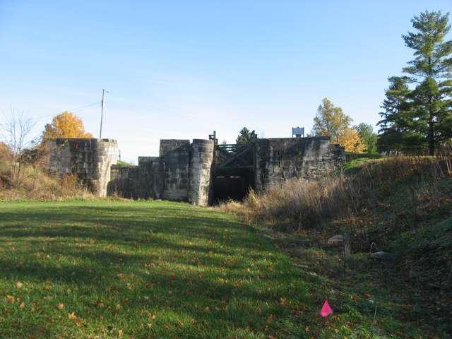
Photo: Nyttend, public domain · Wikimedia Commons
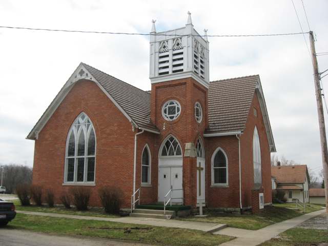
Photo: Nyttend, public domain · Wikimedia Commons
Local history sources: en.wikipedia.org · en.wikipedia.org · villageoflockington.com · ohiohistory.org · mcdwater.org · greatmiamiriverway.com · en.wikipedia.org · commons.wikimedia.org · commons.wikimedia.org · en.wikipedia.org
Water
Piqua draws surface water from the Great Miami River and its historic hydraulic-canal lakes, supplemented by a gravel-pit reservoir, per federal intake records The water here
- Piqua City100% of residentsGreat Miami River + Ernst Gravel Pit + Swift Run Lake (hydraulic system)
- Country Meadows Condo.0% of residentsGroundwater wells (1 wells)
Hospitals, fire stations and more
Inside Lockington's boundary: 1 fire or EMS station. Press a pin or a name for its whole record and its source.
Fire and EMS stations (1)
-
Lockington Volunteer Fire DepartmentLockington
- Address
- 10363 Museum Trail, Lockington, OH 45356
- Coordinates
- 40.20873, -84.23563
USGS National Map structures (source) ↗ Street map and directions ↗
Source: USGS National Map structures (most Ohio records last updated 2019 to 2022), checked against the Columbus and Cleveland station lists. The department that answers a call is set by jurisdiction and mutual aid, not by distance.
Its ZIP codes
Each ZIP code that touches Lockington, with the share of its residents who live here and the same headline figures as the ZIP page.
| ZIP | Share | Water | Radon | Home value | Schools | Flood |
|---|---|---|---|---|---|---|
| 45356 Piqua | 1% | Piqua draws surface water from the Great Miami River and its historic hydraulic-canal lakes, supplemented by a gravel-pit reservoir, per federal intake records | 5.9 pCi/L average radon | Median year built 1950 | Piqua City · 4 stars overall | 1.2% of residents in the 1% floodplain |
Local government
Who holds office in Lockington, how its elections and ballot issues came out, and the state auditor's record.
Money issues on the ballot since 2023: 0 of 2 passed; of those asking for new or higher taxes, 0 of 1.
Ballot issues
| Date | Issue | For | Against | Result |
|---|---|---|---|---|
| 2024-03-19 | Issue: Proposed Tax Levy (Additional) Village of Lockington | 9 | 16 | Failed (36.0% for) |
| 2023-11-07 | Issue: Proposed Tax Levy (Renewal) Village of Lockington | 22 | 32 | Failed (40.74% for) |
| 2022-11-08 | Issue: Village of Lockington | 24 | 30 | Failed (44.44% for) |
| 2019-11-05 | Issue: Lockington Village - Parks and Recreation | 11 | 7 | Passed (61.11% for), unofficial |
Elections for office
| Date | Office | Candidates and votes |
|---|---|---|
| 2023-11-07 | Member of Council | James E. Bryant 40, 64.52%; Paula Johnson 22, 35.48% |
| 2023-11-07 | Mayor | Tracy M. Johnson 23, 42.59%; Shannon E. Petitjean 31, 57.41% |
| 2019-11-05 | Member of Council (unofficial count) | Paula E. Johnson 10, 40.0%; Nancy Ritter 15, 60.0% |
| 2019-11-05 | Mayor (unofficial count) | Tracy M. Johnson 11, 100.0% |
Winners in bold. Results from the county board of elections' official canvass unless marked.
The county
Miami County: 12 ZIP codes, 24 cities, villages and townships, 106,010 people.
Nearby places
Rain and snow
How much has actually fallen on Lockington, day by day, from 1893 to now. Daily totals, not averages.
- rain, last 30 days
- 1.23 in
- 2026-09-30 to 2026-10-29
- rain so far in 2026
- 40.1 in
- 4.2 in above normal for the date
- snow so far in 2026
- 20.1 in
- a normal year brings 18.5 in
- a normal year
- 42.4 in
- average of 30 years, 1991-2020
| Month | Rain (in) | Snow (in) | Days counted |
|---|---|---|---|
| October 2026 | 1.23 | — | 29 |
| September 2026 | 5.02 | — | 30 |
| August 2026 | 9.25 | — | 31 |
| July 2026 | 3.65 | — | 31 |
| June 2026 | 3.31 | — | 30 |
| May 2026 | 6.52 | — | 31 |
| April 2026 | 2.60 | — | 30 |
| March 2026 | 5.75 | 2.4 | 31 |
| February 2026 | 0.99 | 4.3 | 28 |
| January 2026 | 1.74 | 13.3 | 31 |
| December 2025 | 2.01 | 9.4 | 31 |
| November 2025 | 1.68 | 2.9 | 30 |
| Wettest year | 2011 — 58.4 in |
|---|---|
| Driest year | 1963 — 23.9 in |
| Snowiest year | 1912 — 58.9 in |
| Wettest day on record | 8 August 1995 — 6.36 in |
| Heaviest snowfall in a day | 26 November 1950 — 16.84 in |
| Deepest snow on the ground | 23 December 2004 — 19.72 in |
Estimated, not measured. No rain gauge has ever stood inside Lockington, so every figure here is worked out from the gauges around it - the nearest ones weighted most. Treat them as close estimates rather than readings.
48,563 days of records, 1893-01-01 to 2026-10-29. Source: NOAA NCEI GHCN-Daily, 3,240 gauges in and around Ohio. A day is "gauged" when a gauge standing inside the boundary reported it, and the value is the mean of those gauges. Otherwise it is interpolated by inverse distance from every gauge reporting within 50 miles. Nothing is carried forward, back-filled or smoothed. Against NOAA nClimDiv county monthly precipitation over 136,848 complete county-months (checked 2026-10-31): correlation 0.9515, median absolute difference 0.217 in a month. Built 2026-10-31 from the Cracked Buckeye precipitation archive. Snow is the softer number — snowfall is measured by hand with a ruler, no agency publishes a gridded county snowfall series, and blowing snow defeats every observer.
Quick answers
What county is Lockington, Ohio in?
Lockington is a village in Miami County, Ohio, with 162 residents.
When was Lockington, Ohio founded?
Lockington was settled c. 1830; laid out 1837; incorporated 1857-1858. Founders on record: David Mellinger (landowner); surveyed and platted by Jonathan Counts. Source
How did Lockington, Ohio get its name?
The community was originally called Locksport for its position by the Miami and Erie Canal locks; the name shortened to Lockington. Source
Where does Lockington, Ohio get its water?
The main water source for Lockington (Piqua City): Piqua draws surface water from the Great Miami River and its historic hydraulic-canal lakes, supplemented by a gravel-pit reservoir, per federal intake records.
Cite this page
Cite this page as:
Cracked Buckeye, "Lockington, Miami County", https://crackedbuckeye.com/place/lockington/, built 2026-10-31, accessed [date].
How to cite · Report a correction · Built 2026-10-31
