Local events in Liberty Township, Crawford County
Nothing is posted for Liberty Township itself yet; here is what is on within 10 miles. All local events in Liberty Township, Crawford County
Know a calendar we should watch? Send the link
Checked October 20; the events page is refreshed daily.
How Liberty Township, Crawford County began
Liberty Township lies in the center of Crawford County, organized in 1825 on 'New Purchase' land ceded by the 1817 Treaty of the Maumee Rapids. Daniel McMichael built the first cabin in 1820, Ralph Bacon arrived from Geauga County that November, and in 1821 came John Maxfield of Vermont and John O. Blowers of Wayne County. The unincorporated crossroads community of Sulphur Springs grew up in the township's east side. Bucyrus's Neff and Pines reservoirs, built in 1900 and 1919 to impound raw water for the city's works, lie about two miles northeast of the city, and a small part of the city of Bucyrus itself reaches into the township's southwest.
Settled 1820, incorporated 1825, by organized as a township; first settlers Daniel McMichael and Ralph Bacon in 1820, then John Maxfield and John O. Blowers in 1821.
Where the name comes from
No source specific to this township explains the choice of 'Liberty.' It is one of twenty-five townships of that name in Ohio, part of a wave of patriotically named townships platted across the state in the early nineteenth century; nothing site-specific ties the name to a person or event here.
Before the town
No native site, village, or trail specific to Liberty Township is recorded in the sources checked. The township lies within the area of the 1817 Treaty of the Maumee Rapids cession that opened Crawford County's 'New Purchase' lands to settlement, and just east of the former Wyandot reservation whose boundary ran through the western part of the county.
Nations recorded here: Wyandot.
Timeline
- — Treaty of the Maumee Rapids (Fort Meigs) cedes the remaining Indian-held portion of the region to the United States, opening the 'New Purchase' that included the future Liberty Township to settlement.
- — Daniel McMichael, born in Ireland, builds the first cabin in the township on the southwest quarter of section 32 and soon starts the first mill in what was then Crawford County, on the Sandusky River; in 1823 he rents it to Nehemiah Squires and moves to Bucyrus, where he dies in 1825.
- — Ralph Bacon, of Massachusetts descent and lately of Geauga County, reaches Bucyrus with his wife and nine children by ox-wagon, stays in a vacant shanty, and moves in early December into a round-log cabin on his eighty acres in section 33.
- — Thomas McClure settles in the spring on 160 acres south of the Sandusky River (selling in 1833 to Michael Nigh), and John Maxfield of Vermont buys 160 acres; John O. Blowers first visits the township and buys 160 acres by a deed dated October 8, 1821.
- — McMichael's mill, unable to run twelve months a year on the low river, is rented out; settlers also use horse mills such as Isaac Rise's, and mills at Mansfield two days away by pack horse.
- — Liberty Township is organized as one of Crawford County's sixteen townships.
- — The township, an unbroken forest with no white inhabitant in 1820, has 655 people by the census, then 1,169 in 1840, 1,782 in 1850, 1,788 in 1860, 1,597 in 1870 and 1,685 in 1880.
- — The Germans of the north of the township establish a cemetery at the Reformed Church; the Lutheran church is built in 1852 and its cemetery started about then.
- — John Maxfield builds the first brick house in the township, making brick with oxen yoked to a sweep.
- — The county commissioners form two townships from Sandusky's territory and attach the eastern fractional sections of Liberty to the northern one, later returned to Liberty.
- — The City of Bucyrus builds Neff Reservoir, a 40-acre, 90-million-gallon raw-water impoundment, about two miles northeast of the city.
- — Pines Reservoir, a second 38-acre impoundment, is added to Bucyrus's water system in the same area.
- — The census counts 1,358 people in Liberty Township.
Stories
A township that waters the county seat
Liberty Township never held the county seat, but two of the reservoirs that keep it running sit inside the township's boundary. Bucyrus's original 1882 waterworks pumped straight from the Sandusky River, but by 1900 the growing city needed a buffer against dry spells, and it built Neff Reservoir on Liberty Township ground: 40 acres of impounded water drawing on a watershed of just under two square miles. Pines Reservoir followed in 1919, another 38 acres a short distance away. The city bought the whole works from its private operator, the Bucyrus Development Company, in 1926. A photograph of the reservoir from the southeast, taken in 2015, shows a quiet stretch of open water and treeline that most Bucyrus residents drinking from the tap have never seen.
Maxfield moves his cabin
John Maxfield, a Vermonter who had lived a short time at the Harding settlement southeast of Galion, bought 160 acres in Liberty Township in the spring or summer of 1821 and built a cabin on his east eighty, on the bluff just south of the Sandusky River. Not knowing exactly where his northern boundary lay, he unfortunately put the cabin on land to the north that was not his. A peddler named Richard Spicer, who had come into the neighborhood, discovered the mistake and hurried to the land office at Delaware to enter the eighty acres where the cabin stood. His haste raised Maxfield's suspicions. Rather than lose his improvements, Maxfield gathered his neighbors, explained, and had the cabin carried onto his own land in a few hours. When Spicer returned to take possession he found the cabin gone, outwitted by the Yankee. Maxfield stayed about twenty years, built the township's first brick house about 1833, and sold out to Dexter Bacon.
Johnny Appleseed in the southwest
Several years before settlers reached Liberty Township, Johnny Appleseed had visited its southwestern portion and planted one of his many nurseries on a farm later entered by the first settler there. The 1881 county history, quoting pioneer sketches, describes the township as an unbroken wilderness traversed by roving bands of Indians who used it as an occasional hunting ground, with no Indian village or cluster of wigwams on the land. Planted fruit trees soon came up, and peaches became abundant long before apple trees began to bear. The township lies along the boundary of the New Purchase, the tract the United States bought from the Indians in 1817.
Photographs
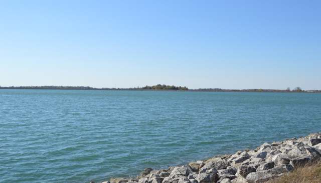
Photo: Nyttend, public domain · Wikimedia Commons
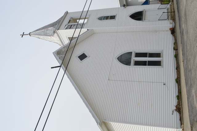
Photo: Nyttend, public domain · Wikimedia Commons
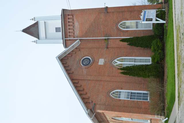
Photo: Nyttend, public domain · Wikimedia Commons
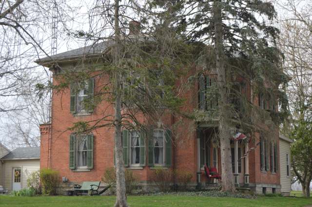
Photo: Nyttend, public domain · Wikimedia Commons
Local history sources: web.archive.org · archive.org · en.wikipedia.org · crawfordcountyohiogenealogy.org · bucyrushistoricalsociety.org · en.wikipedia.org · commons.wikimedia.org · archive.org
Water
Mostly private wells The water here
- Bucyrus City100% of residentsSandusky River (via Outhwaite & Riley up-ground reservoirs)
Hospitals, fire stations and more
Inside Liberty Township, Crawford County's boundary: 1 fire or EMS station, 3 high-hazard dams, 1 poor-rated bridge, 1 Toxics Release Inventory facility and 4 spill cases. Press a pin or a name for its whole record and its source.
Fire and EMS stations (1)
-
Liberty Township Fire DepartmentSulphur Springs
- Address
- 4628 Liberty Street, Sulphur Springs, OH 44820
- Coordinates
- 40.87207, -82.87722
USGS National Map structures (source) ↗ Street map and directions ↗
Source: USGS National Map structures (most Ohio records last updated 2019 to 2022), checked against the Columbus and Cleveland station lists. The department that answers a call is set by jurisdiction and mutual aid, not by distance.
High-hazard dams (3)
-
Bucyrus Reservoir No. 1 Dam PoorTributary To Sandusky River · condition: poor
- Hazard class
- High: a failure would probably cost a life
- Condition
- Poor (assessed 05/17/2024)
- River or stream
- Tributary To Sandusky River
- Purpose
- Recreation
- Type
- Earth
- Height
- 18 ft
- Storage
- 878 acre-feet
- Completed
- 1900
- Owner type
- Local Government
- County
- Crawford County
- Nearest town (NID)
- Bucyrus
- Last inspection
- 06/08/2023
- Emergency action plan
- Yes
- NID ID
- OH00151
National Inventory of Dams record ↗ National Inventory of Dams (source) ↗ Street map and directions ↗
-
Bucyrus Reservoir No. 3 DamSandusky River - Offstream · condition: fair
- Hazard class
- High: a failure would probably cost a life
- Condition
- Fair (assessed 05/17/2024)
- River or stream
- Sandusky River - Offstream
- Purpose
- Water Supply
- Type
- Earth
- Height
- 32 ft
- Storage
- 695 acre-feet
- Completed
- 1955
- Owner type
- Local Government
- County
- Crawford County
- Nearest town (NID)
- Bucyrus
- Last inspection
- 06/08/2023
- Emergency action plan
- Yes
- NID ID
- OH00153
National Inventory of Dams record ↗ National Inventory of Dams (source) ↗ Street map and directions ↗
-
Bucyrus Upground Reservoir No. 4Offstream · condition: fair
- Hazard class
- High: a failure would probably cost a life
- Condition
- Fair (assessed 05/17/2024)
- River or stream
- Offstream
- Purpose
- Water Supply;Recreation
- Type
- Earth
- Height
- 29 ft
- Storage
- 4,626 acre-feet
- Completed
- 1983
- Owner type
- Local Government
- County
- Crawford County
- Nearest town (NID)
- Bucyrus
- Last inspection
- 06/08/2023
- Emergency action plan
- Yes
- NID ID
- OH01467
National Inventory of Dams record ↗ National Inventory of Dams (source) ↗ Street map and directions ↗
Source: U.S. Army Corps of Engineers National Inventory of Dams, August 2026. "High hazard" rates what a failure would cost downstream, not how likely one is; the condition is the state's assessment.
Bridges rated poor (1)
-
US 30 over Ns R/rPoor · built 1970
- Condition
- Poor: a deck, superstructure, substructure or culvert rated 4 or below on the 0 to 9 scale
- What it is
- Bridge
- Built
- 1970
- Length
- 52 ft
- Owner
- State
- Vehicles a day
- 6,325
- Coordinates
- 40.82636, -82.95614
National Bridge Inventory (source) ↗ Street map and directions ↗
Source: FHWA National Bridge Inventory 2025. "Poor" means one major part rated 4 or below on the 0 to 9 scale; it calls for repair, not closing, unless the state posts or closes the bridge.
Facilities reporting toxic releases (1)
-
Countrystar Co-Op Ridgeton BranchToxics Release Inventory · Bucyrus
- Address
- 3507 Ridgeton Rd, Bucyrus, OH 44820
- County
- Crawford County
- Status
- Reports to the Toxics Release Inventory (active)
- EPA program ID
- 44820LYKNS3507R
- EPA registry ID
- 110000577750
EPA facility record ↗ EPA Facility Registry Service (source) ↗ Street map and directions ↗
Source: EPA Facility Registry Service, Toxics Release Inventory reporters. Reporting a release is required of large users of listed chemicals; it is not by itself a violation.
Spills reported since 2021 (4)
-
Fuel Diesel / Diesel Fuel (Vehicle On Or Off Road)2025-04-21 · Liberty Twp
- Reported
- 2025-04-21
- What spilled
- Fuel Diesel / Diesel Fuel (Vehicle On Or Off Road)
- Where
- Liberty Twp, Crawford County
- Ohio EPA district office
- NWDO
- Ohio EPA case number
- 2504EPA0000605
Ohio EPA spill reports (source) ↗ Street map and directions ↗
-
Manure Nos (Not Specified)2023-07-23 · Sandusky Twp
- Reported
- 2023-07-23
- What spilled
- Manure Nos (Not Specified)
- Where
- Sandusky Twp, Crawford County
- Ohio EPA district office
- NWDO
- Ohio EPA case number
- 2307EPA0001247
Ohio EPA spill reports (source) ↗ Street map and directions ↗
-
Sheen Rainbow / Hydrocarbon Reached water2021-03-31 · Liberty Twp
- Reported
- 2021-03-31
- What spilled
- Sheen Rainbow / Hydrocarbon; Fish Kill; Fuel Diesel / Diesel Fuel (Vehicle On Or Off Road)
- Reached a waterway
- 17 - Broken Sword Creek
- Where
- Liberty Twp, Crawford County
- Ohio EPA district office
- NWDO
- Ohio EPA case number
- 2103EPA0000438
Ohio EPA spill reports (source) ↗ Street map and directions ↗
-
Aluminum Sulfate (Al2(So4)3)2021-02-25 · Liberty Twp
- Reported
- 2021-02-25
- What spilled
- Aluminum Sulfate (Al2(So4)3)
- Largest amount reported
- 200 gallons
- Where
- Liberty Twp, Crawford County
- Ohio EPA district office
- NWDO
- Ohio EPA case number
- 2102EPA0000246
Ohio EPA spill reports (source) ↗ Street map and directions ↗
Source: Ohio EPA emergency response spill reports, 2021 to September 2026, one point per case where Ohio EPA placed it. A report is what the caller or responder recorded; amounts are often blank or estimated.
Its ZIP codes
Each ZIP code that touches Liberty Township, Crawford County, with the share of its residents who live here and the same headline figures as the ZIP page.
| ZIP | Share | Water | Radon | Home value | Schools | Flood |
|---|---|---|---|---|---|---|
| 44881 Liberty Township and Sulphur Springs | 100% | Mostly private wells | Too few radon tests | Median year built 1910 | Colonel Crawford Local · 4.5 stars overall | 0.0% of residents in the 1% floodplain |
| 44820 Bucyrus | 7% | Sandusky River (via Outhwaite & Riley up-ground reservoirs) | 3.9 pCi/L average radon | Median year built 1960 | Bucyrus City · 3.5 stars overall | 2.4% of residents in the 1% floodplain |
Local government
Who holds office in Liberty Township, Crawford County, how its elections and ballot issues came out, and the state auditor's record.
Money issues on the ballot since 2026: 2 of 2 passed.
Ballot issues
| Date | Issue | For | Against | Result |
|---|---|---|---|---|
| 2026-05-05 | Issue 5: EMS LEVY RENEWAL LIBERTY TOWNSHIP | 174 | 62 | Passed (73.73% for) |
| 2026-05-05 | Issue 6: FIRE LEVY RENEWAL LIBERTY TOWNSHIP | 172 | 65 | Passed (72.57% for) |
| 2023-05-02 | Issue 1: Liberty Township Liberty Township | 94 | 13 | Passed (87.85% for) |
| 2023-05-02 | Issue 2: Liberty Township Liberty Township | 93 | 14 | Passed (86.92% for) |
Elections for office
| Date | Office | Candidates and votes |
|---|---|---|
| 2025-11-04 | Township Trustees | Alan Leonhardt 104, 46.43%; Mark Schimpf 120, 53.57% |
| 2023-11-07 | Township Trustee | Jamie Sherk 404, 100.0% |
| 2023-11-07 | Township Fiscal Officer | Stacey A. Sutherland 397, 100.0% |
| 2021-11-02 | Township Trustee | Douglas R. Cramer 168, 48.0%; Mark Schimpf 182, 52.0% |
| 2019-11-05 | Township Trustee | Jamie Sherk 179, 100.0% |
| 2019-11-05 | Township Fiscal Officer | Stacey A. Sutherland 181, 100.0% |
Winners in bold. Results from the county board of elections' official canvass unless marked.
Auditor of State record
- No fiscal caution, watch or emergency on the Auditor of State's lists.
- Agreed Upon Procedures, 2024 to 2025, released 2026-06-23
The county
Crawford County: 8 ZIP codes, 22 cities, villages and townships, 43,874 people.
Nearby places
Quick answers
What county is Liberty Township, Ohio in?
Liberty Township, Crawford County is a township in Crawford County, Ohio, with 1,358 residents.
When was Liberty Township, Ohio founded?
Liberty Township, Crawford County was settled 1820; incorporated 1825. Founders on record: organized as a township; first settlers Daniel McMichael and Ralph Bacon in 1820, then John Maxfield and John O. Blowers in 1821. Source
What ZIP code is Liberty Township, Ohio?
Liberty Township, Crawford County is served by ZIP codes 44881 and 44820; 44881 holds the largest share of its residents.
Where does Liberty Township, Ohio get its water?
The main water source for Liberty Township, Crawford County (Bucyrus City): Mostly private wells.
Cite this page
Cite this page as:
Cracked Buckeye, "Liberty Township, Crawford County", https://crackedbuckeye.com/place/liberty-township-crawford-county/, built 2026-10-31, accessed [date].
How to cite · Report a correction · Built 2026-10-31
