Local events in Johnson Township, Champaign County
Nothing is posted for Johnson Township itself yet; here is what is on within 10 miles. All local events in Johnson Township, Champaign County
Know a calendar we should watch? Send the link
Checked October 20; the events page is refreshed daily.
How Johnson Township, Champaign County began
Johnson Township, in western Champaign County against the Miami and Shelby county lines, was set off in 1821 and named for Maj. Silas Johnson, a Revolutionary War spy and War of 1812 officer who came from Fayette County, Kentucky, and built the first cabin here in 1802. Its first farms were a settlement of German-speaking families from Virginia's Shenandoah Valley, among them the Comers, Hanbacks, Longs and Kizers along Nettle Creek, beside a deserted Native village the pioneers called Nettletown. The township holds the southern part of St. Paris, which David Huffman laid out in 1831, the crossroads of Millerstown, platted in 1837, and Kiser Lake, a state park on land the Kiser family gave to Ohio. It is among the highest farmland in Ohio and was known in 1876 for having the state's largest buckeye tree.
Settled 1802, incorporated 1821, by first settler Maj. Silas Johnson and his sons James and Charles.
Where the name comes from
Named for Maj. Silas Johnson, the first white settler within its limits. Born in Virginia in 1758 to Irish parents, he had lived about twenty years in Fayette County, Kentucky, served as a spy watching Native movements during the Revolution, and was a major of Ohio militia in the War of 1812; the 1881 history credits him with getting the township established.
Before the town
When Philip Comer's family arrived in 1810 on the land Silas Johnson had first cleared, they found a Native town of thirteen huts still standing but empty, some already torn down. The huts were small, built of elm poles like a rail pen and roofed with bark. The pioneers called the place Nettletown because it stood on a branch of Nettle Creek, and the 1881 history says the settlers' mail went to and from it. The history also tells of two Native men who confronted Silas Johnson and his sons at their campfire, before they had built a shelter, over their coming onto Native land, and of a Native boy who watched the Comers roof their stable. It does not name the nation that built Nettletown. The land was ceded under the Treaty of Greenville (1795).
- Nettletown (village) — on a tributary of Nettle Creek, on the farm first cleared by Silas Johnson and later owned by the Comer family, about half a mile west of Millerstown, standing but deserted by 1810 (archive.org)
Timeline
- — Silas Johnson and his sons James and Charles came from Fayette County, Kentucky, built a pole cabin and cleared ground before returning for the rest of the family.
- — The Johnson family of nine arrived in January; when the land was surveyed and valued at eight dollars an acre, Johnson moved to the cheaper section to the north.
- — Acory Berry of Shenandoah County, Virginia, entered 320 acres in section 6; the 1917 history dates his arrival to 1807.
- — 'Big' John and Philip Long came from Horseshoe Bend, Rockingham County, Virginia; a third John Long, called 'Cucumber' John, came later.
- — Philip Comer of Shenandoah County, Virginia, bought the land Silas Johnson had first cleared, now valued at four dollars an acre; his family of twelve arrived by five-horse wagon in 1810.
- — Joseph Kizer arrived from the Shenandoah Valley and settled near the later Millerstown; he became the township's first justice of the peace in 1816.
- — David Huffman came from Culpeper County, Virginia, and entered a half-section that included the later site of St. Paris.
- — Rev. Saul Henkle held the settlement's first recorded religious service in Philip Comer's barn.
- — The township's first schoolhouse, a round-log building, was put up on the Zerkle farm; a teacher named Jackson taught there.
- — Silas Johnson moved to Adams Township, where he died the next year.
- — Henry Long built the first sawmill, on Mosquito Creek near the lake.
- — Johnson Township was set off, and the Salem Lutheran and Reformed Union Church, a round-log building, was put up at the site of Salem Cemetery in section 1.
- — William Hill built the township's first grist mill, on Mosquito Creek at the mouth of Mosquito Lake.
- — David Huffman laid out St. Paris, naming it for the French capital and adding 'Saint' because Ohio already had a New Paris.
- — Millerstown was surveyed by John Arrowsmith on the farm of the late Casper Miller for his son Christ and a cousin, John G. Miller.
- — A post office opened at Millerstown; it closed in 1903.
- — A dam was built at the site of today's Kiser Lake to power a mill.
- — The largest buckeye tree in Ohio, found on E. H. Furrow's farm north of St. Paris, was cut for the Centennial Exposition in Philadelphia but was not sent because parts of it were unsound.
- — The township counted 2,479 people, up from 1,213 in 1840.
- — John and Thyrza Kiser, whose family later gave the state the land for Kiser Lake, built the Kiser Mansion in neighboring St. Paris village.
- — John W. Kiser gave the land at the old mill dam to the State of Ohio to rebuild the lake for recreation.
- — The new dam begun in 1939 was finished and Kiser Lake filled.
Stories
A family's gift becomes a lake
The Kiser family of St. Paris, prosperous enough by 1913 to build a Classical Revival mansion on the village's Main Street, also gave the land in Johnson Township that became Kiser Lake, now a state park, and the wetlands beside it that are protected today as the Kiser Lake Wetlands State Nature Preserve. The same family funded the building that became the village's public library. What was once part of a single family's private landholding in this quiet farm township is now public parkland used by residents across the county.
Hanback's wife and the three acres
Lewis Hanback came from Shenandoah County, Virginia, in 1808 and entered 160 acres of second-rate land in section 14 at $2.25 an acre. Government land was then sold on installments, and a missed payment meant losing the land and everything built on it. When Hanback went away to the War of 1812, his wife Barbara stayed with the children, gave birth to another while he was gone, and cleared nearly three acres with an ax so the family could meet the next payment. The 1881 county history says it was the fear of forfeiture that 'prompted the noble wife of Hanback to grasp the ax'.
Two red heads in the hay
During the War of 1812, the frontiersman Simon Kenton was among the men watching Native movements near the Nettle Creek settlement. The 1881 county history records that one day, wanting to stay out of sight of a passing party, Kenton climbed into the loft of Philip Comer's stable. As his head came through the opening, a voice from the haymow called out that he should go back, because 'twill never do for two red heads to be with the hay, as it will surely take fire.' The history does not say who was already hiding there.
Photographs
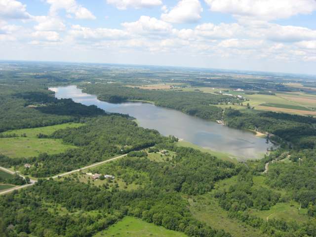
Photo: Nyttend (Wikimedia Commons), public domain · Wikimedia Commons
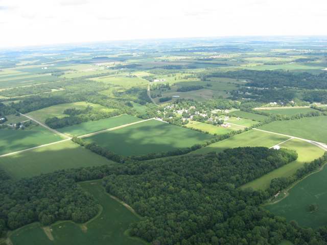
Photo: Nyttend (Wikimedia Commons), public domain · Wikimedia Commons
Local history sources: en.wikipedia.org · gohistoric.com · archive.org · archive.org · archive.org · archive.org · archive.org · archive.org · archive.org · archive.org · archive.org · archive.org · en.wikipedia.org · en.wikipedia.org · archive.org · archive.org · commons.wikimedia.org · commons.wikimedia.org
Water
Mostly private wells The water here
- Saint Paris Village85% of residentsGroundwater wells (3 wells)
- Christiansburg Village10% of residentsGroundwater wells (2 wells)
- Grandview Heights Civic Association5% of residentsGroundwater wells (2 wells)
Hospitals, fire stations and more
Inside Johnson Township, Champaign County's boundary: 1 high-hazard dam, 1 private school, 1 Toxics Release Inventory facility and 2 spill cases. Press a pin or a name for its whole record and its source.
High-hazard dams (1)
-
Kiser Lake DamMosquito Creek · condition: fair
- Hazard class
- High: a failure would probably cost a life
- Condition
- Fair (assessed 11/20/2019)
- River or stream
- Mosquito Creek
- Purpose
- Recreation
- Type
- Earth
- Height
- 25 ft
- Storage
- 4,450 acre-feet
- Completed
- 1939
- Owner type
- State
- County
- Champaign County
- Nearest town (NID)
- Pasco
- Last inspection
- 11/19/2024
- Emergency action plan
- Yes
- NID ID
- OH00435
National Inventory of Dams record ↗ National Inventory of Dams (source) ↗ Street map and directions ↗
Source: U.S. Army Corps of Engineers National Inventory of Dams, August 2026. "High hazard" rates what a failure would cost downstream, not how likely one is; the condition is the state's assessment.
Private schools (1)
-
Operation Rebirth Christian AcademyPrivate, religious, independent · Saint Paris
- Address
- 1638 Apple Rd, Saint Paris, OH 43072
- Kind
- religious, independent
- Students, 2023-24
- 4
- Teachers (full-time equivalent)
- 2
- Students per teacher
- 2
- Phone
- (937) 663-5765
- NCES private school ID
- A9300710
Source: NCES Private School Survey 2023-24.
Facilities reporting toxic releases (1)
-
Kth Parts Industries IncToxics Release Inventory · Saint Paris
- Address
- 1111 N. St.Rte. 235, Saint Paris, OH 43072
- County
- Champaign County
- Status
- Reports to the Toxics Release Inventory (active)
- EPA program ID
- 43072KTHPR1111N
- EPA registry ID
- 110000381747
EPA facility record ↗ EPA Facility Registry Service (source) ↗ Street map and directions ↗
Source: EPA Facility Registry Service, Toxics Release Inventory reporters. Reporting a release is required of large users of listed chemicals; it is not by itself a violation.
Spills reported since 2021 (2)
-
Antifreeze Vehicle Cooling2025-04-23 · Johnson Twp
- Reported
- 2025-04-23
- What spilled
- Antifreeze Vehicle Cooling
- Where
- Johnson Twp, Champaign County
- Ohio EPA district office
- SWDO
- Ohio EPA case number
- 2504EPA0000623
Ohio EPA spill reports (source) ↗ Street map and directions ↗
-
Fuel Jet / Kerosene (All)2024-01-01 · Johnson Twp
- Reported
- 2024-01-01
- What spilled
- Fuel Jet / Kerosene (All)
- Where
- Johnson Twp, Champaign County
- Ohio EPA district office
- SWDO
- Ohio EPA case number
- 2401EPA0000001
Ohio EPA spill reports (source) ↗ Street map and directions ↗
Source: Ohio EPA emergency response spill reports, 2021 to September 2026, one point per case where Ohio EPA placed it. A report is what the caller or responder recorded; amounts are often blank or estimated.
Its ZIP codes
Each ZIP code that touches Johnson Township, Champaign County, with the share of its residents who live here and the same headline figures as the ZIP page.
| ZIP | Share | Water | Radon | Home value | Schools | Flood |
|---|---|---|---|---|---|---|
| 43072 St Paris and Saint Paris | 25% | Mostly private wells | 5.2 pCi/L average radon | Median year built 1965 | Graham Local · 4.5 stars overall | 0.5% of residents in the 1% floodplain |
| 45317 Brown Township and Conover | 9% | Mostly private wells | 2.5 pCi/L average radon | Median year built 1942 | Miami East Local · 5 stars overall | 0.0% of residents in the 1% floodplain |
Local government
Who holds office in Johnson Township, Champaign County, how its elections and ballot issues came out, and the state auditor's record.
Ballot issues
| Date | Issue | For | Against | Result |
|---|---|---|---|---|
| 2020-11-03 | Issue: Johnson Township | 494 | 386 | Passed (56.14% for) |
Elections for office
| Date | Office | Candidates and votes |
|---|---|---|
| 2023-11-07 | Township Trustee | David Ervin 898, 100.0% |
| 2023-11-07 | Township Fiscal Officer | Nicalette Sarver 545, 53.27%; Gina Verlaney 478, 46.73% |
Winners in bold. Results from the county board of elections' official canvass unless marked.
Auditor of State record
- No fiscal caution, watch or emergency on the Auditor of State's lists.
- Financial Audit, 2024 to 2025, released 2026-08-04
- Agreed Upon Procedures, 2022 to 2023, released 2024-10-01
The county
Champaign County: 9 ZIP codes, 17 cities, villages and townships, 37,209 people.
Nearby places
Quick answers
What county is Johnson Township, Ohio in?
Johnson Township, Champaign County is a township in Champaign County, Ohio, with 1,456 residents.
When was Johnson Township, Ohio founded?
Johnson Township, Champaign County was settled 1802; incorporated 1821. Founders on record: first settler Maj. Silas Johnson and his sons James and Charles. Source
How did Johnson Township, Ohio get its name?
Named for Maj. Source
What ZIP code is Johnson Township, Ohio?
Johnson Township, Champaign County is served by ZIP codes 43072 and 45317; 43072 holds the largest share of its residents.
Where does Johnson Township, Ohio get its water?
The main water source for Johnson Township, Champaign County (Saint Paris Village): Mostly private wells.
Cite this page
Cite this page as:
Cracked Buckeye, "Johnson Township, Champaign County", https://crackedbuckeye.com/place/johnson-township-champaign-county/, built 2026-10-31, accessed [date].
How to cite · Report a correction · Built 2026-10-31
