Local events in Clay Township, Tuscarawas County
Nothing is posted for Clay Township itself yet; here is what is on within 20 miles. All local events in Clay Township, Tuscarawas County
Know a calendar we should watch? Send the link
Checked October 20; the events page is refreshed daily.
Deep dives about Clay Township, Tuscarawas County
Long reads built from maps, newspapers and public records. All deep dives
How Clay Township, Tuscarawas County began
Clay Township, in south-central Tuscarawas County, was set off from Salem Township on March 2, 1824. It holds the Gnadenhutten tract, where the Moravian mission village stood until the massacre of March 8, 1782, and where Heckewelder returned in 1798 and the first white lessees settled in 1799. German-speaking Moravian families and Yankee neighbours farmed the valley along the Tuscarawas, the Ohio Canal (Lock 17, 1829) and, later, the railroad. The township counted 1,942 residents in 2020.
Settled 1798-1799 (Heckewelder at Gnadenhutten, 1798; first lessee families, 1799), incorporated March 2, 1824 (set off from Salem Township), by John Heckewelder and the Moravian lessees of the Gnadenhutten tract.
Where the name comes from
Clay is the name of nine Ohio townships, many of them named for the statesman Henry Clay; no local naming account is recorded for this township.
Before the town
The township's central 4,000 acres are the Gnadenhutten Moravian tract, site of the Christian Indian mission village where, on March 8, 1782, ninety-six converts were killed; the 1884 county history says the cemetery grove holds the mission site (with an apple tree planted by the Indians in 1774) and that bones turned up in digging graves showed it was earlier an Indian burial ground. Missionaries returned in 1798 and the tract passed to the United States in 1824. The land lies in the area ceded by the Treaty of Greenville (1795).
Nations recorded here: Lenape (Delaware).
- Gnadenhutten mission village and cemetery (burial) — south part of the village of Gnadenhutten on the east bank of the Tuscarawas, mission 1772-1782; earlier burials not dated (archive.org)
Timeline
- — On March 8, ninety-six Christian Indians at the mission village of Gnadenhutten are killed by a border militia force; the cemetery marks the site.
- — John Heckewelder and William Edwards reach Gnadenhutten on June 18 to restore the Moravian mission; on September 29 Heckewelder moves into the first house, on Lot 3 at Main and Cherry streets, and on October 8 the Salem and Gnadenhutten tracts are surveyed into farming lots.
- — Paul Greer, Peter Edmonds, Ezra Warner and Peter Warner arrive from Pennsylvania on May 29 and clear land west of the river, becoming the first permanent white settlers in what is now Tuscarawas County; by the end of the year the Warner, Walton and Everett families are on the Gnadenhutten tract as lessees.
- — School opens at Beersheba on February 3 with eighteen children; the Rev. Lewis Huebner and his wife arrive at Gnadenhutten in July.
- — A horse mill completed at Gnadenhutten on December 9 grinds the first meal in the county; a twenty-foot well finished on July 6 stands in Main Street and is still in use in 1884.
- — The Tuscarawas overflows its banks in a remarkable flood on May 11 and 12, noted in the records of Beersheba church.
- — Clay Township is set off from Salem Township on March 2, 1824, with its first election ordered at the house of John G. Demuth; its original bounds took in most of what is now Rush and Clay townships.
- — James Patrick, agent for the United States, surveys Gnadenhutten in September into 83 inlots and 32 outlots after the Moravian tract reverts to the government.
- — The Ohio and Erie Canal is built through the Tuscarawas Valley past Gnadenhutten and the township's river bottoms; a 1913 flood later destroys the canal works, which are never rebuilt.
- — Whitaker and Avery build Lock 17 of the Ohio Canal; John G. Demuth later puts up a warehouse and store there and the lock becomes a hamlet.
- — A towering monument to the murdered Christian Indians is dedicated in the Gnadenhutten cemetery.
- — Gnadenhutten has 336 people (284 in 1870) and Lock 17 has 55; the village has two hotels, two general stores and a three-room frame school.
- — The census counts 1,942 residents in Clay Township.
Stories
The families from Pennsylvania
After the Moravian mission era ended in violence and relocation in the 1780s and 1790s, the land around Gnadenhutten drew a different wave of settlers: German-speaking families from Pennsylvania with surnames like Uhrich, Peter, Roming, Stocker and Blickensderfer. In 1824 the area was set off from Salem Township as Clay Township. The 1884 county history says that Heckewelder kept the first tavern at Gnadenhutten and John G. Demuth the second, and that Conrad Westhaeffer worked as a weaver and ran the ferry until 1812.
Heckewelder returns to the Tuscarawas
In June 1798 John Heckewelder, the Moravian agent, came back to the valley from the Canadian mission with William Edwards and five Indian brethren, intending to restore Gnadenhutten to its Christian Indian owners, as he had known it before 1782. The Indian mission lasted only a short time before it was merged with the Goshen mission, and the Gnadenhutten and Salem tracts, held in trust by the Society of United Brethren, were opened to Moravian lessees from Pennsylvania. Heckewelder built the first house on Lot 3, kept the first tavern and served as first postmaster. The lessees settled on both banks: those west of the river, in the Yankeetown settlement, spoke English, while Gnadenhutten across the water held to German for many years. The tract reverted to the United States in 1824, the year the township was set off, and Patrick's survey turned it into a town.
What things cost in 1800
The Beersheba church records preserved a price list from the Gnadenhutten settlement in 1800, when everything came by wagon from Georgetown on the Ohio at $2 per 100 pounds. Salt ran 11 shillings 3 pence a peck, powder 9 shillings 6 pence a pound, a blanket 22 shillings, and a day's labor 3 shillings 9 pence, while venison was 3 pence and corn cheap enough to be lost in the totals. A brass kettle was $5.50 and raccoon skins were taken at two shillings each. David Peter, who arrived from Bethlehem in October 1799 to run the store of the Moravian society, was later postmaster of Gnadenhutten until 1840.
Photographs
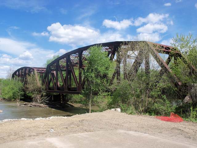
Photo: Roseohioresident (Wikimedia Commons), CC BY-SA 4.0 · Wikimedia Commons
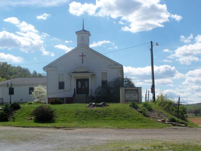
Photo: Roseohioresident (Wikimedia Commons), CC BY-SA 4.0 · Wikimedia Commons
Local history sources: en.wikipedia.org · en.wikipedia.org · genealogytrails.com · en.wikipedia.org · commons.wikimedia.org · archive.org
Water
Groundwater wells (2 wells) The water here
- Gnadenhutten96% of residentsGroundwater wells (2 wells)
- Tuscarawas Village4% of residentsGroundwater wells (2 wells)
Hospitals, fire stations and more
Inside Clay Township, Tuscarawas County's boundary: 4 shale and injection wells and 1 spill case. Press a pin or a name for its whole record and its source.
Shale and injection wells (4)
-
E. & L. Gardner {Swiw#1} 1 InjectionInjection well (Class II)
- What it is
- Injection well (Class II)
- Operator
- Mainspring Llc
- County
- Tuscarawas County
- API well number
- 34157205750000
- Coordinates
- 40.32028, -81.46531
ODNR oil and gas wells (source) ↗ Street map and directions ↗
-
Glass C B 1 {Swiw#4} InjectionInjection well (Class II)
- What it is
- Injection well (Class II)
- Operator
- Mainspring Llc
- County
- Tuscarawas County
- API well number
- 34157205420000
- Coordinates
- 40.33019, -81.47165
ODNR oil and gas wells (source) ↗ Street map and directions ↗
-
Nettle 3HUtica shale well
- What it is
- Utica shale well
- Drilled sideways
- Yes
- Operator
- Eog Ohio, Llc
- County
- Tuscarawas County
- API well number
- 34157254940000
- Coordinates
- 40.29522, -81.43618
ODNR oil and gas wells (source) ↗ Street map and directions ↗
The point is the surface well head (the pad); a horizontal well runs a mile or more underground from it.
-
Nora Garrett {Swiw#6} 21 InjectionInjection well (Class II)
- What it is
- Injection well (Class II)
- Operator
- Mainspring Llc
- County
- Tuscarawas County
- API well number
- 34157243110000
- Coordinates
- 40.33397, -81.44998
ODNR oil and gas wells (source) ↗ Street map and directions ↗
Source: ODNR Division of Oil and Gas Resources well inventory (September 2026): drilled Utica, Marcellus and horizontal wells and Class II injection wells not plugged. Older vertical wells are on the full map.
Spills reported since 2021 (1)
-
Fuel Diesel / Diesel Fuel (Vehicle On Or Off Road)2022-03-02 · Clay Twp
- Reported
- 2022-03-02
- What spilled
- Fuel Diesel / Diesel Fuel (Vehicle On Or Off Road)
- Largest amount reported
- 50 gallons
- Where
- Clay Twp, Tuscarawas County
- Ohio EPA district office
- SEDO
- Ohio EPA case number
- 2203EPA0000262
Ohio EPA spill reports (source) ↗ Street map and directions ↗
Source: Ohio EPA emergency response spill reports, 2021 to September 2026, one point per case where Ohio EPA placed it. A report is what the caller or responder recorded; amounts are often blank or estimated.
Its ZIP codes
Each ZIP code that touches Clay Township, Tuscarawas County, with the share of its residents who live here and the same headline figures as the ZIP page.
| ZIP | Share | Water | Radon | Home value | Schools | Flood |
|---|---|---|---|---|---|---|
| 44629 Gnadenhutten | 23% | Groundwater wells (2 wells) | 8.4 pCi/L average radon | Median year built 1954 | Indian Valley Local · 4.5 stars overall | 8.8% of residents in the 1% floodplain |
| 43837 Port Washington | 7% | Mostly private wells | 18.6 pCi/L average radon | Median year built 1972 | Indian Valley Local · 4.5 stars overall | 2.8% of residents in the 1% floodplain |
Local government
Who holds office in Clay Township, Tuscarawas County, how its elections and ballot issues came out, and the state auditor's record.
Elections for office
| Date | Office | Candidates and votes |
|---|---|---|
| 2019-11-05 | Township Trustee | David Arnold 20, 18.02%; Brice E. Miller 91, 81.98% |
| 2019-11-05 | Township Fiscal Officer | Debbie Gray 96, 100.0% |
Winners in bold. Results from the county board of elections' official canvass unless marked.
Auditor of State record
- No fiscal caution, watch or emergency on the Auditor of State's lists.
- Basic Audit, 2023 to 2024, released 2025-04-22
The county
Tuscarawas County: 17 ZIP codes, 40 cities, villages and townships, 92,903 people.
Nearby places
Quick answers
What county is Clay Township, Ohio in?
Clay Township, Tuscarawas County is a township in Tuscarawas County, Ohio, with 732 residents.
When was Clay Township, Ohio founded?
Clay Township, Tuscarawas County was settled 1798-1799 (Heckewelder at Gnadenhutten, 1798; first lessee families, 1799); incorporated March 2, 1824 (set off from Salem Township). Founders on record: John Heckewelder and the Moravian lessees of the Gnadenhutten tract. Source
How did Clay Township, Ohio get its name?
Clay is the name of nine Ohio townships, many of them named for the statesman Henry Clay; no local naming account is recorded for this township. Source
What ZIP code is Clay Township, Ohio?
Clay Township, Tuscarawas County is served by ZIP codes 44629 and 43837; 44629 holds the largest share of its residents.
Where does Clay Township, Ohio get its water?
The main water source for Clay Township, Tuscarawas County (Gnadenhutten): Groundwater wells (2 wells).
Cite this page
Cite this page as:
Cracked Buckeye, "Clay Township, Tuscarawas County", https://crackedbuckeye.com/place/clay-township-tuscarawas-county/, built 2026-10-31, accessed [date].
How to cite · Report a correction · Built 2026-10-31
