Local events in Athens
269 events in the next 90 days from 6 public calendars. All local events in Athens
Checked October 20; the events page is refreshed daily.
Lakes near Athens
The history under the water: the valley before, the dam, the stories. All Ohio lakes
Deep dives about Athens
Long reads built from maps, newspapers and public records. All deep dives
Notable people from Athens
Ohioans tied to this place, each with a sourced profile. All notable Ohioans

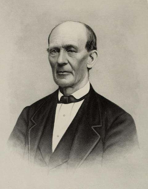
History from Athens
People and inventions tied to this place, each with its sources. All people · All inventions
How Athens began
Athens sits on a bend of the Hocking River in the hill country of southeastern Ohio, platted around 1800 by surveyors acting for the Ohio Company of Associates on land Congress had set aside in 1787 to endow a university in the Northwest Territory. The town and Ohio University, chartered February 18, 1804, grew up together and share a name drawn from the university and library of ancient Athens, Greece. Athens was incorporated as a village in 1811 and became a city in 1912 once its population passed 5,000. For more than a century its economy and identity were also shaped by the Athens Lunatic Asylum (1874-1993), one of the largest employers in the county, and by repeated Hocking River floods that led the Army Corps of Engineers to reroute the river around the city after 1968. Today Athens is the Athens County seat and a college town built around Ohio University's College Green.
Settled 1797, platted 1800, incorporated 1811 (village); 1912 (city), by Surveyors for the Ohio Company of Associates, acting under the 1787 congressional land grant that also endowed Ohio University.
Where the name comes from
Athens was named for Athens, Greece, the center of learning in the ancient world, because its founders intended the town to be the seat of a university. Athens County, formed in 1805, took the same name for the same reason.
Before the town
Archaeological evidence places human presence in the Hocking Valley back to roughly 8000-1500 BC, with people hunting elk, deer and bear and gathering nuts, berries, roots and seeds. The Adena culture (roughly 1000-800 BC onward) settled in small villages along the Hocking River in the Athens area and left pottery, ornaments and burial mounds; the Hopewell culture that followed (from about 300 BC) is associated with earthworks nearby, most notably the Plains Mound/earthworks a few miles north of Athens in what is now Athens Township, built between roughly 300 BC and AD 200. By the time Euro-American explorers and surveyors reached the area in the later 1700s, the Shawnee were the predominant nation in the region, holding the Scioto and Miami country and, per period accounts, 'the present county of Athens and adjacent region.' The Hocking River's name is itself a Native-language legacy: in the Delaware (Lenape) tongue 'Hockhocking' is said to mean 'bottle,' describing the shape of a wide place in the river near modern Lancaster, and the Shawnee term recorded for the river, rendered 'Wea-tha-kagh-qua-sepe,' is likewise translated as 'bottle river.' No specific village site, trail or treaty boundary within the present city limits of Athens itself is documented in the sources consulted; the nearest well-documented Native site (the Plains earthworks) lies outside the city in Athens Township.
Nations recorded here: Shawnee, Adena culture, Hopewell culture.
- The Plains earthworks (Plains Mound) (mound|earthwork) — The Plains, Athens Township, a few miles north of the city of Athens, Adena/Hopewell, c. 300 BC - AD 200 (athensfoundation.org)
Timeline
- — Congress grants the Ohio Company of Associates two townships of land in the Northwest Territory to endow a 'literary institution,' the land grant that later became Ohio University.
- — European-American settlers first arrive at the site that becomes Athens.
- — The town of Athens is surveyed and platted; Manasseh Cutler proposes a model charter for a university there.
- — The Ohio General Assembly passes an act, signed February 18, establishing 'the President and Trustees of the Ohio University,' the first university chartered in the Northwest Territory.
- — Athens County is formed and organized, named, like the town, for Athens, Greece.
- — Ohio University opens its doors, with three students enrolled.
- — Athens is incorporated as a village.
- — The College Edifice (later Manasseh Cutler Hall), begun in 1816, is finally completed after an 1818 lightning strike and fire delayed the work; it is the oldest academic building at Ohio University and in the original Northwest Territory.
- — The Hocking Canal opens, giving Athens a shipping connection and spurring growth.
- — Construction of the Athens Lunatic Asylum begins in 1868 on the former Coates farm; the Kirkbride-plan hospital, designed by Cleveland architect Levi T. Scofield, opens January 9, 1874.
- — Athens begins relying on groundwater for its municipal water supply; the first well is sunk about 4,400 feet west of the courthouse and 2,000 feet north of the Hocking River, near today's West State Street.
- — A confrontation between U.S. Army regulars and Ohio National Guard troops ends in gunfire on Washington Street, killing one guardsman and wounding five others.
- — Athens is incorporated as a city after its population passes 5,000.
- — The city's well system has expanded to supply about 1.3 million gallons of water per day.
- — After a severe Hocking River flood in 1968, the U.S. Army Corps of Engineers reroutes and widens about 5.5 miles of the river channel around Athens, moving it hundreds of feet from its historic course.
- — The Athens Lunatic Asylum closes; Ohio University acquires the property through a land swap the same year, later renaming it 'The Ridges.'
- — Ohio EPA and the city's groundwater consultant study sporadic volatile organic compound detections in the well field and rate the aquifer highly susceptible to contamination.
- — Ohio EPA requires Athens to obtain a Municipal Separate Storm Sewer System (MS4) permit, triggering a formal stormwater management program.
- — A major water treatment plant upgrade is completed and an orphaned brine well in the Armitage well field is plugged by an ODNR contractor.
Stories
A university before there was a state
Ohio University's roots go back further than Ohio itself. In 1787 the Continental Congress granted the Ohio Company of Associates two full townships of Northwest Territory land to endow a 'literary institution' — a promise made before a single American settler had crossed into the region. Manasseh Cutler, the New England minister and lobbyist who helped negotiate that grant, drafted a model charter for the school in 1800, and on February 18, 1804 the Ohio General Assembly formally created 'the President and Trustees of the Ohio University' in the little town of Athens. It opened its doors in 1808 with three students. The College Edifice they occupied, begun in 1816, was delayed by an 1818 lightning fire and not finished until 1819; renamed Manasseh Cutler Hall, it still stands on College Green as the oldest academic building anywhere in the old Northwest Territory, and was made a National Historic Landmark in 1965.
The asylum on the hill
In 1867 the Ohio Legislature went looking for a site in southeastern Ohio for a new state mental hospital and settled on the Coates farm outside Athens. Cleveland architect Levi T. Scofield — who also designed the Ohio State Reformatory in Mansfield — laid out a sprawling Kirkbride-plan building 853 feet long, built around the then-progressive theory that patients healed better in a home-like environment with light, air and useful work. It opened January 9, 1874, and by the 1950s the Athens Lunatic Asylum was the town's largest employer, with about 1,800 patients across 1,019 acres and 78 buildings that included its own farms, orchards, greenhouse and dairy. Early admission records list causes of 'insanity' that read as a catalogue of Victorian medicine's blind spots — epilepsy, menopause, 'hysteria.' The asylum closed in 1993 as psychiatric care moved toward community treatment; Ohio University took over the campus the same year and renamed it The Ridges after a naming contest. Three campus cemeteries hold 1,930 burials, hundreds of them marked only by number until Ohio began restoring names to the graves in 1943; a 2000 restoration effort found 80 military veterans among the dead, 68 of them from the Civil War.
Moving the river
Athens sits in a bend of the Hocking River, and the river has flooded the town repeatedly and destructively — recorded floods struck in 1832, 1873, 1907, 1937, 1949, 1964 and 1968. The 1968 flood was the last straw: the U.S. Army Corps of Engineers spent the next year rechanneling and widening about 5.5 miles of the Hocking around the city, moving the river's course hundreds of feet from where it had run for a century, in an effort to keep downtown Athens from flooding again.
Water from a well by the courthouse
Before Athens had a modern water system, the city turned to groundwater rather than the flood-prone Hocking River. Its first municipal well, sunk in 1894, sat about 4,400 feet west of the courthouse and 2,000 feet north of the river, near today's West State Street — an early recognition that the alluvial aquifer along the Hocking could supply the growing college town more reliably than the river itself. By 1954 that well system was producing roughly 1.3 million gallons a day; nearly a century later, in 2003, state and city investigators found sporadic traces of volatile organic compounds in the same aquifer and rated it highly vulnerable to contamination, a concern that shaped later stormwater rules (the 2017 MS4 permit) and a 2019 treatment-plant upgrade paired with the plugging of an old, orphaned brine well in the Armitage well field.
Photographs
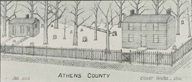
Photo: Digital Public Library of America, via Wikimedia Commons, public domain · Wikimedia Commons
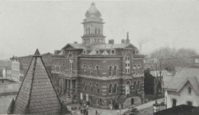
Photo: Digital Public Library of America, via Wikimedia Commons, public domain · Wikimedia Commons
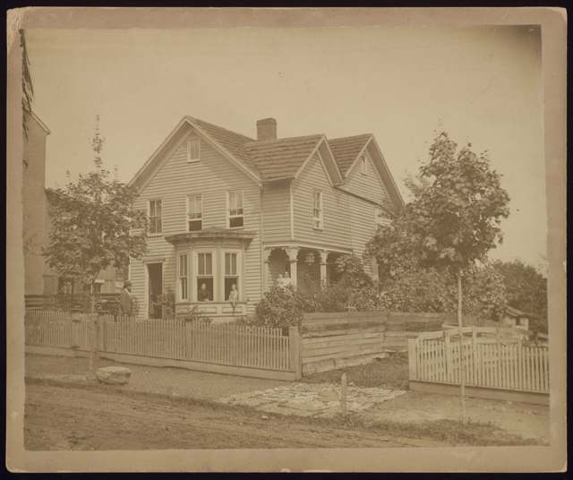
Photo: Digital Public Library of America, via Wikimedia Commons, public domain · Wikimedia Commons
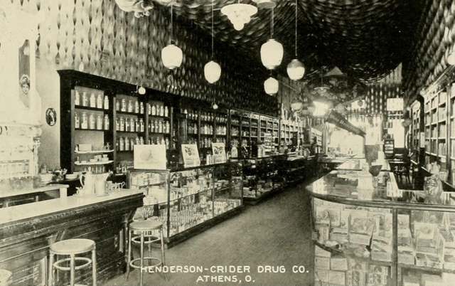
Photo: Ohio University 'Athena' yearbook, 1910, public domain · Wikimedia Commons
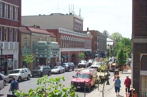
Photo: Wikimedia Commons contributor, CC BY-SA · Wikimedia Commons
Local history sources: en.wikipedia.org · en.wikipedia.org · en.wikipedia.org · ohio.edu · en.wikipedia.org · en.wikipedia.org · ohio.edu · athensfoundation.org · en.wikipedia.org · commons.wikimedia.org
Historic places
9 places in Athens on the National Register of Historic Places, 1 of them National Historic Landmark. Press a pin or a name for its whole record.
-
Manasseh Cutler Hall, Ohio University LandmarkBuilding · Athens · listed 1966
- Address
- Ohio University campus
- Where
- Athens, Athens County · ZIP 45701
- What it is
- Building
- Listed on the National Register
- 1966
- National Historic Landmark
- Yes
- NRIS reference number
- 66000604
- Coordinates
- 39.32614, -82.10038
National Register file (NPS) ↗ Search Wikipedia ↗ Street map and directions ↗ On the Cracked Buckeye map
-
Athens B & O Train DepotBuilding · Athens · listed 1983
- Address
- Depot St.
- Where
- Athens, Athens County · ZIP 45701
- What it is
- Building
- Listed on the National Register
- 1983
- NRIS reference number
- 83001944
- Coordinates
- 39.32906, -82.10576
National Register file (NPS) ↗ Search Wikipedia ↗ Street map and directions ↗ On the Cracked Buckeye map
-
Athens State Hospital Cow BarnBuilding · Athens · listed 1978
- Address
- SW of Athens off U.S. 33
- Where
- Athens, Athens County · ZIP 45701
- What it is
- Building
- Listed on the National Register
- 1978
- NRIS reference number
- 78002003
- Coordinates
- 39.31455, -82.11516
National Register file (NPS) ↗ Search Wikipedia ↗ Street map and directions ↗ On the Cracked Buckeye map
-
Beasley BuildingBuilding · Athens · listed 1982
- Address
- 93 W. Union St.
- Where
- Athens, Athens County · ZIP 45701
- What it is
- Building
- Listed on the National Register
- 1982
- NRIS reference number
- 82001358
- Coordinates
- 39.32889, -82.10495
National Register file (NPS) ↗ Search Wikipedia ↗ Street map and directions ↗ On the Cracked Buckeye map
-
Herrold, Thomas Jefferson, House and StoreBuilding · Athens · listed 1980
- Address
- 234 W. Washington St.
- Where
- Athens, Athens County · ZIP 45701
- What it is
- Building
- Listed on the National Register
- 1980
- NRIS reference number
- 80002937
- Coordinates
- 39.33235, -82.11011
National Register file (NPS) ↗ Search Wikipedia ↗ Street map and directions ↗ On the Cracked Buckeye map
-
Mount Zion Baptist ChurchBuilding · Athens · listed 1980
- Address
- Congress and Carpenter Sts.
- Where
- Athens, Athens County · ZIP 45701
- What it is
- Building
- Listed on the National Register
- 1980
- NRIS reference number
- 80002938
- Coordinates
- 39.33252, -82.10187
National Register file (NPS) ↗ Search Wikipedia ↗ Street map and directions ↗ On the Cracked Buckeye map
-
Sheltering Arms HospitalBuilding · Athens · listed 1982
- Address
- Clark St.
- Where
- Athens, Athens County · ZIP 45701
- What it is
- Building
- Listed on the National Register
- 1982
- NRIS reference number
- 82003542
- Coordinates
- 39.33567, -82.11190
National Register file (NPS) ↗ Search Wikipedia ↗ Street map and directions ↗ On the Cracked Buckeye map
-
Stedman-Shafer Grocery Warehouse BuildingBuilding · Athens
- Address
- 21 North Shafer St.
- Where
- Athens, Athens County · ZIP 45701
- What it is
- Building
- Latest NPS certification action
- 2020
- NRIS reference number
- 100005540
- Coordinates
- 39.33100, -82.11110
National Register file (NPS) ↗ Search Wikipedia ↗ Street map and directions ↗ On the Cracked Buckeye map
-
White's-Vale MillBuilding · Athens · listed 1982
- Address
- OH 682
- Where
- Athens, Athens County · ZIP 45701
- What it is
- Building
- Listed on the National Register
- 1982
- NRIS reference number
- 82003543
- Coordinates
- 39.32112, -82.12536
National Register file (NPS) ↗ Search Wikipedia ↗ Street map and directions ↗ On the Cracked Buckeye map
Source: National Park Service, National Register of Historic Places point file. The listing year is shown where NPS's certification date agrees with the listing's reference number. Listing recognizes significance; it does not restrict a private owner.
Water
Wells in the Hocking River valley aquifer at the city's West State Street well field, about 2,000 feet north of the Hocking River The water here
- Athens98% of residentsHocking River Valley aquifer (wells)
- Sunday Creek Valley Water1% of residentsHocking River Buried Valley Aquifer (wells)
- Le-ax Regional Water District1% of residentsHocking River Valley aquifer (horizontal collector wells)
- Athens Co., the Plains S.d. 10% of residentsHocking River Valley aquifer (wells)
Hospitals, fire stations and more
Inside Athens's boundary: 2 hospitals, 2 health centers, 1 dialysis center, 1 nursing home, 4 fire and EMS stations, 1 college, 3 public schools, 1 library, 5 museums, 3 police stations, 8 public charging sites, 1 Superfund site, 2 Toxics Release Inventory facilities, 1 station or terminal and 9 spill cases. Press a pin or a name for its whole record and its source.
Hospitals (2)
-
Appalachian Behavioral Health CarePsychiatric hospital · Athens
- What it is
- Psychiatric hospital
- Address
- 100 Hospital Drive, Athens, OH 45701
- County
- Athens County
- Beds
- 88
- Ownership
- Government - state
- Medicare overall rating
- not rated
- Emergency department (Medicare)
- No
- Phone
- (614) 594-5000
- Medicare ID
- 364015
Medicare Care Compare ↗ Hospital's website ↗ Where HIFLD got this record ↗ HIFLD hospitals (source) ↗ Street map and directions ↗
-
O'Bleness Memorial HospitalGeneral hospital · Athens
- What it is
- General hospital
- Address
- 55 Hospital Drive, Athens, OH 45701
- County
- Athens County
- Beds
- 135
- Helipad
- Yes
- Ownership
- Non-profit
- Medicare overall rating
- 3 of 5 stars
- Emergency department (Medicare)
- Yes
- Medicare reports it as
- Ohiohealth O'Bleness Hospital
- Phone
- (740) 592-9354
- Medicare ID
- 360014
Medicare Care Compare ↗ Hospital's website ↗ Where HIFLD got this record ↗ HIFLD hospitals (source) ↗ Street map and directions ↗
Source: HIFLD hospitals inventory via FEMA (closed hospitals it still lists left out, hospitals opened since added), with Medicare Care Compare ratings matched by name and address.
Community health centers (2)
-
Hopewell Health Centers - AthensHealth center · Athens
- Run by
- a federally qualified health center
- Setting
- Clinic
- City
- Athens
- Coordinates
- 39.32860, -82.11844
Find a Health Center (HRSA) ↗ HRSA data (source) ↗ Street map and directions ↗
-
Hopewell Health Centers - Athens RespiteHealth center · Athens
- Run by
- a federally qualified health center
- Setting
- Clinic
- City
- Athens
- Coordinates
- 39.31346, -82.11595
Find a Health Center (HRSA) ↗ HRSA data (source) ↗ Street map and directions ↗
Source: HRSA health center service delivery sites, active, September 2026 (school-based sites left out). Health centers see patients whether or not they have insurance, with fees on a sliding scale.
Dialysis centers (1)
-
Davita Rivers Edge DialysisDialysis · Athens
- Address
- 1006 E. State St., Ste. B, Athens, OH 45701
- Dialysis stations
- 12
- Medicare star rating
- 3 of 5 stars
- Services
- in-center hemodialysis, peritoneal dialysis
- Ownership
- for profit
- Chain
- DaVita
- Medicare certified since
- 2009-11-04
- Phone
- (740) 592-1364
- Medicare ID
- 362748
Medicare Care Compare ↗ CMS dialysis facility list (source) ↗ Street map and directions ↗
Source: CMS dialysis facility list, September 2026, geocoded with the Census Bureau batch geocoder (an address it could not place sits at its ZIP center).
Nursing homes (1)
-
Kimes Nursing and Rehab LLC1 of 5 stars · Athens
- Address
- 75 Kimes Lane, Athens, OH 45701
- Certified beds
- 61
- Residents on an average day
- 56
- Medicare overall rating
- 1 of 5 stars
- Health inspections
- 1 of 5 stars
- Staffing
- 1 of 5 stars
- Quality measures
- 2 of 5 stars
- Penalties since 2023
- 1 fine totalling $68,432 (latest 2026-03-09)
- Ownership
- For profit - Individual
- Takes
- Medicare and Medicaid
- Phone
- (740) 593-3391
- Medicare ID
- 366250
Medicare Care Compare ↗ CMS nursing home data (source) ↗ Street map and directions ↗
Source: CMS Care Compare nursing home provider and penalties files; Medicare star ratings run 1 to 5.
Fire and EMS stations (4)
-
Athens County Emergency Medical Services Station 51Athens
- Address
- 21 Kenny Drive, Athens, OH 45701
- Coordinates
- 39.31834, -82.13783
USGS National Map structures (source) ↗ Street map and directions ↗
-
Athens Fire Department Station 1Athens
- Address
- 61 Columbus Road, Athens, OH 45701
- Coordinates
- 39.33761, -82.10407
USGS National Map structures (source) ↗ Street map and directions ↗
-
Athens Fire Department Station 2Athens
- Address
- 454 Richland Avenue, Athens, OH 45701
- Coordinates
- 39.31030, -82.10384
USGS National Map structures (source) ↗ Street map and directions ↗
-
Richland Area Fire Department Station 2Athens
- Address
- 301 East State Street, Athens, OH 45701
- Coordinates
- 39.33722, -82.08944
USGS National Map structures (source) ↗ Street map and directions ↗
Source: USGS National Map structures (most Ohio records last updated 2019 to 2022), checked against the Columbus and Cleveland station lists. The department that answers a call is set by jurisdiction and mutual aid, not by distance.
Colleges (1)
-
Ohio University-Main CampusPublic university · Athens
- What it is
- Public university
- City
- Athens
- Students, 2023-24 (12-month count)
- 28,654
- Tuition and fees, in state
- $13,746
- Tuition and fees, out of state
- $24,114
- Graduation rate
- 66% of bachelor's students, within six years (a class of 3,991)
- IPEDS unit ID
- 204857
College Navigator (NCES) ↗ IPEDS data (source) ↗ Street map and directions ↗
Source: NCES IPEDS 2024 directory, 2023-24 enrollment and tuition, graduation rates for the 2017 (four-year) and 2020 (two-year) entering classes.
Public schools (3)
-
Athens Middle School4 of 5 stars · Athens
- Address
- 51 W State St - 55, Athens, OH 45701
- School district
- Athens City School District
- Kind (NCES)
- Regular School
- Students, 2023-24
- 360
- Teachers (full-time equivalent)
- 31
- Report card, 2025-26
- 4 of 5 stars
- Performance index
- 79.6%
- Ohio building IRN
- 024471
- NCES school ID
- 390435200098
NCES school record ↗ Ohio School Report Card ↗ Street map and directions ↗
-
East Elementary School4.5 of 5 stars · Athens
- Address
- 3 Wallace Dr, Athens, OH 45701
- School district
- Athens City School District
- Kind (NCES)
- Regular School
- Students, 2023-24
- 334
- Teachers (full-time equivalent)
- 24
- Report card, 2025-26
- 4.5 of 5 stars
- Performance index
- 86.3%
- Ohio building IRN
- 009431
- NCES school ID
- 390435200100
NCES school record ↗ Ohio School Report Card ↗ Street map and directions ↗
-
Morrison Gordon Elementary School3.5 of 5 stars · Athens
- Address
- 793 W Union St, Athens, OH 45701
- School district
- Athens City School District
- Kind (NCES)
- Regular School
- Students, 2023-24
- 387
- Teachers (full-time equivalent)
- 21
- Report card, 2025-26
- 3.5 of 5 stars
- Performance index
- 79%
- Ohio building IRN
- 025585
- NCES school ID
- 390435200101
NCES school record ↗ Ohio School Report Card ↗ Street map and directions ↗
Source: NCES EDGE public school locations 2024-25 and Common Core of Data 2023-24 (type, students, teachers); Ohio School Report Cards 2025-26 (Department of Education and Workforce), matched by name within the district.
Public libraries (1)
-
Athens BranchBranch · Athens
- Address
- 30 Home St, Athens, OH 45701
- What it is
- Branch
- Library system
- Athens County Public Libraries
- Open
- 3,120 hours a year, 52 weeks
- Building
- 20,635 sq ft
- System's visits, FY2024
- 315,692
- System's loans, FY2024
- 559,090
- People the system serves
- 62,431
- Phone
- (740) 592-4272
IMLS Public Libraries Survey (source) ↗ Street map and directions ↗
Source: IMLS Public Libraries Survey FY2024 (outlets and their systems). Any Ohio resident can get a free card at any Ohio public library.
Museums, historical societies, gardens and zoos (5)
-
Athens County Historical Society & MuseumHistorical society · Athens
- What it is
- Historical society
- City
- Athens
- Coordinates
- 39.33097, -82.10108
Search Wikipedia ↗ IMLS Museum Data Files (source) ↗ Street map and directions ↗
The museum list is IMLS's 2018 file; a museum may have closed or moved since.
-
Chagrin Falls Park Historical SocietyHistorical society · Athens
- What it is
- Historical society
- City
- Athens
- Coordinates
- 39.34578, -82.12154
Search Wikipedia ↗ IMLS Museum Data Files (source) ↗ Street map and directions ↗
The museum list is IMLS's 2018 file; a museum may have closed or moved since.
-
Kennedy Museum Of ArtArt museum · Athens
- What it is
- Art museum
- City
- Athens
- Coordinates
- 39.31910, -82.10165
Search Wikipedia ↗ IMLS Museum Data Files (source) ↗ Street map and directions ↗
The museum list is IMLS's 2018 file; a museum may have closed or moved since.
-
Ohio Valley Museum Of DiscoveryChildren's museum · Athens
- What it is
- Children's museum
- City
- Athens
- Coordinates
- 39.33747, -82.07641
Search Wikipedia ↗ IMLS Museum Data Files (source) ↗ Street map and directions ↗
The museum list is IMLS's 2018 file; a museum may have closed or moved since.
-
Trisolini GalleryArt museum · Athens
- What it is
- Art museum
- City
- Athens
- Coordinates
- 39.34852, -82.09617
Search Wikipedia ↗ IMLS Museum Data Files (source) ↗ Street map and directions ↗
The museum list is IMLS's 2018 file; a museum may have closed or moved since.
Source: IMLS Museum Data Files, 2018.
Police stations (3)
-
Athens County Sheriff's OfficeAthens
- Address
- 13 West Washington Street, Athens, OH 45701
- Coordinates
- 39.32906, -82.10185
USGS National Map structures (source) ↗ Street map and directions ↗
-
Athens Police DepartmentAthens
- Address
- 11 North College Street, Athens, OH 45701-2437
- Coordinates
- 39.32955, -82.10035
USGS National Map structures (source) ↗ Street map and directions ↗
-
Ohio University Police DepartmentAthens
- Address
- 118 Ridges Circle Drive, Athens, OH 45701
- Coordinates
- 39.32013, -82.10891
USGS National Map structures (source) ↗ Street map and directions ↗
Source: USGS National Map structures, police stations, corrected and completed by hand (September 2026). The department that answers a call is set by jurisdiction, not by distance.
Public EV charging (8)
-
ACPL CHARGER #14 Level 2 · Athens
- Address
- 30 Home Street, Athens, OH 45701
- Ports
- 4 Level 2
- Plugs
- J1772
- Network
- ChargePoint Network
- Hours
- 24 hours daily
- Phone
- 888-758-4389
Station Locator (NREL) ↗ Alternative Fuels Data Center (source) ↗ Street map and directions ↗
-
DONWOODAUTO DON WOOD FORD 3 DC fast6 DC fast · 2 Level 2 · Athens
- Address
- 2065 E State St, Athens, OH 45701
- Ports
- 6 DC fast · 2 Level 2
- Plugs
- CCS, J1772
- Network
- ChargePoint Network
- Hours
- 24 hours daily
- Phone
- 888-758-4389
Station Locator (NREL) ↗ Alternative Fuels Data Center (source) ↗ Street map and directions ↗
-
DONWOODAUTO DW FORD 14 Level 2 · Athens
- Address
- 2065 East State Street, Athens, OH 45701
- Ports
- 4 Level 2
- Plugs
- J1772
- Network
- ChargePoint Network
- Hours
- 24 hours daily
- Phone
- 888-758-4389
Station Locator (NREL) ↗ Alternative Fuels Data Center (source) ↗ Street map and directions ↗
-
DONWOODAUTO DW TOYOTA 1 DC fast1 DC fast · Athens
- Address
- 898 E State St, Athens, OH 45701
- Ports
- 1 DC fast
- Plugs
- CCS, Tesla (NACS)
- Network
- ChargePoint Network
- Hours
- 24 hours daily
- Phone
- 888-758-4389
Station Locator (NREL) ↗ Alternative Fuels Data Center (source) ↗ Street map and directions ↗
-
DONWOODAUTO HYUNDAI 1 DC fast2 DC fast · Athens
- Address
- 810 E State St, Athens, OH 45701
- Ports
- 2 DC fast
- Plugs
- CCS, CHAdeMO, Tesla (NACS)
- Network
- ChargePoint Network
- Hours
- 24 hours daily
- Phone
- 888-758-4389
Station Locator (NREL) ↗ Alternative Fuels Data Center (source) ↗ Street map and directions ↗
-
FRONT OF POOL DC FAST CHARGE DC fast1 DC fast · 2 Level 2 · Athens
- Address
- 601 E State St, Athens, OH 45701
- Ports
- 1 DC fast · 2 Level 2
- Plugs
- CCS, CHAdeMO, J1772
- Network
- ChargePoint Network
- Hours
- 24 hours daily
- Phone
- 888-758-4389
Station Locator (NREL) ↗ Alternative Fuels Data Center (source) ↗ Street map and directions ↗
-
Little Fish Brewing Co1 Level 2 · Athens
- Address
- 8675 Armitage Rd, Athens, OH 45701
- Ports
- 1 Level 2
- Plugs
- J1772
- Network
- Non-Networked
- Hours
- 24 hours daily
- Price
- Free
- Phone
- 740-447-5011
Station Locator (NREL) ↗ Alternative Fuels Data Center (source) ↗ Street map and directions ↗
-
O'BLENESS OBH STATION 36 Level 2 · Athens
- Address
- 75 Hospital Dr, Athens, OH 45701
- Ports
- 6 Level 2
- Plugs
- J1772
- Network
- ChargePoint Network
- Hours
- 24 hours daily
- Phone
- 888-758-4389
Station Locator (NREL) ↗ Alternative Fuels Data Center (source) ↗ Street map and directions ↗
Source: NREL Alternative Fuels Data Center station list (May 2026), public and open stations, the posts at one address counted as one site.
Superfund sites (1)
-
Factory and Station Ground Water PlumeSuperfund program · Athens
- Address
- Factory Street and Station Street Intersection, Athens, OH 45701
- County
- Athens County
- Status
- Superfund program site, not on the National Priorities List
- EPA program ID
- OHN000520341
- EPA registry ID
- 110071102288
EPA facility record ↗ EPA Facility Registry Service (source) ↗ Street map and directions ↗
Source: EPA Facility Registry Service, Superfund (SEMS) and National Priorities List sites. Many program sites were assessed and needed no cleanup.
Facilities reporting toxic releases (2)
-
Diagnostic Hybrids Inc.Toxics Release Inventory · Athens
- Address
- 2005 E State St Suite 100, Athens, OH 45701
- County
- Athens County
- Status
- Reports to the Toxics Release Inventory (active)
- EPA program ID
- 4570WDGNST25EST
- EPA registry ID
- 110067127727
EPA facility record ↗ EPA Facility Registry Service (source) ↗ Street map and directions ↗
-
Ts Trim Industries Inc *Toxics Release Inventory · Athens
- Address
- 10 Kenny Dr., Athens, OH 45701
- County
- Athens County
- Status
- Reports to the Toxics Release Inventory (active)
- EPA program ID
- 45701TSTRM10KEN
- EPA registry ID
- 110000771585
EPA facility record ↗ EPA Facility Registry Service (source) ↗ Street map and directions ↗
Source: EPA Facility Registry Service, Toxics Release Inventory reporters. Reporting a release is required of large users of listed chemicals; it is not by itself a violation.
Stations and terminals (1)
-
701 E State StIntercity bus stop · Greyhound Lines
- What it is
- Intercity bus stop
- Operator
- Greyhound Lines
- City
- Athens
- Coordinates
- 39.33750, -82.07700
BTS Intermodal Passenger Connectivity Database (source) ↗ Street map and directions ↗
Source: BTS Intermodal Passenger Connectivity Database and National Transit Map (2025). Bus stops are counted on the card and drawn on the full map.
Spills reported since 2021 (9)
-
Fuel Oil/ Home Heating / Heating Oil2025-09-08 · Athens
- Reported
- 2025-09-08
- What spilled
- Fuel Oil/ Home Heating / Heating Oil
- Largest amount reported
- 10 gallons
- Where
- Athens, Athens County
- Ohio EPA district office
- SEDO
- Ohio EPA case number
- 2509EPA0001518
Ohio EPA spill reports (source) ↗ Street map and directions ↗
-
Fuel Diesel / Diesel Fuel (Vehicle On Or Off Road)2024-09-25 · Athens
- Reported
- 2024-09-25
- What spilled
- Fuel Diesel / Diesel Fuel (Vehicle On Or Off Road); Oil Motor / Lube Oil / Vehicle
- Largest amount reported
- 40 gallons
- Where
- Athens, Athens County
- Ohio EPA district office
- SEDO
- Ohio EPA case number
- 2409EPA0001647
Ohio EPA spill reports (source) ↗ Street map and directions ↗
-
Fuel Diesel / Diesel Fuel (Vehicle On Or Off Road)2024-07-16 · Athens
- Reported
- 2024-07-16
- What spilled
- Fuel Diesel / Diesel Fuel (Vehicle On Or Off Road)
- Where
- Athens, Athens County
- Ohio EPA district office
- SEDO
- Ohio EPA case number
- 2407EPA0001198
Ohio EPA spill reports (source) ↗ Street map and directions ↗
-
Other / All Other / Trade Name / Mixture / Solution Etc2024-04-24 · Athens Twp
- Reported
- 2024-04-24
- What spilled
- Other / All Other / Trade Name / Mixture / Solution Etc
- Largest amount reported
- 4,000 gallons
- Where
- Athens Twp, Athens County
- Ohio EPA district office
- SEDO
- Ohio EPA case number
- 2404EPA0000677
Ohio EPA spill reports (source) ↗ Street map and directions ↗
-
Fuel Gasoline ( 25% Ethanol Not E85)2024-04-18 · Athens
- Reported
- 2024-04-18
- What spilled
- Fuel Gasoline ( 25% Ethanol Not E85)
- Where
- Athens, Athens County
- Ohio EPA district office
- SEDO
- Ohio EPA case number
- 2404EPA0000650
Ohio EPA spill reports (source) ↗ Street map and directions ↗
-
Oil Transformer Non Pcb Reached water2023-03-27 · Athens
- Reported
- 2023-03-27
- What spilled
- Oil Transformer Non Pcb
- Largest amount reported
- 25 gallons
- Reached a waterway
- Unnamed
- Where
- Athens, Athens County
- Ohio EPA district office
- SEDO
- Ohio EPA case number
- 2303EPA0000462
Ohio EPA spill reports (source) ↗ Street map and directions ↗
-
Fat(S) / Oil / Grease / Tallow Food Types (Fog)2022-12-13 · Athens
- Reported
- 2022-12-13
- What spilled
- Fat(S) / Oil / Grease / Tallow Food Types (Fog)
- Where
- Athens, Athens County
- Ohio EPA district office
- SEDO
- Ohio EPA case number
- 2212EPA0001853
Ohio EPA spill reports (source) ↗ Street map and directions ↗
-
Other / All Other / Trade Name / Mixture / Solution Etc2022-01-25 · Athens
- Reported
- 2022-01-25
- What spilled
- Other / All Other / Trade Name / Mixture / Solution Etc
- Largest amount reported
- 10 gallons
- Where
- Athens, Athens County
- Ohio EPA district office
- SEDO
- Ohio EPA case number
- 2201EPA0000075
Ohio EPA spill reports (source) ↗ Street map and directions ↗
-
Sewage Sludge / Biosolids Reached water2021-07-03 · Athens
- Reported
- 2021-07-03
- What spilled
- Sewage Sludge / Biosolids
- Reached a waterway
- 99 - Unnamed
- Where
- Athens, Athens County
- Ohio EPA district office
- SEDO
- Ohio EPA case number
- 2107EPA0000988
Ohio EPA spill reports (source) ↗ Street map and directions ↗
Source: Ohio EPA emergency response spill reports, 2021 to September 2026, one point per case where Ohio EPA placed it. A report is what the caller or responder recorded; amounts are often blank or estimated.
Its ZIP codes
Each ZIP code that touches Athens, with the share of its residents who live here and the same headline figures as the ZIP page.
| ZIP | Share | Water | Radon | Home value | Schools | Flood |
|---|---|---|---|---|---|---|
| 45701 Athens | 71% | Wells in the Hocking River valley aquifer at the city's West State Street well field, about 2,000 feet north of the Hocking River | 2.5 pCi/L average radon | Median year built 1966 | Athens City · 4 stars overall | 29% of residents in the 1% floodplain |
Local government
Who holds office in Athens, how its elections and ballot issues came out, and the state auditor's record.
Money issues on the ballot since 2020: 3 of 4 passed.
Ballot issues
| Date | Issue | For | Against | Result |
|---|---|---|---|---|
| 2026-05-05 | 1: #1 City of Athens Income Tax | 973 | 965 | Passed (50.21% for), unofficial |
| 2025-05-06 | 3: #3 City of Athens Municipal Income Tax | 632 | 843 | Failed (42.85% for) |
| 2022-05-03 | 1: #1 City of Athens Income Tax Increase | 841 | 571 | Passed (59.56% for) |
| 2020-11-03 | 1: 1 City of Athens Income Tax Levy | 4,281 | 1,622 | Passed (72.52% for), unofficial |
Elections for office
| Date | Office | Candidates and votes |
|---|---|---|
| 2025-05-06 | Treasurer (DEM primary) | Joshua Thomas 967, 100.0% |
| 2025-05-06 | President of Council (DEM primary) | Micah McCarey 1,040, 100.0% |
| 2025-05-06 | Member of Council, Ward 4 (DEM primary) | Alan G. Swank 299, 100.0% |
| 2025-05-06 | Member of Council, Ward 3 (DEM primary) | Michael Harrison Burchby Wood 276, 100.0% |
| 2025-05-06 | Member of Council, Ward 2 (DEM primary) | John Adams Staser 187, 100.0% |
| 2025-05-06 | Member of Council, Ward 1 (DEM primary) | Megan Leah Almeida 114, 55.07%; Anthony D. Jacobs 79, 38.16% |
| 2025-05-06 | Member of Council at Large (DEM primary) | Beth Clodfelter 860, 30.63%; Iva Faber 518, 18.45%; Paul Isherwood 627, 22.33%; Jessica Thomas 803, 28.6% |
| 2021-11-02 | Member of Council at Large (unofficial count) | Sarah H. Grace (DEM) 1,620, 26.54%; Damon Krane 580, 9.5%; Micah McCarey (DEM) 1,624, 26.6%; Iris Virjee 685, 11.22%; Ben Ziff (DEM) 1,596, 26.14% |
Winners in bold. Results from the county board of elections' official canvass unless marked.
Auditor of State record
- No fiscal caution, watch or emergency on the Auditor of State's lists.
- Financial Health Indicators (the Auditor of State's 17 measures; critical / cautionary / positive): 2020 0 / 1 / 16; 2021 0 / 0 / 17; 2022 0 / 2 / 15; 2023 0 / 5 / 12; 2024 1 / 1 / 15; 2025 0 / 0 / 16.
- OPERS Examination, 2025, released 2026-05-07
- Financial Audit, 2024, released 2025-12-23
- Financial Audit, 2023, released 2024-08-13
The county
Athens County: 16 ZIP codes, 29 cities, villages and townships, 67,237 people.
Nearby places
Rain and snow
How much has actually fallen on Athens, day by day, from 1893 to now. Daily totals, not averages.
- rain, last 30 days
- 1.18 in
- 2026-09-30 to 2026-10-29
- rain so far in 2026
- 45.2 in
- 9.4 in above normal for the date
- snow so far in 2026
- 19.6 in
- a normal year brings 17.9 in
- a normal year
- 42.2 in
- average of 30 years, 1991-2020
| Month | Rain (in) | Snow (in) | Days counted |
|---|---|---|---|
| October 2026 | 1.18 | — | 29 |
| September 2026 | 8.98 | — | 30 |
| August 2026 | 8.60 | — | 31 |
| July 2026 | 4.03 | — | 31 |
| June 2026 | 6.17 | — | 30 |
| May 2026 | 5.15 | — | 31 |
| April 2026 | 2.51 | — | 30 |
| March 2026 | 5.62 | 4.6 | 31 |
| February 2026 | 1.03 | 4.5 | 28 |
| January 2026 | 1.96 | 10.4 | 31 |
| December 2025 | 1.85 | 8.4 | 31 |
| November 2025 | 2.53 | 0.6 | 30 |
| Wettest year | 2018 — 64.0 in |
|---|---|
| Driest year | 1930 — 24.1 in |
| Snowiest year | 1985 — 54.5 in |
| Wettest day on record | 9 September 2004 — 5.12 in |
| Heaviest snowfall in a day | 23 January 1966 — 13.50 in |
| Deepest snow on the ground | 21 January 1978 — 20.98 in |
59% of these days are measurements from a gauge inside Athens; the rest are estimated from the nearest gauges around it.
46,864 days of records, 1893-03-01 to 2026-10-29. Source: NOAA NCEI GHCN-Daily, 3,240 gauges in and around Ohio. A day is "gauged" when a gauge standing inside the boundary reported it, and the value is the mean of those gauges. Otherwise it is interpolated by inverse distance from every gauge reporting within 50 miles. Nothing is carried forward, back-filled or smoothed. Against NOAA nClimDiv county monthly precipitation over 136,848 complete county-months (checked 2026-10-31): correlation 0.9515, median absolute difference 0.217 in a month. Built 2026-10-31 from the Cracked Buckeye precipitation archive. Snow is the softer number — snowfall is measured by hand with a ruler, no agency publishes a gridded county snowfall series, and blowing snow defeats every observer.
Environmental permits and filings
What Ohio EPA has on file for Athens: permits, inspections, violations, cleanups and the state loans behind sewer and water work. Every line links to the agency's own document.
- facilities and sites on file
- 111
- those placed on the map inside Athens
| Program | Facilities and sites |
|---|---|
| Wastewater and stormwater discharge | 27 |
| Sewer and water-line construction | 26 |
| Hazardous waste | 24 |
| State sewer loans | 8 |
| Air pollution | 6 |
| Contaminated-site cleanup | 3 |
| Landfills | 3 |
| State water loans | 3 |
| Wetland and stream fill | 3 |
| Brownfield | 2 |
| Composting | 2 |
| Public drinking water | 2 |
| 2 smaller programs |
| Date | Facility or site | What |
|---|---|---|
| ATHENS PWS | Public drinking water report | |
| ATHENS PWS | Public drinking water notice of violation | |
| ATHENS PWS | Source-water protection report | |
| ATHENS COUNTY 691 LANDFILL | Landfills inspection | |
| ATHENS COUNTY 691 LANDFILL | Landfills report | |
| ATHENS COUNTY 691 LANDFILL | Landfills report | |
| ATHENS PWS | Public drinking water warning letter | |
| ATHENS COUNTY 691 LANDFILL | Landfills inspection | |
| ATHENS COUNTY 691 LANDFILL | Landfills inspection | |
| OHIO UNIVERSITY COMPOSTING FACILITY | Composting inspection | |
| ATHENS PWS | Public drinking water report | |
| ATHENS COUNTY 691 LANDFILL | Landfills report | |
| HOCKING HILLS CREMATION SERVICES | Air pollution report | |
| HOCKING HILLS CEMETERY AND CREMATION SERVICES | Air pollution report | |
| OHIO UNIVERSITY COMPOSTING FACILITY | Composting inspection | |
| ATHENS PWS | Public drinking water violation resolved | |
| ATH-SR 56 - 11267 ROUNDABOUT | Wastewater and stormwater discharge permit | |
| ATH-682-607 PID 118465 | Wastewater and stormwater discharge permit | |
| ATHENS COUNTY 691 LANDFILL | Landfills inspection | |
| ATHENS PWS | Public drinking water notice of violation | |
| AMBASSADOR LAUNDRIES INC | Brownfield assessment | |
| ATHENS PWS | Public drinking water plan | |
| ATHENS COUNTY 691 LANDFILL | Landfills report | |
| ATHENS COUNTY 691 LANDFILL | Landfills report | |
| CITY OF ATHENS | Wastewater and stormwater discharge permit |
Source: Ohio EPA eDocument portal (edocpub.epa.ohio.gov), indexed 2026-10-14. Facilities are placed on the map from Ohio EPA's own map layers, EPA's Facility Registry, coordinates written in the filings, or a geocoded street address. A permit filed under a private person's name (most are household septic systems) is counted but never named, placed or linked; licenses for individual workers and open-burning notices are left out entirely.
Quick answers
What county is Athens, Ohio in?
Athens is a city in Athens County, Ohio, with 23,868 residents.
When was Athens, Ohio founded?
Athens was settled 1797; laid out 1800; incorporated 1811 (village); 1912 (city). Founders on record: Surveyors for the Ohio Company of Associates, acting under the 1787 congressional land grant that also endowed Ohio University. Source
How did Athens, Ohio get its name?
Athens was named for Athens, Greece, the center of learning in the ancient world, because its founders intended the town to be the seat of a university. Source
What ZIP code is Athens, Ohio?
Most of Athens is in ZIP code 45701.
Where does Athens, Ohio get its water?
The main water source for Athens (Athens): Wells in the Hocking River valley aquifer at the city's West State Street well field, about 2,000 feet north of the Hocking River.
Cite this page
Cite this page as:
Cracked Buckeye, "Athens, Athens County", https://crackedbuckeye.com/place/athens/, built 2026-10-31, accessed [date].
How to cite · Report a correction · Built 2026-10-31
