Water system
Burr Oak Regional Water District
EPA ID OH0501311 · Athens County · 1,994 people served
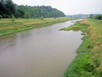
Burr Oak Regional Water District treats its own water from Hocking River Buried Valley Aquifer (wells).
The system's record
- Aquifer
- Hocking River buried valley aquifer (sand and gravel)
- Active wells
- 6
- Serves
- 1,994 people · Athens County
- EPA ID
- OH0501311
About this area's water
Did you know
- The district has grown from its 1959 founding into a network of 6 wells, a 4-MGD plant, 4 booster stations, and 8 storage tanks, supplying (directly and wholesale) over 38,000 people across Athens, Hocking, Morgan, and…
- The district draws from the Hocking River buried-valley aquifer, a sand-and-gravel formation adjacent to the river rather than the river itself.
- Its current capital program pairs a GAC treatment upgrade for disinfection byproducts with a roughly 120,000-foot rural waterline expansion into Morgan County, funded partly by Ohio BUILDS (HB 168) and Appalachian…
Source: burroakwater.orgburroakwater.org
History4
- 1959Burr Oak Regional Water District founded; now supplies water (directly and via 17 wholesale satellite systems - 8 villages, 7 rural systems, and Burr Oak State Park) across Athens, Hocking, Morgan…
- 2020EPA SDWIS records a violation for an inadequate yearly water quality report (the Consumer Confidence Report), not health-based, with compliance period opening 1/10/2020; still shown unresolved (no compliance-period end date) in the current…
- 2024District began planning/design in October for a Granular Activated Carbon (GAC) treatment addition, engineered by Verdantas LLC with Kirk Brothers Co., Inc. as contractor, aimed at reducing…
- 2025District held an unconditioned Ohio EPA license to operate, per its CCR page.
Treatment & pressure
How it is treated
Water is drawn from 6 wells tapping the Hocking River buried-valley sand-and-gravel aquifer and treated at a roughly 4-million-gallon-per-day plant; distribution runs through 4 booster pump stations, 8 elevated storage tanks, and 6"-18" mains. A GAC (granular activated carbon) stage is being added…
Source: burroakwater.orgburroakwater.org
Water pressure
Not published.
What it costs
$11.10 per 1,000 gallons
Burr Oak system: $28.60 minimum monthly charge (covers first 2,000 gal), then $11.10 per 1,000 gallons above that; Satellite/large-volume rate is $5.70 per 1,000 gallons. Separate…
Source: burroakwater.org
Water quality & impurities1
| Contaminant | Level | Limit | Year |
|---|---|---|---|
| Yearly water quality report (inadequate) Non-health-based violation, compliance period opened 1/10/2020, still open per EPA federal SDWIS/ECHO record; no… | N/A violation | N/A | 2020 |
Source: data.epa.gov
EPA compliance record
Lead at the tap: 90th-percentile result 1.7 ppb in 2025 (action level 15 ppb).
EPA record: no health-based violations since 2015.
1 violation of any kind logged since 2020: 1 for a report, record or notice that was missing, late or incomplete (the yearly water quality report, a public notice, lead line records).
Projects & plans2
Recent and current work
- Morgan County Waterline Expansion Project · 2024-2025 · under construction
Approximately 120,000 feet of new 2"-8" waterline with hydrants, valves, and services along SR-78, Drake Rd, Nichols Rd, Buck Run Rd, Finley Rd and others.…
Source: burroakwater.org
Planned or needed
- Granular Activated Carbon (GAC) treatment addition · 2024- · planned
Adds a GAC stage to reduce disinfection byproducts and meet Ohio EPA TTHM/HAA5 standards. Engineered by Verdantas LLC; contractor Kirk Brothers Co., Inc.…
Source: burroakwater.org
Supply stress
The buried-valley aquifer supply (about 4 MGD plant capacity) is not described anywhere as capacity-constrained for this population; the district's active capital spending is instead aimed at water-quality risk from disinfection byproducts, prompting the GAC addition, rather than raw-water scarcity.
Source: burroakwater.orgburroakwater.org
Sewers
Sanitary
Burr Oak Regional Water District is a water-only district. No sewer service is described anywhere on its website; served villages/rural areas most likely rely on individual septic systems or separate municipal sewer utilities, but this was not separately confirmed for each community.
Storm
No storm-sewer role found; district's public materials cover only water distribution.
Source: burroakwater.org
Sourcesverified
Compiled from the utility's own reports and public records, then independently re-checked against primary sources.
Present in 1 ZIP code
Serves
Main water supplier in 1 ZIP code
- 45761 · Dover Township and Millfield24% of residents
Population-weighted resident shares; a ZIP code can have more than one system on record. Recomputed from each ZIP's own system list, not from the map's cached footprint.
Buys from · Sells to
Burr Oak Regional Water District does not buy water from another system on record; it treats its own source water.
21 systems on record buy water from Burr Oak Regional Water District: Carbon Hill Water Association, Corning, Village Of, Crooksville, Glouster Public Water System, Jacksonville Village, Junction City, Murray City Village, New Straitsville, Village Of, Northern Perry Co.water #2, Oakdale Water District, Old Straitsville Water Association, Portersville East Branch Water Co., Shawnee, Village Of, Southern Perry Co-buckingham, Southern Perry Co-congo, Southern Perry Co-hemlock, Southern Perry Co-irish Ridge, Southern Perry Co-mainesville, Southern Perry Co-millertown, Sunday Creek Valley Water, Trimble Village.
What the records show about Burr Oak Regional Water District
Who runs it
EPA's record says Burr Oak Regional Water District has 831 service connections and serves 1,994 people.
EPA classes it as a community water system, one that serves the same residents all year.
EPA's record says it has substantially implemented source water protection under Ohio's program, dating the program from 2025. Its office telephone on EPA's record is 740-767-2558.
Source: EPA Safe Drinking Water Information System (SDWIS), water system record.
How the water is treated
EPA's treatment table registers these steps for Burr Oak Regional Water District: aeration, corrosion control, chlorine disinfection, iron and manganese removal, fluoridation, ion-exchange softening, and sand or media filtration.
The list is what each system registered with EPA for treatment plants EPA still shows as active, and it can lag a plant upgrade.
Source: EPA Safe Drinking Water Information System (SDWIS) treatment table (EPA Envirofacts, pulled September 2026).
Violations
EPA's record shows no health-based violations for Burr Oak Regional Water District since 2015.
EPA logs 1 violation of any kind since 2020: 1 for a report, record or notice that was missing, late or incomplete (the yearly water quality report, a public notice, lead line records).
Source: EPA Safe Drinking Water Information System (SDWIS) violation records: health-based violations with compliance periods beginning in 2015 or later, all violations from 2020 or later (EPA Envirofacts, pulled September 2026).
Lead and copper at the tap
In the sampling period ending December 2025, the 90th-percentile lead result at Burr Oak Regional Water District was 1.7 ppb, under both the current 15 ppb action level and the 10 ppb level that applies from 2027.
EPA has 8 sampling periods on file for Burr Oak Regional Water District since 2016, the first ending in 2018; no period was above 10 ppb.
Every water system has to inventory its service lines, the pipes from the main to each building. In the inventory Burr Oak Regional Water District sent EPA, 833 lines are counted.
| Material | Lines |
|---|---|
| Lead | 0 |
| Galvanized, needing replacement | 0 |
| Unknown material | 574 |
| Not lead | 259 |
| All lines | 833 |
Systems sample taps in the homes most likely to have lead pipes or solder. The 90th-percentile result is the level nine in ten of the sampled homes were at or below. Lead comes mostly from service lines and house plumbing, not the source water, so a low result for the system does not clear an old house.
EPA's dashboard status for this inventory: reported all required service line types.
Source: EPA Safe Drinking Water Information System (SDWIS) lead and copper 90th-percentile results (EPA Envirofacts), sampling periods ending 2016 or later; EPA's service line inventory dashboard, Ohio's 2026 Q2 submission.
PFAS
Ohio EPA's own statewide sampling tested 1 plant of Burr Oak Regional Water District (latest sample June 2020). Not one of the six PFAS tested (PFOA, PFOS, PFHxS, PFNA, GenX and PFBS) was detected.
Ohio EPA's current sampling status map lists 1 plant of Burr Oak Regional Water District as sampled, most recently June 2026.
PFAS are the 'forever chemicals' from firefighting foam, plating shops and non-stick coatings. Results are for water leaving the plant, not your tap.
Source: EPA UCMR 5 occurrence data (final release, August 2026); Ohio EPA statewide PFAS sampling, 2019 to 2021, and its sampling status map.
Disinfection byproducts
Chlorine that disinfects water also reacts with organic matter to form byproducts. Two groups have federal limits: total trihalomethanes (TTHM, 80 µg/L) and five haloacetic acids (HAA5, 60 µg/L), judged on running yearly averages at each sampling site.
For TTHM, the average of Burr Oak Regional Water District's samples in 2019, the last year it was sampled, was 52.3 µg/L. The worst yearly average was 56.9 µg/L and the highest single sample was 63.5 µg/L, from 26 samples taken from 2012 to 2019.
For HAA5, the average in the last year sampled was 14.9 µg/L. The worst yearly average was 17.8 µg/L and the highest single sample was 22.2 µg/L, from 26 samples.
| Byproduct | Limit | Latest yearly average | Worst yearly average | Highest sample | Samples |
|---|---|---|---|---|---|
| TTHM | 80 µg/L | 52.3 µg/L (2019) | 56.9 µg/L | 63.5 µg/L | 26 |
| HAA5 | 60 µg/L | 14.9 µg/L | 17.8 µg/L | 22.2 µg/L | 26 |
A yearly average of 0 means nothing was detected in that year's samples. EPA's file stops at 2019; Ohio EPA's Drinking Water Watch has newer results.
Source: EPA Six-Year Review 4 compliance monitoring data, 2012 to 2019, distribution-system samples (non-detects counted as zero).
Nitrate, arsenic and radioactivity
Nitrate: the highest of 10 samples was 0.48 mg/L (as nitrogen) in 2013; in 2019, the last year sampled, nitrate was not detected. No sample was over the limit of 10 mg/L. Nitrate above 10 is unsafe for infants.
Arsenic was not detected in 3 samples (limit 10 µg/L).
| Contaminant | Samples | Highest result | Limit | Samples over limit |
|---|---|---|---|---|
| Nitrate (as nitrogen) | 10 | 0.48 mg/L | 10 mg/L | 0 |
| Arsenic | 3 | not detected | 10 µg/L | 0 |
Measured in finished water: at the plant's entry points and in the distribution system; raw well and intake samples are left out. Non-detects count as zero.
Source: EPA Six-Year Review 4 compliance monitoring data, 2012 to 2019, finished water.
Solvents and fuels
EPA's file holds results for all six solvent and fuel compounds it checked. Benzene, carbon tetrachloride, 1,2-dichloroethane, trichloroethylene, tetrachloroethylene, and vinyl chloride were not detected in 9 samples each.
| Compound | Limit | Samples | Detected in | Highest result | Samples over limit |
|---|---|---|---|---|---|
| Benzene | 5 µg/L | 9 | 0 of 9 | not detected | 0 |
| Carbon tetrachloride | 5 µg/L | 9 | 0 of 9 | not detected | 0 |
| 1,2-dichloroethane | 5 µg/L | 9 | 0 of 9 | not detected | 0 |
| Trichloroethylene (TCE) | 5 µg/L | 9 | 0 of 9 | not detected | 0 |
| Tetrachloroethylene (PCE) | 5 µg/L | 9 | 0 of 9 | not detected | 0 |
| Vinyl chloride | 2 µg/L | 9 | 0 of 9 | not detected | 0 |
"Not detected" means the lab's result was below what its method can measure, not that the compound is absent. Non-detects count as zero in the highest-result column.
Source: EPA Six-Year Review 4 compliance monitoring data, 2012 to 2019, finished water.
Farm chemicals and metals
EPA's file holds results for 8 of the nine herbicides and metals it checked. Detected: barium in 3 of 3 samples, highest 53.8 µg/L (limit 2,000). Not detected: atrazine in 2 samples, alachlor in 2 samples, chromium in 3 samples, cadmium in 3 samples, mercury in 3 samples, selenium in 3 samples, thallium in 3 samples.
| Substance | Kind | Limit | Samples | Detected in | Highest result | Samples over limit |
|---|---|---|---|---|---|---|
| Atrazine | Farm chemical | 3 µg/L | 2 | 0 of 2 | not detected | 0 |
| Alachlor | Farm chemical | 2 µg/L | 2 | 0 of 2 | not detected | 0 |
| Chromium | Metal | 100 µg/L | 3 | 0 of 3 | not detected | 0 |
| Cadmium | Metal | 5 µg/L | 3 | 0 of 3 | not detected | 0 |
| Barium | Metal | 2,000 µg/L | 3 | 3 of 3 | 53.8 µg/L | 0 |
| Mercury | Metal | 2 µg/L | 3 | 0 of 3 | not detected | 0 |
| Selenium | Metal | 50 µg/L | 3 | 0 of 3 | not detected | 0 |
| Thallium | Metal | 2 µg/L | 3 | 0 of 3 | not detected | 0 |
Non-detects count as zero in the highest-result column.
Source: EPA Six-Year Review 4 compliance monitoring data, 2012 to 2019, finished water.
Bacteria in the pipes
From 2012 to 2019, 0 of 388 routine total coliform samples taken in the distribution system at Burr Oak Regional Water District tested positive (0%); in 2019, the last year on file, 0 of 48 did.
A positive coliform test is a warning sign, not a violation by itself. E. coli is a sign that human or animal waste may have reached the water. Coliform counts are routine samples only; E. coli counts include repeat samples.
Source: EPA Six-Year Review 4 compliance monitoring data, 2012 to 2019, distribution-system presence/absence tests for total coliform and E. coli.
Fluoride
The Ohio Department of Health's report to the CDC (My Water's Fluoride) says Burr Oak Regional Water District adjusts the fluoride level to the recommended level for preventing tooth decay.
EPA's treatment table lists fluoridation among the steps at Burr Oak Regional Water District.
Measured fluoride: 1 mg/L on average at the plant's entry points in 2017 (in the range dentists aim for); samples ran from 0.92 to 1.04 mg/L across 3 samples in 2012 to 2019.
The recommended level for preventing tooth decay is 0.7 mg/L; the federal limit is 4 mg/L. The treatment list is what each system registered with EPA and can lag a plant upgrade.
Source: CDC My Water's Fluoride (fluoridation status as reported by the Ohio Department of Health, fetched September 2026); EPA Safe Drinking Water Information System (SDWIS) treatment table; EPA Six-Year Review 4 compliance monitoring data, 2012 to 2019, entry-point fluoride samples.
How well the service area is mapped
EPA estimated the service area of Burr Oak Regional Water District with a computer model rather than drawing it from the utility's map, so its edges are approximate.
Source: EPA Service Area Boundaries; resident estimate by this atlas from ZIP-code overlap.
Photograph
On the map
Show this system's territory on the map — 1 ZIP code in all.
Sources
U.S. EPA SDWIS and Community Water System Service Area Boundaries (v3, 2026), Ohio EPA primacy data, 2020 census blocks: the system serving most residents, traced through purchases to the treating utility; Ohio EPA 2023 Sewer and Water Rate Survey (Ohio State, May 2025) for household bills; Ohio EPA DEFA loan awards since 2016 for the loans paragraph · EPA SDWIS · EPA service area boundaries · Ohio EPA drinking water · Ohio EPA rate survey
EPA's own record for this system: Enforcement and Compliance History report for OH0501311 (EPA ECHO).
Burr Oak Regional Water District's own pages: burroakwater.org, waterutilityreport.com
Notable facts: burroakwater.org, burroakwater.org
History: burroakwater.org, burroakwater.org, data.epa.gov, burroakwater.org
Water quality: data.epa.gov
Planned work: burroakwater.org
Capital projects: burroakwater.org
Rates: burroakwater.org
Sewers: burroakwater.org
Treatment: burroakwater.org, burroakwater.org
Supply stress: burroakwater.org, burroakwater.org
