West Carrollton
City · Montgomery County · 13,129 residents · 2.25% municipal income tax
Local events in West Carrollton
40 events in the next 90 days from 2 public calendars. All local events in West Carrollton
Checked October 20; the events page is refreshed daily.
How West Carrollton began
West Carrollton grew up on the west bank of the Great Miami River south of Dayton, laid out as Carrollton in 1830 and renamed West Carrollton after mail kept being misrouted to another Ohio town of the same name. It stayed a small river and canal village through the nineteenth century, then grew through the twentieth as an industrial suburb of Dayton, absorbing the neighboring settlement of Alexandersville in 1943. A 1970s civic emblem, a pentagon representing rail, canal, river, trolley and automobile, marks the town's identity as a place five kinds of transportation once passed through.
Platted 1830-04-27, by Moses Smith, Alexander [surname illegible in the 1882 county history] and H. G. Phillips.
Where the name comes from
The town was laid out and originally platted as Carrollton in 1830. It was later renamed West Carrollton because mail was repeatedly delivered to the wrong town after confusion with another Carrollton in Ohio.
Before the town
No Native American village, trail, or earthwork specific to West Carrollton's own ground is documented in the sources we checked. The Great Miami valley in which the town sits was Shawnee and Miami (Myaamia) country in the eighteenth century, part of the land the 1795 Treaty of Greenville pushed the Native cession line back from; the Treaty of Greenville's western boundary ran through western Ohio near the Great Miami drainage.
Nations recorded here: Shawnee, Miami.
Timeline
- — The town later called West Carrollton is laid out on the Great Miami River as Carrollton on April 27, by proprietors Moses Smith, H. G. Phillips and a third man named Alexander (surname illegible in the copy of the 1882 county history consulted).
- — Carrollton/West Carrollton has 226 residents.
- — The Carrollton Cemetery Association was organized, its ground platted by John Beaver; incorporators included Julius S. Taylor, Moses Smith (one of the town's original 1830 proprietors), James Dodds, Perry Pease and George Pease, with George Pease as president, Taylor as clerk and Smith as treasurer and later superintendent of the grounds.
- — H. & P. Pease established a large flouring-mill and distillery at Carrollton, powered by the Miami and Erie Canal's locks at that point; large numbers of hogs were fattened annually in connection with the distilling operation.
- — Population reaches 987, up 174% from 1850, as river and rail industry builds the town.
- — The neighboring settlement of Alexandersville, just north of West Carrollton on the Great Miami, is incorporated into West Carrollton.
- — West Carrollton's population peaks at 13,148.
Stories
A pentagon for five ways of getting through town
In the 1970s the artist James Williamson designed a pentagon-shaped civic symbol for West Carrollton, its five sides standing for five modes of transportation that had each, in their turn, run through the town on the west bank of the Great Miami: the railroad, the Miami and Erie Canal, riverboats on the Great Miami itself, the interurban trolley, and finally the automobile. The emblem captured something true about a small river town squeezed for a century and a half between Dayton and the water: every new way of moving people and freight through the Miami Valley left its mark on Carrollton's streets and edges, from towpath to rail siding to state route.
A mail mix-up renamed the town
Carrollton, platted on the Great Miami in 1830, ran for decades under a name it shared with another town elsewhere in Ohio. Letters and freight addressed to Carrollton kept going astray between the two, a problem serious enough for a small commercial river town that it eventually took the name West Carrollton to settle which office mail belonged to. The town then absorbed its smaller riverside neighbor Alexandersville in 1943, rounding out the built-up strip along the Great Miami's west bank.
From whiskey to wallpaper
The canal that once carried Carrollton's trade also powered its biggest industry, and that industry changed twice within one building. The Miami and Erie Canal gave the town two locks' worth of water power, and around the middle of the nineteenth century H. and P. Pease built a large flouring-mill and distillery there, fattening hogs in large numbers on the spent grain from the whiskey they made. The Pease family ran it until 1864, when the Turner family bought it and kept the distillery going until 1872; that year it passed to G. H. Friend, who tore out the distilling equipment and turned the works into a paper mill, manufacturing heavy paper from straw and other material for roofing and siding. By the early 1880s Friend's paper mill had been enlarged and employed seventy-five people, while the town's newer generation of farmers had turned from grain to tobacco -- three changes of trade run through one water-powered building on the same stretch of canal.
Photographs
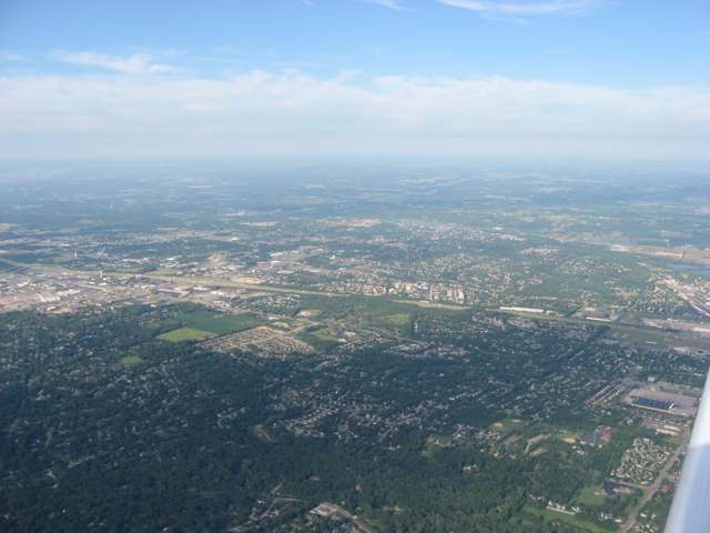
Photo: Nyttend, public domain · Wikimedia Commons
Local history sources: en.wikipedia.org · en.wikipedia.org · en.wikipedia.org · en.wikipedia.org · commons.wikimedia.org · archive.org
Water
Great Miami Buried Valley Aquifer (wells) The water here
- West Carrollton City70% of residentsGreat Miami Buried Valley Aquifer (wells)
- Montgomery County Water Services 130% of residentsGreat Miami Buried Valley Aquifer wells (recharged by Great Miami & Mad Rivers)
Hospitals, fire stations and more
Inside West Carrollton's boundary: 1 nursing home, 2 fire and EMS stations, 5 public schools, 1 private school, 1 library, 2 museums, 1 police station, 2 public charging sites, 5 Toxics Release Inventory facilities and 14 spill cases. Press a pin or a name for its whole record and its source.
Nursing homes (1)
-
Laurels of West Carrollton The1 of 5 stars · West Carrollton
- Address
- 115 Elmwood Circle, West Carrollton, OH 45449
- Certified beds
- 88
- Residents on an average day
- 76
- Medicare overall rating
- 1 of 5 stars
- Health inspections
- 2 of 5 stars
- Staffing
- 1 of 5 stars
- Quality measures
- 4 of 5 stars
- Penalties since 2023
- none
- Ownership
- For profit - Corporation
- Chain
- CIENA HEALTHCARE/LAUREL HEALTH CARE
- Takes
- Medicare and Medicaid
- Phone
- (937) 866-3814
- Medicare ID
- 365598
Medicare Care Compare ↗ CMS nursing home data (source) ↗ Street map and directions ↗
Source: CMS Care Compare nursing home provider and penalties files; Medicare star ratings run 1 to 5.
Fire and EMS stations (2)
-
West Carrollton Fire Department Station 56West Carrollton
- Address
- 125 West Central Avenue, West Carrollton, OH 45449
- Coordinates
- 39.67108, -84.25461
USGS National Map structures (source) ↗ Street map and directions ↗
-
West Carrollton Fire Department Station 57West Carrollton
- Address
- 1700 South Alex Road, West Carrollton, OH 45449
- Coordinates
- 39.65562, -84.24192
USGS National Map structures (source) ↗ Street map and directions ↗
Source: USGS National Map structures (most Ohio records last updated 2019 to 2022), checked against the Columbus and Cleveland station lists. The department that answers a call is set by jurisdiction and mutual aid, not by distance.
Public schools (5)
-
Harold Schnell Elementary SchoolWest Carrollton
- Address
- 5995 Student St, West Carrollton, OH 45449
- Kind (NCES)
- Regular School
- Students, 2023-24
- 501
- Teachers (full-time equivalent)
- 26
- NCES school ID
- 390450501967
-
Harry Russell Elementary SchoolWest Carrollton
- Address
- 123 Elementary Dr, West Carrollton, OH 45449
- Kind (NCES)
- Regular School
- Students, 2023-24
- 237
- Teachers (full-time equivalent)
- 14
- NCES school ID
- 390450501966
-
West Carrollton Early Childhood Center3 of 5 stars · West Carrollton
- Address
- 510 E Pease Ave, West Carrollton, OH 45449
- School district
- West Carrollton City School District
- Kind (NCES)
- Regular School
- Students, 2023-24
- 650
- Teachers (full-time equivalent)
- 35
- Report card, 2025-26
- 3 of 5 stars
- Ohio building IRN
- 034074
- NCES school ID
- 390450501968
NCES school record ↗ Ohio School Report Card ↗ Street map and directions ↗
-
West Carrollton High School3.5 of 5 stars · West Carrollton
- Address
- 5833 Student St, West Carrollton, OH 45449
- School district
- West Carrollton City School District
- Kind (NCES)
- Regular School
- Students, 2023-24
- 940
- Teachers (full-time equivalent)
- 61
- Report card, 2025-26
- 3.5 of 5 stars
- Performance index
- 67.9%
- Four-year graduation rate
- 91.3%
- Ohio building IRN
- 038588
- NCES school ID
- 390450501969
NCES school record ↗ Ohio School Report Card ↗ Street map and directions ↗
-
West Carrollton Middle School2 of 5 stars · West Carrollton
- Address
- 424 E Main St, West Carrollton, OH 45449
- School district
- West Carrollton City School District
- Kind (NCES)
- Regular School
- Students, 2023-24
- 471
- Teachers (full-time equivalent)
- 35
- Report card, 2025-26
- 2 of 5 stars
- Performance index
- 59.7%
- Ohio building IRN
- 038596
- NCES school ID
- 390450501970
NCES school record ↗ Ohio School Report Card ↗ Street map and directions ↗
Source: NCES EDGE public school locations 2024-25 and Common Core of Data 2023-24 (type, students, teachers); Ohio School Report Cards 2025-26 (Department of Education and Workforce), matched by name within the district.
Private schools (1)
-
Bethel Baptist SchoolPrivate, conservative Christian · West Carrollton
- Address
- 434 Wilson Park Dr, West Carrollton, OH 45449
- Kind
- conservative Christian
- Students, 2023-24
- 33
- Teachers (full-time equivalent)
- 6.3
- Students per teacher
- 5.2381
- Phone
- (937) 859-4713
- NCES private school ID
- A9903442
Source: NCES Private School Survey 2023-24.
Public libraries (1)
-
West Carrollton Branch LibraryBranch · West Carrollton
- Address
- 300 E. Central Ave., West Carrollton, OH 45449
- What it is
- Branch
- Library system
- Dayton Metro Library
- Open
- 3,042 hours a year, 52 weeks
- Building
- 16,244 sq ft
- System's visits, FY2024
- 1,987,700
- System's loans, FY2024
- 4,831,439
- People the system serves
- 452,238
- Phone
- (937) 463-2665
IMLS Public Libraries Survey (source) ↗ Street map and directions ↗
Source: IMLS Public Libraries Survey FY2024 (outlets and their systems). Any Ohio resident can get a free card at any Ohio public library.
Museums, historical societies, gardens and zoos (2)
-
West Carrollton Historical Preservation & Restoration SocietyHistorical society · West Carrollton
- What it is
- Historical society
- City
- West Carrollton
- Coordinates
- 39.67352, -84.24846
Search Wikipedia ↗ IMLS Museum Data Files (source) ↗ Street map and directions ↗
The museum list is IMLS's 2018 file; a museum may have closed or moved since.
-
Wright Seaplane BaseHistorical society · Dayton
- What it is
- Historical society
- City
- Dayton
- Coordinates
- 39.66860, -84.24936
Search Wikipedia ↗ IMLS Museum Data Files (source) ↗ Street map and directions ↗
The museum list is IMLS's 2018 file; a museum may have closed or moved since.
Source: IMLS Museum Data Files, 2018.
Police stations (1)
-
West Carrollton Police DepartmentWest Carrollton
- Address
- 300 East Central Avenue, West Carrollton, OH 45449
- Coordinates
- 39.67259, -84.24848
USGS National Map structures (source) ↗ Street map and directions ↗
Source: USGS National Map structures, police stations, corrected and completed by hand (September 2026). The department that answers a call is set by jurisdiction, not by distance.
Public EV charging (2)
-
1651 S. Elm St.4 Level 2 · West Carollton
- Address
- 1651 S. Elm St., West Carollton, OH 45449
- Ports
- 4 Level 2
- Plugs
- J1772
- Network
- SYNERGEV
- Hours
- 24 hours daily
- Phone
- 888-807-4522
Station Locator (NREL) ↗ Alternative Fuels Data Center (source) ↗ Street map and directions ↗
-
WEST CARROLLTON THE POINT 12 Level 2 · Dayton
- Address
- 955 E Dixie Dr, Dayton, OH 45449
- Ports
- 2 Level 2
- Plugs
- J1772
- Network
- ChargePoint Network
- Hours
- 24 hours daily
- Phone
- 888-758-4389
Station Locator (NREL) ↗ Alternative Fuels Data Center (source) ↗ Street map and directions ↗
Source: NREL Alternative Fuels Data Center station list (May 2026), public and open stations, the posts at one address counted as one site.
Facilities reporting toxic releases (5)
-
Appleton Papers Inc West CarroToxics Release Inventory · West Carrollton
- Address
- 4000 Hydraulic Rd., West Carrollton, OH 45449
- County
- Montgomery County
- Status
- Reports to the Toxics Release Inventory (active)
- EPA program ID
- 45449PPLTN4000H
- EPA registry ID
- 110027373143
EPA facility record ↗ EPA Facility Registry Service (source) ↗ Street map and directions ↗
-
Dayton Progress CorporationToxics Release Inventory · West Carrollton
- Address
- 500 Progress Rd, West Carrollton, OH 45449
- County
- Montgomery County
- Status
- Reports to the Toxics Release Inventory (active)
- EPA program ID
- 45449DYTNP500PR
- EPA registry ID
- 110000766966
EPA facility record ↗ EPA Facility Registry Service (source) ↗ Street map and directions ↗
-
Fraser Papers IncToxics Release Inventory · W Carrollton
- Address
- 51 S. Elm St., W Carrollton, OH 45449
- County
- Montgomery County
- Status
- Reports to the Toxics Release Inventory (closed)
- EPA program ID
- 45449MMPPRPOBOX
- EPA registry ID
- 110000394939
EPA facility record ↗ EPA Facility Registry Service (source) ↗ Street map and directions ↗
-
Pennsylvania Iron & Coal IncToxics Release Inventory · Miamisburg
- Address
- 4634 S Infirmary Rd, Miamisburg, OH 45342
- County
- Montgomery County
- Status
- Reports to the Toxics Release Inventory (active)
- EPA program ID
- 45342PNNSY4634S
- EPA registry ID
- 110002450400
EPA facility record ↗ EPA Facility Registry Service (source) ↗ Street map and directions ↗
-
West Carrollton Parchment CoToxics Release Inventory · W Carrollton
- Address
- 1 S Elm St, W Carrollton, OH 45449
- County
- Montgomery County
- Status
- Reports to the Toxics Release Inventory (active)
- EPA program ID
- 45449WSTCRCORNE
- EPA registry ID
- 110000901105
EPA facility record ↗ EPA Facility Registry Service (source) ↗ Street map and directions ↗
Source: EPA Facility Registry Service, Toxics Release Inventory reporters. Reporting a release is required of large users of listed chemicals; it is not by itself a violation.
Spills reported since 2021 (14)
-
Waste Water2025-10-30 · West Carrollton
- Reported
- 2025-10-30
- What spilled
- Waste Water
- Where
- West Carrollton, Montgomery County
- Ohio EPA district office
- SWDO
- Ohio EPA case number
- 2510EPA0001774
Ohio EPA spill reports (source) ↗ Street map and directions ↗
-
Waste Water Reached water2025-10-30 · West Carrollton
- Reported
- 2025-10-30
- What spilled
- Waste Water
- Reached a waterway
- 57 - Great Miami River
- Where
- West Carrollton, Montgomery County
- Ohio EPA district office
- SWDO
- Ohio EPA case number
- 2510EPA0001773
Ohio EPA spill reports (source) ↗ Street map and directions ↗
-
Fat(S) / Oil / Grease / Tallow Food Types (Fog)2025-09-29 · West Carrollton
- Reported
- 2025-09-29
- What spilled
- Fat(S) / Oil / Grease / Tallow Food Types (Fog)
- Largest amount reported
- 10 gallons
- Where
- West Carrollton, Montgomery County
- Ohio EPA district office
- SWDO
- Ohio EPA case number
- 2509EPA0001614
Ohio EPA spill reports (source) ↗ Street map and directions ↗
-
Fuel Diesel / Diesel Fuel (Vehicle On Or Off Road)2024-08-30 · West Carrollton
- Reported
- 2024-08-30
- What spilled
- Fuel Diesel / Diesel Fuel (Vehicle On Or Off Road)
- Where
- West Carrollton, Montgomery County
- Ohio EPA district office
- SWDO
- Ohio EPA case number
- 2408EPA0001489
Ohio EPA spill reports (source) ↗ Street map and directions ↗
-
Foam Reached water2024-07-23 · West Carrollton
- Reported
- 2024-07-23
- What spilled
- Foam
- Reached a waterway
- 57 - Great Miami River
- Where
- West Carrollton, Montgomery County
- Ohio EPA district office
- SWDO
- Ohio EPA case number
- 2407EPA0001255
Ohio EPA spill reports (source) ↗ Street map and directions ↗
-
Foam Reached water2024-07-10 · West Carrollton
- Reported
- 2024-07-10
- What spilled
- Foam
- Reached a waterway
- 57 - Great Miami River
- Where
- West Carrollton, Montgomery County
- Ohio EPA district office
- SWDO
- Ohio EPA case number
- 2407EPA0001161
Ohio EPA spill reports (source) ↗ Street map and directions ↗
-
Oil Transformer Non Pcb2024-02-28 · West Carrollton
- Reported
- 2024-02-28
- What spilled
- Oil Transformer Non Pcb
- Largest amount reported
- 25 gallons
- Where
- West Carrollton, Montgomery County
- Ohio EPA district office
- SWDO
- Ohio EPA case number
- 2402EPA0000307
Ohio EPA spill reports (source) ↗ Street map and directions ↗
-
Fuel Diesel / Diesel Fuel (Vehicle On Or Off Road)2023-11-07 · West Carrollton
- Reported
- 2023-11-07
- What spilled
- Fuel Diesel / Diesel Fuel (Vehicle On Or Off Road)
- Largest amount reported
- 150 gallons
- Where
- West Carrollton, Montgomery County
- Ohio EPA district office
- SWDO
- Ohio EPA case number
- 2311EPA0001897
Ohio EPA spill reports (source) ↗ Street map and directions ↗
-
Fuel Diesel / Diesel Fuel (Vehicle On Or Off Road)2023-09-29 · West Carrollton
- Reported
- 2023-09-29
- What spilled
- Fuel Diesel / Diesel Fuel (Vehicle On Or Off Road)
- Largest amount reported
- 100 gallons
- Where
- West Carrollton, Montgomery County
- Ohio EPA district office
- SWDO
- Ohio EPA case number
- 2309EPA0001701
Ohio EPA spill reports (source) ↗ Street map and directions ↗
-
Oil Petroleum Not Otherwise Specified (Nos)2023-05-26 · West Carrollton
- Reported
- 2023-05-26
- What spilled
- Oil Petroleum Not Otherwise Specified (Nos)
- Where
- West Carrollton, Montgomery County
- Ohio EPA district office
- SWDO
- Ohio EPA case number
- 2305EPA0000866
Ohio EPA spill reports (source) ↗ Street map and directions ↗
-
Waste Water2023-03-03 · West Carrollton
- Reported
- 2023-03-03
- What spilled
- Waste Water
- Where
- West Carrollton, Montgomery County
- Ohio EPA district office
- SWDO
- Ohio EPA case number
- 2303EPA0000328
Ohio EPA spill reports (source) ↗ Street map and directions ↗
-
Sewage Human Reached water2022-09-26 · West Carrollton
- Reported
- 2022-09-26
- What spilled
- Sewage Human
- Reached a waterway
- 57 - Great Miami River
- Where
- West Carrollton, Montgomery County
- Ohio EPA district office
- SWDO
- Ohio EPA case number
- 2209EPA0001470
Ohio EPA spill reports (source) ↗ Street map and directions ↗
-
Toluene / Methylbenzene (C6H6Ch3)2021-07-15 · West Carrollton
- Reported
- 2021-07-15
- What spilled
- Toluene / Methylbenzene (C6H6Ch3)
- Where
- West Carrollton, Montgomery County
- Ohio EPA district office
- SWDO
- Ohio EPA case number
- 2107EPA0001055
Ohio EPA spill reports (source) ↗ Street map and directions ↗
-
Fuel Diesel / Diesel Fuel (Vehicle On Or Off Road)2021-07-08 · West Carrollton
- Reported
- 2021-07-08
- What spilled
- Fuel Diesel / Diesel Fuel (Vehicle On Or Off Road)
- Where
- West Carrollton, Montgomery County
- Ohio EPA district office
- SWDO
- Ohio EPA case number
- 2107EPA0001021
Ohio EPA spill reports (source) ↗ Street map and directions ↗
Source: Ohio EPA emergency response spill reports, 2021 to September 2026, one point per case where Ohio EPA placed it. A report is what the caller or responder recorded; amounts are often blank or estimated.
Its ZIP codes
Each ZIP code that touches West Carrollton, with the share of its residents who live here and the same headline figures as the ZIP page.
| ZIP | Share | Water | Radon | Home value | Schools | Flood |
|---|---|---|---|---|---|---|
| 45449 West Carrollton and Dayton | 69% | Great Miami Buried Valley Aquifer (wells) | 3.9 pCi/L average radon | Median year built 1967 | West Carrollton City · 3 stars overall | 6.3% of residents in the 1% floodplain |
Local government
Who holds office in West Carrollton, how its elections and ballot issues came out, and the state auditor's record.
Ballot issues
| Date | Issue | For | Against | Result |
|---|---|---|---|---|
| 2026-05-05 | Issue: City of West Carrollton - Charter Amendments - 4.06, 5.02, 5.05, 5.08, 7.05, 7.10, and 10.02 | 714 | 416 | Passed (63.19% for) |
| 2025-11-04 | Issue: City of West Carrollton - Charter Amendment - Sections 4.06, 5.02, 5.05, 5.08, 7.05, 7.10, and 10.02 | 702 | 478 | Passed (59.49% for), unofficial |
Elections for office
| Date | Office | Candidates and votes |
|---|---|---|
| 2025-11-04 | Council Member (unofficial count) | Keith A. Tilton 706, 37.12%; Lauren N. Williams 763, 40.12%; Write-in 433, 22.77% |
Winners in bold. Results from the county board of elections' official canvass unless marked.
Auditor of State record
- No fiscal caution, watch or emergency on the Auditor of State's lists.
- Financial Health Indicators (the Auditor of State's 17 measures; critical / cautionary / positive): 2018 4 / 1 / 12; 2019 5 / 1 / 11; 2020 5 / 2 / 10; 2021 6 / 1 / 10; 2022 6 / 1 / 10; 2023 3 / 2 / 12.
- Financial Audit, 2023, released 2026-07-07
- Compliance Examination, 2023, released 2026-04-21
- Financial Audit, 2022, released 2024-12-03
The county
Montgomery County: 33 ZIP codes, 27 cities, villages and townships, 531,614 people.
Nearby places
Rain and snow
How much has actually fallen on West Carrollton, day by day, from 1893 to now. Daily totals, not averages.
- rain, last 30 days
- 0.83 in
- 2026-10-01 to 2026-10-30
- rain so far in 2026
- 49.7 in
- 13.5 in above normal for the date
- snow so far in 2026
- 18.6 in
- a normal year brings 13.8 in
- a normal year
- 42.8 in
- average of 30 years, 1991-2020
| Month | Rain (in) | Snow (in) | Days counted |
|---|---|---|---|
| October 2026 | 0.83 | — | 30 |
| September 2026 | 5.77 | — | 30 |
| August 2026 | 11.46 | — | 31 |
| July 2026 | 3.18 | — | 31 |
| June 2026 | 4.80 | — | 30 |
| May 2026 | 8.27 | — | 31 |
| April 2026 | 3.90 | — | 30 |
| March 2026 | 7.22 | 0.4 | 31 |
| February 2026 | 2.82 | 3.7 | 28 |
| January 2026 | 1.44 | 14.5 | 31 |
| December 2025 | 2.31 | 9.6 | 31 |
| November 2025 | 2.64 | 2.7 | 30 |
| Wettest year | 2011 — 62.8 in |
|---|---|
| Driest year | 1934 — 24.0 in |
| Snowiest year | 1960 — 42.4 in |
| Wettest day on record | 14 September 1979 — 4.76 in |
| Heaviest snowfall in a day | 17 February 1910 — 10.51 in |
| Deepest snow on the ground | 16 January 1982 — 30.20 in |
Estimated, not measured. No rain gauge has ever stood inside West Carrollton, so every figure here is worked out from the gauges around it - the nearest ones weighted most. Treat them as close estimates rather than readings.
48,424 days of records, 1893-01-01 to 2026-10-30. Source: NOAA NCEI GHCN-Daily, 3,240 gauges in and around Ohio. A day is "gauged" when a gauge standing inside the boundary reported it, and the value is the mean of those gauges. Otherwise it is interpolated by inverse distance from every gauge reporting within 50 miles. Nothing is carried forward, back-filled or smoothed. Against NOAA nClimDiv county monthly precipitation over 136,848 complete county-months (checked 2026-11-01): correlation 0.9515, median absolute difference 0.217 in a month. Built 2026-11-01 from the Cracked Buckeye precipitation archive. Snow is the softer number — snowfall is measured by hand with a ruler, no agency publishes a gridded county snowfall series, and blowing snow defeats every observer.
Environmental permits and filings
What Ohio EPA has on file for West Carrollton: permits, inspections, violations, cleanups and the state loans behind sewer and water work. Every line links to the agency's own document.
- facilities and sites on file
- 35
- those placed on the map inside West Carrollton
| Program | Facilities and sites |
|---|---|
| Hazardous waste | 13 |
| Air pollution | 6 |
| Wastewater and stormwater discharge | 6 |
| State water loans | 2 |
| Contaminated-site cleanup | 1 |
| Landfills | 1 |
| Public drinking water | 1 |
| Site assessment | 1 |
| State sewer loans | 1 |
| Underground injection wells | 1 |
| Voluntary cleanup | 1 |
| Wetland and stream fill | 1 |
| Date | Facility or site | What |
|---|---|---|
| COHEN BROTHERS INC - WEST CARROLLTON | Hazardous waste notice of violation | |
| VEOLIA ES TECHNICAL SOLUTIONS LLC | Hazardous waste inspection | |
| VEOLIA ES TECHNICAL SOLUTIONS LLC | Hazardous waste permit | |
| CULVER'S WEST CARROLLTON | Wastewater and stormwater discharge inspection | |
| VEOLIA ES TECHNICAL SOLUTIONS LLC | Hazardous waste permit | |
| VEOLIA ES TECHNICAL SOLUTIONS LLC | Hazardous waste permit | |
| WEST CARROLLTON CITY PWS | Public drinking water inspection | |
| WEST CARROLLTON CITY PWS | Public drinking water notice of violation | |
| VEOLIA ES TECHNICAL SOLUTIONS LLC | Hazardous waste inspection | |
| VEOLIA ES TECHNICAL SOLUTIONS LLC | Hazardous waste permit | |
| VEOLIA ES TECHNICAL SOLUTIONS LLC | Hazardous waste report | |
| WEST CARROLLTON CITY PWS | Public drinking water inspection | |
| VEOLIA ES TECHNICAL SOLUTIONS LLC | Hazardous waste permit | |
| VEOLIA ES TECHNICAL SOLUTIONS LLC | Hazardous waste incident report | |
| METAL SHREDDERS LANDFILL | Landfills director's approval | |
| METAL SHREDDERS LANDFILL | Landfills director's approval | |
| METAL SHREDDERS LANDFILL | Landfills inspection | |
| VEOLIA ES TECHNICAL SOLUTIONS LLC | Hazardous waste report | |
| WEST CARROLLTON CITY OF | State water loans | |
| WEST CARROLLTON CITY PWS | Public drinking water inspection | |
| WEST CARROLLTON CITY PWS | Public drinking water inspection | |
| WEST CARROLLTON CITY PWS | Public drinking water compliance letter | |
| WEST CARROLLTON DAM MITIGATION AND WHITEWATER PARK | Wetland and stream fill permit | |
| WEST CARROLLTON CITY PWS | Public drinking water plan | |
| METAL SHREDDERS LANDFILL | Landfills report |
Source: Ohio EPA eDocument portal (edocpub.epa.ohio.gov), indexed 2026-10-14. Facilities are placed on the map from Ohio EPA's own map layers, EPA's Facility Registry, coordinates written in the filings, or a geocoded street address. A permit filed under a private person's name (most are household septic systems) is counted but never named, placed or linked; licenses for individual workers and open-burning notices are left out entirely.
Quick answers
What county is West Carrollton, Ohio in?
West Carrollton is a city in Montgomery County, Ohio, with 13,129 residents.
When was West Carrollton, Ohio founded?
West Carrollton was laid out 1830-04-27. Founders on record: Moses Smith, Alexander [surname illegible in the 1882 county history] and H. G. Phillips. Source
How did West Carrollton, Ohio get its name?
The town was laid out and originally platted as Carrollton in 1830. Source
What ZIP code is West Carrollton, Ohio?
Most of West Carrollton is in ZIP code 45449.
Where does West Carrollton, Ohio get its water?
The main water source for West Carrollton (West Carrollton City): Great Miami Buried Valley Aquifer (wells).
Cite this page
Cite this page as:
Cracked Buckeye, "West Carrollton, Montgomery County", https://crackedbuckeye.com/place/west-carrollton/, built 2026-10-31, accessed [date].
How to cite · Report a correction · Built 2026-10-31