How Sugar Grove began
Sugar Grove sits in Berne Township at the confluence of Rush Creek and the Hocking River, on ground Daniel Stuckey claimed as early as 1792 and that the 1912 county history says carried an Indian encampment and a burying-ground before white settlement; it took its own name from the sugar-maple grove that once covered the site. The village was platted in 1830, though its first house was not built until about 1835, and it was incorporated by a special act of the legislature in 1851 with William Fisher as its first mayor. The Hocking Canal and, later, the Hocking Valley Railroad ran through it, and in the early twentieth century it became a hub for compressing and shipping natural gas from the surrounding fields. Today, sitting on U.S. Route 33 between Lancaster and the Hocking Hills, it markets itself as the "gateway to the Hocking Hills," a village of about 430 people.
Settled 1792 (Daniel Stuckey takes a 1,200-acre claim covering the future village site); the first house on the town site itself was not built until about 1835, platted 1830, incorporated 1851, by special act of the Ohio legislature; the village organized on March 25, 1851 with William Fisher as first mayor, by Mrs. Elizabeth Rudolph laid out the village.
Where the name comes from
The village took its name from a heavy natural growth of sugar-maple timber that had occupied its site before settlement. Wikipedia's short article gives the same origin, describing the name as taken "for a sugar orchard near the original town site."
Before the town
The 1912 county history states plainly that "an Indian encampment had formerly stood at this place, and a large burying-ground close by," on the ground where Sugar Grove was later built at the junction of the Hocking River and Rush Creek, adding that "numerous skeletons have been unearthed and many other evidences of savage occupation have been revealed." No source consulted names which nation held this camp; Fairfield County's documented historic-era occupants were the Wyandot, whose principal local town, Tarhe Town, stood on the Hocking at Lancaster until the 1795 Treaty of Greenville, after which most withdrew toward the Sandusky River, though a few lingered near old hunting grounds for some years. Separately, the 1877 county history records ancient mounds elsewhere in Berne Township, near Ream's Mill, without further description or attributed culture. No source connects the Sugar Grove burying-ground to a specific prehistoric culture (Adena or Hopewell) or to a named historic nation; the record here is a documented but unattributed site.
Nations recorded here: Wyandot.
- Indian encampment and burying-ground (camp) — site of Sugar Grove village, at the confluence of the Hocking River and Rush Creek, Berne Township, unspecified; skeletons and other evidence of occupation reported by 19th-century residents (archive.org)
- Mounds near Ream's Mill (mound) — Berne Township, near Ream's Mill, prehistoric, culture unspecified in the source (archive.org)
Timeline
- — Daniel Stuckey takes a claim of about 1,200 acres on the ground where Sugar Grove is later built, according to the recollections of the oldest residents of the vicinity.
- — William, David, Samuel and John Carpenter, with their father, emigrate from Lancaster County, Pennsylvania, and settle in the Hocking valley in what becomes Berne Township, among the township's earliest settlers.
- — Judge Joseph Stukey builds a grist mill on Rush Creek at the foot of what is now Sugar Grove, at what the county history calls "a very early period."
- — Sugar Grove is platted.
- — Samuel White builds the first house in Sugar Grove, a log cabin standing opposite the later site of Dennis's hotel; the first store follows soon after, stocked by Christian Krebs and Jefferson Meeks.
- — Sugar Grove is incorporated by a special act of the state legislature and organizes on March 25, electing William Fisher as its first mayor.
- — The rich local gas field draws the Northwestern and Logan Natural Gas and Fuel Company pumping stations to the village's outskirts, compressing gas to 200-300 pounds per square inch for shipment to cities across the state.
- — The village supports the Bank of Sugar Grove, a public school system with 120 pupils including a second-grade high school, and four churches (Methodist Episcopal, Bethel Reformed, Lutheran and Catholic).
- — Sugar Grove's population is recorded as 429.
Stories
A Grove of Sugar Trees and the Ground Beneath It
Long before Mrs. Elizabeth Rudolph laid out Sugar Grove's lots, the point where Rush Creek meets the Hocking River already carried two histories layered on top of each other. The village's own name came from an ordinary thing, a stand of sugar-maple trees that once covered the site; but the 1912 county history also records, in the same breath, that an Indian encampment and "a large burying-ground" had stood there, and that "numerous skeletons have been unearthed" over the years as the town grew up around them. No source names which nation kept that camp, only that it existed. Daniel Stuckey's 1,200-acre claim on the same ground dates to 1792, decades before the village itself was platted in 1830 or its first log house went up in 1835, built by Samuel White on a lot across from where Dennis's hotel would later stand.
The Round Knob
The 1912 county history lingers over Sugar Grove's setting more than almost any other village in the county, describing a landscape where "in summer the landscape is mostly made up of beautiful, dome-shaped hills," and where autumn frost strips away the green cover to expose "majestic cliffs of rock" above the Hocking's glacial gap. Just northeast of the village stands what local people called the Round Knob, a hill the historian describes as originally a spur of a ridge running along Rush Creek, until an ice-age glacial dam forced the creek to abandon its older, wider valley and cut a new, narrow channel straight through the hill's heart, leaving the Knob standing apart from the ridge it once belonged to. One of the smaller glens nearby was set aside as a park called Crystal Springs, drawing excursionists from across the region even before the automobile age.
Gas Under Two Hundred Pounds of Pressure
By the early 1900s, Sugar Grove's economy had shifted from the grain and coal traffic of the canal and railroad era to a resource nobody could see: natural gas, drawn from a rich field discovered nearby. The Northwestern company and the Logan Natural Gas and Fuel Company each built pumping stations just outside the village, with three more compression plants within a three-mile radius, and the 1912 county history describes their "ponderous engines" forcing gas to pressures of 200 to 300 pounds per square inch so it could travel through pipelines to cities elsewhere in Ohio. The industry left little physical trace in the village itself, but for a generation it was the reason Sugar Grove's economy no longer depended solely on the farms and coal traffic that had sustained it since the canal era.
Photographs
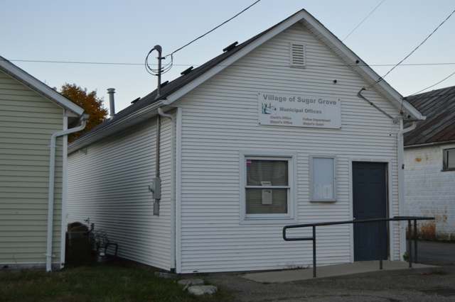
Photo: Nyttend, via Wikimedia Commons, public domain · Wikimedia Commons
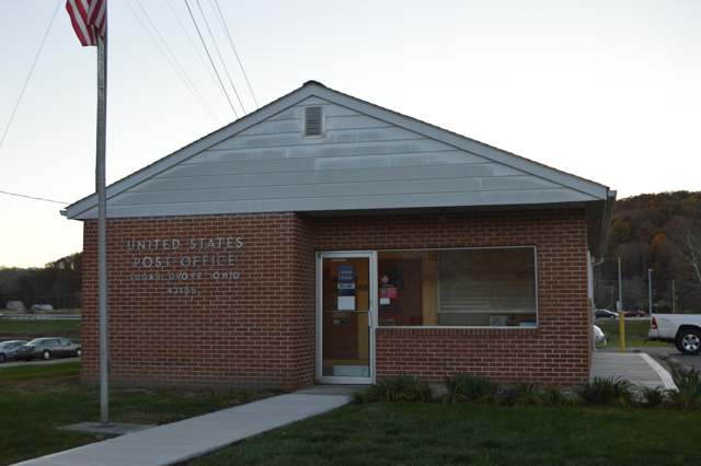
Photo: Nyttend, via Wikimedia Commons, public domain · Wikimedia Commons
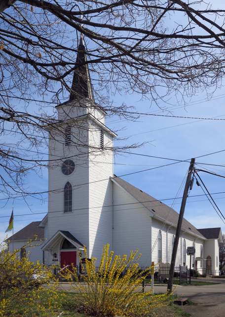
Photo: Nheyob, via Wikimedia Commons, CC BY-SA 4.0 · Wikimedia Commons
Local history sources: archive.org · archive.org · archive.org · en.wikipedia.org · en.wikipedia.org · commons.wikimedia.org · commons.wikimedia.org · commons.wikimedia.org
Water
Mostly private wells The water here
- Sugar Grove Village100% of residentsGroundwater wells (2 wells)
Its ZIP codes
Each ZIP code that touches Sugar Grove, with the share of its residents who live here and the same headline figures as the ZIP page.
| ZIP | Share | Water | Radon | Home value | Schools | Flood |
|---|---|---|---|---|---|---|
| 43155 Berne Township and Sugar Grove | 17% | Mostly private wells | 11.7 pCi/L average radon | Median year built 1978 | Berne Union Local · 3.5 stars overall | 10% of residents in the 1% floodplain |
The county
Fairfield County: 13 ZIP codes, 27 cities, villages and townships, 144,692 people.
Nearby places
Cite this page
Cite this page as:
Cracked Buckeye (Open Shower Co), "Sugar Grove, Fairfield County", https://crackedbuckeye.com/place/sugar-grove/, built 2026-09-16, accessed [date].
Machine-readable: /api/place/sugar-grove.json (open JSON, CC BY 4.0 for the compilation; the underlying records keep their own terms) · How to cite · Report a correction · Built 2026-09-16