Local events in Riverlea
Riverlea itself has 2 events posted in the next 90 days; the others here are within 10 miles. All local events in Riverlea
Checked October 20; the events page is refreshed daily.
How Riverlea began
Riverlea is a small, young village carved out of Sharon Township farmland that had belonged, since 1804, to the orbit of Worthington, the planned New England colony James Kilbourn led to the Olentangy River. The Van De Boe-Hager Company of Cleveland platted 102.29 acres as an upscale subdivision of 267 home sites in 1924, advertising lots through the Worthington News the next year, and residents incorporated their own village government in January 1939 rather than be absorbed by their much older neighbor. Bounded by Worthington on three sides and the Olentangy River on the fourth, Riverlea has stayed fiercely independent, most recently voting in 2011 to reject annexation, and remains one of Franklin County's smallest municipalities at 599 residents in 2020.
Platted 1924-06-09, incorporated 1939-01-04, by The Van De Boe-Hager Company of Cleveland platted the 102.29-acre subdivision, filed as "Addition No. 11," on land in Sharon Township; residents incorporated the Village of Riverlea on January 4, 1939.
Where the name comes from
No source we found explains who chose the name "Riverlea" or exactly why, though the village sits directly on the Olentangy River and "lea" is an old word for meadow or open farmland, which the subdivision was before 1924; this reading is plausible but not confirmed by any source and should not be treated as established fact.
Before the town
No Native American village, mound, earthwork, or trail specific to the Riverlea site itself turned up in the sources checked. The surrounding township was originally surveyed as part of the United States Military District (Township 2, Range 18) and organized in 1803 as Liberty Township before being renamed Sharon Township in 1806. The land lies within the area the Treaty of Greenville (August 3, 1795) ceded to the United States, seven years before the Scioto Company's settlers arrived.
Nations recorded here: Wyandot, Shawnee, Lenape (Delaware), Mingo (Seneca-Cayuga).
Timeline
- — The Scioto Company, a group of Connecticut and Massachusetts investors led by James Kilbourn, purchases 16,000 acres along the Olentangy River, including the future site of Sharon Township, at $1.25 an acre.
- — Ezra Griswold arrives on October 26 as the first of Kilbourn's colonists to reach the settlement; the township holds its first election at the house of Joseph Beaty.
- — James Kilbourn lays out the village of Worthington in 162 lots in May, on the Scioto Company's purchase; the Worthington Public Square is established the same year.
- — The surrounding township, originally organized in the United States Military District survey and first called Liberty Township, is renamed Sharon Township on March 4.
- — The Aurora Buttles House, built for one of Worthington's founding families, goes up near the future site of Riverlea.
- — Worthington incorporates as a village on March 9.
- — The Van De Boe-Hager Company of Cleveland files a plat on June 9 for 102.29 acres of former farmland in Sharon Township, calling it "Addition No. 11" — the origin of Riverlea.
- — The Worthington News runs an advertisement on July 16 announcing the new subdivision's 267 home sites, priced from $6,000 to $12,000.
- — Riverlea incorporates as an independent village on January 4.
- — The first census after incorporation counts 92 residents.
- — The population reaches 324, more than tripling in a decade as postwar home-building fills out the subdivision.
- — Riverlea residents vote to reject annexation by the city of Worthington, choosing to remain an independent village.
Stories
An upscale subdivision on the Olentangy
In June 1924, the Van De Boe-Hager Company of Cleveland, a firm already at work on Columbus-area developments like Beechwold and Sharon Heights, filed a plat for 102.29 acres of farmland in Sharon Township, laying out what it called "Addition No. 11." The Worthington News announced the project to readers on July 16, 1925, promising 267 home sites on land already platted, subdivided, and improved. At $6,000 to $12,000, the houses were priced well above what most 1920s buyers could afford, and the development drew residents who wanted a quiet, planned neighborhood on the river's edge rather than a farm town or a streetcar suburb. Within a decade and a half, enough of those homes had been built and sold that residents chose to incorporate their own village rather than be governed as part of Sharon Township or absorbed by Worthington next door.
Sixteen thousand acres for a New England colony
The land Riverlea would eventually occupy was part of a much larger purchase: in December 1802, the Scioto Company, a group of investors from Connecticut and Massachusetts led by James Kilbourn, bought 16,000 acres along the Olentangy River at $1.25 an acre, intending to plant a transplanted New England town in the Ohio wilderness. Ezra Griswold reached the site on October 26, 1803, the first of Kilbourn's colonists to arrive, and by May 1804 Kilbourn had laid out the village of Worthington in 162 lots around a central square. Worthington incorporated in 1835 and grew steadily for the next century, its early families like the Buttleses building substantial homes still standing today, while the farmland just south and west of the village, including the ground that became Riverlea, stayed in agricultural use for another hundred-plus years.
The historic houses next door
Several National Register-listed houses associated with this area's ZIP code, including homes built for the Buttles, Adams, Evans, and Gardner families, turn out on closer inspection to stand within Worthington itself rather than in Riverlea, whose own oldest ground was still farmland when those houses went up in the nineteenth century. The Aurora Buttles House, for instance, dates to 1818, built for a member of one of Worthington's founding families, decades before anyone platted a lot in what became Riverlea. Riverlea does hold at least one National Register property of its own, though: the Mark Russell House, listed under reference number 76001429, stands within the village's small boundary along the Olentangy.
Staying independent
Riverlea has spent nine decades as a very small, very independent place, surrounded on three sides by the much larger city of Worthington and bounded on the fourth by the Olentangy River. Its population never grew large: 92 residents at the first census after incorporation in 1940, a jump to 324 by 1950 as the subdivision filled in, and a slow drift since then between roughly 500 and 700. Full absorption into Worthington would have been the easier administrative path more than once over the decades, but Riverlea's residents chose otherwise as recently as 2011, voting down an annexation proposal and keeping their own mayor and village council rather than becoming another Worthington neighborhood.
Photographs
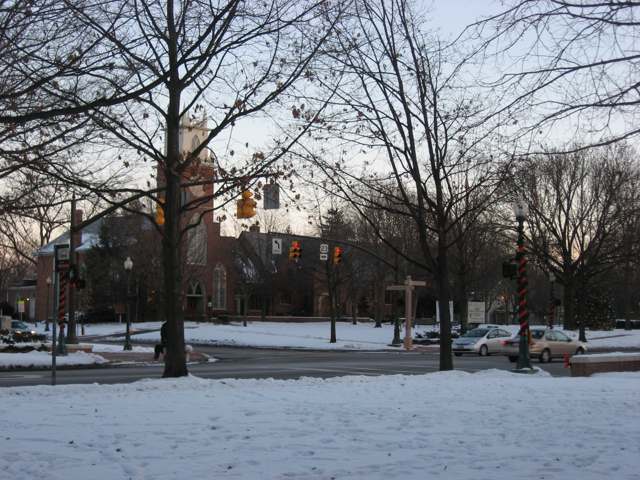
Photo: Photograph by Nyttend, public domain · Wikimedia Commons
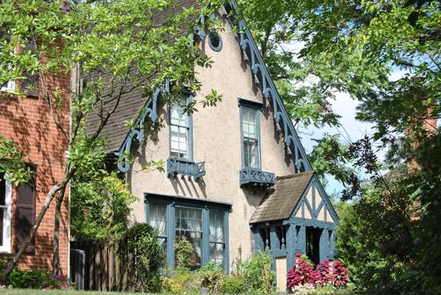
Photo: Photograph by Wdzinc, CC BY-SA 3.0 · Wikimedia Commons
Local history sources: riverleaohio.org · riverleaohio.org · en.wikipedia.org · ohiogenealogyexpress.com · en.wikipedia.org · en.wikipedia.org · commons.wikimedia.org · commons.wikimedia.org · commons.wikimedia.org
Historic places
2 places in Riverlea on the National Register of Historic Places. Press a pin or a name for its whole record.
-
Russell, Mark, HouseBuilding · Riverlea · listed 1976
- Address
- 5751 N. High St.
- Where
- Riverlea, Franklin County · ZIP 43085
- What it is
- Building
- Listed on the National Register
- 1976
- NRIS reference number
- 76001429
- Coordinates
- 40.07997, -83.01901
National Register file (NPS) ↗ Search Wikipedia ↗ Street map and directions ↗ On the Cracked Buckeye map
-
Worthington Manufacturing Company BoardinghouseBuilding · Worthington · listed 1973
- Address
- 25 Fox Lane
- Where
- Worthington, Franklin County · ZIP 43085
- What it is
- Building
- Listed on the National Register
- 1973
- NRIS reference number
- 73001446
- Coordinates
- 40.07737, -83.02879
National Register file (NPS) ↗ Search Wikipedia ↗ Street map and directions ↗ On the Cracked Buckeye map
Source: National Park Service, National Register of Historic Places point file. The listing year is shown where NPS's certification date agrees with the listing's reference number. Listing recognizes significance; it does not restrict a private owner.
Water
Big Walnut Creek at the plant's low-head dam and screen house on Morse Rd, below Hoover Dam The water here
- Columbus Public Water System100% of residentsScioto River (Griggs & O'Shaughnessy), Hoover Reservoir on Big Walnut Ck, plus wells
Its ZIP codes
Each ZIP code that touches Riverlea, with the share of its residents who live here and the same headline figures as the ZIP page.
| ZIP | Share | Water | Radon | Home value | Schools | Flood |
|---|---|---|---|---|---|---|
| 43085 Worthington and Columbus | 2% | Big Walnut Creek at the plant's low-head dam and screen house on Morse Rd, below Hoover Dam | 8.0 pCi/L average radon | Median year built 1977 | Worthington City · 4 stars overall | 0.1% of residents in the 1% floodplain |
Local government
Who holds office in Riverlea, how its elections and ballot issues came out, and the state auditor's record.
Who holds office
| Office | Name | Party | Term ends | Contact |
|---|---|---|---|---|
| MAYOR () | Dan Schlichting | |||
| CLERK-TREASURER () | Josh Mehling | |||
| COUNCIL () | Jeff Amick | |||
| COUNCIL () | Suzanne Surface | |||
| COUNCIL () | Thomas Bell | |||
| COUNCIL () | Emily Saving | |||
| COUNCIL () | Jeff Mussman | |||
| COUNCIL () | VACANT - Pending Appt.; |
Roster as of 8/17/2026: county board of elections.
Money issues on the ballot since 2025: 2 of 2 passed; of those asking for new or higher taxes, 2 of 2.
Ballot issues
| Date | Issue | For | Against | Result |
|---|---|---|---|---|
| 2025-11-04 | #31: #31 Proposed Tax Levy (Replacement and Decrease) - Current Expenses Village of Riverlea | 410 | 48 | Passed (89.52% for) |
| 2025-11-04 | #32: #32 Proposed Tax Levy (Replacement and Decrease) - Road Construction and Repair Village of Riverlea | 418 | 44 | Passed (90.48% for) |
Elections for office
| Date | Office | Candidates and votes |
|---|---|---|
| 2025-11-04 | Member of Council (number of seats not on file, so winners are not marked) | Emily Saving 372, 47.33%; Thomas Bell 354, 45.04%; Write-in 60, 7.63% |
| 2023-11-07 | RV For Member of Council | No Valid Petition Filed 0; No Valid Petition Filed 0 |
| 2023-11-07 | RV For Mayor | Daniel Schlichting 578, 100.0% |
| 2023-11-07 | RV For Clerk-Treasurer | No Valid Petition Filed 0 |
Winners in bold. Results from the county board of elections' official canvass unless marked.
Auditor of State record
- No fiscal caution, watch or emergency on the Auditor of State's lists.
- Agreed Upon Procedures, 2022 to 2023, released 2024-09-17
The county
Franklin County: 45 ZIP codes, 42 cities, villages and townships, 1,356,733 people.
Nearby places
Rain and snow
How much has actually fallen on Riverlea, day by day, from 1893 to now. Daily totals, not averages.
- rain, last 30 days
- 1.13 in
- 2026-10-01 to 2026-10-30
- rain so far in 2026
- 46.2 in
- 11.8 in above normal for the date
- snow so far in 2026
- 17.9 in
- a normal year brings 18.7 in
- a normal year
- 40.2 in
- average of 30 years, 1991-2020
| Month | Rain (in) | Snow (in) | Days counted |
|---|---|---|---|
| October 2026 | 1.13 | — | 30 |
| September 2026 | 5.76 | — | 30 |
| August 2026 | 9.93 | — | 31 |
| July 2026 | 4.27 | — | 31 |
| June 2026 | 4.09 | — | 30 |
| May 2026 | 7.32 | — | 31 |
| April 2026 | 3.48 | — | 30 |
| March 2026 | 6.79 | 2.4 | 31 |
| February 2026 | 2.08 | 2.7 | 28 |
| January 2026 | 1.35 | 12.8 | 31 |
| December 2025 | 2.16 | 9.2 | 31 |
| November 2025 | 2.67 | 1.1 | 30 |
| Wettest year | 2018 — 57.8 in |
|---|---|
| Driest year | 1934 — 23.1 in |
| Snowiest year | 1910 — 47.9 in |
| Wettest day on record | 14 September 1979 — 5.49 in |
| Heaviest snowfall in a day | 25 November 1950 — 10.54 in |
| Deepest snow on the ground | 9 February 1896 — 20.98 in |
Estimated, not measured. No rain gauge has ever stood inside Riverlea, so every figure here is worked out from the gauges around it - the nearest ones weighted most. Treat them as close estimates rather than readings.
47,955 days of records, 1893-06-01 to 2026-10-30. Source: NOAA NCEI GHCN-Daily, 3,240 gauges in and around Ohio. A day is "gauged" when a gauge standing inside the boundary reported it, and the value is the mean of those gauges. Otherwise it is interpolated by inverse distance from every gauge reporting within 50 miles. Nothing is carried forward, back-filled or smoothed. Against NOAA nClimDiv county monthly precipitation over 136,848 complete county-months (checked 2026-11-01): correlation 0.9515, median absolute difference 0.217 in a month. Built 2026-11-01 from the Cracked Buckeye precipitation archive. Snow is the softer number — snowfall is measured by hand with a ruler, no agency publishes a gridded county snowfall series, and blowing snow defeats every observer.
Environmental permits and filings
What Ohio EPA has on file for Riverlea: permits, inspections, violations, cleanups and the state loans behind sewer and water work. Every line links to the agency's own document.
- facilities and sites on file
- 2
- those placed on the map inside Riverlea
| Program | Facilities and sites |
|---|---|
| Wastewater and stormwater discharge | 2 |
| Date | Facility or site | What |
|---|---|---|
| VILLAGE OF RIVERLEA | Wastewater and stormwater discharge notice of violation | |
| VILLAGE OF RIVERLEA | Wastewater and stormwater discharge violation resolved | |
| VILLAGE OF RIVERLEA | Wastewater and stormwater discharge notice of violation | |
| VILLAGE OF RIVERLEA | Wastewater and stormwater discharge notice of violation | |
| VILLAGE OF RIVERLEA | Wastewater and stormwater discharge inspection | |
| VILLAGE OF RIVERLEA | Wastewater and stormwater discharge inspection | |
| VILLAGE OF RIVERLEA | Wastewater and stormwater discharge notice of violation | |
| RIVERLEA STREET AND INFRASTRUCTURE IMPROVEMENS | Wastewater and stormwater discharge inspection | |
| VILLAGE OF RIVERLEA | Wastewater and stormwater discharge violation resolved | |
| VILLAGE OF RIVERLEA | Wastewater and stormwater discharge notice of violation | |
| VILLAGE OF RIVERLEA | Wastewater and stormwater discharge violation resolved | |
| VILLAGE OF RIVERLEA | Wastewater and stormwater discharge violation resolved | |
| VILLAGE OF RIVERLEA | Wastewater and stormwater discharge notice of violation |
Source: Ohio EPA eDocument portal (edocpub.epa.ohio.gov), indexed 2026-10-14. Facilities are placed on the map from Ohio EPA's own map layers, EPA's Facility Registry, coordinates written in the filings, or a geocoded street address. A permit filed under a private person's name (most are household septic systems) is counted but never named, placed or linked; licenses for individual workers and open-burning notices are left out entirely.
Quick answers
What county is Riverlea, Ohio in?
Riverlea is a village in Franklin County, Ohio, with 599 residents.
When was Riverlea, Ohio founded?
Riverlea was laid out 1924-06-09; incorporated 1939-01-04. Founders on record: The Van De Boe-Hager Company of Cleveland platted the 102.29-acre subdivision, filed as "Addition No. 11," on land in Sharon Township; residents incorporated the Village of Riverlea on January 4, 1939. Source
What ZIP code is Riverlea, Ohio?
Most of Riverlea is in ZIP code 43085.
Where does Riverlea, Ohio get its water?
The main water source for Riverlea (Columbus Public Water System): Big Walnut Creek at the plant's low-head dam and screen house on Morse Rd, below Hoover Dam.
Cite this page
Cite this page as:
Cracked Buckeye, "Riverlea, Franklin County", https://crackedbuckeye.com/place/riverlea/, built 2026-10-31, accessed [date].
How to cite · Report a correction · Built 2026-10-31