Local events in Jacksonville
Nothing is posted for Jacksonville itself yet; here is what is on within 20 miles. All local events in Jacksonville
Know a calendar we should watch? Send the link
Checked October 20; the events page is refreshed daily.
How Jacksonville began
Jacksonville was laid out in 1879 by Oliver D. Jackson along Sunday Creek in northwestern Athens County, growing quickly as a coal-mining camp; a post office opened there in 1884 and is still running. The village's population peaked around 1,285 in 1910 at the height of the coal boom and has fallen steadily since, to 400 by the 2020 census. Sunday Creek itself carries the district's environmental legacy: an Ohio EPA study in 1997 found its lower thirteen miles, which run past Jacksonville and neighboring Trimble, 'irretrievably damaged' by acid mine drainage from the historic mines. The village's water system has also logged a recurring string of federal monitoring and reporting violations from 2000 into the 2020s.
Platted 1879, by Oliver D. Jackson.
Where the name comes from
Jacksonville is named for its founder, Oliver D. Jackson, who laid out the village in 1879 as coal mining developed along Sunday Creek.
Before the town
No source specific to the Jacksonville village site was found naming a Native village, camp, or trail there. At the county level, Walker's 1883 History of Athens County places the Shawnee (Shawanese) in possession of the wider Scioto-Miami country including Athens County, with Wyandot and Lenape (Delaware) parties present on hunting and war expeditions, and records a tradition that troops in Lord Dunmore's 1774 campaign camped along Sunday Creek itself, the waterway Jacksonville sits on — though not at the later village site, which was not founded for another century. This should be read as county- and creek-level context, not a claim about the village site specifically.
Nations recorded here: Shawnee, Wyandot, Lenape (Delaware).
- Sunday Creek encampment tradition (camp) — Sunday Creek, Athens County (exact location not specified), 1774 (Lord Dunmore's War) (archive.org)
Timeline
- — Tradition recorded in the 1883 county history holds that troops from Lord Dunmore's campaign camped along Sunday Creek, the stream Jacksonville later grew up beside.
- — Oliver D. Jackson laid out Jacksonville village along Sunday Creek as coal mining developed in the area.
- — A post office named Jacksonville was established; it continues operating.
- — Jacksonville's population peaked at about 1,285 during the coal-mining era.
- — An Ohio EPA study found the lower 13 miles of Sunday Creek, running past Jacksonville, 'irretrievably damaged to the extent that no appreciable aquatic life can be supported' by acid mine drainage from historic coal mining.
- — The Sunday Creek Watershed Group, sponsored by the nonprofit Rural Action, began sustained remediation and monitoring work on the creek's water quality.
- — Census recorded 400 residents, down from the 1910 peak of about 1,285.
Stories
A coal camp on a poisoned creek
Jacksonville was one of a string of villages — with Buchtel, Trimble, and others nearby — that sprang up along Sunday Creek in the last quarter of the nineteenth century as coal operators opened mines through the Hocking Valley coal district. Oliver D. Jackson laid the town out in 1879, and by 1910 it held roughly 1,285 people, a peak it has never approached again. The mines that built the town were also its long environmental legacy: decades of underground and surface mining released acid mine drainage into Sunday Creek, and by the time the Ohio EPA studied the stream in 1997, the lower thirteen miles — the stretch running past Jacksonville and Trimble on the way to the Hocking River at Chauncey — could no longer support appreciable aquatic life. Since 2012 the Sunday Creek Watershed Group, working with the regional nonprofit Rural Action, has pursued treatment and remediation projects aimed at bringing the creek back.
Photographs
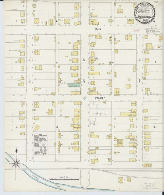
Photo: Sanborn Map Company, via Wikimedia Commons, public domain · Wikimedia Commons
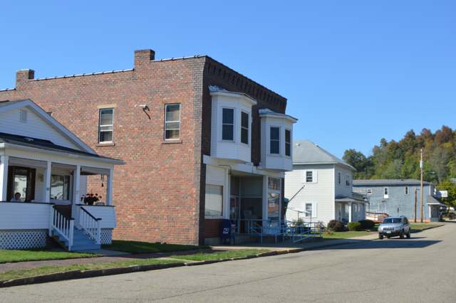
Photo: Wikimedia Commons contributor, public domain · Wikimedia Commons
Local history sources: en.wikipedia.org · en.wikipedia.org · archive.org · commons.wikimedia.org · commons.wikimedia.org
Water
Six wells (4 MGD combined) in a sand-and-gravel aquifer in the Hocking River Buried Valley aquifer system, Dover Township, Athens County (2025 CCR). Ohio EPA's May 2012 source water assessment rates the source highly susceptible to contamination (thin clay cover, aquifer less than 20 ft deep). The water here
- Jacksonville Village100% of residentsHocking River Buried Valley Aquifer (wells)
Hospitals, fire stations and more
Inside Jacksonville's boundary: 1 fire or EMS station. Press a pin or a name for its whole record and its source.
Fire and EMS stations (1)
-
Jacksonville Fire and RescueJacksonville
- Address
- 34 South 6th Street, Jacksonville, OH 45740
- Coordinates
- 39.47457, -82.08111
USGS National Map structures (source) ↗ Street map and directions ↗
Source: USGS National Map structures (most Ohio records last updated 2019 to 2022), checked against the Columbus and Cleveland station lists. The department that answers a call is set by jurisdiction and mutual aid, not by distance.
Its ZIP codes
Each ZIP code that touches Jacksonville, with the share of its residents who live here and the same headline figures as the ZIP page.
Local government
Who holds office in Jacksonville, how its elections and ballot issues came out, and the state auditor's record.
Money issues on the ballot since 2020: 6 of 6 passed.
Ballot issues
| Date | Issue | For | Against | Result |
|---|---|---|---|---|
| 2026-05-05 | 6: #6 Jacksonville Village Tax Levy Fire | 24 | 17 | Passed (58.54% for), unofficial |
| 2026-05-05 | 7: #7 Jacksonville Village Tax Levy Current Expenses | 24 | 17 | Passed (58.54% for), unofficial |
| 2022-11-08 | 8: #8 Jacksonville Village Tax Levy Current Operating Expenses | 98 | 47 | Passed (67.59% for) |
| 2022-05-03 | 3: #3 Jacksonville Village Tax Levy Ren Current Expenses | 33 | 16 | Passed (67.35% for) |
| 2022-05-03 | 4: #4 Jacksonville Village Tax Levy Ren Fire | 34 | 15 | Passed (69.39% for) |
| 2021-11-02 | 23: #23 Local Option Jacksonville Village Muddy Creek Tavern | 52 | 33 | Passed (61.18% for), unofficial |
| 2020-11-03 | 6: 6 Jacksonville Village Tax Levy Fire | 140 | 53 | Passed (72.54% for), unofficial |
| 2020-11-03 | 7: 7 Jacksonville Village Ordinance Marihuana | 112 | 80 | Passed (58.33% for), unofficial |
Elections for office
| Date | Office | Candidates and votes |
|---|---|---|
| 2021-11-02 | Member of Council (unofficial count) | Butch Chapman 47, 51.09%; Jay Chapman 45, 48.91% |
Winners in bold. Results from the county board of elections' official canvass unless marked.
Auditor of State record
- Fiscal emergency: declared 1984-04-02, released 1986-06-17. source
- Agreed Upon Procedures, 2023 to 2024, released 2025-07-15
The county
Athens County: 16 ZIP codes, 29 cities, villages and townships, 67,237 people.
Nearby places
Rain and snow
How much has actually fallen on Jacksonville, day by day, from 1893 to now. Daily totals, not averages.
- rain, last 30 days
- 1.49 in
- 2026-10-01 to 2026-10-30
- rain so far in 2026
- 49.2 in
- 12.1 in above normal for the date
- snow so far in 2026
- 19.8 in
- a normal year brings 16.7 in
- a normal year
- 43.5 in
- average of 30 years, 1991-2020
| Month | Rain (in) | Snow (in) | Days counted |
|---|---|---|---|
| October 2026 | 1.49 | — | 30 |
| September 2026 | 7.98 | — | 30 |
| August 2026 | 10.03 | — | 31 |
| July 2026 | 5.98 | — | 31 |
| June 2026 | 5.15 | — | 30 |
| May 2026 | 5.62 | — | 31 |
| April 2026 | 3.51 | — | 30 |
| March 2026 | 6.21 | 3.4 | 31 |
| February 2026 | 0.97 | 4.4 | 28 |
| January 2026 | 2.31 | 12.0 | 31 |
| December 2025 | 2.28 | 8.2 | 31 |
| November 2025 | 2.77 | 0.9 | 30 |
| Wettest year | 2018 — 66.8 in |
|---|---|
| Driest year | 1930 — 22.1 in |
| Snowiest year | 1910 — 54.3 in |
| Wettest day on record | 9 September 2004 — 4.51 in |
| Heaviest snowfall in a day | 14 January 1968 — 13.44 in |
| Deepest snow on the ground | 15 January 1968 — 21.16 in |
Estimated, not measured. No rain gauge has ever stood inside Jacksonville, so every figure here is worked out from the gauges around it - the nearest ones weighted most. Treat them as close estimates rather than readings.
48,318 days of records, 1893-06-01 to 2026-10-30. Source: NOAA NCEI GHCN-Daily, 3,240 gauges in and around Ohio. A day is "gauged" when a gauge standing inside the boundary reported it, and the value is the mean of those gauges. Otherwise it is interpolated by inverse distance from every gauge reporting within 50 miles. Nothing is carried forward, back-filled or smoothed. Against NOAA nClimDiv county monthly precipitation over 136,848 complete county-months (checked 2026-11-01): correlation 0.9515, median absolute difference 0.217 in a month. Built 2026-11-01 from the Cracked Buckeye precipitation archive. Snow is the softer number — snowfall is measured by hand with a ruler, no agency publishes a gridded county snowfall series, and blowing snow defeats every observer.
Environmental permits and filings
What Ohio EPA has on file for Jacksonville: permits, inspections, violations, cleanups and the state loans behind sewer and water work. Every line links to the agency's own document.
- facilities and sites on file
- 1
- those placed on the map inside Jacksonville
| Program | Facilities and sites |
|---|---|
| State water loans | 1 |
| Date | Facility or site | What |
|---|---|---|
| JACKSONVILLE VILLAGE PWS | State water loans | |
| JACKSONVILLE VILLAGE PWS | State water loans | |
| JACKSONVILLE VILLAGE PWS | State water loans | |
| JACKSONVILLE VILLAGE PWS | State water loans | |
| JACKSONVILLE VILLAGE PWS | State water loans |
Source: Ohio EPA eDocument portal (edocpub.epa.ohio.gov), indexed 2026-10-14. Facilities are placed on the map from Ohio EPA's own map layers, EPA's Facility Registry, coordinates written in the filings, or a geocoded street address. A permit filed under a private person's name (most are household septic systems) is counted but never named, placed or linked; licenses for individual workers and open-burning notices are left out entirely.
Quick answers
What county is Jacksonville, Ohio in?
Jacksonville is a village in Athens County, Ohio, with 400 residents.
When was Jacksonville, Ohio founded?
Jacksonville was laid out 1879. Founders on record: Oliver D. Jackson. Source
How did Jacksonville, Ohio get its name?
Jacksonville is named for its founder, Oliver D. Source
What ZIP code is Jacksonville, Ohio?
Most of Jacksonville is in ZIP code 45740.
Where does Jacksonville, Ohio get its water?
The main water source for Jacksonville (Jacksonville Village): Six wells (4 MGD combined) in a sand-and-gravel aquifer in the Hocking River Buried Valley aquifer system, Dover Township, Athens County (2025 CCR). Ohio EPA's May 2012 source water assessment rates the source highly susceptible to contamination (thin clay cover, aquifer less than 20 ft deep).
Cite this page
Cite this page as:
Cracked Buckeye, "Jacksonville, Athens County", https://crackedbuckeye.com/place/jacksonville/, built 2026-10-31, accessed [date].
How to cite · Report a correction · Built 2026-10-31