Local events in Hubbard Township, Trumbull County
Nothing is posted for Hubbard Township itself yet; here is what is on within 10 miles. All local events in Hubbard Township, Trumbull County
Know a calendar we should watch? Send the link
Checked October 20; the events page is refreshed daily.
How Hubbard Township, Trumbull County began
Hubbard Township, owned originally by Connecticut Land Company member Nehemiah Hubbard Jr. and sold to settlers by his agent Samuel Tylee, was organized as an election district in 1806 and named for its absentee owner. Tylee and his family, arriving from Middletown, Connecticut on September 1, 1801, were the township's first settlers; his brother Sylvester settled the crossroads that became known as Tylee's Corners, the seed of the later village and city of Hubbard. Growth was slow through the early 1800s -- only about a hundred voters lived in the township by 1834 -- with settlers arriving chiefly from Connecticut, New Jersey, Virginia, Pennsylvania and Maryland. That changed abruptly after 1861, when coal development turned the sleepy crossroads into a boomtown almost overnight. The township also contains the unincorporated communities of Maplewood Park and Masury and today is a populous Youngstown-Warren-area suburb.
Settled 1801-09-01, incorporated 1806 (organized as an election district), by Samuel Tylee and family, first settlers, arriving from Middletown, Connecticut.
Where the name comes from
Hubbard Township takes its name, like the city of Hubbard within it, from Nehemiah Hubbard Jr., an original member of the Connecticut Land Company who owned township three, range one, and sold the land to settlers through his agent Samuel Tylee. The township was organized into an election district and named after him in 1806. It is the only Hubbard Township in Ohio.
Before the town
No Native village, camp or treaty event specific to Hubbard Township is recorded in the sources reviewed. The township sits at the county's southeastern corner near the Pennsylvania line, within the wider Mahoning-valley region the county's 1882 history describes as Delaware-occupied hunting ground used seasonally by Seneca and Mingo bands through the 1700s, but no source found names a site inside the township's present boundaries.
Nations recorded here: Lenape (Delaware), Seneca, Mingo (Seneca-Cayuga).
Timeline
- — Samuel Tylee and his family, from Middletown, Connecticut, arrive as the township's first settlers; Tylee chooses a cabin site northwest of the later village corners.
- — Sylvester Tylee, Samuel's brother, settles the northeast corner lot at the crossroads, which becomes known as Tylee's Corners -- the future village and city of Hubbard.
- — Silas Burnett, son of settler William Burnett, is born in December -- the first white child born in the township.
- — Rev. Noah Fidler of the Erie Conference forms a Methodist class in Hubbard, the township's earliest organized religious congregation.
- — A Presbyterian church organizes in the township; its first log church edifice, a rude hewn-log structure, is the first church building erected in the township.
- — The township is organized into an election district and named after absentee owner Nehemiah Hubbard Jr.
- — Rev. Jacob Gruber holds a camp meeting in eastern Hubbard near the later Veach meeting-house, adding fifty members to the Methodist church.
- — Samuel Tylee opens the first store at Tylee's Corners, in his own house.
- — Only about one hundred voters live in the township, reflecting decades of slow population growth.
- — Large-scale coal development begins, rapidly transforming the crossroads village at Tylee's Corners; within a decade the place grows to nearly 2,000 residents.
- — The census records 12,969 residents in Hubbard Township, including the city of Hubbard and the communities of Maplewood Park and Masury.
Stories
A slow-growing township, then a boomtown almost overnight
For sixty years after Samuel Tylee's family arrived from Connecticut in 1801, Hubbard Township grew the way most rural Western Reserve townships did: gradually, family by family, from Connecticut, New Jersey, Virginia and Pennsylvania, with so many New Jersey settlers on one road running north from the center that it became known locally as 'Jersey Street.' Growth was slow enough that by 1834 the whole township counted only about a hundred voters. Then, in 1861, coal development began in earnest. The crossroads settlement at Tylee's Corners -- 'too young to have much history,' the 1882 county history says of it -- was transformed within a decade into a village of nearly two thousand people, its Main Street thick with hastily built houses and stores for a mile and a half. The transformation was so fast that, twenty years on, 'many of them still stand unimproved in appearance.'
Photographs
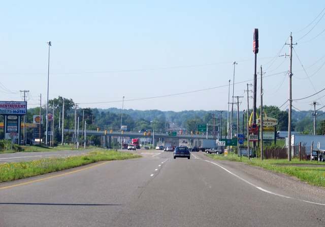
Photo: Idawriter (Panoramio), CC BY-SA 3.0 · Wikimedia Commons
Local history sources: en.wikipedia.org · en.wikipedia.org · archive.org · commons.wikimedia.org
Water
Shenango River / Shenango River Lake (Pymatuning area) surface intake The water here
- Hubbard City89% of residentsShenango River / Shenango River Lake (Pymatuning area) surface intake
- Aqua Ohio - Masury6% of residentsShenango River / Shenango River Lake (Pymatuning area) surface intake
- Stoneybrooke Village MHP3% of residentsGroundwater wells (2 wells)
- Valley Mobile Homes2% of residentsGroundwater wells (2 wells)
- Girard City1% of residentsMeander Creek Reservoir (via Niles/MVSD, blended)
Hospitals, fire stations and more
Inside Hubbard Township, Trumbull County's boundary: 1 high-hazard dam, 1 police station, 1 public charging site, 4 Toxics Release Inventory facilities and 11 spill cases. Press a pin or a name for its whole record and its source.
High-hazard dams (1)
-
Coalburg Lake Dam PoorLittle Yankee Run · condition: poor
- Hazard class
- High: a failure would probably cost a life
- Condition
- Poor (assessed 11/21/2019)
- River or stream
- Little Yankee Run
- Purpose
- Recreation
- Type
- Earth
- Height
- 24 ft
- Storage
- 770 acre-feet
- Completed
- 1916
- Owner type
- Private
- County
- Trumbull County
- Nearest town (NID)
- Coalburg
- Last inspection
- 11/21/2019
- Emergency action plan
- Yes
- NID ID
- OH00334
National Inventory of Dams record ↗ National Inventory of Dams (source) ↗ Street map and directions ↗
Source: U.S. Army Corps of Engineers National Inventory of Dams, August 2026. "High hazard" rates what a failure would cost downstream, not how likely one is; the condition is the state's assessment.
Police stations (1)
-
Hubbard Township Police DepartmentHubbard
- Address
- 2600 Elmwood Drive Extension, Hubbard, OH 44425
- Coordinates
- 41.17272, -80.55569
USGS National Map structures (source) ↗ Street map and directions ↗
Source: USGS National Map structures, police stations, corrected and completed by hand (September 2026). The department that answers a call is set by jurisdiction, not by distance.
Public EV charging (1)
-
Flying J 697 DC fast4 DC fast · Hubbard
- Address
- 2226 North Main Street, Hubbard, OH 44425
- Ports
- 4 DC fast
- Plugs
- CCS
- Network
- eVgo Network
- Hours
- 24 hours daily
- Phone
- 877-455-3833
Station Locator (NREL) ↗ Alternative Fuels Data Center (source) ↗ Street map and directions ↗
Source: NREL Alternative Fuels Data Center station list (May 2026), public and open stations, the posts at one address counted as one site.
Facilities reporting toxic releases (4)
-
Astralloy Steel Products IncToxics Release Inventory · Masury
- Address
- 1445 Standard Ave, Masury, OH 44438
- County
- Trumbull County
- Status
- Reports to the Toxics Release Inventory (active)
- EPA program ID
- 4443WSTRLL1445S
- EPA registry ID
- 110046278620
EPA facility record ↗ EPA Facility Registry Service (source) ↗ Street map and directions ↗
-
Berenfield Containers LtdToxics Release Inventory · Masury
- Address
- 7838 Iron St., Masury, OH 44438
- County
- Trumbull County
- Status
- Reports to the Toxics Release Inventory (active)
- EPA program ID
- 44438CNTNR7838I
- EPA registry ID
- 110000389678
EPA facility record ↗ EPA Facility Registry Service (source) ↗ Street map and directions ↗
-
Ellwood Engineered CastingsToxics Release Inventory · Hubbard
- Address
- 7158 Hubbard Masury Rd, Hubbard, OH 44425
- County
- Trumbull County
- Status
- Reports to the Toxics Release Inventory (open)
- EPA program ID
- 44425LLWDN7158M
- EPA registry ID
- 110000389641
EPA facility record ↗ EPA Facility Registry Service (source) ↗ Street map and directions ↗
-
Valley-Vulcan Mold CoToxics Release Inventory · Hubbard
- Address
- 7158 Masury Rd Se, Hubbard, OH 44425
- County
- Trumbull County
- Status
- Reports to the Toxics Release Inventory (active)
- EPA program ID
- 44425VLLYV7158M
- EPA registry ID
- 110069447227
EPA facility record ↗ EPA Facility Registry Service (source) ↗ Street map and directions ↗
Source: EPA Facility Registry Service, Toxics Release Inventory reporters. Reporting a release is required of large users of listed chemicals; it is not by itself a violation.
Spills reported since 2021 (11)
-
Fuel Diesel / Diesel Fuel (Vehicle On Or Off Road)2025-04-26 · Hubbard Twp
- Reported
- 2025-04-26
- What spilled
- Fuel Diesel / Diesel Fuel (Vehicle On Or Off Road)
- Largest amount reported
- 50 gallons
- Where
- Hubbard Twp, Trumbull County
- Ohio EPA district office
- NEDO
- Ohio EPA case number
- 2504EPA0000640
Ohio EPA spill reports (source) ↗ Street map and directions ↗
-
Fuel Diesel / Diesel Fuel (Vehicle On Or Off Road)2024-09-10 · Hubbard Twp
- Reported
- 2024-09-10
- What spilled
- Fuel Diesel / Diesel Fuel (Vehicle On Or Off Road)
- Largest amount reported
- 60 gallons
- Where
- Hubbard Twp, Trumbull County
- Ohio EPA district office
- NEDO
- Ohio EPA case number
- 2409EPA0001553
Ohio EPA spill reports (source) ↗ Street map and directions ↗
-
Brine Oil And Gas Related2024-03-07 · Hubbard Twp
- Reported
- 2024-03-07
- What spilled
- Brine Oil And Gas Related
- Largest amount reported
- 4,956 gallons
- Where
- Hubbard Twp, Trumbull County
- Ohio EPA district office
- NEDO
- Ohio EPA case number
- 2403EPA0000360
Ohio EPA spill reports (source) ↗ Street map and directions ↗
-
Fuel Gasoline ( 25% Ethanol Not E85)2023-11-06 · Hubbard Twp
- Reported
- 2023-11-06
- What spilled
- Fuel Gasoline ( 25% Ethanol Not E85); Oil Motor / Lube Oil / Vehicle
- Where
- Hubbard Twp, Trumbull County
- Ohio EPA district office
- NEDO
- Ohio EPA case number
- 2311EPA0001891
Ohio EPA spill reports (source) ↗ Street map and directions ↗
-
Paint Nos / Lacquer (Not Specified)2023-10-08 · Hubbard Twp
- Reported
- 2023-10-08
- What spilled
- Paint Nos / Lacquer (Not Specified)
- Largest amount reported
- 600 gallons
- Where
- Hubbard Twp, Trumbull County
- Ohio EPA district office
- NEDO
- Ohio EPA case number
- 2310EPA0001733
Ohio EPA spill reports (source) ↗ Street map and directions ↗
-
Sewage Human2023-02-25 · Hubbard Twp
- Reported
- 2023-02-25
- What spilled
- Sewage Human
- Where
- Hubbard Twp, Trumbull County
- Ohio EPA district office
- NEDO
- Ohio EPA case number
- 2302EPA0000285
Ohio EPA spill reports (source) ↗ Street map and directions ↗
-
Fuel Diesel / Diesel Fuel (Vehicle On Or Off Road)2022-10-13 · Hubbard Twp
- Reported
- 2022-10-13
- What spilled
- Fuel Diesel / Diesel Fuel (Vehicle On Or Off Road)
- Largest amount reported
- 100 gallons
- Where
- Hubbard Twp, Trumbull County
- Ohio EPA district office
- NEDO
- Ohio EPA case number
- 2210EPA0001549
Ohio EPA spill reports (source) ↗ Street map and directions ↗
-
Fuel Diesel / Diesel Fuel (Vehicle On Or Off Road)2022-07-27 · Hubbard Twp
- Reported
- 2022-07-27
- What spilled
- Fuel Diesel / Diesel Fuel (Vehicle On Or Off Road)
- Where
- Hubbard Twp, Trumbull County
- Ohio EPA district office
- NEDO
- Ohio EPA case number
- 2207EPA0001143
Ohio EPA spill reports (source) ↗ Street map and directions ↗
-
Fuel Diesel / Diesel Fuel (Vehicle On Or Off Road)2022-07-23 · Hubbard Twp
- Reported
- 2022-07-23
- What spilled
- Fuel Diesel / Diesel Fuel (Vehicle On Or Off Road)
- Where
- Hubbard Twp, Trumbull County
- Ohio EPA district office
- NEDO
- Ohio EPA case number
- 2207EPA0001118
Ohio EPA spill reports (source) ↗ Street map and directions ↗
-
Fuel Diesel / Diesel Fuel (Vehicle On Or Off Road)2021-05-29 · Hubbard Twp
- Reported
- 2021-05-29
- What spilled
- Fuel Diesel / Diesel Fuel (Vehicle On Or Off Road)
- Largest amount reported
- 150 gallons
- Where
- Hubbard Twp, Trumbull County
- Ohio EPA district office
- NEDO
- Ohio EPA case number
- 2105EPA0000761
Ohio EPA spill reports (source) ↗ Street map and directions ↗
-
Reported spill2021-04-13 · Hubbard Twp
- Reported
- 2021-04-13
- Where
- Hubbard Twp, Trumbull County
- Ohio EPA district office
- NEDO
- Ohio EPA case number
- 2104EPA0000510
Ohio EPA spill reports (source) ↗ Street map and directions ↗
Source: Ohio EPA emergency response spill reports, 2021 to September 2026, one point per case where Ohio EPA placed it. A report is what the caller or responder recorded; amounts are often blank or estimated.
Its ZIP codes
Each ZIP code that touches Hubbard Township, Trumbull County, with the share of its residents who live here and the same headline figures as the ZIP page.
| ZIP | Share | Water | Radon | Home value | Schools | Flood |
|---|---|---|---|---|---|---|
| 44425 Hubbard | 35% | Shenango River / Shenango River Lake (Pymatuning area) surface intake | 3.2 pCi/L average radon | Median year built 1957 | Hubbard Exempted Village · 3.5 stars overall | 1.9% of residents in the 1% floodplain |
| 44438 Brookfield Township and Masury | 7% | Shenango River / Shenango River Lake (Pymatuning area) surface intake | 3.3 pCi/L average radon | Median year built 1940 | Brookfield Local · 3 stars overall | 0.0% of residents in the 1% floodplain |
Local government
Who holds office in Hubbard Township, Trumbull County, how its elections and ballot issues came out, and the state auditor's record.
Who holds office
| Office | Name | Party | Term ends | Contact |
|---|---|---|---|---|
| Trustee | JASON TEDROW | 12/31/2027 | 3344 BEECHWOOD DR, HUBBARD, OH 44425 | |
| Trustee | MONICA J. BAKER | 12/31/2029 | 7544 CHESTNUT RIDGE RD, HUBBARD, OH 44425 | |
| Trustee | ERIC LAMB | 12/31/2029 | 1567 GREENSLEAVE CIR, HUBBARD, OH 44425 | |
| Fiscal officer | JENNIFER A. EVANS | 3/31/2028 | 7487 CHESTNUT RIDGE RD, HUBBARD, OH 44425 |
Roster as of 2026-08-24: county board of elections.
Elections for office
| Date | Office | Candidates and votes |
|---|---|---|
| 2017-11-07 | Trustee (number of seats not on file, so winners are not marked) | Hernandez, Rick Jr. 664, 38.52%; Jacobs, Tom 626, 36.31%; Rowlands, Jeffrey L. 434, 25.17% |
| 2015-11-03 | Trustee | Hanley, Frederick 1,328, 100.0% |
| 2015-11-03 | Fiscal Officer | Goterba, Sue Ann 1,179, 100.0% |
Winners in bold. Results from the county board of elections' official canvass unless marked.
The county
Trumbull County: 25 ZIP codes, 32 cities, villages and townships, 194,818 people.
Nearby places
Quick answers
What county is Hubbard Township, Ohio in?
Hubbard Township, Trumbull County is a township in Trumbull County, Ohio, with 5,333 residents.
When was Hubbard Township, Ohio founded?
Hubbard Township, Trumbull County was settled 1801-09-01; incorporated 1806 (organized as an election district). Founders on record: Samuel Tylee and family, first settlers, arriving from Middletown, Connecticut. Source
How did Hubbard Township, Ohio get its name?
Hubbard Township takes its name, like the city of Hubbard within it, from Nehemiah Hubbard Jr., an original member of the Connecticut Land Company who owned township three, range one, and sold the land to settlers through his agent Samuel Tylee. Source
What ZIP code is Hubbard Township, Ohio?
Hubbard Township, Trumbull County is served by ZIP codes 44425 and 44438; 44425 holds the largest share of its residents.
Where does Hubbard Township, Ohio get its water?
The main water source for Hubbard Township, Trumbull County (Hubbard City): Shenango River / Shenango River Lake (Pymatuning area) surface intake.
Cite this page
Cite this page as:
Cracked Buckeye, "Hubbard Township, Trumbull County", https://crackedbuckeye.com/place/hubbard-township-trumbull-county/, built 2026-10-31, accessed [date].
How to cite · Report a correction · Built 2026-10-31
