Local events in Center Township, Morgan County
Nothing is posted for Center Township itself yet; here is what is on within 20 miles. All local events in Center Township, Morgan County
Know a calendar we should watch? Send the link
Checked October 20; the events page is refreshed daily.
How Center Township, Morgan County began
Center Township, despite its name, is the easternmost township of Morgan County, along the old Zanesville-Marietta state road near the Noble County line. It was organized by the county commissioners on July 6, 1819, after settlers such as Nicholas Hoit, George Nott and John Shepard began clearing eighty-acre government tracts about 1818. The township had no flour mill for years, until Amos Brady built one on Olive Green Creek, and its first elections were so disputed that the township's choice of a justice was challenged three times between 1819 and 1822. The old state road was the main route until about 1835, when the Marietta-Zanesville mail was moved to a new road by way of McConnelsville. It is a farming township of 677 people (2020); its hamlet of Hackney has a former one-room school turned elementary school and Smith's Chapel Methodist church.
Settled c. 1818, by township organized by the county commissioners July 6, 1819; Nicholas Hoit, his son-in-law George Nott, John Shepard, Joseph McKinley, Joseph C. Linn, Patrick Sherlock, John Duffy, Lot Gard and others settled along the state road before 1820.
Where the name comes from
No source consulted says why the township was named Center (the 1886 chapter spells it Centre and gives no reason). Wikipedia notes that, despite the name, it is the easternmost township of Morgan County, bordering Noble County.
Before the town
No Native American village, mound, trail or treaty site specific to Center Township was found in the sources checked; the 1886 county history's settlement chapter makes no mention of Native people. The township lies within the Ohio Company purchase and the area ceded by the 1795 Treaty of Greenville; Wyandot, Shawnee, Lenape (Delaware) and Mingo (Seneca-Cayuga) people traveled and hunted the wider Muskingum valley before removal, but no site-specific record for Center Township was located.
Timeline
- — Settlers including Nicholas Hoit, George Nott and John Shepard begin clearing government land along the Zanesville-Marietta road; before this the township was largely wilderness.
- — Morgan County is created by act of the General Assembly; its commissioners organize Center Township the next summer.
- — Center Township is officially organized on July 6; its first election, held July 24, draws twenty-six votes and elects Lot Gard as justice of the peace, a result that is later contested.
- — Pioneers on Union Run include Samuel George, William L. Ireland and Daniel Lowry, a Black settler, who support their families on 'day's work' and the chase; along the 'ridge' state road Linn's and Gard's houses are the only places travelers can count on for a meal and bed.
- — In April Enoch S. McIntosh is elected justice of the peace; Lot Gard's election of 1819 had later been held void.
- — A two-justice election draws forty votes and is thrown out because one election judge is a foreigner; a second election in November is also contested, on the ground that the advertisement and the polling were unlawful.
- — A further election, attended by nearly every voter, seats Joseph C. Linn (later an associate judge) with thirty of fifty votes, ending the strife over offices.
- — Thomas Murray of Bristol Township is stabbed to death on the state road near Nicholas Hoit's house by Johnson, a fellow drover bringing hogs to the Grave Creek flats; Johnson is convicted of second-degree murder, sentenced to life and later pardoned.
- — A blacksmith named Wilson builds the small log house in Hackney that is later used for the township's first schools.
- — The first school in the northern part of the township opens for the winter term in a log house at Hackney, taught by Miss Louisa Carter.
- — Miss Mercy Bliss keeps the township's second school, the winter after Louisa Carter's, in the same log house between the Catholic chapel and the highway at Hackney.
- — The Marietta-Zanesville mail line is moved from the old state road to a new road by way of McConnelsville, and the road through Center loses its stage coaches and its character as a thoroughfare.
- — The census counts 677 residents in the township's 32.3 square miles.
Stories
Two dollars an acre and a long ride to the mill
Settlers who bought into Center Township in the years after 1818 paid the government's standard two dollars an acre for eighty-acre tracts and then found there was nowhere close by to have their grain ground into flour — the township had no mill of its own for years. That changed only when Amos Brady built the first mill on Olive Green Creek. Until then, and to some extent after, the township's other notable frontier character was Abraham 'Essence' Smith, who gave up trapping and hunting to gather and distill wild herbs for sale, a small window into the improvised economies that filled the gap before conventional milling and trade reached this easternmost corner of the county.
An 800-mile circuit
The Reverend Archibald McElroy, the first ordained Methodist minister to serve Center Township, rode a preaching circuit the 1886 county history puts at 800 miles. Miss Louisa Carter kept the first school in the northern part of the township in the winter of 1826-27, in a small log house at Hackney.
The election nobody could win
Center Township's first election, on July 24, 1819, drew twenty-six votes, and Lot Gard got twenty-five of them as justice of the peace; it was later held void. In April 1821 Enoch S. McIntosh won the office. The October 1822 election for two justices drew forty votes, with James Anderson at 29 and Gard at 25, and it too was declared invalid, because one of the judges was a foreigner. A third election on November 3 was contested over the legality of the advertisement and the closing of the polls, and the committee that examined it left a report that the county historian printed 'verbatim as a specimen of the manner in which legal business was done by the pioneers': 'We the onder signers beingen cold apond and sworn akorden to law to exemen the contested Lection of Joseph C. Lin and Willem Olephan of Senter Townshep...'. Only a fourth election, in which nearly every voter in the township took part, settled things: Joseph C. Linn was seated with thirty of the fifty votes.
Photographs
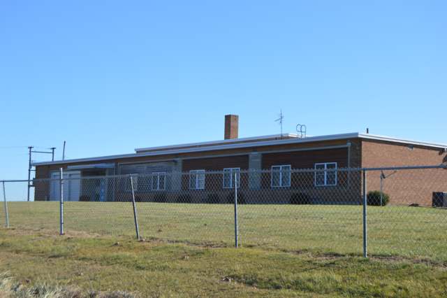
Photo: Nyttend, public domain · Wikimedia Commons
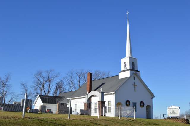
Photo: Nyttend, public domain · Wikimedia Commons
Local history sources: ohiogenealogyexpress.com · en.wikipedia.org · archive.org · en.wikipedia.org · commons.wikimedia.org · commons.wikimedia.org
Water
Groundwater wells (4 wells) The water here
- Beverly Village95% of residentsGroundwater wells (4 wells)
- Mcconnelsville Village4% of residentsGroundwater wells (4 wells)
- Morgan Meigsville - Sr 3761% of residentsGroundwater wells (4 wells)
- Malta Village0% of residentsGroundwater wells (4 wells)
- Morgan Meigsville Rural0% of residentsGroundwater wells (4 wells)
Hospitals, fire stations and more
Inside Center Township, Morgan County's boundary: 1 fire or EMS station, 1 poor-rated bridge, 3 shale and injection wells and 1 spill case. Press a pin or a name for its whole record and its source.
Fire and EMS stations (1)
-
Center Township Volunteer Fire DepartmentBeverly
- Address
- 1745 State Highway 83, Beverly, OH 45715
- Coordinates
- 39.61837, -81.65671
USGS National Map structures (source) ↗ Street map and directions ↗
Source: USGS National Map structures (most Ohio records last updated 2019 to 2022), checked against the Columbus and Cleveland station lists. The department that answers a call is set by jurisdiction and mutual aid, not by distance.
Bridges rated poor (1)
-
Township Road 249 over Olive Green CreekPoor · built 1903
- Condition
- Poor: a deck, superstructure, substructure or culvert rated 4 or below on the 0 to 9 scale
- What it is
- Bridge
- Built
- 1903
- Length
- 11 ft
- Owner
- County
- Vehicles a day
- 209
- Coordinates
- 39.65541, -81.60560
National Bridge Inventory (source) ↗ Street map and directions ↗
Source: FHWA National Bridge Inventory 2025. "Poor" means one major part rated 4 or below on the 0 to 9 scale; it calls for repair, not closing, unless the state posts or closes the bridge.
Shale and injection wells (3)
-
Palmer 2HUtica shale well
- What it is
- Utica shale well
- Drilled sideways
- Yes
- Operator
- Inr Ohio Llc
- County
- Morgan County
- API well number
- 34115246840000
- Coordinates
- 39.60931, -81.66692
ODNR oil and gas wells (source) ↗ Street map and directions ↗
The point is the surface well head (the pad); a horizontal well runs a mile or more underground from it.
-
Palmer 3HUtica shale well
- What it is
- Utica shale well
- Drilled sideways
- Yes
- Operator
- Inr Ohio Llc
- County
- Morgan County
- API well number
- 34115246830000
- Coordinates
- 39.60928, -81.66696
ODNR oil and gas wells (source) ↗ Street map and directions ↗
The point is the surface well head (the pad); a horizontal well runs a mile or more underground from it.
-
Ullman {Swiw#22} 1-B InjectionInjection well (Class II)
- What it is
- Injection well (Class II)
- Operator
- Eltringham Producing Llc
- County
- Morgan County
- API well number
- 34115240960000
- Coordinates
- 39.60107, -81.67703
ODNR oil and gas wells (source) ↗ Street map and directions ↗
Source: ODNR Division of Oil and Gas Resources well inventory (September 2026): drilled Utica, Marcellus and horizontal wells and Class II injection wells not plugged. Older vertical wells are on the full map.
Spills reported since 2021 (1)
-
Oil Crude2022-05-10 · Center Twp
- Reported
- 2022-05-10
- What spilled
- Oil Crude
- Largest amount reported
- 10 gallons
- Where
- Center Twp, Morgan County
- Ohio EPA district office
- SEDO
- Ohio EPA case number
- 2205EPA0000670
Ohio EPA spill reports (source) ↗ Street map and directions ↗
Source: Ohio EPA emergency response spill reports, 2021 to September 2026, one point per case where Ohio EPA placed it. A report is what the caller or responder recorded; amounts are often blank or estimated.
Its ZIP codes
Each ZIP code that touches Center Township, Morgan County, with the share of its residents who live here and the same headline figures as the ZIP page.
| ZIP | Share | Water | Radon | Home value | Schools | Flood |
|---|---|---|---|---|---|---|
| 45715 Beverly | 26% | Groundwater wells (4 wells) | 6.3 pCi/L average radon | Median year built 1970 | Fort Frye Local · 5 stars overall | 1.6% of residents in the 1% floodplain |
| 43756 Mcconnelsville and Mc Connelsville | 1% | Mostly private wells | 2.4 pCi/L average radon | Median year built 1969 | Morgan Local · 3 stars overall | 7.5% of residents in the 1% floodplain |
The county
Washington County: 17 ZIP codes, 33 cities, villages and townships, 61,140 people.
Nearby places
Quick answers
What county is Center Township, Ohio in?
Center Township, Morgan County is a township in Washington County, Ohio, with 677 residents.
When was Center Township, Ohio founded?
Center Township, Morgan County was settled c. 1818. Founders on record: township organized by the county commissioners July 6, 1819; Nicholas Hoit, his son-in-law George Nott, John Shepard, Joseph McKinley, Joseph C. Linn, Patrick Sherlock, John Duffy, Lot Gard and others settled along the state road before 1820. Source
What ZIP code is Center Township, Ohio?
Most of Center Township, Morgan County is in ZIP code 45715.
Where does Center Township, Ohio get its water?
The main water source for Center Township, Morgan County (Beverly Village): Groundwater wells (4 wells).
Cite this page
Cite this page as:
Cracked Buckeye, "Center Township, Morgan County", https://crackedbuckeye.com/place/center-township-morgan-county/, built 2026-10-31, accessed [date].
How to cite · Report a correction · Built 2026-10-31
