Water system
Orrville City
EPA ID OH8502712 · Wayne County · 8,452 people served · owned by a local government
Orrville City treats its own water from Local groundwater wells (Wayne County).
The system's record
- Active wells
- 10
- Serves
- 8,452 people · Wayne County
- EPA ID
- OH8502712
Orrville draws from 10 active wells; no documented named buried-valley aquifer found for this specific wellfield, so kept as generic local wells per SDWIS GW code.
About this area's water
Did you know
- Since 1995 Orrville's wastewater plant has sent more than a billion gallons of treated effluent — about 500,000 gallons a day — to cool the city's own municipally owned power plant.
- On an ordinary day the wastewater plant's discharge makes up more than 90% of the entire flow of Little Chippewa Creek, the stream it discharges into.
- Orrville's groundwater is naturally fluoridated; the plant adds only a small amount to reach EPA levels rather than fluoridating from scratch.
- The 10 wells fan out from town to the Stark County line across four wellfields, drawing from sandstone, conglomerate, and buried sand and gravel.
- The water is softened to 100 mg/L, and the utility tells residents that home water softeners are unnecessary.
Source: orrutilities.comorrutilities.com
History6
- 1893The first waterworks plant opened with four 8-inch wells, a small boiler and a steam pump. (Orrville Utilities prints the 1893 plant opening ahead of the 1894 board formation; the ordering is the…
- 1894A Board of Waterworks Trustees was formed to construct and administer a waterworks for the Village of Orrville.
- 1918Three additional 10-inch wells were drilled as population and demand grew.
- 1923Three more 10-inch wells were added, bringing the total to 10 — the same count still in service today.
- 1995The municipally owned power plant began reusing treated wastewater effluent as cooling water.
- 1997A $13 million treatment plant capable of treating 3.7 million gallons per day was completed in late 1997.
Treatment & pressure
How it is treated
Groundwater from 10 wells in four wellfields — Park (2 wells northwest of town, buried sand and gravel), Beaubien (1 well southeast, sandstone bedrock), Burton City (2 wells, sandstone units) and East (5 wells in Baughman Township, sandstone and conglomerate aquifers) — is softened with alum and…
Source: orrutilities.comorrutilities.comorrutilities.com
Water pressure
Not published. No system psi figure appears in the CCR or on Orrville Utilities' pages. The distribution system is roughly 61 miles of 4- to 16-inch main with two booster stations…
Source: orrutilities.com
What it costs
$6.36 per 1,000 gallons
Typical household bill about $51 a month for water.
Water only, Residential Schedule No. 1 (file dated 11/2022; no effective date is printed on the schedule). Inside city: $18.75 per month capacity-of-service charge for a 3/4-inch…
Source: orrutilities.com
Water quality & impurities8
| Contaminant | Level | Limit | Year |
|---|---|---|---|
| Total Trihalomethanes (TTHM) Range 34.3-34.5 ppb. Byproduct of chlorination; no violation. Notably less than half Oberlin's level, the usual… | 34.5 ppb | 80 ppb | 2025 |
| Fluoride Range 0.82-1.05 ppm. Naturally occurring, with only a small treatment addition. | 1.05 ppm | 4 ppm | 2025 |
| Nitrate Single result; no range reported. Well below limit. | 0.22 ppm | 10 ppm | 2025 |
| Total Chlorine Range 1.05-1.32 ppm. | 1.15 ppm | 4 ppm (MRDL) | 2025 |
| Lead (90th percentile) 0 of 20 samples exceeded the action level. | 2.8 ppb | 15 ppb (action… | 2023 |
| Copper (90th percentile) 0 of 20 samples exceeded the action level. | 0.07 ppm | 1.3 ppm (action… | 2023 |
| Lithium (unregulated, UCMR 5) Range of detections 12-13 ppb. Monitored under the fifth Unregulated Contaminant Monitoring Rule. | 12.5 (average) ppb | none (no… | 2025 |
| PFAS (six regulated compounds: PFOA… The CCR states all PFAS tested were below the minimum reporting levels, which is a reporting-limit statement rather… | below minimum… ppt | n/a (UCMR 5… | 2025 |
Source: orrutilities.com
EPA compliance record
Lead at the tap: 90th-percentile result 2.8 ppb in 2023 (action level 15 ppb).
EPA record: no health-based violations since 2015.
Projects & plans2
Recent and current work
- East Chestnut Street waterline replacement (South Walnut Street to Briarwood Street) · 2026 · under construction
Contractor selected through competitive bidding; expected completion including final road repairs in fall 2026. No cost published by the utility. - Wabash Avenue waterline replacement (Penn Avenue to West Market Street) · 2026 · under construction
Contractor selected through competitive bidding; expected completion including final road repairs in fall 2026. No cost published by the utility.
Source: orrutilities.com
Supply stress
Groundwater, and comparatively comfortable. Ohio EPA's 2007 susceptibility analysis rates the Beaubien and Burton City wellfields low and the East wellfield moderate — its overlying sediments are thinner in places — within a regional sandstone aquifer, while the Park wellfield draws from a sand and gravel aquifer rated moderate. The CCR…
Sewers
Sanitary
Orrville Utilities operates its own wastewater plant: primary settling tanks, trickling filters (one 96-foot filter rated 2.0 MGD and two 68-foot filters rated 1.1 MGD each), anoxic tanks, first- and second-stage aeration with settling, tertiary filters, chlorination and post-aeration. Stated design capacity is 4.0 MGD, with bypass…
Storm
Not documented in the utility's published pages.
Source: orrutilities.com
Sourcesverified
Compiled from the utility's own reports and public records, then independently re-checked against primary sources.
Main supplier in 1 ZIP code
Serves
Main water supplier in 1 ZIP code
- 44667 · Orrville63% of residents
Population-weighted resident shares; a ZIP code can have more than one system on record. Recomputed from each ZIP's own system list, not from the map's cached footprint.
Buys from · Sells to
Orrville City does not buy water from another system on record; it treats its own source water.
No other system is on record buying water from Orrville City.
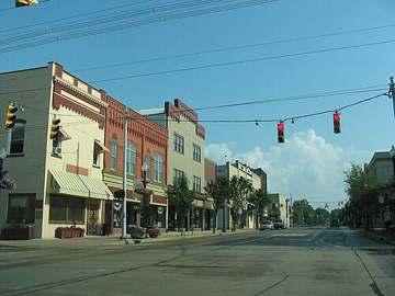
Photograph
On the map
Show this system's territory on the map — 1 ZIP code in all.
Sources
U.S. EPA SDWIS and Community Water System Service Area Boundaries (v3, 2026), Ohio EPA primacy data, 2020 census blocks: the system serving most residents, traced through purchases to the treating utility; Ohio EPA 2023 Sewer and Water Rate Survey (Ohio State, May 2025) for household bills; Ohio EPA DEFA loan awards since 2016 for the loans paragraph · EPA SDWIS · EPA service area boundaries · Ohio EPA drinking water · Ohio EPA rate survey
Notable facts: orrutilities.com, orrutilities.com
History: orrutilities.com, orrutilities.com, orrutilities.com
Water quality: orrutilities.com
Water pressure: orrutilities.com
Capital projects: orrutilities.com
Rates: orrutilities.com
Sewers: orrutilities.com
Treatment: orrutilities.com, orrutilities.com, orrutilities.com
Supply stress: orrutilities.com, orrutilities.com, orrutilities.com