Water system
Medina Co/southern Water Dist
EPA ID OH5260712 · Medina County · 4,708 people served · owned by a local government
Medina Co/southern Water Dist treats its own water from Groundwater wells (3 wells).
The system's record
The Ohio Department of Health's fluoridation report (CDC My Water's Fluoride) lists Medina Co/southern Water Dist as buying its water from Ashland City; EPA's inventory shows its own sources as primary with Ashland City as an emergency connection. The two records may reflect a blend or a recent switch.
- Active wells
- 3
- Serves
- 4,708 people · Medina County
- EPA ID
- OH5260712
About this area's water
Did you know
- The district is run out of the Medina County Sanitary Engineer's office in Columbia Station, not by either of the two communities it serves.
- In 2025 the county permanently shut down the Westfield well rather than operate it after the state permitted an oil well inside the 300-foot sanitary isolation radius around the wellhead.
- The Westfield Road well was screened less than 20 feet below the surface under a thin clay layer, which is why Ohio EPA rated it highly susceptible to contamination while the deeper Greenwich Road wells, under 40-plus…
- For 217 days in 2025 the district ran on an emergency pipe: the Friendsville and Lafayette Road interconnection to the county's Northwest Water System delivered 67 million gallons.
- The Chippewa Lake wastewater plant that serves the same community was originally built in 1925 as Imhoff tanks and slow sand filtration, and its last real upgrade was an equalization tank in 1995.
History6
- 2020January 21: SDWIS opens a non-health-based 'Other' category violation; no return-to-compliance date is recorded.
- 2022December 7: a second non-health-based 'Other' category violation opens; also with no return-to-compliance date recorded.
- 2025The district receives a significant deficiency violation because an ODNR-permitted oil well was installed inside the 300-foot sanitary isolation radius of the Westfield wellhead. Medina County…
- 2025The Westfield emergency interconnection to the county's Northwest Water System, at Friendsville and Lafayette Roads, was used for 217 days and delivered 67 million gallons.
- 2025December 3: source water protection status begins for the system in SDWIS.
- 2026April 9: Ohio EPA issues a preliminary Finding of No Significant Impact for a $75 million replacement of the Chippewa Lake WWTP, which serves the same Chippewa Lake area.
Treatment & pressure
How it is treated
Two county-run groundwater plants. The Chippewa Lake Water Plant draws three wells at 7090 Lake Road and, per EPA treatment records, uses packed-tower aeration, pressure sand filtration for both filtration and manganese removal, and pre-hypochlorination. The Westfield Water Plant drew two wells…
Source: medinaco.orgdata.epa.govdata.epa.gov
Water pressure
Not published. No CCR figure, engineering report or pressure-zone map for the district was located.
What it costs
Not verified. The Medina County Sanitary Engineering fee and charge schedule (effective January 1, 2026) is the governing document but its PDF is served behind a bot-protection…
Source: citizenportal.ai
Water quality & impurities10
| Contaminant | Level | Limit | Year |
|---|---|---|---|
| Total trihalomethanes (TTHM) Range 8.6-66.2. The highest reading is 83% of the federal limit, the district's closest approach to any standard. | 66.2 ppb | 80 (MCL) | 2025 |
| Haloacetic acids (HAA5) Range <2.8-27.8; disinfection by-product. | 27.8 ppb | 60 (MCL) | 2025 |
| Arsenic Range <0.5-2.0; erosion of natural deposits. | 2.0 ppb | 10 (MCL) | 2025 |
| Nitrate (as N) Range <0.19-0.58. | 0.58 ppm | 10 (MCL) | 2025 |
| Nitrite (as N) Range 0.02-0.22. | 0.22 ppm | 1 (MCL) | 2025 |
| Total chlorine residual Range 0.34-2.62. | 0.98 ppm | 4.0 (MRDL) | 2025 |
| Barium Range 0.0209-0.0299. | 0.0209 ppm | 2 (MCL) | 2024 |
| Cyanide Range 1-1. | 1 ppb | 200 (MCL) | 2024 |
| Fluoride Range 0.32-0.33. | 0.33 ppm | 4.0 (MCL) | 2024 |
| Lead (90th percentile) 0 of 20 sites above the action level; the county reports no lead, galvanized-requiring-replacement or unknown-material… | 1 ppb | 15 (action… | 2024 |
Source: medinaco.org
EPA compliance record
Lead at the tap: 90th-percentile result 1 ppb in 2024 (action level 15 ppb).
EPA record: no health-based violations since 2015.
Projects & plans3
Recent and current work
- Permanent shutdown of the Westfield well · 2025 · completed
Taken permanently out of service after an ODNR-permitted oil well was installed inside the 300-foot sanitary isolation radius of the wellhead, which drew a…
Source: medinaco.orgdata.epa.gov
Planned or needed
- Chippewa Lake WWTP replacement and pump station reconstruction (Sewer District #700) · $75 million · 2026 · planned
Wastewater, not water, but it serves the same Chippewa Lake community. Medina County requested $75 million from the Ohio Water Pollution Control Loan Fund at… - Westfield water plant expansion · $23 million · 2026 · proposed
Flagged with caution: the only source located is AI-generated coverage of a February 2026 Medina County commissioners meeting on a capital plan of more than…
Supply stress
Real and documented. Ohio EPA rates the Chippewa Lake wells and the Greenwich Road wells as moderately susceptible to contamination, but the Westfield Road well, screened less than 20 feet below ground under a thin clay layer, as highly susceptible; the county maintains a wellhead protection plan in response. That well is now permanently…
Sewers
Sanitary
Not the same footprint as the water district, and only partly documented. The Medina County Sanitary Engineer operates three wastewater plants countywide; the Chippewa Lake WWTP (Plant #700, Sewer District #700) serves the villages of Chippewa Lake and Gloria Glens Park, about 1,100 people, with a 0.874 MGD design average flow…
Storm
Not documented. No county or Ohio EPA source located describes storm sewers, separation, or drainage problems in Westfield Center or Chippewa Lake. The CCR notes only that storm drains discharge directly to the ground or streams.
Source: dam.assets.ohio.govmedinaco.org
Sourcesverified
Compiled from the utility's own reports and public records, then independently re-checked against primary sources.
Main supplier in 2 ZIP codes
Serves
Main water supplier in 2 ZIP codes
- 44251 · Westfield Center100% of residents
- 44215 · Lafayette Township and Chippewa Lake80% of residents
Also present in 1 more ZIP code
- 44273 · Seville3% of residents
Population-weighted resident shares; a ZIP code can have more than one system on record. Recomputed from each ZIP's own system list, not from the map's cached footprint.
Buys from · Sells to
Medina Co/southern Water Dist does not buy water from another system on record; it treats its own source water.
No other system is on record buying water from Medina Co/southern Water Dist.
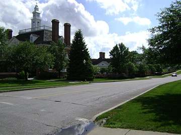
Photograph
On the map
Show this system's territory on the map — 3 ZIP codes in all.
Sources
U.S. EPA SDWIS and Community Water System Service Area Boundaries (v3, 2026), Ohio EPA primacy data, 2020 census blocks: the system serving most residents, traced through purchases to the treating utility; Ohio EPA 2023 Sewer and Water Rate Survey (Ohio State, May 2025) for household bills; Ohio EPA DEFA loan awards since 2016 for the loans paragraph · EPA SDWIS · EPA service area boundaries · Ohio EPA drinking water · Ohio EPA rate survey
Notable facts: medinaco.org, data.epa.gov, dam.assets.ohio.gov
History: data.epa.gov, data.epa.gov, medinaco.org, dam.assets.ohio.gov
Water quality: medinaco.org
Planned work: dam.assets.ohio.gov, citizenportal.ai
Capital projects: medinaco.org, data.epa.gov
Rates: citizenportal.ai
Sewers: dam.assets.ohio.gov, medinaco.org
Treatment: medinaco.org, data.epa.gov, data.epa.gov
Supply stress: medinaco.org, data.epa.gov, data.epa.gov