West Lafayette
Village · Coshocton County · 2,417 residents · 1.5% municipal income tax
Local events in West Lafayette
5 events in the next 90 days from 2 public calendars. All local events in West Lafayette
Checked October 20; the events page is refreshed daily.
How West Lafayette began
West Lafayette was laid out in 1850 by Robert Shaw and William Wheeler on the north bank of the Tuscarawas River in Lafayette Township, and grew fast after the Steubenville and Indiana Railroad (later the Pennsylvania Railroad's Panhandle Route) reached it in 1855. In the early 1900s it became known as the "Enamel Center of the World" on the strength of three enamelware plants: Lafayette Stamping and Enameling Co. (1903), Moore Enameling, and Jones Metal. On September 11, 1950 a troop train carrying the Pennsylvania National Guard's 109th Field Artillery Battalion collided with the Spirit of St. Louis passenger train at the edge of the village, killing 33 soldiers, one of the worst rail disasters in Ohio history. The village, whose National Register houses actually sit in the surrounding township rather than inside its limits, was not separately incorporated until 2016 in Census records even though it had operated as a village for well over a century.
Platted 1850, by Robert Shaw and William Wheeler.
Where the name comes from
The village and its township are named, like many places platted in the years after his 1824-25 farewell tour of the United States, for Gilbert du Motier, the Marquis de Lafayette; Lafayette Township itself was renamed in his honor at its 1835 organization, the year after his death, and the village founded on its river bank in 1850 took the same name with 'West' distinguishing it from other Lafayettes.
Before the town
No village-specific Native American sites or events are recorded for West Lafayette; the 1850 town site was platted on land that had already passed out of Native hands by the 1785-1808 treaty cessions covering this part of the Muskingum-Tuscarawas valley. The broader township (see T41132-COS) and Coshocton County's own file carry what is documented for this stretch of the Tuscarawas valley, including the Delaware capital of Goschachgunk a few miles downstream at present-day Coshocton.
Nations recorded here: Lenape (Delaware).
Timeline
- — Robert Shaw and William Wheeler lay out the village of West Lafayette on 13 lots along Main Street on the Tuscarawas River.
- — The Steubenville and Indiana Railroad is built through the new town, later folded into the Pennsylvania Railroad's Panhandle Route.
- — Lafayette Stamping and Enameling Co. is founded, the first of three enamelware plants that earned the village the nickname 'Enamel Center of the World.'
- — On September 11 the Spirit of St. Louis passenger train collides with a troop train carrying the Pennsylvania National Guard's 109th Field Artillery Battalion at West Lafayette, killing 33 soldiers.
- — The West Lafayette Homecoming is established; it continues today as the Hometown Festival.
- — A memorial with a 105mm howitzer is dedicated at the 1950 train-wreck site, also recalling the shells Moore Enamelling made in the village during World War II.
- — A city of Coshocton waterline expansion is extended to serve West Lafayette.
Stories
The Spirit of St. Louis wreck
On the night of September 11, 1950, a special troop train was carrying men of the Pennsylvania National Guard's 109th Field Artillery Battalion east toward federal duty in the Korean War buildup. Near West Lafayette it collided with the eastbound Spirit of St. Louis, one of the Pennsylvania Railroad's named passenger trains, on the Panhandle line that had run through the village since 1855. Thirty-three soldiers were killed, making it one of the deadliest train wrecks in Ohio's history and a defining tragedy for a village of only a few thousand people. Forty years later, in 1990, the village dedicated a memorial at the site, topped with a 105mm howitzer that also nodded to the village's own World War II industry: Moore Enamelling had turned out shells for the war effort a few years before. The wreck and the memorial are still the story most West Lafayette residents point to when asked what put the village on the map.
The Enamel Center of the World
West Lafayette's small-town skyline was shaped for most of the twentieth century by enamelware. Lafayette Stamping and Enameling Co. opened in 1903, followed by Moore Enameling and by Jones Metal, and between them the three plants stamped and fired enough pots, pans, and sinks that the village earned the nickname 'Enamel Center of the World.' The industry gave the village its payroll through the Depression and both World Wars, with Moore's wartime work turning to munitions casings in the 1940s. The population figures trace the arc: from 250 residents in 1880 to a peak growth decade between 1970 and 1980, when the village grew 29.4 percent, before enamelware manufacturing nationally contracted in the later twentieth century.
Photographs
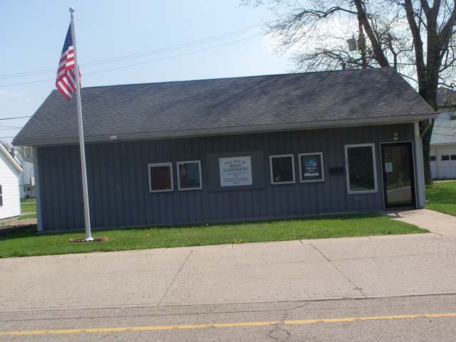
Photo: Roseohioresident, Wikimedia Commons, CC BY-SA 4.0 · Wikimedia Commons
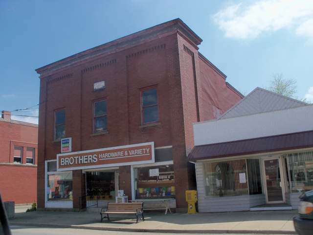
Photo: Roseohioresident, Wikimedia Commons, CC BY-SA 4.0 · Wikimedia Commons
Local history sources: en.wikipedia.org · en.wikipedia.org · en.wikipedia.org · commons.wikimedia.org · commons.wikimedia.org · commons.wikimedia.org
Water
Mostly private wells The water here
- Millers Acres Home Owner Association100% of residentsGroundwater wells (3 wells)
Hospitals, fire stations and more
Inside West Lafayette's boundary: 1 nursing home, 1 fire or EMS station, 3 public schools, 1 library, 1 police station and 1 Superfund site. Press a pin or a name for its whole record and its source.
Nursing homes (1)
-
Lafayette Pointe Nursing & Rehab Ctr4 of 5 stars · West Lafayette
- Address
- 620 East Main Street, West Lafayette, OH 43845
- Certified beds
- 65
- Residents on an average day
- 56
- Medicare overall rating
- 4 of 5 stars
- Health inspections
- 4 of 5 stars
- Staffing
- 3 of 5 stars
- Quality measures
- 4 of 5 stars
- Penalties since 2023
- none
- Ownership
- For profit - Corporation
- Chain
- FOUNDATIONS HEALTH SOLUTIONS
- Takes
- Medicare and Medicaid
- Phone
- (740) 545-6355
- Medicare ID
- 365891
Medicare Care Compare ↗ CMS nursing home data (source) ↗ Street map and directions ↗
Source: CMS Care Compare nursing home provider and penalties files; Medicare star ratings run 1 to 5.
Fire and EMS stations (1)
-
West Lafayette Fire DepartmentWest Lafayette
- Address
- 100 Orchard Street, West Lafayette, OH 43845
- Coordinates
- 40.27589, -81.74971
USGS National Map structures (source) ↗ Street map and directions ↗
Source: USGS National Map structures (most Ohio records last updated 2019 to 2022), checked against the Columbus and Cleveland station lists. The department that answers a call is set by jurisdiction and mutual aid, not by distance.
Public schools (3)
-
Ridgewood Elementary School3 of 5 stars · West
- Address
- 225 W Union Ave, West, OH 43845
- School district
- Ridgewood Local School District
- Kind (NCES)
- Regular School
- Students, 2023-24
- 431
- Teachers (full-time equivalent)
- 20.4
- Report card, 2025-26
- 3 of 5 stars
- Performance index
- 73.9%
- Ohio building IRN
- 009128
- NCES school ID
- 390464705423
NCES school record ↗ Ohio School Report Card ↗ Street map and directions ↗
-
Ridgewood High School4 of 5 stars · West Lafayette
- Address
- 602 Johnson St, West Lafayette, OH 43845
- School district
- Ridgewood Local School District
- Kind (NCES)
- Regular School
- Students, 2023-24
- 427
- Teachers (full-time equivalent)
- 26.19
- Report card, 2025-26
- 4 of 5 stars
- Performance index
- 80%
- Four-year graduation rate
- 97.6%
- Ohio building IRN
- 031732
- NCES school ID
- 390464702565
NCES school record ↗ Ohio School Report Card ↗ Street map and directions ↗
-
Ridgewood Middle School4 of 5 stars · West Lafayette
- Address
- 517 S Oak St, West Lafayette, OH 43845
- School district
- Ridgewood Local School District
- Kind (NCES)
- Regular School
- Students, 2023-24
- 388
- Teachers (full-time equivalent)
- 20.3
- Report card, 2025-26
- 4 of 5 stars
- Performance index
- 77.7%
- Ohio building IRN
- 138552
- NCES school ID
- 390464703515
NCES school record ↗ Ohio School Report Card ↗ Street map and directions ↗
Source: NCES EDGE public school locations 2024-25 and Common Core of Data 2023-24 (type, students, teachers); Ohio School Report Cards 2025-26 (Department of Education and Workforce), matched by name within the district.
Public libraries (1)
-
West Lafayette Branch LibraryBranch · West Lafayette
- Address
- 601 E Main St, West Lafayette, OH 43845
- What it is
- Branch
- Library system
- Coshocton County District Library
- Open
- 2,392 hours a year, 52 weeks
- Building
- 1,200 sq ft
- System's visits, FY2024
- 115,180
- System's loans, FY2024
- 312,386
- People the system serves
- 33,676
- Phone
- (740) 545-6672
IMLS Public Libraries Survey (source) ↗ Street map and directions ↗
Source: IMLS Public Libraries Survey FY2024 (outlets and their systems). Any Ohio resident can get a free card at any Ohio public library.
Police stations (1)
-
West Lafayette Police DepartmentWest Lafayette
- Address
- 116 North Kirk Street, West Lafayette, OH 43845
- Coordinates
- 40.27619, -81.75095
USGS National Map structures (source) ↗ Street map and directions ↗
Source: USGS National Map structures, police stations, corrected and completed by hand (September 2026). The department that answers a call is set by jurisdiction, not by distance.
Superfund sites (1)
-
Penn-Michigan Mfg Corp (Sia)Superfund program · W Lafayette
- Address
- 220 N Kirk St, W Lafayette, OH 43845
- County
- Coshocton County
- Status
- Superfund program site, not on the National Priorities List
- EPA program ID
- OHD004293494
- EPA registry ID
- 110009304449
EPA facility record ↗ EPA Facility Registry Service (source) ↗ Street map and directions ↗
Source: EPA Facility Registry Service, Superfund (SEMS) and National Priorities List sites. Many program sites were assessed and needed no cleanup.
Its ZIP codes
Each ZIP code that touches West Lafayette, with the share of its residents who live here and the same headline figures as the ZIP page.
| ZIP | Share | Water | Radon | Home value | Schools | Flood |
|---|---|---|---|---|---|---|
| 43845 West Lafayette | 50% | Mostly private wells | 6.0 pCi/L average radon | Median year built 1962 | Ridgewood Local · 4 stars overall | 1.7% of residents in the 1% floodplain |
Local government
Who holds office in West Lafayette, how its elections and ballot issues came out, and the state auditor's record.
Money issues on the ballot since 2019: 1 of 1 passed.
Ballot issues
| Date | Issue | For | Against | Result |
|---|---|---|---|---|
| 2019-11-05 | Issue 18: Village of West Lafayette (levy type not on the results report) | 281 | 149 | Passed (65.35% for) |
Elections for office
| Date | Office | Candidates and votes |
|---|---|---|
| 2019-11-05 | Mayor | Stephen R. Bordenkircher 332, 100.0% |
Winners in bold. Results from the county board of elections' official canvass unless marked.
Auditor of State record
- No fiscal caution, watch or emergency on the Auditor of State's lists.
- Agreed Upon Procedures, 2023 to 2024, released 2025-07-01
The county
Coshocton County: 8 ZIP codes, 25 cities, villages and townships, 33,626 people.
Nearby places
Rain and snow
How much has actually fallen on West Lafayette, day by day, from 1893 to now. Daily totals, not averages.
- rain, last 30 days
- 1.02 in
- 2026-10-01 to 2026-10-30
- rain so far in 2026
- 38.5 in
- 2.9 in above normal for the date
- snow so far in 2026
- 23.4 in
- a normal year brings 21.4 in
- a normal year
- 41.7 in
- average of 30 years, 1991-2020
| Month | Rain (in) | Snow (in) | Days counted |
|---|---|---|---|
| October 2026 | 1.02 | — | 30 |
| September 2026 | 4.58 | — | 30 |
| August 2026 | 7.96 | — | 31 |
| July 2026 | 3.43 | — | 31 |
| June 2026 | 3.67 | — | 30 |
| May 2026 | 5.59 | — | 31 |
| April 2026 | 3.27 | — | 30 |
| March 2026 | 5.53 | 2.0 | 31 |
| February 2026 | 1.47 | 3.7 | 28 |
| January 2026 | 1.94 | 17.7 | 31 |
| December 2025 | 2.73 | 11.2 | 31 |
| November 2025 | 2.24 | 0.1 | 30 |
| Wettest year | 2004 — 57.8 in |
|---|---|
| Driest year | 1930 — 24.3 in |
| Snowiest year | 1910 — 57.7 in |
| Wettest day on record | 7 August 1935 — 6.22 in |
| Heaviest snowfall in a day | 9 November 1913 — 13.37 in |
| Deepest snow on the ground | 10 November 1913 — 21.66 in |
Estimated, not measured. No rain gauge has ever stood inside West Lafayette, so every figure here is worked out from the gauges around it - the nearest ones weighted most. Treat them as close estimates rather than readings.
48,689 days of records, 1893-01-01 to 2026-10-30. Source: NOAA NCEI GHCN-Daily, 3,240 gauges in and around Ohio. A day is "gauged" when a gauge standing inside the boundary reported it, and the value is the mean of those gauges. Otherwise it is interpolated by inverse distance from every gauge reporting within 50 miles. Nothing is carried forward, back-filled or smoothed. Against NOAA nClimDiv county monthly precipitation over 136,848 complete county-months (checked 2026-11-01): correlation 0.9515, median absolute difference 0.217 in a month. Built 2026-11-01 from the Cracked Buckeye precipitation archive. Snow is the softer number — snowfall is measured by hand with a ruler, no agency publishes a gridded county snowfall series, and blowing snow defeats every observer.
Environmental permits and filings
What Ohio EPA has on file for West Lafayette: permits, inspections, violations, cleanups and the state loans behind sewer and water work. Every line links to the agency's own document.
- facilities and sites on file
- 28
- those placed on the map inside West Lafayette
| Program | Facilities and sites |
|---|---|
| Contaminated-site cleanup | 5 |
| Hazardous waste | 5 |
| Wastewater and stormwater discharge | 5 |
| Sewer and water-line construction | 3 |
| Site assessment | 3 |
| Voluntary cleanup | 3 |
| State sewer loans | 2 |
| Brownfield | 1 |
| Public drinking water | 1 |
| Date | Facility or site | What |
|---|---|---|
| PENN MICHIGAN MFG CORP, WEST LAFAYETTE | Contaminated-site cleanup cleanup response | |
| COS WEST LAFAYETTE VAR (COS-119747) | Wastewater and stormwater discharge permit | |
| PEARL VALLEY CHEESE CO | Wastewater and stormwater discharge permit | |
| PEARL VALLEY CHEESE CO | Wastewater and stormwater discharge permit | |
| PEARL VALLEY CHEESE CO | Wastewater and stormwater discharge inspection | |
| WEST LAFAYETTE WWTP | Wastewater and stormwater discharge permit | |
| RIDGEWOOD HIGH SCHOOL | Wastewater and stormwater discharge permit | |
| WEST LAFAYETTE WWTP | State sewer loans | |
| PENN MICHIGAN MFG CORP, WEST LAFAYETTE | Site assessment assessment | |
| WEST LAFAYETTE WWTP | State sewer loans | |
| PENN MICHIGAN MFG CORP, WEST LAFAYETTE | Contaminated-site cleanup assessment | |
| WEST LAFAYETTE WWTP | State sewer loans | |
| PENN MICHIGAN MFG CORP, WEST LAFAYETTE | Site assessment assessment | |
| PENN MICHIGAN MFG CORP, WEST LAFAYETTE | Site assessment assessment | |
| PEARL VALLEY CHEESE CO | Wastewater and stormwater discharge violation resolved | |
| PENN MICHIGAN MFG CORP, WEST LAFAYETTE | Contaminated-site cleanup assessment | |
| PEARL VALLEY CHEESE CO | Wastewater and stormwater discharge inspection | |
| WEST LAFAYETTE WWTP | State sewer loans | |
| WEST LAFAYETTE WWTP | State sewer loans | |
| WEST LAFAYETTE WWTP | State sewer loans | |
| INDIAN CIRCLE SS REPLACEMENT | Sewer and water-line construction permit | |
| PENN MICHIGAN MFG CORP, WEST LAFAYETTE | Site assessment assessment | |
| PENN MICHIGAN MFG CORP, WEST LAFAYETTE | Site assessment assessment | |
| WEST LAFAYETTE WWTP | State sewer loans | |
| PENN MICHIGAN MFG CORP, WEST LAFAYETTE | Contaminated-site cleanup assessment |
Source: Ohio EPA eDocument portal (edocpub.epa.ohio.gov), indexed 2026-10-14. Facilities are placed on the map from Ohio EPA's own map layers, EPA's Facility Registry, coordinates written in the filings, or a geocoded street address. A permit filed under a private person's name (most are household septic systems) is counted but never named, placed or linked; licenses for individual workers and open-burning notices are left out entirely.
Quick answers
What county is West Lafayette, Ohio in?
West Lafayette is a village in Coshocton County, Ohio, with 2,417 residents.
When was West Lafayette, Ohio founded?
West Lafayette was laid out 1850. Founders on record: Robert Shaw and William Wheeler. Source
How did West Lafayette, Ohio get its name?
The village and its township are named, like many places platted in the years after his 1824-25 farewell tour of the United States, for Gilbert du Motier, the Marquis de Lafayette; Lafayette Township itself was renamed in his honor at its 1835 organization, the year after his death, and the village founded on its river bank in 1850 took the same name with 'West' distinguishing it from other Lafayettes. Source
What ZIP code is West Lafayette, Ohio?
Most of West Lafayette is in ZIP code 43845.
Where does West Lafayette, Ohio get its water?
The main water source for West Lafayette (Millers Acres Home Owner Association): Mostly private wells.
Cite this page
Cite this page as:
Cracked Buckeye, "West Lafayette, Coshocton County", https://crackedbuckeye.com/place/west-lafayette/, built 2026-10-31, accessed [date].
How to cite · Report a correction · Built 2026-10-31