Local events in Oxford Township, Coshocton County
Nothing is posted for Oxford Township itself yet; here is what is on within 10 miles. All local events in Oxford Township, Coshocton County
Know a calendar we should watch? Send the link
Checked October 20; the events page is refreshed daily.
How Oxford Township, Coshocton County began
Oxford Township, in the far eastern part of Coshocton County, was organized in the fall of 1811, making it one of the county's oldest civil townships and, by one 1881 account, possibly the site of the county's very first white settlement. Isaac Evans and a small group of Virginians raised the first crop of corn here around 1803-1804 on the level ground called White Eyes Plains, later platting the village of Evansburg, which thrived briefly as a canal port before the founding of neighboring Orange in 1839 drew away its trade and left it to fall to pieces. It is farm country today, crossed in the railroad era by the Pittsburgh, Cincinnati and St. Louis Railway with a depot at Oxford near the township's center. Three lost place names survive in Ohio's federal place-name records for the township's ZIP-code area: Clio and Toledoville (both once tied to the 43749 ZIP) and Holly (in the 43824 ZIP shared with neighboring townships), none of which the 1881 county history mentions or explains.
Settled c. 1803-1804 (Isaac and Henry Evans, Charles and Esaias Baker), incorporated fall of 1811.
Where the name comes from
No source found gives a documented reason for the choice of 'Oxford,' including the 1881 county history, whose Oxford Township chapter opens directly with physical geography rather than a naming account. It is one of six Oxford Townships in Ohio, a name common enough across the state that no township-specific origin story could be confirmed here.
Before the town
No Native American village, trail, or treaty event specific to Oxford Township is documented in the sources checked, but the 1881 county history records that the White Eyes Plains and the adjoining Tuscarawas River valley were favorite hunting grounds of the historic tribes, evidenced by tomahawks, bullets, stone mortars and pestles, silver ornaments and pieces of pottery that early settlers found scattered there. Small prehistoric mounds were also scattered along the river valley; one on Willis Richard's farm in the western part of the township was originally about thirty feet across and eight to ten feet high before cultivation wore it down. See the Coshocton county-level history file for the wider Lenape (Delaware) presence at Goschachgunk (Coshocton).
- Willis Richard farm mound (mound) — Willis Richard's farm, western part of Oxford Township, prehistoric (undetermined) (archive.org)
Timeline
- — Charles Williams settles on the Walhonding prairie and, the same season, Isaac and Henry Evans and Charles and Esaias Baker raise a crop of corn on the Tuscarawas near the future Evansburg, in what a later local history calls possibly the first settlement in the county.
- — Oxford Township is organized in the fall, soon after the county itself was formed.
- — Isaac Evans raises and commands a company under General Harrison during the War of 1812; he later serves as an early associate justice of the county.
- — John Mills lays out Millsville on a bend of the Tuscarawas River; the village never thrives and soon disappears from the record.
- — Evansburg is surveyed on September 4 by proprietor Isaac Evans, who gives the village his own name.
- — Orange is laid out half a mile west of Evansburg by William K. Johnson, G. A. Humerickhouse and Samuel Wolfe; its easier river ford draws away Evansburg's trade and the older village collapses.
- — The White Eyes Plains post office, one of the earliest in the county, is moved from Evansburg to Orange, though it keeps its original name for years afterward.
Stories
A village killed by its own river crossing
Isaac Evans surveyed Evansburg in September 1830 and gave the new village his own name; for a few years it grew vigorously, with a dry goods store, a warehouse dealing in grain, a tannery and an inn. But the Tuscarawas River at Evansburg could be forded only with great difficulty if at all, so a ferry had to run there constantly, while the river at Orange, a new village laid out half a mile to the west in 1839, could be forded easily. Merchant Joseph Watkins moved his warehouse to the new village, and Evansburg, in the 1881 county history's words, 'speedily fell to pieces'; by the time that history was written, only a few dilapidated structures marked the site of what had briefly been a flourishing canal port.
Photographs
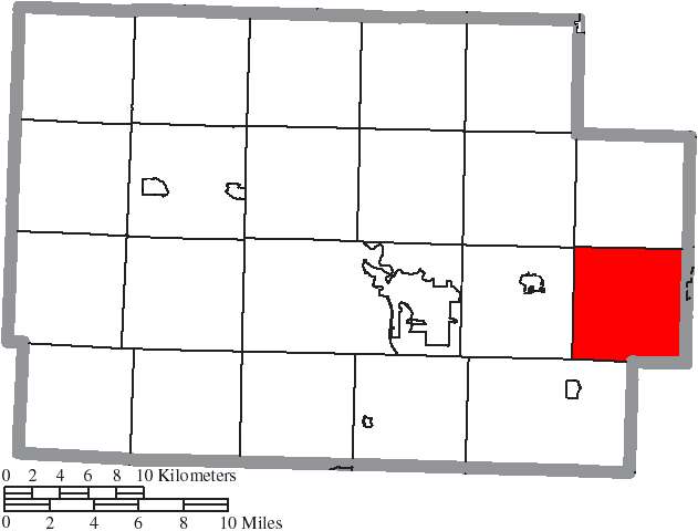
Photo: Ruhrfisch and Nyttend, Wikimedia Commons, CC BY-SA 3.0 · Wikimedia Commons
Local history sources: en.wikipedia.org · en.wikipedia.org · commons.wikimedia.org · archive.org
Water
Mostly private wells The water here
- Newcomerstown Village94% of residentsGroundwater wells (2 wells)
- Millers Acres Home Owner Association6% of residentsGroundwater wells (3 wells)
Hospitals, fire stations and more
Inside Oxford Township, Coshocton County's boundary: 1 public charging site and 2 shale and injection wells. Press a pin or a name for its whole record and its source.
Public EV charging (1)
-
Unusual Junction - Tesla Destination3 Level 2 · West Lafayette
- Address
- 56310 US 36, West Lafayette, OH 43845
- Ports
- 3 Level 2
- Plugs
- Tesla (NACS)
- Network
- Tesla Destination
- Phone
- 877-798-3752
Station Locator (NREL) ↗ Alternative Fuels Data Center (source) ↗ Street map and directions ↗
Source: NREL Alternative Fuels Data Center station list (May 2026), public and open stations, the posts at one address counted as one site.
Shale and injection wells (2)
-
Hawbaker (Swiw #13) 1 InjectionInjection well (Class II)
- What it is
- Injection well (Class II)
- Operator
- Glenn O Hawbaker Inc
- County
- Coshocton County
- API well number
- 34031272470000
- Coordinates
- 40.28052, -81.63804
ODNR oil and gas wells (source) ↗ Street map and directions ↗
-
J Hill 1HUtica shale well · Well drilled
- What it is
- Utica shale well
- Drilled sideways
- Yes
- Status (ODNR)
- Well drilled
- Operator
- Geopetro Llc
- County
- Coshocton County
- API well number
- 34031272050100
- Coordinates
- 40.23804, -81.69944
ODNR oil and gas wells (source) ↗ Street map and directions ↗
The point is the surface well head (the pad); a horizontal well runs a mile or more underground from it.
Source: ODNR Division of Oil and Gas Resources well inventory (September 2026): drilled Utica, Marcellus and horizontal wells and Class II injection wells not plugged. Older vertical wells are on the full map.
Its ZIP codes
Each ZIP code that touches Oxford Township, Coshocton County, with the share of its residents who live here and the same headline figures as the ZIP page.
| ZIP | Share | Water | Radon | Home value | Schools | Flood |
|---|---|---|---|---|---|---|
| 43845 West Lafayette | 19% | Mostly private wells | 6.0 pCi/L average radon | Median year built 1962 | Ridgewood Local · 4 stars overall | 1.7% of residents in the 1% floodplain |
| 43832 Newcomerstown | 7% | Mostly private wells | 5.8 pCi/L average radon | Median year built 1946 | Newcomerstown Exempted Village · 3 stars overall | 5.4% of residents in the 1% floodplain |
| 43749 Monroe Township and Kimbolton | 2% | Mostly private wells | 16.3 pCi/L average radon | Appraisal records without year built | Cambridge City · 2.5 stars overall | 6.3% of residents in the 1% floodplain |
| 43824 Crawford Township and Fresno | 1% | Mostly private wells | 4.8 pCi/L average radon | Median year built 1988 | Ridgewood Local · 4 stars overall | 5.3% of residents in the 1% floodplain |
Local government
Who holds office in Oxford Township, Coshocton County, how its elections and ballot issues came out, and the state auditor's record.
Elections for office
| Date | Office | Candidates and votes |
|---|---|---|
| 2019-11-05 | Township Trustee | Raymond Allen Gress 232, 61.38%; John N. Sharier 146, 38.62% |
| 2019-11-05 | Township Fiscal Officer | Patricia A. Rausch 340, 100.0% |
Winners in bold. Results from the county board of elections' official canvass unless marked.
Auditor of State record
- No fiscal caution, watch or emergency on the Auditor of State's lists.
- Agreed Upon Procedures, 2023 to 2024, released 2025-05-29
The county
Coshocton County: 8 ZIP codes, 25 cities, villages and townships, 33,626 people.
Nearby places
Quick answers
What county is Oxford Township, Ohio in?
Oxford Township, Coshocton County is a township in Coshocton County, Ohio, with 1,554 residents.
When was Oxford Township, Ohio founded?
Oxford Township, Coshocton County was settled c. 1803-1804 (Isaac and Henry Evans, Charles and Esaias Baker); incorporated fall of 1811. Source
What ZIP code is Oxford Township, Ohio?
Oxford Township, Coshocton County is served by ZIP codes 43845 and 43832; 43845 holds the largest share of its residents.
Where does Oxford Township, Ohio get its water?
The main water source for Oxford Township, Coshocton County (Newcomerstown Village): Mostly private wells.
Cite this page
Cite this page as:
Cracked Buckeye, "Oxford Township, Coshocton County", https://crackedbuckeye.com/place/oxford-township-coshocton-county/, built 2026-10-31, accessed [date].
How to cite · Report a correction · Built 2026-10-31
