Local events in Sullivan Township, Ashland County
Nothing is posted for Sullivan Township itself yet; here is what is on within 10 miles. All local events in Sullivan Township, Ashland County
Know a calendar we should watch? Send the link
Checked October 20; the events page is refreshed daily.
How Sullivan Township, Ashland County began
Sullivan Township, in the northeast corner of Ashland County, was surveyed in October and November 1816 by a Mr. Baldwin of Newburg with S. Parmely, a Vermonter who picked out three thousand acres for himself and his neighbors. Seven Vermont families left home on June 6, 1817, and reached the center of the township on August 28, sheltering first in the surveyors' old camp; each family then drew lots for 160 acres near the center. The township was organized on May 27, 1819, while it belonged to Medina County, passed to Lorain County in 1822 and to Ashland County in 1846. The village of Sullivan was laid out at the center in 1836, and by 1863 the township had four churches, a Masonic lodge and 230 voters. The Black River, which the 1880 history calls the Canesadooharie, rises in the township.
Settled 1817-08-28 (arrival of the Parmely party at the township center), platted 1836 (village of Sullivan), incorporated 1819 (as part of Medina County), by seven families from Vermont.
Where the name comes from
Not documented in the sources consulted for this township specifically; likely connected to the Vermont settlers' place of origin or a namesake among them, but no source found states the derivation directly.
Before the town
The pioneer account of the first settlement, printed in the 1863 county history, says the settlers of 1817 found that Indians had already built rough wigwams on Butternut Creek, northeast of the township center, on land later owned by Whitney Chamberlain, and were mostly peaceable. Soon after, a large party of Indians from Sandusky came in to hunt, quarreled among themselves and killed one of their own number, and left. The 1880 history says the Black River, or Canesadooharie, which rises in the township, was 'famed as the region of deer and bear in Indian times,' and it and the 1909 history record a deposit of flint arrowheads found in the township. No source names the nation of the Butternut Creek camp.
- Riggs arrowhead cache (other) — Sullivan Township (exact location not given), prehistoric, culture unspecified (archive.org)
- Butternut Creek wigwams (camp) — Butternut Creek, northeast of the township center, on land later owned by Whitney Chamberlain, 1817 (archive.org)
Timeline
- — A survey party under a Mr. Baldwin of Newburg, with S. Parmely, surveys the township in October and November, wading water up to their armpits and living on a quarter pound of bread a day at the end.
- — Seven families from Vermont settle Sullivan Township, then still surveyed but unorganized land.
- — On June 6, seven families from one Vermont neighborhood, led by John Parmely Sr., start for Ohio with ox teams.
- — On August 28 the party reaches the center of the township and shelters in the surveyors' camp; the next day Henry and Benjamin Close arrive from New York and take land three and a half miles northwest on what became Close Street.
- — In the spring Whitney Chamberlain arrives with his wife and four children, and Thomas Rice, who had wintered at Medina, settles in the township.
- — Sullivan Township is organized on May 27, while it is part of Medina County.
- — The township is transferred to the newly formed Lorain County in December.
- — A post office named Sullivan opens, eight years before the village around it is formally laid out.
- — A Baptist church is organized in the township, meeting in the town hall.
- — The township has fifty voters.
- — A Disciples church organizes under Elders Almond Green and Sutton Hayden after seceding from the Baptist congregation.
- — The village of Sullivan is laid out at the township's center.
- — Sylvanus Parmely, Ira Palmer (Parmely in the 1909 history), Joseph Palmer and Joseph Carlton lay out the village of Sullivan at the corners where their lands met.
- — Sullivan Township joins the newly formed Ashland County on February 24.
- — Sullivan Lodge No. 313 of the Masons is chartered on October 20 with fifteen charter members.
- — The township has 230 voters, four churches (Methodist, Baptist, Disciple and Congregational), two taverns and a steam sawmill.
- — The Sullivan post office, open since 1828, closes for good in the summer.
Stories
A post office that outlived three counties
The Sullivan post office opened in 1828 while the surrounding land was still part of Lorain County, eight years before the village around it was even platted, and ten years before Ashland County existed at all. It stayed open through the township's transfer into Ashland County in 1846, through the rise and fall of its four nineteenth-century churches, and into the twenty-first century, finally closing in the summer of 2015 -- a run of 187 years, nearly the entire span of organized settlement in the township.
Lost in the Sullivan woods
In September 1817, soon after the Vermont families reached Sullivan, James Palmer went out to gather nuts, walked out of sight of the clearing and was lost. He spent the night beside a log; a bear came close but did not attack. His neighbors searched in the dark without success, then sent two men with hickory-bark torches ten miles to Harrisville for help; they went and came back before daylight. Palmer found his way home about nine the next morning by following the stakes the surveyors had set. Another search ended differently: a child of Mr. Durfee, sent home alone at dusk while his uncle hunted hogs, never arrived. That night two girls walking home heard what sounded like a child moaning but, fearing an animal, went on; when the father went to the spot he could not trace the sound over the rain on the leaves. The boy's bones were found beside a log the next spring.
Drawing lots at the center
S. Parmely helped survey Sullivan in the fall of 1816, when the nearest settlements were Harrisville to the east and Elyria to the north and the only road was a line of marked trees. He picked three thousand acres for himself and his Vermont neighbors and went home. On June 6, 1817, seven families started west; they buried a child, Hannah Parmely, at Medina on the way, and had to chop their own road from Harrisville. They reached the center of the township on August 28 and lived in the surveyors' old camp, roofed with split troughs laid edge to edge, and in their wagons. Each family chose 160 acres as near the center as it could and, since all wanted the same ground, they drew lots. Salt cost nine dollars a barrel, the nearest store was at Wooster, and until a horse mill was built they pounded corn in a stump hollowed into a mortar and worked by a spring pole. The first child born in the township was Ashley Parmely, son of Asahel Parmely.
Photographs
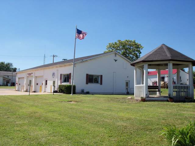
Photo: Roseohioresident, CC BY-SA 4.0 · Wikimedia Commons
Local history sources: en.wikipedia.org · en.wikipedia.org · ashland.ohgenweb.org · archive.org · en.wikipedia.org · archive.org · archive.org · archive.org · archive.org · archive.org · archive.org · archive.org · archive.org · archive.org · archive.org · archive.org · commons.wikimedia.org
Water
Wells (14 listed as active in EPA SDWIS: Wells 1-7 and 10-15; Well 9 was deactivated 2025-11-17) in the Jerome Fork Basin sand-and-gravel aquifer, sited generally north of the treatment plant on Cleveland Road The water here
- Rural Lorain Co. Water A100% of residentsMostly Lake Erie (bought from Avon Lake); some New London Reservoir and Ashland wells
Hospitals, fire stations and more
Inside Sullivan Township, Ashland County's boundary: 2 fire and EMS stations and 4 public schools. Press a pin or a name for its whole record and its source.
Fire and EMS stations (2)
-
Sullivan Township Fire DepartmentSullivan
- Address
- 500 US Highway 224, Sullivan, OH 44880
- Coordinates
- 41.02864, -82.22278
USGS National Map structures (source) ↗ Street map and directions ↗
-
Sullivan Volunteer Fire Department Station 2Sullivan
- Address
- Township Road 481, Sullivan, OH 44880
- Coordinates
- 41.02948, -82.21893
USGS National Map structures (source) ↗ Street map and directions ↗
Source: USGS National Map structures (most Ohio records last updated 2019 to 2022), checked against the Columbus and Cleveland station lists. The department that answers a call is set by jurisdiction and mutual aid, not by distance.
Public schools (4)
-
Black River Education Center Elementary School3.5 of 5 stars · Sullivan
- Address
- 257 County Road 40, Sullivan, OH 44880
- School district
- Black River Local School District
- Kind (NCES)
- Regular School
- Students, 2023-24
- 487
- Teachers (full-time equivalent)
- 27
- Report card, 2025-26
- 3.5 of 5 stars
- Performance index
- 74.7%
- Ohio building IRN
- 036384
- NCES school ID
- 390484603261
NCES school record ↗ Ohio School Report Card ↗ Street map and directions ↗
-
Black River Education Center Middle School3.5 of 5 stars · Sullivan
- Address
- 257 County Road 40, Sullivan, OH 44880
- School district
- Black River Local School District
- Kind (NCES)
- Regular School
- Students, 2023-24
- 221
- Teachers (full-time equivalent)
- 18
- Report card, 2025-26
- 3.5 of 5 stars
- Performance index
- 78.3%
- Ohio building IRN
- 035311
- NCES school ID
- 390484603260
NCES school record ↗ Ohio School Report Card ↗ Street map and directions ↗
-
Black River High School3.5 of 5 stars · Sullivan
- Address
- 233 County Road 40, Sullivan, OH 44880
- School district
- Black River Local School District
- Kind (NCES)
- Regular School
- Students, 2023-24
- 283
- Teachers (full-time equivalent)
- 21
- Report card, 2025-26
- 3.5 of 5 stars
- Performance index
- 78.2%
- Four-year graduation rate
- 100%
- Ohio building IRN
- 002782
- NCES school ID
- 390484603258
NCES school record ↗ Ohio School Report Card ↗ Street map and directions ↗
-
Black River Local Virtual SchoolSullivan
- Address
- 257A County Road 40, Sullivan, OH 44880
- Kind (NCES)
- Regular School
- Students, 2023-24
- 0
- NCES school ID
- 390484606220
Source: NCES EDGE public school locations 2024-25 and Common Core of Data 2023-24 (type, students, teachers); Ohio School Report Cards 2025-26 (Department of Education and Workforce), matched by name within the district.
Its ZIP codes
Each ZIP code that touches Sullivan Township, Ashland County, with the share of its residents who live here and the same headline figures as the ZIP page.
| ZIP | Share | Water | Radon | Home value | Schools | Flood |
|---|---|---|---|---|---|---|
| 44880 Sullivan Township and Sullivan | 89% | Wells (14 listed as active in EPA SDWIS: Wells 1-7 and 10-15; Well 9 was deactivated 2025-11-17) in the Jerome Fork Basin sand-and-gravel aquifer, sited generally north of the treatment plant on Cleveland Road | 3.4 pCi/L average radon | Median year built 1997 | Black River Local · 3.5 stars overall | 0.0% of residents in the 1% floodplain |
| 44859 Troy Township and Nova | 1% | Wells (14 listed as active in EPA SDWIS: Wells 1-7 and 10-15; Well 9 was deactivated 2025-11-17) in the Jerome Fork Basin sand-and-gravel aquifer, sited generally north of the treatment plant on Cleveland Road | 3.2 pCi/L average radon | Median year built 1995 | Mapleton Local · 4 stars overall | 1.0% of residents in the 1% floodplain |
Local government
Who holds office in Sullivan Township, Ashland County, how its elections and ballot issues came out, and the state auditor's record.
Ballot issues
| Date | Issue | For | Against | Result |
|---|---|---|---|---|
| 2020-11-03 | Issue: Sullivan Twp Add Cem 0.5m (0.5 mills) | 486 | 749 | Failed (39.35% for) |
| 2018-11-06 | Issue: Sullivan Township Add 2m CE (2.0 mills) | 298 | 500 | Failed (37.34% for) |
Elections for office
| Date | Office | Candidates and votes |
|---|---|---|
| 2025-11-04 | Township Trustee (unofficial count) | Ermal Alexander 209, 29.19%; Rob Gibson 125, 17.46%; Glen M. Goff, Sr. 194, 27.09%; Suzanne E. Runals 188, 26.26% |
| 2023-11-07 | Township Trustee (unofficial count) | Neal Durfey 430, 57.56%; Robert Gibson 82, 10.98%; Glen M. Goff, Sr. 235, 31.46% |
| 2023-11-07 | Township Fiscal Officer (unofficial count) | Anna Gibson 575, 100.0% |
| 2021-11-02 | Township Trustee | Ermal Alexander 221, 24.13%; Richard E. Bennett 77, 8.41%; Tab Bloom 186, 20.31%; Douglas Campbell 101, 11.03%; Brian Danish 34, 3.71%; James Diaz 112, 12.23%; Glen Goff, Sr. 185, 20.2% |
| 2021-11-02 | Township Trustee | Martin E. Konicek, Sr. 203, 43.66%; Samantha Shank 262, 56.34% |
| 2019-11-05 | Township Trustee | Tab Bloom 171, 36.08%; Suzanne Fayak 112, 23.63%; Walker Hartman 191, 40.3% |
| 2019-11-05 | Township Fiscal Officer | Anna Gibson 329, 100.0% |
| 2017-11-07 | Township Trustee | Suzanne L. Fayak 170, 17.31%; Glen M. Goff, Sr. 264, 26.88%; Duane D. Jenkins 254, 25.87%; Suzanne E. Runals 162, 16.5%; Janice K. Steele 132, 13.44% |
Winners in bold. Results from the county board of elections' official canvass unless marked.
Auditor of State record
- No fiscal caution, watch or emergency on the Auditor of State's lists.
- Financial Audit, 2023 to 2024, released 2026-03-05
The county
Ashland County: 9 ZIP codes, 22 cities, villages and townships, 50,803 people.
Nearby places
Quick answers
What county is Sullivan Township, Ohio in?
Sullivan Township, Ashland County is a township in Ashland County, Ohio, with 2,620 residents.
When was Sullivan Township, Ohio founded?
Sullivan Township, Ashland County was settled 1817-08-28 (arrival of the Parmely party at the township center); laid out 1836 (village of Sullivan); incorporated 1819 (as part of Medina County). Founders on record: seven families from Vermont. Source
How did Sullivan Township, Ohio get its name?
Not documented in the sources consulted for this township specifically; likely connected to the Vermont settlers' place of origin or a namesake among them, but no source found states the derivation directly.
What ZIP code is Sullivan Township, Ohio?
Most of Sullivan Township, Ashland County is in ZIP code 44880.
Where does Sullivan Township, Ohio get its water?
The main water source for Sullivan Township, Ashland County (Rural Lorain Co. Water A): Wells (14 listed as active in EPA SDWIS: Wells 1-7 and 10-15; Well 9 was deactivated 2025-11-17) in the Jerome Fork Basin sand-and-gravel aquifer, sited generally north of the treatment plant on Cleveland Road.
Cite this page
Cite this page as:
Cracked Buckeye, "Sullivan Township, Ashland County", https://crackedbuckeye.com/place/sullivan-township-ashland-county/, built 2026-10-31, accessed [date].
How to cite · Report a correction · Built 2026-10-31
