Local events in Strongsville
47 events in the next 90 days from 2 public calendars. All local events in Strongsville
Checked October 20; the events page is refreshed daily.
Deep dives about Strongsville
Long reads built from maps, newspapers and public records. All deep dives
History from Strongsville
People and inventions tied to this place, each with its sources. All people · All inventions
How Strongsville began
Strongsville was settled in 1816 when John Stoughton Strong, a Vermont-born pioneer, led a party of families into the Connecticut Western Reserve township that took his name; Strong went on to recruit further settlers and help establish the area's mills, roads, schools and churches. Organized as Township No. 5 of the 14th range in 1818, it stayed a farming community -- briefly home in 1853 to the boyhood John D. Rockefeller's family -- until 20th-century suburban growth brought village incorporation in 1923 and city status in 1961. On April 11, 1965, Strongsville took some of the worst damage in the Palm Sunday tornado outbreak, and the city today is a Cleveland suburb of about 46,000 with three National Register-listed 19th-century buildings, including a house once used on the Underground Railroad.
Settled 1816, incorporated 1818-02-25 (Township No. 5, 14th range); 1923 (village); 1961 (city), by John Stoughton Strong and settling families.
Where the name comes from
Strongsville was named directly for John Stoughton Strong, the Vermont-born pioneer who led the settling party into the township in 1816 and became its leading early organizer of mills, roads, schools and churches.
Before the town
No source we reviewed names a specific Native American village, trail or burial site within present Strongsville. The township lies within the Connecticut Western Reserve, secured for settlement by the 1785 Treaty of Fort McIntosh and confirmed by the 1795 Treaty of Greenville.
Timeline
- — John Stoughton Strong leads settlers into the township that becomes Strongsville.
- — The township is officially organized as Township No. 5, 14th range.
- — The township's first mill is built on the Rocky River.
- — Alanson Pomeroy builds the house on Pearl and Westwood Roads that later becomes known for sheltering freedom-seekers on the Underground Railroad, who were taken from it to boats on the Rocky River bound for Canada.
- — The family of a young John D. Rockefeller, future oil magnate, moves to Strongsville.
- — Strongsville incorporates as a village.
- — Strongsville is designated a city.
- — A tornado tracking through Pittsfield, Grafton and Strongsville during the Palm Sunday outbreak levels 18 homes and severely damages 50 more in northernmost Strongsville, with borderline-F5-level damage rated officially as F4; the tornado's full track killed 18 people and injured about 200.
- — The Alanson Pomeroy House is listed on the National Register of Historic Places.
- — The John Stoughton Strong House is listed on the National Register of Historic Places.
- — The restored Pomeroy House reopens as Don's Pomeroy House Restaurant & Pub.
Stories
A safe house on Pearl and Westwood Roads
Alanson Pomeroy built his farmhouse at the corner of Pearl and Westwood Roads in 1847, in a Strongsville still just a generation removed from its 1816 settlement. As an active member of his congregation and, by local record, a committed abolitionist, Pomeroy used the house as a station on the Underground Railroad: people fleeing slavery were sheltered there before being taken the short distance to boats on the Rocky River for passage across Lake Erie to Canada. The house survived long enough to be documented by the Historic American Buildings Survey and listed on the National Register of Historic Places in June 1975, and in 1980 it reopened under new ownership as a restaurant and pub -- a 19th-century farmhouse built for hiding freedom-seekers now serving dinner to Strongsville residents who pass it on Pearl Road every day.
Palm Sunday, 1965
Late on the night of April 11, 1965, one of the most violent tornado outbreaks in American history tore across six Midwestern states, and one of its tracks cut through Pittsfield and Grafton before slamming into northernmost Strongsville. Meteorologists later rated the tornado F4, though researcher Ted Fujita's own reviewer, Thomas Grazulis, judged its damage borderline F5 -- eighteen homes in Strongsville were leveled, some swept cleanly from their foundations, and another fifty were severely damaged. Witnesses along the track reported an unusual sight as the storm approached Cleveland: two separate funnels, roughly half a mile apart, appearing to merge into one before touching down. Across its full path through Pittsfield, Grafton and Strongsville the tornado killed 18 people and injured roughly 200, part of an outbreak that caused so much damage across Ohio, Indiana, Michigan, Illinois, Wisconsin and Iowa that it directly led to the creation of the National Weather Service's modern tornado watch and warning system.
Photographs
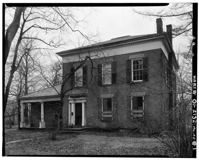
Photo: Historic American Buildings Survey, Library of Congress, public domain · Wikimedia Commons
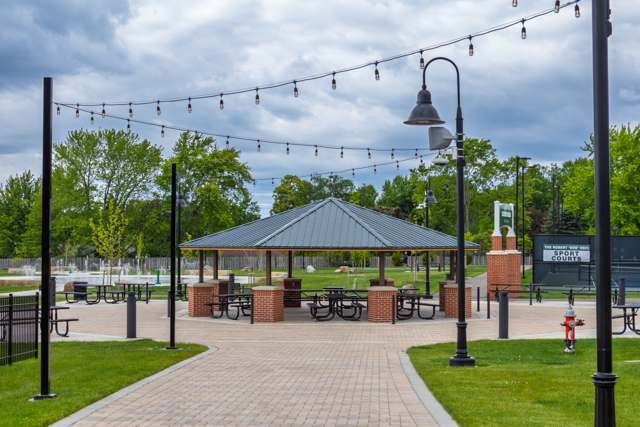
Photo: EthanolB (Wikimedia Commons), CC0 · Wikimedia Commons
Local history sources: en.wikipedia.org · en.wikipedia.org · commons.wikimedia.org · commons.wikimedia.org
Historic places
4 places in Strongsville on the National Register of Historic Places. Press a pin or a name for its whole record.
-
Pomeroy, Alanson, HouseBuilding · Strongsville · listed 1975
- Address
- Pearl Rd. at Westwood Dr.
- Where
- Strongsville, Cuyahoga County · ZIP 44149
- What it is
- Building
- Listed on the National Register
- 1975
- NRIS reference number
- 75001371
- Coordinates
- 41.31514, -81.83568
National Register file (NPS) ↗ Search Wikipedia ↗ Street map and directions ↗ On the Cracked Buckeye map
-
Stone, Valerius C., HouseBuilding · Strongsville · listed 1978
- Address
- 21706 Lunn Rd.
- Where
- Strongsville, Cuyahoga County · ZIP 44149
- What it is
- Building
- Listed on the National Register
- 1978
- NRIS reference number
- 78002050
- Coordinates
- 41.29780, -81.86543
National Register file (NPS) ↗ Search Wikipedia ↗ Street map and directions ↗ On the Cracked Buckeye map
-
Strong, John Stoughton, HouseBuilding · Strongsville · listed 1980
- Address
- 18910 Westwood St.
- Where
- Strongsville, Cuyahoga County · ZIP 44136
- What it is
- Building
- Listed on the National Register
- 1980
- NRIS reference number
- 80002985
- Coordinates
- 41.31542, -81.83472
National Register file (NPS) ↗ Search Wikipedia ↗ Street map and directions ↗ On the Cracked Buckeye map
-
Strongsville Town HallBuilding · Strongsville · listed 2008
- Address
- 18825 Royalton Rd.
- Where
- Strongsville, Cuyahoga County · ZIP 44136
- What it is
- Building
- Listed on the National Register
- 2008
- NRIS reference number
- 08000147
- Coordinates
- 41.31416, -81.83387
National Register file (NPS) ↗ Search Wikipedia ↗ Street map and directions ↗ On the Cracked Buckeye map
Source: National Park Service, National Register of Historic Places point file. The listing year is shown where NPS's certification date agrees with the listing's reference number. Listing recognizes significance; it does not restrict a private owner.
Water
Lake Erie, through an 8-foot pipe running 2.5 miles offshore from the Westlake shoreline The water here
- Cleveland Public Water System100% of residentsLake Erie
- Medina Co/northwest0% of residentsLake Erie
Hospitals, fire stations and more
Inside Strongsville's boundary: 3 nursing homes, 4 fire and EMS stations, 1 college, 11 public schools, 2 private schools, 5 poor-rated bridges, 1 library, 2 museums, 1 police station, 7 public charging sites, 1 Superfund site, 19 Toxics Release Inventory facilities, 1 station or terminal and 23 spill cases. Press a pin or a name for its whole record and its source.
Nursing homes (3)
-
Altenheim4 of 5 stars · Strongsville
- Address
- 18627 Shurmer Road, Strongsville, OH 44136
- Certified beds
- 128
- Residents on an average day
- 110
- Medicare overall rating
- 4 of 5 stars
- Health inspections
- 3 of 5 stars
- Staffing
- 4 of 5 stars
- Quality measures
- 5 of 5 stars
- Penalties since 2023
- none
- Ownership
- Non profit - Corporation
- Continuing care retirement community
- Yes
- Takes
- Medicare and Medicaid
- Phone
- (440) 238-3361
- Medicare ID
- 365109
Medicare Care Compare ↗ CMS nursing home data (source) ↗ Street map and directions ↗
-
Falling Water Healthcare Center4 of 5 stars · Strongsville
- Address
- 18840 Falling Water, Strongsville, OH 44136
- Certified beds
- 135
- Residents on an average day
- 102
- Medicare overall rating
- 4 of 5 stars
- Health inspections
- 3 of 5 stars
- Staffing
- 2 of 5 stars
- Quality measures
- 5 of 5 stars
- Penalties since 2023
- 1 fine totalling $10,839 (latest 2024-12-19)
- Ownership
- For profit - Limited Liability company
- Chain
- COMMUNICARE HEALTH
- Takes
- Medicare and Medicaid
- Phone
- (440) 238-1100
- Medicare ID
- 366111
Medicare Care Compare ↗ CMS nursing home data (source) ↗ Street map and directions ↗
-
Strongsville Healthcare and Rehabilitation3 of 5 stars · Strongsville
- Address
- 18936 Pearl Road, Strongsville, OH 44136
- Certified beds
- 99
- Residents on an average day
- 91
- Medicare overall rating
- 3 of 5 stars
- Health inspections
- 2 of 5 stars
- Staffing
- 2 of 5 stars
- Quality measures
- 5 of 5 stars
- Penalties since 2023
- 2 fines totalling $27,254 (latest 2024-11-14)
- Ownership
- For profit - Limited Liability company
- Chain
- PROGRESSIVE QUALITY CARE
- Takes
- Medicare and Medicaid
- Phone
- (440) 870-2600
- Medicare ID
- 366491
Medicare Care Compare ↗ CMS nursing home data (source) ↗ Street map and directions ↗
Source: CMS Care Compare nursing home provider and penalties files; Medicare star ratings run 1 to 5.
Fire and EMS stations (4)
-
Strongsville Fire and Emergency Services Station 1Strongsville
- Address
- 11297 Webster Road, Strongsville, OH 44136
- Coordinates
- 41.32989, -81.80037
USGS National Map structures (source) ↗ Street map and directions ↗
-
Strongsville Fire and Emergency Services Station 2Strongsville
- Address
- 15939 Drake Road, Strongsville, OH 44136
- Coordinates
- 41.29027, -81.81058
USGS National Map structures (source) ↗ Street map and directions ↗
-
Strongsville Fire and Emergency Services Station 3Strongsville
- Address
- 22000 Albion Road, Strongsville, OH 44149
- Coordinates
- 41.33137, -81.86775
USGS National Map structures (source) ↗ Street map and directions ↗
-
Strongsville Fire and Emergency Services Station 4Strongsville
- Address
- 17000 Prospect Road, Strongsville, OH 44149
- Coordinates
- 41.29399, -81.85857
USGS National Map structures (source) ↗ Street map and directions ↗
Source: USGS National Map structures (most Ohio records last updated 2019 to 2022), checked against the Columbus and Cleveland station lists. The department that answers a call is set by jurisdiction and mutual aid, not by distance.
Colleges (1)
-
Brown Aveda Institute-StrongsvilleFor-profit two-year college · Strongsville
- What it is
- For-profit two-year college
- City
- Strongsville
- Students, 2023-24 (12-month count)
- 235
- Graduation rate
- 88% within three years (a class of 33)
- IPEDS unit ID
- 450395
College Navigator (NCES) ↗ IPEDS data (source) ↗ Street map and directions ↗
Source: NCES IPEDS 2024 directory, 2023-24 enrollment and tuition, graduation rates for the 2017 (four-year) and 2020 (two-year) entering classes.
Public schools (11)
-
Albert Einstein Academy for Letters Arts and Sciences-OhioStrongsville
- Address
- 20566 Albion Rd, Strongsville, OH 44149
- Kind (NCES)
- Regular School
- Students, 2023-24
- 329
- Teachers (full-time equivalent)
- 30
- NCES school ID
- 390153905804
-
Chapman Elementary School3.5 of 5 stars · Strongsville
- Address
- 13883 Drake Rd, Strongsville, OH 44136
- School district
- Strongsville City School District
- Kind (NCES)
- Regular School
- Students, 2023-24
- 458
- Teachers (full-time equivalent)
- 25.3
- Report card, 2025-26
- 3.5 of 5 stars
- Performance index
- 86.6%
- Ohio building IRN
- 064741
- NCES school ID
- 390448401727
NCES school record ↗ Ohio School Report Card ↗ Street map and directions ↗
-
Early Learning PreschoolStrongsville
- Address
- 19543 Lunn Rd, Strongsville, OH 44149
- Kind (NCES)
- Regular School
- Students, 2023-24
- 132
- Teachers (full-time equivalent)
- 11.2
- NCES school ID
- 390448405639
-
Kinsner Elementary School4.5 of 5 stars · Strongsville
- Address
- 19091 Waterford Pkwy, Strongsville, OH 44149
- School district
- Strongsville City School District
- Kind (NCES)
- Regular School
- Students, 2023-24
- 625
- Teachers (full-time equivalent)
- 33.1
- Report card, 2025-26
- 4.5 of 5 stars
- Performance index
- 90.1%
- Ohio building IRN
- 125955
- NCES school ID
- 390448401333
NCES school record ↗ Ohio School Report Card ↗ Street map and directions ↗
-
Muraski Elementary School4.5 of 5 stars · Strongsville
- Address
- 20270 Royalton Rd, Strongsville, OH 44149
- School district
- Strongsville City School District
- Kind (NCES)
- Regular School
- Students, 2023-24
- 525
- Teachers (full-time equivalent)
- 28.4
- Report card, 2025-26
- 4.5 of 5 stars
- Performance index
- 91.7%
- Ohio building IRN
- 025999
- NCES school ID
- 390448401726
NCES school record ↗ Ohio School Report Card ↗ Street map and directions ↗
-
Strongsville AcademyStrongsville
- Address
- 16000 Foltz Pkwy, Strongsville, OH 44149
- Kind (NCES)
- Regular School
- Students, 2023-24
- 37
- Teachers (full-time equivalent)
- 2
- NCES school ID
- 391004310825
-
Strongsville High School5 of 5 stars · Strongsville
- Address
- 20025 Lunn Rd, Strongsville, OH 44149
- School district
- Strongsville City School District
- Kind (NCES)
- Regular School
- Students, 2023-24
- 1,859
- Teachers (full-time equivalent)
- 97.9
- Report card, 2025-26
- 5 of 5 stars
- Performance index
- 92.2%
- Four-year graduation rate
- 98.9%
- Ohio building IRN
- 036277
- NCES school ID
- 390448401730
NCES school record ↗ Ohio School Report Card ↗ Street map and directions ↗
-
Strongsville Middle School4.5 of 5 stars · Strongsville
- Address
- 13200 Pearl Rd, Strongsville, OH 44136
- School district
- Strongsville City School District
- Kind (NCES)
- Regular School
- Students, 2023-24
- 1,297
- Teachers (full-time equivalent)
- 83.8
- Report card, 2025-26
- 4.5 of 5 stars
- Performance index
- 86.7%
- Ohio building IRN
- 036285
- NCES school ID
- 390448401722
NCES school record ↗ Ohio School Report Card ↗ Street map and directions ↗
-
Strongsville Online Learning Opportunity AcademyStrongsville
- Address
- 18199 Cook Ave, Strongsville, OH 44136
- Kind (NCES)
- Regular School
- Students, 2023-24
- 10
- NCES school ID
- 390448406071
-
Surrarrer Elementary School4.5 of 5 stars · Strongsville
- Address
- 9306 Priem Rd, Strongsville, OH 44149
- School district
- Strongsville City School District
- Kind (NCES)
- Regular School
- Students, 2023-24
- 363
- Teachers (full-time equivalent)
- 23.9
- Report card, 2025-26
- 4.5 of 5 stars
- Performance index
- 91.5%
- Ohio building IRN
- 036558
- NCES school ID
- 390448401725
NCES school record ↗ Ohio School Report Card ↗ Street map and directions ↗
-
Whitney Elementary School5 of 5 stars · Strongsville
- Address
- 13548 Whitney Rd, Strongsville, OH 44136
- School district
- Strongsville City School District
- Kind (NCES)
- Regular School
- Students, 2023-24
- 458
- Teachers (full-time equivalent)
- 22.4
- Report card, 2025-26
- 5 of 5 stars
- Performance index
- 95.4%
- Ohio building IRN
- 041053
- NCES school ID
- 390448401724
NCES school record ↗ Ohio School Report Card ↗ Street map and directions ↗
Source: NCES EDGE public school locations 2024-25 and Common Core of Data 2023-24 (type, students, teachers); Ohio School Report Cards 2025-26 (Department of Education and Workforce), matched by name within the district.
Private schools (2)
-
Strongsville MontessoriPrivate, nonsectarian, special program · Strongsville
- Address
- 16000 Foltz Pkwy, Strongsville, OH 44149
- Kind
- nonsectarian, special program
- Students, 2023-24
- 12
- Teachers (full-time equivalent)
- 2
- Students per teacher
- 6
- Phone
- (440) 572-9365
- NCES private school ID
- A9702691
-
Sts Joseph and John InterparochiPrivate, Catholic · Strongsville
- Address
- 12580 Pearl Rd, Strongsville, OH 44136
- Kind
- Catholic
- Students, 2023-24
- 549
- Teachers (full-time equivalent)
- 23
- Students per teacher
- 23.8696
- Phone
- (440) 238-4877
- NCES private school ID
- BB201421
Source: NCES Private School Survey 2023-24.
Bridges rated poor (5)
-
Cheerful Lane over East Branch Rocky RiverPoor · built 1900
- Condition
- Poor: a deck, superstructure, substructure or culvert rated 4 or below on the 0 to 9 scale
- What it is
- Bridge
- Built
- 1900
- Length
- 29 ft
- Owner
- Other
- Vehicles a day
- 1,000
- Coordinates
- 41.31491, -81.80219
National Bridge Inventory (source) ↗ Street map and directions ↗
-
Royalview Lane over East Branch Rocky RiverPoor · built 1975
- Condition
- Poor: a deck, superstructure, substructure or culvert rated 4 or below on the 0 to 9 scale
- What it is
- Bridge
- Built
- 1975
- Length
- 25 ft
- Owner
- Other
- Vehicles a day
- 1,000
- Coordinates
- 41.31167, -81.79361
National Bridge Inventory (source) ↗ Street map and directions ↗
-
Royalview Lane over Mill Stream RunPoor · built 1900
- Condition
- Poor: a deck, superstructure, substructure or culvert rated 4 or below on the 0 to 9 scale
- What it is
- Culvert
- Built
- 1900
- Length
- 7 ft
- Owner
- Other
- Vehicles a day
- 2,000
- Coordinates
- 41.30974, -81.79584
National Bridge Inventory (source) ↗ Street map and directions ↗
-
Tpk Exit 161 Ramp over I-71Poor · built 1966
- Condition
- Poor: a deck, superstructure, substructure or culvert rated 4 or below on the 0 to 9 scale
- What it is
- Bridge
- Built
- 1966
- Length
- 97 ft
- Owner
- Other
- Vehicles a day
- 74,360
- Coordinates
- 41.33869, -81.81712
National Bridge Inventory (source) ↗ Street map and directions ↗
-
Whitney Road over East Branch Rocky RiverPoor · built 1983
- Condition
- Poor: a deck, superstructure, substructure or culvert rated 4 or below on the 0 to 9 scale
- What it is
- Bridge
- Built
- 1983
- Length
- 29 ft
- Owner
- City
- Vehicles a day
- 500
- Coordinates
- 41.34286, -81.83676
National Bridge Inventory (source) ↗ Street map and directions ↗
Source: FHWA National Bridge Inventory 2025. "Poor" means one major part rated 4 or below on the 0 to 9 scale; it calls for repair, not closing, unless the state posts or closes the bridge.
Public libraries (1)
-
Strongsville Branch LibraryBranch · Strongsville
- Address
- 18700 Westwood Dr, Strongsville, OH 44136
- What it is
- Branch
- Library system
- Cuyahoga County Public Library
- Open
- 3,499 hours a year, 52 weeks
- Building
- 36,002 sq ft
- System's visits, FY2024
- 3,917,784
- System's loans, FY2024
- 11,584,178
- People the system serves
- 626,288
- Phone
- (440) 238-5530
IMLS Public Libraries Survey (source) ↗ Street map and directions ↗
Source: IMLS Public Libraries Survey FY2024 (outlets and their systems). Any Ohio resident can get a free card at any Ohio public library.
Museums, historical societies, gardens and zoos (2)
-
Gardenview Horticultural ParkArboretum or botanical garden · Strongsville
- What it is
- Arboretum or botanical garden
- City
- Strongsville
- Coordinates
- 41.29619, -81.83168
Search Wikipedia ↗ IMLS Museum Data Files (source) ↗ Street map and directions ↗
The museum list is IMLS's 2018 file; a museum may have closed or moved since.
-
Strongsville Historical SocietyHistorical society · Cleveland
- What it is
- Historical society
- City
- Cleveland
- Coordinates
- 41.31854, -81.83560
Search Wikipedia ↗ IMLS Museum Data Files (source) ↗ Street map and directions ↗
The museum list is IMLS's 2018 file; a museum may have closed or moved since.
Source: IMLS Museum Data Files, 2018.
Police stations (1)
-
Strongsville Police DepartmentStrongsville
- Address
- 18688 Royalton Rd, Strongsville, OH 44136
- Coordinates
- 41.31501, -81.83263
USGS National Map structures (source) ↗ Street map and directions ↗
Source: USGS National Map structures, police stations, corrected and completed by hand (September 2026). The department that answers a call is set by jurisdiction, not by distance.
Public EV charging (7)
-
Ganley Buick GMC DC fast2 DC fast · 1 Level 2 · STRONGSVILLE
- Address
- 14000 PEARL RD, STRONGSVILLE, OH 44136
- Ports
- 2 DC fast · 1 Level 2
- Plugs
- CCS, J1772
- Network
- EV Connect
- Hours
- 24 hours daily
- Phone
- 866-816-7584
Station Locator (NREL) ↗ Alternative Fuels Data Center (source) ↗ Street map and directions ↗
-
HUNTINGTON STRONGSVILLE1 Level 2 · Strongsville
- Address
- 13866 Pearl Rd, Strongsville, OH 44136
- Ports
- 1 Level 2
- Plugs
- J1772
- Network
- ChargePoint Network
- Hours
- 24 hours daily
- Phone
- 888-758-4389
Station Locator (NREL) ↗ Alternative Fuels Data Center (source) ↗ Street map and directions ↗
-
Serpentini Chevrolet DC fast1 DC fast · Strongsville
- Address
- 15303 Royalton Rd, Strongsville, OH 44136
- Ports
- 1 DC fast
- Plugs
- CCS
- Network
- Non-Networked
- Hours
- 24 hours daily
- Price
- Free
- Phone
- 440-879-2217
Station Locator (NREL) ↗ Alternative Fuels Data Center (source) ↗ Street map and directions ↗
-
Sheetz - Tesla Supercharger DC fast8 DC fast · Strongsville
- Address
- 9037 Pearl Road, Strongsville, OH 44136
- Ports
- 8 DC fast
- Plugs
- Tesla (NACS)
- Network
- Tesla
- Hours
- 24 hours daily. Please check Tesla's online station map to see if an adapter is required at this location.
- Phone
- 877-798-3752
Station Locator (NREL) ↗ Alternative Fuels Data Center (source) ↗ Street map and directions ↗
-
Strongsville Police Station DC fast1 DC fast · Strongsville
- Address
- 18780 Westwood Drive, Strongsville, OH 44136
- Ports
- 1 DC fast
- Plugs
- CCS, CHAdeMO
- Network
- FLO
- Hours
- 24 hours daily
- Phone
- 888-356-8911
Station Locator (NREL) ↗ Alternative Fuels Data Center (source) ↗ Street map and directions ↗
-
Strongsville, OH DC fast6 DC fast · Strongsville
- Address
- 8913 Pearl Road, Strongsville, OH 44136
- Ports
- 6 DC fast
- Plugs
- CCS
- Network
- RIVIAN_ADVENTURE
- Hours
- 24 hours daily
- Phone
- 866-576-1495
Station Locator (NREL) ↗ Alternative Fuels Data Center (source) ↗ Street map and directions ↗
-
Strongville Family Health & Surgery Center6 Level 2 · Strongville
- Address
- 16761 South Park Center, Strongville, OH 44136
- Ports
- 6 Level 2
- Plugs
- J1772
- Network
- Blink Network
- Hours
- 24 hours daily
- Phone
- 888-998-2546
Station Locator (NREL) ↗ Alternative Fuels Data Center (source) ↗ Street map and directions ↗
Source: NREL Alternative Fuels Data Center station list (May 2026), public and open stations, the posts at one address counted as one site.
Superfund sites (1)
-
Ohio Pool Chlorine SpillSuperfund program · Strongsville
- Address
- 22350 Royalton Road, Strongsville, OH 44136
- County
- Cuyahoga County
- Status
- Superfund program site, not on the National Priorities List
- EPA program ID
- OHN000508094
- EPA registry ID
- 110009343184
EPA facility record ↗ EPA Facility Registry Service (source) ↗ Street map and directions ↗
Source: EPA Facility Registry Service, Superfund (SEMS) and National Priorities List sites. Many program sites were assessed and needed no cleanup.
Facilities reporting toxic releases (19)
-
Banner Service CorporationToxics Release Inventory · Strongsville
- Address
- 17382 Foltz Industrial Parkway, Strongsville, OH 44149
- Status
- Reports to the Toxics Release Inventory (***unchanged***)
- EPA program ID
- 4414WBNNRS17382
- EPA registry ID
- 110070290184
EPA facility record ↗ EPA Facility Registry Service (source) ↗ Street map and directions ↗
-
Ccl Label, Inc. - Industrial Products Div (1318558062)Toxics Release Inventory · Strongsville
- Address
- 17700 Foltz Industrial Pky., Strongsville, OH 44149
- County
- Cuyahoga County
- Status
- Reports to the Toxics Release Inventory (active)
- EPA program ID
- 44136VRYDN17700
- EPA registry ID
- 110037249037
EPA facility record ↗ EPA Facility Registry Service (source) ↗ Street map and directions ↗
-
Dsi Metals LlcToxics Release Inventory · Strongsville
- Address
- 12005 Prospect Rd, Strongsville, OH 44149
- County
- Cuyahoga County
- Status
- Reports to the Toxics Release Inventory
- EPA program ID
- TRI_OFFSITE_647
- EPA registry ID
- 110070690151
EPA facility record ↗ EPA Facility Registry Service (source) ↗ Street map and directions ↗
-
Eberhard Mfg Co *Toxics Release Inventory · Strongsville
- Address
- 21944 Drake Rd, Strongsville, OH 44149
- County
- Cuyahoga County
- Status
- Reports to the Toxics Release Inventory (active)
- EPA program ID
- 4414WBRHRD21944
- EPA registry ID
- 110004694876
EPA facility record ↗ EPA Facility Registry Service (source) ↗ Street map and directions ↗
-
Efficient Machine ProductsToxics Release Inventory · Strongsville
- Address
- 12133 Alameda Dr, Strongsville, OH 44149
- County
- Cuyahoga County
- Status
- Reports to the Toxics Release Inventory (active)
- EPA program ID
- 4414WFFCNT12133
- EPA registry ID
- 110039493580
EPA facility record ↗ EPA Facility Registry Service (source) ↗ Street map and directions ↗
-
Heroux Devtek Usa IncToxics Release Inventory · Strongsville
- Address
- 15900 Foltz Industrial Pkwy, Strongsville, OH 44149
- County
- Cuyahoga County
- Status
- Reports to the Toxics Release Inventory
- EPA program ID
- 4414WHDLND159FL
- EPA registry ID
- 110055946053
EPA facility record ↗ EPA Facility Registry Service (source) ↗ Street map and directions ↗
-
Heroux Devtek Usa IncToxics Release Inventory · Strongsville
- Address
- 15900 Foltz Industrial Pkwy, Strongsville, OH 44149
- County
- Cuyahoga County County
- Status
- Reports to the Toxics Release Inventory
- EPA program ID
- 4414WHRXDV159FL
- EPA registry ID
- 110070739931
EPA facility record ↗ EPA Facility Registry Service (source) ↗ Street map and directions ↗
-
Hy-Level Industries IncToxics Release Inventory · Strongsville
- Address
- 21693 Drake Rd, Strongsville, OH 44136
- County
- Cuyahoga County
- Status
- Reports to the Toxics Release Inventory (active)
- EPA program ID
- 44136HYLVL21693
- EPA registry ID
- 110006226529
EPA facility record ↗ EPA Facility Registry Service (source) ↗ Street map and directions ↗
-
Modine Aftermarket Holdings IncToxics Release Inventory · Strongsville
- Address
- 20137 Progress Dr., Strongsville, OH 44149
- County
- Cuyahoga County
- Status
- Reports to the Toxics Release Inventory (active)
- EPA program ID
- 44136MDNGR20137
- EPA registry ID
- 110000387778
EPA facility record ↗ EPA Facility Registry Service (source) ↗ Street map and directions ↗
-
Momentive Performance Materials Quartz Inc. (1318558216)Toxics Release Inventory · Strongsville
- Address
- 22557 West Lunn Road, Strongsville, OH 44149
- County
- Cuyahoga County
- Status
- Reports to the Toxics Release Inventory (open)
- EPA program ID
- 44136DVNCD22557
- EPA registry ID
- 110008057495
EPA facility record ↗ EPA Facility Registry Service (source) ↗ Street map and directions ↗
-
Ppg Inds IncToxics Release Inventory · Strongsville
- Address
- 19699 Progress Dr., Strongsville, OH 44136
- County
- Cuyahoga County
- Status
- Reports to the Toxics Release Inventory (open)
- EPA program ID
- 45505PPGND19699
- EPA registry ID
- 110000395046
EPA facility record ↗ EPA Facility Registry Service (source) ↗ Street map and directions ↗
-
Precision Production, Inc.Toxics Release Inventory · Strongsville
- Address
- 8250 Dow Circle, Strongsville, OH 44136
- County
- Cuyahoga County County
- Status
- Reports to the Toxics Release Inventory (active)
- EPA program ID
- 4413WPRCSN825DW
- EPA registry ID
- 110060260499
EPA facility record ↗ EPA Facility Registry Service (source) ↗ Street map and directions ↗
-
Protech Powder Coatings Inc, StrongsvilleToxics Release Inventory · Strongsville
- Address
- 22720 Stelfast Pkwy, Strongsville, OH 44149
- County
- Cuyahoga County County
- Status
- Reports to the Toxics Release Inventory (***unchanged***)
- EPA program ID
- 4414WPRTCH2272S
- EPA registry ID
- 110072218589
EPA facility record ↗ EPA Facility Registry Service (source) ↗ Street map and directions ↗
-
Quaker HoughtonToxics Release Inventory · Strongsville
- Address
- 21845 Drake Rd, Strongsville, OH 44149
- County
- Cuyahoga County
- Status
- Reports to the Toxics Release Inventory (active)
- EPA program ID
- 44136WLLVR21845
- EPA registry ID
- 110001137289
EPA facility record ↗ EPA Facility Registry Service (source) ↗ Street map and directions ↗
-
Republic Anode FabricatorsToxics Release Inventory · Strongsville
- Address
- 11288 Alameda Dr, Strongsville, OH 44136
- County
- Cuyahoga County
- Status
- Reports to the Toxics Release Inventory (active)
- EPA program ID
- 44136RPBLC11288
- EPA registry ID
- 110000387787
EPA facility record ↗ EPA Facility Registry Service (source) ↗ Street map and directions ↗
-
Sumitomo Demag Plastics MachineryToxics Release Inventory · Strongsville
- Address
- 11792 Alameda Drive, Strongsville, OH 44149
- County
- Cuyahoga County
- Status
- Reports to the Toxics Release Inventory (active)
- EPA program ID
- 44136VNDRN11792
- EPA registry ID
- 110000893748
EPA facility record ↗ EPA Facility Registry Service (source) ↗ Street map and directions ↗
-
Swagelok Manufacturing Co LlcToxics Release Inventory · Cleveland
- Address
- 15400 Foltz Industrial Parkway, Cleveland, OH 44136
- County
- Cuyahoga County
- Status
- Reports to the Toxics Release Inventory (active)
- EPA program ID
- 44136HYLVL15400
- EPA registry ID
- 110000823949
EPA facility record ↗ EPA Facility Registry Service (source) ↗ Street map and directions ↗
-
Univar Solutions Usa Inc. - Strongsville Branch (1318557875)Toxics Release Inventory · Strongsville
- Address
- 21600 Drake Rd., Strongsville, OH 44149
- County
- Cuyahoga County
- Status
- Reports to the Toxics Release Inventory (active)
- EPA program ID
- 44136CHMCN21600
- EPA registry ID
- 110000387769
EPA facility record ↗ EPA Facility Registry Service (source) ↗ Street map and directions ↗
-
VintecToxics Release Inventory · Strongsville
- Address
- 12200 Alameda Drive, Strongsville, OH 44149
- County
- Cuyahoga County
- Status
- Reports to the Toxics Release Inventory (active)
- EPA program ID
- 44136VNTCX12200
- EPA registry ID
- 110000850678
EPA facility record ↗ EPA Facility Registry Service (source) ↗ Street map and directions ↗
Source: EPA Facility Registry Service, Toxics Release Inventory reporters. Reporting a release is required of large users of listed chemicals; it is not by itself a violation.
Stations and terminals (1)
-
Strongsville Park-N-RideRail transit stop · Greater Cleveland RTA
- What it is
- Rail transit stop
- Operator
- Greater Cleveland RTA
- Coordinates
- 41.33901, -81.82699
BTS National Transit Map (source) ↗ Street map and directions ↗
Source: BTS Intermodal Passenger Connectivity Database and National Transit Map (2025). Bus stops are counted on the card and drawn on the full map.
Spills reported since 2021 (23)
-
Oil Hydraulic Fluid(S)2025-11-14 · Strongsville
- Reported
- 2025-11-14
- What spilled
- Oil Hydraulic Fluid(S)
- Largest amount reported
- 40 gallons
- Where
- Strongsville, Cuyahoga County
- Ohio EPA district office
- NEDO
- Ohio EPA case number
- 2511EPA0001866
Ohio EPA spill reports (source) ↗ Street map and directions ↗
-
Material White Reached water2025-05-27 · Strongsville
- Reported
- 2025-05-27
- What spilled
- Material White
- Reached a waterway
- 18 - Big Creek
- Where
- Strongsville, Cuyahoga County
- Ohio EPA district office
- NEDO
- Ohio EPA case number
- 2505EPA0000845
Ohio EPA spill reports (source) ↗ Street map and directions ↗
-
Oil Motor / Lube Oil / Vehicle2025-05-15 · Strongsville
- Reported
- 2025-05-15
- What spilled
- Oil Motor / Lube Oil / Vehicle
- Where
- Strongsville, Cuyahoga County
- Ohio EPA district office
- NEDO
- Ohio EPA case number
- 2505EPA0000773
Ohio EPA spill reports (source) ↗ Street map and directions ↗
-
Oil Cutting /Cutting Oil / Coolant / Lubricant2025-04-27 · Strongsville
- Reported
- 2025-04-27
- What spilled
- Oil Cutting /Cutting Oil / Coolant / Lubricant
- Largest amount reported
- 5 gallons
- Where
- Strongsville, Cuyahoga County
- Ohio EPA district office
- NEDO
- Ohio EPA case number
- 2504EPA0000650
Ohio EPA spill reports (source) ↗ Street map and directions ↗
-
Fuel Diesel / Diesel Fuel (Vehicle On Or Off Road)2025-03-04 · Strongsville
- Reported
- 2025-03-04
- What spilled
- Fuel Diesel / Diesel Fuel (Vehicle On Or Off Road)
- Where
- Strongsville, Cuyahoga County
- Ohio EPA district office
- NEDO
- Ohio EPA case number
- 2503EPA0000294
Ohio EPA spill reports (source) ↗ Street map and directions ↗
-
Fuel Diesel / Diesel Fuel (Vehicle On Or Off Road)2024-11-28 · Strongsville
- Reported
- 2024-11-28
- What spilled
- Fuel Diesel / Diesel Fuel (Vehicle On Or Off Road)
- Where
- Strongsville, Cuyahoga County
- Ohio EPA district office
- NEDO
- Ohio EPA case number
- 2411EPA0001953
Ohio EPA spill reports (source) ↗ Street map and directions ↗
-
Fuel Diesel / Diesel Fuel (Vehicle On Or Off Road)2024-10-11 · Strongsville
- Reported
- 2024-10-11
- What spilled
- Fuel Diesel / Diesel Fuel (Vehicle On Or Off Road)
- Largest amount reported
- 100 gallons
- Where
- Strongsville, Cuyahoga County
- Ohio EPA district office
- NEDO
- Ohio EPA case number
- 2410EPA0001738
Ohio EPA spill reports (source) ↗ Street map and directions ↗
-
Fuel Gasoline ( 25% Ethanol Not E85)2024-08-07 · Strongsville
- Reported
- 2024-08-07
- What spilled
- Fuel Gasoline ( 25% Ethanol Not E85)
- Largest amount reported
- 15 gallons
- Where
- Strongsville, Cuyahoga County
- Ohio EPA district office
- NEDO
- Ohio EPA case number
- 2408EPA0001370
Ohio EPA spill reports (source) ↗ Street map and directions ↗
-
Chemical(S) Unk2024-06-17 · Strongsville
- Reported
- 2024-06-17
- What spilled
- Chemical(S) Unk
- Where
- Strongsville, Cuyahoga County
- Ohio EPA district office
- NEDO
- Ohio EPA case number
- 2406EPA0001018
Ohio EPA spill reports (source) ↗ Street map and directions ↗
-
Runoff Nos (Not Specified) Reached water2024-04-26 · Strongsville
- Reported
- 2024-04-26
- What spilled
- Runoff Nos (Not Specified)
- Reached a waterway
- 99 - Unnamed
- Where
- Strongsville, Cuyahoga County
- Ohio EPA district office
- NEDO
- Ohio EPA case number
- 2404EPA0000692
Ohio EPA spill reports (source) ↗ Street map and directions ↗
-
Oil Motor / Lube Oil / Vehicle2024-04-10 · Berea
- Reported
- 2024-04-10
- What spilled
- Oil Motor / Lube Oil / Vehicle
- Largest amount reported
- 1 gallons
- Where
- Berea, Cuyahoga County
- Ohio EPA district office
- NEDO
- Ohio EPA case number
- 2404EPA0000585
Ohio EPA spill reports (source) ↗ Street map and directions ↗
-
Material Unknown2023-09-21 · Strongsville
- Reported
- 2023-09-21
- What spilled
- Material Unknown
- Where
- Strongsville, Cuyahoga County
- Ohio EPA district office
- NEDO
- Ohio EPA case number
- 2309EPA0001651
Ohio EPA spill reports (source) ↗ Street map and directions ↗
-
Fuel Diesel / Diesel Fuel (Vehicle On Or Off Road)2023-07-05 · Strongsville
- Reported
- 2023-07-05
- What spilled
- Fuel Diesel / Diesel Fuel (Vehicle On Or Off Road)
- Largest amount reported
- 50 gallons
- Where
- Strongsville, Cuyahoga County
- Ohio EPA district office
- NEDO
- Ohio EPA case number
- 2307EPA0001099
Ohio EPA spill reports (source) ↗ Street map and directions ↗
-
Contaminated Water Reached water2022-05-27 · Strongsville
- Reported
- 2022-05-27
- What spilled
- Contaminated Water
- Reached a waterway
- 99 - Unnamed
- Where
- Strongsville, Cuyahoga County
- Ohio EPA district office
- NEDO
- Ohio EPA case number
- 2205EPA0000777
Ohio EPA spill reports (source) ↗ Street map and directions ↗
-
Antifreeze Vehicle Cooling2022-04-26 · Strongsville
- Reported
- 2022-04-26
- What spilled
- Antifreeze Vehicle Cooling
- Largest amount reported
- 20 gallons
- Where
- Strongsville, Cuyahoga County
- Ohio EPA district office
- NEDO
- Ohio EPA case number
- 2204EPA0000587
Ohio EPA spill reports (source) ↗ Street map and directions ↗
-
Fuel Diesel / Diesel Fuel (Vehicle On Or Off Road)2022-02-03 · Strongsville
- Reported
- 2022-02-03
- What spilled
- Fuel Diesel / Diesel Fuel (Vehicle On Or Off Road)
- Where
- Strongsville, Cuyahoga County
- Ohio EPA district office
- NEDO
- Ohio EPA case number
- 2202EPA0000128
Ohio EPA spill reports (source) ↗ Street map and directions ↗
-
Material White Reached water2021-09-27 · Strongsville
- Reported
- 2021-09-27
- What spilled
- Material White
- Reached a waterway
- 99 - Unnamed
- Where
- Strongsville, Cuyahoga County
- Ohio EPA district office
- NEDO
- Ohio EPA case number
- 2109EPA0001524
Ohio EPA spill reports (source) ↗ Street map and directions ↗
-
Fuel Diesel / Diesel Fuel (Vehicle On Or Off Road)2021-09-07 · Strongsville
- Reported
- 2021-09-07
- What spilled
- Fuel Diesel / Diesel Fuel (Vehicle On Or Off Road)
- Largest amount reported
- 100 gallons
- Where
- Strongsville, Cuyahoga County
- Ohio EPA district office
- NEDO
- Ohio EPA case number
- 2109EPA0001415
Ohio EPA spill reports (source) ↗ Street map and directions ↗
-
Fuel Diesel / Diesel Fuel (Vehicle On Or Off Road)2021-08-25 · Strongsville
- Reported
- 2021-08-25
- What spilled
- Fuel Diesel / Diesel Fuel (Vehicle On Or Off Road)
- Largest amount reported
- 5 gallons
- Where
- Strongsville, Cuyahoga County
- Ohio EPA district office
- NEDO
- Ohio EPA case number
- 2108EPA0001329
Ohio EPA spill reports (source) ↗ Street map and directions ↗
-
Paint Waste(S) Reached water2021-07-04 · Strongsville
- Reported
- 2021-07-04
- What spilled
- Paint Waste(S)
- Reached a waterway
- 99 - Unnamed
- Where
- Strongsville, Cuyahoga County
- Ohio EPA district office
- NEDO
- Ohio EPA case number
- 2107EPA0000990
Ohio EPA spill reports (source) ↗ Street map and directions ↗
-
Fuel Diesel / Diesel Fuel (Vehicle On Or Off Road)2021-04-21 · Strongsville
- Reported
- 2021-04-21
- What spilled
- Fuel Diesel / Diesel Fuel (Vehicle On Or Off Road)
- Largest amount reported
- 25 gallons
- Where
- Strongsville, Cuyahoga County
- Ohio EPA district office
- NEDO
- Ohio EPA case number
- 2104EPA0000546
Ohio EPA spill reports (source) ↗ Street map and directions ↗
-
Other / All Other / Trade Name / Mixture / Solution Etc Reached water2021-01-19 · Middleburg Heights
- Reported
- 2021-01-19
- What spilled
- Other / All Other / Trade Name / Mixture / Solution Etc
- Reached a waterway
- 18 - Baldwin Creek
- Where
- Middleburg Heights, Cuyahoga County
- Ohio EPA district office
- NEDO
- Ohio EPA case number
- 2101EPA0000066
Ohio EPA spill reports (source) ↗ Street map and directions ↗
-
Paint Nos / Lacquer (Not Specified)2026-06-15 · Strongsville
- Reported
- 2026-06-15
- What spilled
- Paint Nos / Lacquer (Not Specified)
- Largest amount reported
- 4 gallons
- Where
- Strongsville, Cuyahoga County
- Ohio EPA district office
- NEDO
- Ohio EPA case number
- 2606EPA0001065
Ohio EPA spill reports (source) ↗ Street map and directions ↗
Source: Ohio EPA emergency response spill reports, 2021 to September 2026, one point per case where Ohio EPA placed it. A report is what the caller or responder recorded; amounts are often blank or estimated.
Its ZIP codes
Each ZIP code that touches Strongsville, with the share of its residents who live here and the same headline figures as the ZIP page.
| ZIP | Share | Water | Radon | Home value | Schools | Flood |
|---|---|---|---|---|---|---|
| 44136 Strongsville | 100% | Lake Erie, through an 8-foot pipe running 2.5 miles offshore from the Westlake shoreline | 3.0 pCi/L average radon | Median year built 1980 | Strongsville City · 5 stars overall | 0.4% of residents in the 1% floodplain |
| 44149 Strongsville | 100% | Lake Erie, through an 8-foot pipe running 2.5 miles offshore from the Westlake shoreline | 2.9 pCi/L average radon | Median year built 1987 | Strongsville City · 5 stars overall | 5.3% of residents in the 1% floodplain |
Local government
Who holds office in Strongsville, how its elections and ballot issues came out, and the state auditor's record.
Auditor of State record
- No fiscal caution, watch or emergency on the Auditor of State's lists.
- Financial Health Indicators (the Auditor of State's 17 measures; critical / cautionary / positive): 2020 0 / 3 / 14; 2021 0 / 1 / 16; 2022 1 / 3 / 13; 2023 0 / 2 / 15; 2024 0 / 3 / 14; 2025 0 / 1 / 14.
- Financial Audit, 2024, released 2025-09-23
- Financial Audit, 2023, released 2024-07-16
The county
Cuyahoga County: 52 ZIP codes, 59 cities, villages and townships, 1,270,867 people.
Nearby places
No nearby place shares a ZIP code with Strongsville in the atlas yet.
Rain and snow
How much has actually fallen on Strongsville, day by day, from 1871 to now. Daily totals, not averages.
- rain, last 30 days
- 2.02 in
- 2026-09-29 to 2026-10-28
- rain so far in 2026
- 34.5 in
- about normal for the date
- snow so far in 2026
- 39.5 in
- a normal year brings 62.4 in
- a normal year
- 41.7 in
- average of 30 years, 1991-2020
| Month | Rain (in) | Snow (in) | Days counted |
|---|---|---|---|
| October 2026 | 2.02 | — | 28 |
| September 2026 | 3.16 | — | 30 |
| August 2026 | 6.02 | — | 31 |
| July 2026 | 3.55 | — | 31 |
| June 2026 | 2.63 | — | 30 |
| May 2026 | 4.17 | — | 31 |
| April 2026 | 6.45 | — | 30 |
| March 2026 | 2.88 | 0.8 | 31 |
| February 2026 | 1.18 | 11.8 | 28 |
| January 2026 | 2.46 | 26.9 | 31 |
| December 2025 | 2.71 | 16.7 | 31 |
| November 2025 | 1.60 | 3.4 | 30 |
| Wettest year | 2011 — 67.2 in |
|---|---|
| Driest year | 1963 — 18.3 in |
| Snowiest year | 1910 — 102.2 in |
| Wettest day on record | 27 August 1903 — 5.55 in |
| Heaviest snowfall in a day | 25 November 1950 — 13.69 in |
| Deepest snow on the ground | 11 November 1913 — 19.02 in |
Mostly estimated. Only 6% of these days come from a gauge standing inside Strongsville - the rest are worked out from the nearest gauges around it, so read them as close estimates rather than readings.
56,914 days of records, 1871-01-01 to 2026-10-28. Source: NOAA NCEI GHCN-Daily, 3,240 gauges in and around Ohio. A day is "gauged" when a gauge standing inside the boundary reported it, and the value is the mean of those gauges. Otherwise it is interpolated by inverse distance from every gauge reporting within 50 miles. Nothing is carried forward, back-filled or smoothed. Against NOAA nClimDiv county monthly precipitation over 136,848 complete county-months (checked 2026-10-31): correlation 0.9515, median absolute difference 0.217 in a month. Built 2026-10-31 from the Cracked Buckeye precipitation archive. Snow is the softer number — snowfall is measured by hand with a ruler, no agency publishes a gridded county snowfall series, and blowing snow defeats every observer.
Environmental permits and filings
What Ohio EPA has on file for Strongsville: permits, inspections, violations, cleanups and the state loans behind sewer and water work. Every line links to the agency's own document.
- facilities and sites on file
- 100
- those placed on the map inside Strongsville
| Program | Facilities and sites |
|---|---|
| Hazardous waste | 29 |
| Wastewater and stormwater discharge | 24 |
| Air pollution | 23 |
| Wetland and stream fill | 8 |
| Contaminated-site cleanup | 3 |
| Site assessment | 3 |
| Sewer and water-line construction | 2 |
| Voluntary cleanup | 2 |
| Composting | 1 |
| Landfills | 1 |
| Municipal Solid Waste Transfer Facilities | 1 |
| Public drinking water | 1 |
| 2 smaller programs |
| Date | Facility or site | What |
|---|---|---|
| BAKER CREEK STREAM RESTORATION NEAR WOODSHIRE DR | Wetland and stream fill permit | |
| MARKS ROAD DEVELOPMENT PHASE 1 & 2 | Wetland and stream fill permit | |
| STRONGSVILLE TRANSFER FACILITY | Municipal Solid Waste Transfer Facilities inspection | |
| BAKER CREEK RESTORATION NEAR WOODSHIRE DR (1724) | Wetland and stream fill permit | |
| CUYAHOGA LANDMARK INC | Wastewater and stormwater discharge notice of violation | |
| HEROUX DEVTEK USA INC | Air pollution notice of violation | |
| ROYALTON ROAD STRONGSVILLE | Wetland and stream fill permit | |
| ROYALTON ROAD STRONGSVILLE | Wetland and stream fill permit | |
| PARK RIDGE RESIDENTIAL SUBDIVISION - PHASE 6 | Wetland and stream fill permit | |
| ROYALTON ROAD STRONGSVILLE | Wetland and stream fill permit | |
| CUYAHOGA LANDMARK INC | Wastewater and stormwater discharge notice of violation | |
| CINTAS - 11 STRONGSVILLE RNTL | Air pollution permit | |
| STRONGSVILLE TRANSFER FACILITY | Municipal Solid Waste Transfer Facilities inspection | |
| PARK RIDGE RESIDENTIAL SUBDIVISION - PHASE 6 | Wetland and stream fill permit | |
| ROYALTON ROAD STRONGSVILLE | Wetland and stream fill permit | |
| JARDINE CREMATION CARE LLC | Air pollution report | |
| NUTRO INC | Air pollution report | |
| PARK RIDGE RESIDENTIAL SUBDIVISION - PHASE 6 | Wetland and stream fill permit | |
| ROYALTON ROAD STRONGSVILLE | Wetland and stream fill permit | |
| PARK RIDGE RESIDENTIAL SUBDIVISION - PHASE 6 | Wetland and stream fill permit | |
| ROYALTON ROAD STRONGSVILLE | Wetland and stream fill permit | |
| CINTAS - 11 STRONGSVILLE RNTL | Air pollution report | |
| HEROUX DEVTEK USA INC | Air pollution report | |
| SGL CARBON TECHNIC LLC | Air pollution report | |
| PLIDCO | Air pollution report |
Source: Ohio EPA eDocument portal (edocpub.epa.ohio.gov), indexed 2026-10-14. Facilities are placed on the map from Ohio EPA's own map layers, EPA's Facility Registry, coordinates written in the filings, or a geocoded street address. A permit filed under a private person's name (most are household septic systems) is counted but never named, placed or linked; licenses for individual workers and open-burning notices are left out entirely.
Quick answers
What county is Strongsville, Ohio in?
Strongsville is a city in Cuyahoga County, Ohio, with 46,491 residents.
When was Strongsville, Ohio founded?
Strongsville was settled 1816; incorporated 1818-02-25 (Township No. 5, 14th range); 1923 (village); 1961 (city). Founders on record: John Stoughton Strong and settling families. Source
How did Strongsville, Ohio get its name?
Strongsville was named directly for John Stoughton Strong, the Vermont-born pioneer who led the settling party into the township in 1816 and became its leading early organizer of mills, roads, schools and churches. Source
What ZIP code is Strongsville, Ohio?
Strongsville is served by ZIP codes 44136 and 44149; 44136 holds the largest share of its residents.
Where does Strongsville, Ohio get its water?
The main water source for Strongsville (Cleveland Public Water System): Lake Erie, through an 8-foot pipe running 2.5 miles offshore from the Westlake shoreline.
Cite this page
Cite this page as:
Cracked Buckeye, "Strongsville, Cuyahoga County", https://crackedbuckeye.com/place/strongsville/, built 2026-10-31, accessed [date].
How to cite · Report a correction · Built 2026-10-31
