Local events in Mowrystown
Nothing is posted for Mowrystown itself yet; here is what is on within 20 miles. All local events in Mowrystown
Know a calendar we should watch? Send the link
Checked October 20; the events page is refreshed daily.
How Mowrystown began
Mowrystown grew up in southern Whiteoak Township as a pioneer settlement near where Captain Andrew Badgley had built a home soon after 1800, and was platted as a town on May 29, 1829, by Samuel Bell, who renamed it for Squire Abe Mowry, a locally esteemed resident. It grew slowly as a farm-trade village, reaching 414 residents in 1870 before losing most of that population by 1880. The village is the home of Whiteoak High School, and today remains a small crossroads community in far southern Highland County near the Brown County line.
Settled c. 1800, platted 1829-05-29, by Samuel Bell (platted); named for Squire Abe Mowry.
Where the name comes from
Mowrystown was renamed in honor of Squire Abe Mowry, a highly esteemed resident, when Samuel Bell platted the pioneer settlement as a town on May 29, 1829.
Before the town
No site-specific Native American history, such as named villages, trails or mounds, is recorded for Mowrystown or Whiteoak Township. The land lay within the roughly two-thirds of Ohio ceded by the Treaty of Greenville (1795), signed by the Wyandot, Shawnee, Lenape (Delaware), Miami, Ottawa and other nations, which opened southern Ohio including the future Highland County to American settlement.
Nations recorded here: Shawnee, Wyandot, Lenape (Delaware).
Timeline
- — Captain Andrew Badgley settles near the future site of Mowrystown, soon after 1800, one of the area's first settlers.
- — May 29: Samuel Bell plats the pioneer settlement as a town and renames it for Squire Abe Mowry.
- — A post office opens at Mowrystown, three years after the plat; it closes in 1861 and reopens in 1862.
- — A Presbyterian church is organized among the French settlers of White Oak at the house of Frederick Grandgirard; his son E. Grandgirard is pastor from 1846, and a church building is later erected at Mowrystown.
- — A United Brethren church is organized at Mowrystown.
- — The brothers James and Charles Euverard begin owning and operating the old water mill at Mowrystown; the mill is sold in 1882.
- — Mowrystown's population reaches 414 in that year's federal census.
- — The village's population falls to 120, a 71 percent drop from 1870.
- — The White Oak Valley Bank is established at Mowrystown with J. F. Cross as president.
- — The census counts 326 people in Mowrystown.
- — Mowrystown's population reaches 427.
- — Mowrystown reaches its census high of 475 residents.
- — The census counts 385 people in Mowrystown.
Stories
French families on White Oak Creek
Whiteoak Township took in a group of French-speaking Protestant families, and the 1902 county history is full of them. George Euverard, a stonemason and wooden-shoe maker from Etobon in France, sailed with his family in 1832 on a thirty-eight-day crossing and landed in New York. They farmed near Lake Ontario, lived five years in Cincinnati, and came to Highland County, where they settled near Mowrystown and bought a small farm. Other French families followed, and a little before 1840 a Presbyterian church was organized among them at Frederick Grandgirard's house; his son, the Rev. E. Grandgirard, was pastor after 1846, and a church building was erected at Mowrystown. Two Euverard grandsons, James and Charles, bought the old water mill at Mowrystown in 1869 and sold it in 1882.
Photographs
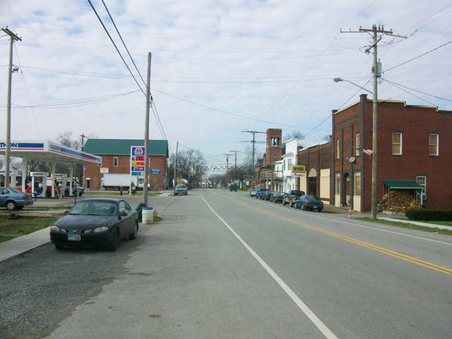
Photo: Aesopposea, via Wikimedia Commons, CC BY-SA 3.0 · Wikimedia Commons
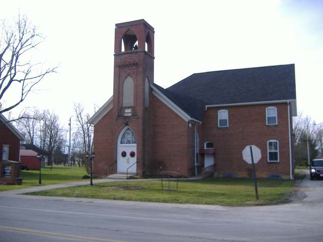
Photo: Aesopposea, via Wikimedia Commons, CC BY-SA 3.0 · Wikimedia Commons
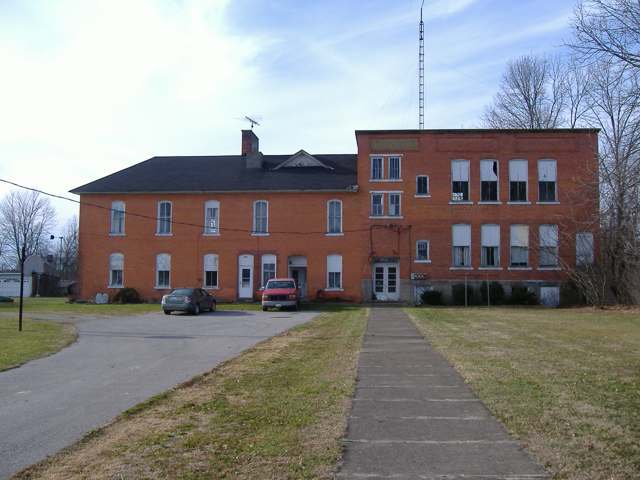
Photo: Aesopposea, via Wikimedia Commons, CC BY-SA 3.0 · Wikimedia Commons
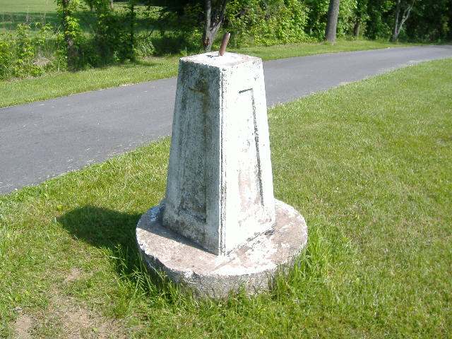
Photo: Aesopposea, via Wikimedia Commons, CC BY-SA 3.0 · Wikimedia Commons
Local history sources: en.wikipedia.org · en.wikipedia.org · findagrave.com · visithighlandcounty.com · en.wikipedia.org · en.wikipedia.org · commons.wikimedia.org · commons.wikimedia.org · commons.wikimedia.org · commons.wikimedia.org · archive.org · archive.org · postalhistory.com
Water
13 active wells drawing from the buried-valley aquifer along the Ohio River near Ripley; specific well-field location not separately documented The water here
- Sardinia Village100% of residentsOhio River Valley Aquifer (wells)
Hospitals, fire stations and more
Inside Mowrystown's boundary: 1 fire or EMS station, 2 public schools and 1 police station. Press a pin or a name for its whole record and its source.
Fire and EMS stations (1)
-
Mowrystown Fire Department and Emergency Medical ServicesMowrystown
- Address
- 50 Maple Street, Mowrystown, OH 45155
- Coordinates
- 39.03812, -83.75365
USGS National Map structures (source) ↗ Street map and directions ↗
Source: USGS National Map structures (most Ohio records last updated 2019 to 2022), checked against the Columbus and Cleveland station lists. The department that answers a call is set by jurisdiction and mutual aid, not by distance.
Public schools (2)
-
Whiteoak High School4 of 5 stars · Mowrystown
- Address
- 44 North High Street, Mowrystown, OH 45155
- School district
- Bright Local School District
- Kind (NCES)
- Regular School
- Students, 2023-24
- 166
- Teachers (full-time equivalent)
- 15
- Report card, 2025-26
- 4 of 5 stars
- Performance index
- 76.8%
- Four-year graduation rate
- 95.9%
- Ohio building IRN
- 041004
- NCES school ID
- 390476102928
NCES school record ↗ Ohio School Report Card ↗ Street map and directions ↗
-
Whiteoak Junior High School3.5 of 5 stars · Mowrystown
- Address
- 44 North High Street, Mowrystown, OH 45155
- School district
- Bright Local School District
- Kind (NCES)
- Regular School
- Students, 2023-24
- 104
- Teachers (full-time equivalent)
- 4
- Report card, 2025-26
- 3.5 of 5 stars
- Performance index
- 79.5%
- Ohio building IRN
- 000519
- NCES school ID
- 390476104938
NCES school record ↗ Ohio School Report Card ↗ Street map and directions ↗
Source: NCES EDGE public school locations 2024-25 and Common Core of Data 2023-24 (type, students, teachers); Ohio School Report Cards 2025-26 (Department of Education and Workforce), matched by name within the district.
Police stations (1)
-
Mowrystown Police DepartmentMowrystown
- Address
- 50 Maple Street, Mowrystown, OH 45155
- Coordinates
- 39.03821, -83.75362
USGS National Map structures (source) ↗ Street map and directions ↗
Source: USGS National Map structures, police stations, corrected and completed by hand (September 2026). The department that answers a call is set by jurisdiction, not by distance.
Its ZIP codes
Each ZIP code that touches Mowrystown, with the share of its residents who live here and the same headline figures as the ZIP page.
| ZIP | Share | Water | Radon | Home value | Schools | Flood |
|---|---|---|---|---|---|---|
| 45155 Mowrystown | 100% | 13 active wells drawing from the buried-valley aquifer along the Ohio River near Ripley; specific well-field location not separately documented | Too few radon tests | Appraisal records without year built | Bright Local · 4 stars overall | 0.0% of residents in the 1% floodplain |
Local government
Who holds office in Mowrystown, how its elections and ballot issues came out, and the state auditor's record.
Money issues on the ballot since 2023: 0 of 1 passed.
Ballot issues
| Date | Issue | For | Against | Result |
|---|---|---|---|---|
| 2023-11-07 | Issue 13: Village of Mowrystown Renewal | 37 | 40 | Failed (48.05% for) |
Elections for office
| Date | Office | Candidates and votes |
|---|---|---|
| 2023-11-07 | Member of Council | Rachel Byrd 64, 100.0% |
| 2023-11-07 | Mayor | Jim Allen 70, 100.0% |
| 2021-11-02 | Member of Council (unofficial count) | Christopher Byrd 37, 38.95%; Jan Marie Cooper 30, 31.58%; Sandra Temple-Hatton 28, 29.47% |
| 2021-11-02 | Mayor (unofficial count) | Jim Allen 39, 78.0%; Stephen M. Sheeley 11, 22.0% |
| 2019-11-05 | Mayor | Stephen M. Sheeley 27, 100.0% |
Winners in bold. Results from the county board of elections' official canvass unless marked.
Auditor of State record
- No fiscal caution, watch or emergency on the Auditor of State's lists.
- Basic Audit, 2024 to 2025, released 2026-08-06
- Financial Audit, 2022 to 2023, released 2025-01-02
The county
Highland County: 7 ZIP codes, 26 cities, villages and townships, 42,302 people.
Nearby places
No nearby place shares a ZIP code with Mowrystown in the atlas yet.
Rain and snow
How much has actually fallen on Mowrystown, day by day, from 1893 to now. Daily totals, not averages.
- rain, last 30 days
- 1.80 in
- 2026-09-30 to 2026-10-29
- rain so far in 2026
- 37.4 in
- about normal for the date
- snow so far in 2026
- 16.9 in
- a normal year brings 18.9 in
- a normal year
- 46.6 in
- average of 30 years, 1991-2020
| Month | Rain (in) | Snow (in) | Days counted |
|---|---|---|---|
| October 2026 | 1.80 | — | 29 |
| September 2026 | 5.11 | — | 30 |
| August 2026 | 5.28 | — | 31 |
| July 2026 | 3.13 | — | 31 |
| June 2026 | 5.22 | — | 30 |
| May 2026 | 5.23 | — | 31 |
| April 2026 | 3.60 | — | 30 |
| March 2026 | 5.60 | 0.2 | 31 |
| February 2026 | 0.87 | 6.5 | 28 |
| January 2026 | 1.57 | 10.2 | 31 |
| December 2025 | 2.70 | 9.5 | 31 |
| November 2025 | 4.23 | 2.1 | 30 |
| Wettest year | 2011 — 62.2 in |
|---|---|
| Driest year | 1901 — 25.3 in |
| Snowiest year | 1910 — 48.5 in |
| Wettest day on record | 10 March 1964 — 4.02 in |
| Heaviest snowfall in a day | 6 January 1910 — 11.35 in |
| Deepest snow on the ground | 21 January 1978 — 21.55 in |
Estimated, not measured. No rain gauge has ever stood inside Mowrystown, so every figure here is worked out from the gauges around it - the nearest ones weighted most. Treat them as close estimates rather than readings.
48,319 days of records, 1893-01-01 to 2026-10-29. Source: NOAA NCEI GHCN-Daily, 3,240 gauges in and around Ohio. A day is "gauged" when a gauge standing inside the boundary reported it, and the value is the mean of those gauges. Otherwise it is interpolated by inverse distance from every gauge reporting within 50 miles. Nothing is carried forward, back-filled or smoothed. Against NOAA nClimDiv county monthly precipitation over 136,848 complete county-months (checked 2026-10-31): correlation 0.9515, median absolute difference 0.217 in a month. Built 2026-10-31 from the Cracked Buckeye precipitation archive. Snow is the softer number — snowfall is measured by hand with a ruler, no agency publishes a gridded county snowfall series, and blowing snow defeats every observer.
Environmental permits and filings
What Ohio EPA has on file for Mowrystown: permits, inspections, violations, cleanups and the state loans behind sewer and water work. Every line links to the agency's own document.
- facilities and sites on file
- 1
- those placed on the map inside Mowrystown
| Program | Facilities and sites |
|---|---|
| Wastewater and stormwater discharge | 1 |
| Date | Facility or site | What |
|---|---|---|
| WHITE OAK HIGH SCHOOL | Wastewater and stormwater discharge permit | |
| WHITE OAK HIGH SCHOOL | Wastewater and stormwater discharge permit |
Source: Ohio EPA eDocument portal (edocpub.epa.ohio.gov), indexed 2026-10-14. Facilities are placed on the map from Ohio EPA's own map layers, EPA's Facility Registry, coordinates written in the filings, or a geocoded street address. A permit filed under a private person's name (most are household septic systems) is counted but never named, placed or linked; licenses for individual workers and open-burning notices are left out entirely.
Quick answers
What county is Mowrystown, Ohio in?
Mowrystown is a village in Highland County, Ohio, with 385 residents.
When was Mowrystown, Ohio founded?
Mowrystown was settled c. 1800; laid out 1829-05-29. Founders on record: Samuel Bell (platted); named for Squire Abe Mowry. Source
How did Mowrystown, Ohio get its name?
Mowrystown was renamed in honor of Squire Abe Mowry, a highly esteemed resident, when Samuel Bell platted the pioneer settlement as a town on May 29, 1829. Source
What ZIP code is Mowrystown, Ohio?
Most of Mowrystown is in ZIP code 45155.
Where does Mowrystown, Ohio get its water?
The main water source for Mowrystown (Sardinia Village): 13 active wells drawing from the buried-valley aquifer along the Ohio River near Ripley; specific well-field location not separately documented.
Cite this page
Cite this page as:
Cracked Buckeye, "Mowrystown, Highland County", https://crackedbuckeye.com/place/mowrystown/, built 2026-10-31, accessed [date].
How to cite · Report a correction · Built 2026-10-31
