Local events in Montgomery Township, Marion County
Nothing is posted for Montgomery Township itself yet; here is what is on within 20 miles. All local events in Montgomery Township, Marion County
Know a calendar we should watch? Send the link
Checked October 20; the events page is refreshed daily.
How Montgomery Township, Marion County began
Montgomery Township lies in the western part of Marion County along the Scioto River and holds two villages, LaRue in the southwest and New Bloomington in the southeast. It was set off from Grand Township on December 5, 1831, and first took in the Virginia Military lands south of the Scioto as well, until Bowling Green Township was cut from it in 1838. Its first settler, Daniel Markley, kept a cabin tavern about 1820 where the Mechanicsburg and Upper Sandusky trail crossed the Scioto; Col. William Cochran, whose house became the Cochranton post office, and Maj. William LaRue, who came in 1825 and laid out LaRue on June 3, 1851, followed. The Bellefontaine & Indiana Railroad reached the township in 1852 and made LaRue and New Bloomington (first called Carey) its shipping towns, while the older crossroads of Scott Town, with its Cochranton post office, stayed a hamlet.
Settled c. 1820, incorporated 1831-12-05, by Marion County commissioners; first settler Daniel Markley.
Where the name comes from
No source consulted gives the specific reason Montgomery Township was named for General Richard Montgomery (or another namesake); the 1883 county history records only the commissioners' order of December 5, 1831, setting off the township 'by the name of Montgomery.' The name follows a common pattern among Ohio townships, and Ohio has two other Montgomery Townships, in Ashland and Wood counties.
Before the town
The 1883 county history places the township's first settlement at a Native route: Daniel Markley's cabin of about 1820 stood on the Scioto at the crossing of the Mechanicsburg and Upper Sandusky trail, then the only traveled trail for twenty-five or thirty miles along the river, and the first mail from Marion to Bellefontaine was carried on horseback along what the history calls the half-beaten path of the Indians. Maj. William LaRue, arriving in 1825, is described as beginning life in a wilderness inhabited only by Indians, with one white family within six miles. The township lay north of the 1795 Greenville Treaty line and stayed closed to legal settlement until the land sales that followed the 1817 Treaty of the Maumee Rapids and 1818 Treaty of St. Marys. A Wikipedia summary of LaRue states the surrounding ground was home to Wyandot communities before their removal in the 1830s, consistent with continued Wyandot presence in north-central Ohio until the 1843 removal, though no source found here names a specific Wyandot village inside the township.
Nations recorded here: Wyandot.
- Scioto crossing of the Mechanicsburg and Upper Sandusky trail (trail) — on the Scioto River at the old James Walker farm, the site of Daniel Markley's cabin, remembered as 'Danny's cabin', in use about 1820 (archive.org)
Timeline
- — Daniel Markley builds a cabin and keeps a tavern on the Scioto where the Mechanicsburg and Upper Sandusky trail crosses it, the first settlement in the township; he leaves in 1824.
- — Samuel Franklin of Fayette County squats on Section 1 and builds a log cabin; in 1823 Col. William Cochran enters the land, and a post office named for him, Cochranton, is later kept in his house.
- — Maj. William LaRue settles on the site of the future village, entering 73 acres from the government in 1827 on a patent signed by John Quincy Adams.
- — The county commissioners set off Township 5 South, Range 13, and the Virginia Military land south of it as Montgomery Township; the first township election follows in June 1832.
- — Almon Bryan marries Jane Cochran, the township's first wedding; seventeen votes are cast in the township at the presidential election that fall.
- — Jacob Myers and Washington Armstrong build the township's first mill, a water sawmill with a corn cracker, at the bend of the Scioto in what became LaRue.
- — Bowling Green Township is set off from the part of Montgomery south of the Scioto River.
- — Salem Presbyterian Church is organized with twelve members at the Union Church, built about 1836 two miles east of Scott Town.
- — Heman Scott buys 120 acres of the Cochran farm and opens a store; the hamlet becomes known as Scott Town while its post office keeps the name Cochranton.
- — The Free-Will Baptist church of LaRue is organized in Lewis Topliff's mill with thirteen members, after revival meetings held in the mill and in Maj. LaRue's barn.
- — Major William LaRue founds the settlement of LaRue in southwestern Montgomery Township.
- — The Bellefontaine & Indiana Railroad is completed through the township, and the town of LaRue gets its start.
- — Maj. LaRue heads the railroad subscription with $1,000 and gives the right of way on condition that LaRue always be a watering place, so that every train stops there.
- — A post office begins operating at LaRue, continuing in service since.
- — The town of Carey Station is laid out in southeastern Montgomery Township; it later takes the name New Bloomington.
- — A church at the nearby hamlet of Winnemac, in adjoining Bowling Green Township, is physically moved to LaRue as LaRue outgrows its smaller neighbors -- part of the same railroad-driven consolidation pattern that shaped Montgomery Township's own villages.
- — The LaRue Elevator Company, twenty-four stockholders, builds a two-story steam elevator of 12,000 bushels; its grain goes mostly to Philadelphia and Baltimore.
- — The Chicago & Atlantic Railroad opens through the township about June 1, giving it four depots in all.
Stories
Church in a mill
In 1845 the Methodists held a three-week revival in Maj. William LaRue's barn, with the women on plank seats and the men and boys on the hay. The Free-Will Baptists followed with a week in the same barn and then moved to Lewis Topliff's new mill on the Scioto, reached by a single plank laid from the bank to the mill door. The pulpit was the raised platform that held the millstones. There, on November 29, 1845, Rev. G. W. Baker organized the LaRue Free-Will Baptist Church with thirteen members, and meetings stayed in the mill until the next carding season, when Topliff needed the room back for his carding machine. The congregation built its first church in 1850 and a new one in 1877 for $6,500.
A depot named for two brothers
New Bloomington did not start out with that name. When the Bellefontaine & Indiana Railroad came through southeastern Montgomery Township there was one log cabin at the spot, and in 1856 W. W. and Wingate Carey laid out most of a town there, with Carey Darlington and Armstrong M. Smallwood platting the rest; it was called Carey after the two Careys. It was later renamed New Bloomington, its station became Belfast in 1879, and in 1883 both station and post office became Agosta before the village took back the name New Bloomington.
Hominy from a stump
The first settlers of Montgomery Township had no mill near them. To reach one at West Liberty they went by way of Scott Town and Judge Wheeler's to the Bellefontaine road, a trip of three or four days with nights camped wherever dark found them. Maj. LaRue bought a hand mill that the whole neighborhood used for years, and wheat bread was a luxury. Hominy was made by burning a hollow into the top of a green white-oak stump, scraping it clean, and pounding the corn in it with an iron wedge hung from a spring pole like a well sweep. The first real mill, a water sawmill with a corn cracker, was not built until 1835.
Photographs
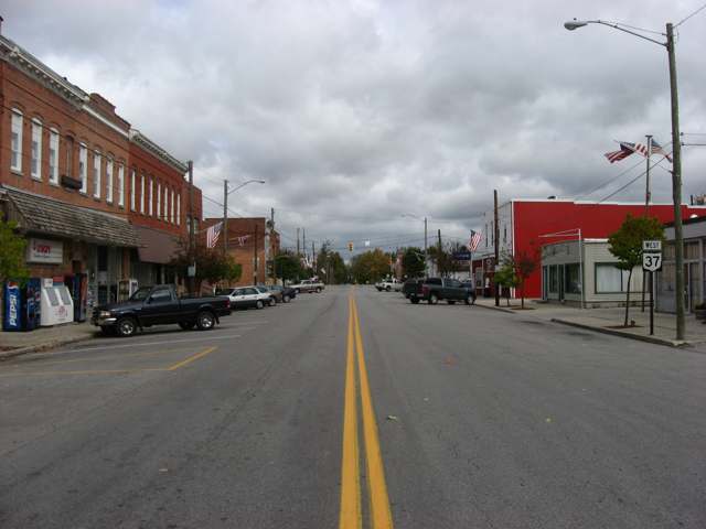
Photo: Nyttend, Wikimedia Commons, public domain · Wikimedia Commons
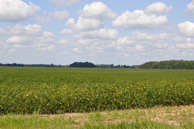
Photo: Nyttend, Wikimedia Commons, public domain · Wikimedia Commons
Local history sources: en.wikipedia.org · en.wikipedia.org · en.wikipedia.org · ohioghosttowns.wordpress.com · ohiogenealogyexpress.com · archive.org · archive.org · archive.org · archive.org · archive.org · archive.org · archive.org · archive.org · archive.org · archive.org · archive.org · commons.wikimedia.org · commons.wikimedia.org · commons.wikimedia.org
Water
Mostly private wells The water here
- Aqua Ohio - La Rue Village100% of residentsGroundwater wells (2 wells)
Hospitals, fire stations and more
Inside Montgomery Township, Marion County's boundary: 1 Toxics Release Inventory facility and 1 spill case. Press a pin or a name for its whole record and its source.
Facilities reporting toxic releases (1)
-
Buckeye Egg Farm Goshen PulletToxics Release Inventory · La Rue
- Address
- 12923 Hardin-Marion Rd., La Rue, OH 43332
- County
- Hardin County
- Status
- Reports to the Toxics Release Inventory (active)
- EPA program ID
- 43340BCKYG12923
- EPA registry ID
- 110022936064
EPA facility record ↗ EPA Facility Registry Service (source) ↗ Street map and directions ↗
Source: EPA Facility Registry Service, Toxics Release Inventory reporters. Reporting a release is required of large users of listed chemicals; it is not by itself a violation.
Spills reported since 2021 (1)
-
Manure Nos (Not Specified)2023-03-31 · Montgomery Twp
- Reported
- 2023-03-31
- What spilled
- Manure Nos (Not Specified)
- Where
- Montgomery Twp, Marion County
- Ohio EPA district office
- NWDO
- Ohio EPA case number
- 2303EPA0000486
Ohio EPA spill reports (source) ↗ Street map and directions ↗
Source: Ohio EPA emergency response spill reports, 2021 to September 2026, one point per case where Ohio EPA placed it. A report is what the caller or responder recorded; amounts are often blank or estimated.
Its ZIP codes
Each ZIP code that touches Montgomery Township, Marion County, with the share of its residents who live here and the same headline figures as the ZIP page.
| ZIP | Share | Water | Radon | Home value | Schools | Flood |
|---|---|---|---|---|---|---|
| 43341 Montgomery Township and New Bloomington | 51% | Mostly private wells | 2.2 pCi/L average radon | Median year built 1972 | Elgin Local · 3.5 stars overall | 15% of residents in the 1% floodplain |
| 43332 Larue and La Rue | 20% | Mostly private wells | 4.5 pCi/L average radon | Median year built 1952 | Elgin Local · 3.5 stars overall | 35% of residents in the 1% floodplain |
Local government
Who holds office in Montgomery Township, Marion County, how its elections and ballot issues came out, and the state auditor's record.
Ballot issues
| Date | Issue | For | Against | Result |
|---|---|---|---|---|
| 2022-11-08 | Issue: Local Liquor Option For Particular Location - By Petition - Sunday Sales - Montgomery Township (Raceway Mini Mart) | 377 | 154 | Passed (71.0% for) |
Elections for office
| Date | Office | Candidates and votes |
|---|---|---|
| 2023-11-07 | Township Trustee (unofficial count) | Trevor J. Fremont 444, 100.0% |
| 2023-11-07 | Township Fiscal Officer (unofficial count) | Thomas P. Ford 437, 100.0% |
| 2021-11-02 | Township Trustees | Jeffrey S. Wall 233, 51.55%; Phillip L. Winslow, Jr. 219, 48.45% |
| 2015-11-03 | Township Trustee (unofficial count) | Jim Lynch 469, 100.0% |
| 2015-11-03 | Township Fiscal Officer (unofficial count) | Thomas P Ford 448, 100.0% |
Winners in bold. Results from the county board of elections' official canvass unless marked.
Auditor of State record
- No fiscal caution, watch or emergency on the Auditor of State's lists.
- Basic Audit, 2023 to 2024, released 2025-12-02
The county
Marion County: 8 ZIP codes, 23 cities, villages and townships, 65,965 people.
Nearby places
Quick answers
What county is Montgomery Township, Ohio in?
Montgomery Township, Marion County is a township in Marion County, Ohio, with 975 residents.
When was Montgomery Township, Ohio founded?
Montgomery Township, Marion County was settled c. 1820; incorporated 1831-12-05. Founders on record: Marion County commissioners; first settler Daniel Markley. Source
What ZIP code is Montgomery Township, Ohio?
Montgomery Township, Marion County is served by ZIP codes 43341 and 43332; 43341 holds the largest share of its residents.
Where does Montgomery Township, Ohio get its water?
The main water source for Montgomery Township, Marion County (Aqua Ohio - La Rue Village): Mostly private wells.
Cite this page
Cite this page as:
Cracked Buckeye, "Montgomery Township, Marion County", https://crackedbuckeye.com/place/montgomery-township-marion-county/, built 2026-10-31, accessed [date].
How to cite · Report a correction · Built 2026-10-31
