Local events in Independence
50 events in the next 90 days from 5 public calendars. All local events in Independence
Checked October 20; the events page is refreshed daily.
Deep dives about Independence
Long reads built from maps, newspapers and public records. All deep dives
How Independence began
Independence Township organized in 1814 on the Cuyahoga River, its land opened to settlement by the July 4, 1805 Treaty of Fort Industry; its first recorded resident, farmer Ichabod Lord Skinner, arrived around 1818 near what became Skinner's Hill. Originally called Center, it was renamed Independence in 1830 for reasons no source reviewed here explains. By 1850 Independence was one of the nation's leading suppliers of building sandstone, quarried by German, Irish, and Scottish workers and shipped to Cleveland landmarks including the pillared Weddell House, where Abraham Lincoln once stayed; quarrying declined by the century's end against competition from Berea sandstone and concrete, but a quarry still operates on part of the Whittlesey-culture South Park Village archaeological site. Independence incorporated as a village in 1914 and became a city in 1960, and after 1970 built a major office corridor along Rockside Road that now anchors its economy.
Settled c. 1818 (Ichabod Lord Skinner, first recorded resident, near Skinner's Hill/Schaaf Road), incorporated township organized 1814; village, 1914; city, November 1960.
Where the name comes from
The township was originally called Center and was renamed Independence in 1830; no source we reviewed explains why.
Before the town
The land that became Independence Township lay west of the Cuyahoga River and was opened to white settlement by the Treaty of Fort Industry, signed July 4, 1805, under which the Ottawa, Potawatomi, Ojibwe (Chippewa), Wyandot, Munsee, Lenape (Delaware), and Shawnee ceded the area and were pushed further west. Independence holds one of Cuyahoga County's best-documented precontact sites: the South Park Village site (also called the South Park Site), a Whittlesey-culture village on a promontory above the west bank of the Cuyahoga River, occupied for hundreds of years by people who hunted duck, beaver, and deer and gathered river mollusks, walnuts, grapes, hickory nuts, and chokeberries; it was listed on the National Register of Historic Places June 22, 1976 (reference 76000212), and part of it is now being quarried away by an active aggregates operation. A second Whittlesey and earlier-period site, the Outdoor Education Center Site along the Cuyahoga River, was excavated in 1999 by Mark Kollecker of the Cleveland Museum of Natural History and again in 2000-2001, turning up post molds, storage pits, a partially subterranean sweat lodge, a large maize storage pit, and pottery and stone tools across a village of roughly two to four acres.
Nations recorded here: Wyandot, Ottawa, Potawatomi, Ojibwe (Chippewa), Munsee, Lenape (Delaware), Shawnee.
- South Park Village (South Park Site) (village) — On a promontory above the west bank of the Cuyahoga River, near Independence, Cuyahoga County, within Cuyahoga Valley National Park, Whittlesey culture, roughly AD 1000-1640 (en.wikipedia.org)
- Outdoor Education Center Site (village) — Along the Cuyahoga River in Independence, Whittlesey culture and earlier; excavated 1999-2001 (en.wikipedia.org)
- Treaty of Fort Industry cession (treaty) — Land west of the Cuyahoga River, including present Independence Township, Signed July 4, 1805 (case.edu)
Timeline
- — The Treaty of Fort Industry opens land west of the Cuyahoga River, including the future Independence Township, to white settlement.
- — Independence Township organizes, straddling the Cuyahoga River.
- — Farmer Ichabod Lord Skinner becomes the township's first recorded resident, settling near what becomes known as Skinner's Hill.
- — The Cleveland-Akron section of the Ohio and Erie Canal opens, aiding trade through the township.
- — The township, originally called Center, is renamed Independence.
- — Skilled German, Irish, and Scottish workers begin commercial sandstone quarrying in Independence.
- — Independence is one of the nation's foremost suppliers of building stone; stone from its quarries is used for the pillars of Cleveland's Weddell House, where Abraham Lincoln once stayed.
- — The Valley Railroad reaches Independence.
- — Independence incorporates as a village.
- — The Willow Cloverleaf interchange opens nearby, one of the first highway interchanges built in the country.
- — Independence incorporates as a city.
- — The South Park Village archaeological site is listed on the National Register of Historic Places.
- — Independence Presbyterian Church, built 1855 for a congregation organized in 1837, is listed on the National Register of Historic Places.
- — The Crown Center office complex is built on Rockside Road, part of the corridor of backup and satellite office space Cleveland businesses began seeking in Independence in the 1970s.
- — The Outdoor Education Center Site along the Cuyahoga River is excavated, yielding a sweat lodge, storage pits, and pottery from Whittlesey and earlier occupation.
Stories
Stone for Lincoln's hotel, and a quarry that never stopped
By 1850 the quarries of Independence Township, worked by German, Irish, and Scottish stonecutters, had made the town one of the country's leading suppliers of building sandstone. Its stone traveled only a few miles to become the pillars of Cleveland's Weddell House, the hotel where Abraham Lincoln stayed on his way to his first inauguration -- a direct physical link between a small river township and a president. The quarry business faded by the century's end, undercut by Berea sandstone companies and by concrete, but it never fully stopped: a DiGeronimo Aggregates quarry still operates in Independence today, cutting, as a 2015 photograph documents, directly into the remains of the South Park Village site, the Whittlesey-culture village that had stood on the same ground centuries earlier -- an uncomfortable overlap between the county's industrial and its Native past on the same acreage.
A sweat lodge under the Cuyahoga Valley
In 1999, archaeologist Mark Kollecker of the Cleveland Museum of Natural History led an excavation along the Cuyahoga River in Independence, at a spot now called the Outdoor Education Center Site, followed by further digging in 2000 and 2001. The team found post molds and cooking features from a village of two to four acres, a large pit once used to store maize, and the remains of a partially subterranean sweat lodge, alongside stone tools and pottery -- physical evidence of the Whittlesey-culture people, and those before them, who lived along this stretch of river for centuries before the treaty line moved through in 1805 and the quarrymen arrived a few decades later.
Photographs
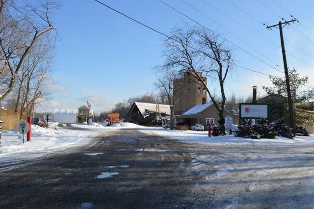
Photo: Nyttend (Wikimedia Commons), public domain · Wikimedia Commons
Local history sources: en.wikipedia.org · case.edu · en.wikipedia.org · en.wikipedia.org · en.wikipedia.org · commons.wikimedia.org
Historic places
5 places in Independence on the National Register of Historic Places. Press a pin or a name for its whole record.
-
Fuller--Bramley HouseBuilding · Independence · listed 1999
- Address
- 7489 Brecksville Rd.
- Where
- Independence, Cuyahoga County · ZIP 44131
- What it is
- Building
- Listed on the National Register
- 1999
- NRIS reference number
- 99001242
- Coordinates
- 41.35858, -81.63466
National Register file (NPS) ↗ Search Wikipedia ↗ Street map and directions ↗ On the Cracked Buckeye map
-
Independence Presbyterian ChurchBuilding · Independence · listed 1977
- Address
- U.S. 21
- Where
- Independence, Cuyahoga County · ZIP 44131
- What it is
- Building
- Listed on the National Register
- 1977
- NRIS reference number
- 77001053
- Coordinates
- 41.38196, -81.64159
National Register file (NPS) ↗ Search Wikipedia ↗ Street map and directions ↗ On the Cracked Buckeye map
-
Lock No. 38 and SpillwayStructure · Valley View · listed 1979
- Address
- Hillside Rd.
- Where
- Valley View, Cuyahoga County · ZIP 44131
- What it is
- Structure
- Listed on the National Register
- 1979
- NRIS reference number
- 79000291
- Coordinates
- 41.37224, -81.64867
National Register file (NPS) ↗ Search Wikipedia ↗ Street map and directions ↗ On the Cracked Buckeye map
-
Packard-Doubler HouseBuilding · Independence · listed 1979
- Address
- 7634 Riverview Rd.
- Where
- Independence, Cuyahoga County · ZIP 44141
- What it is
- Building
- Listed on the National Register
- 1979
- NRIS reference number
- 79000294
- Coordinates
- 41.35497, -81.60330
National Register file (NPS) ↗ Search Wikipedia ↗ Street map and directions ↗ On the Cracked Buckeye map
-
William Tricker Inc. Historic DistrictHistoric district · Independence · listed 2001
- Address
- 7125 Tanglewood Rd.
- Where
- Independence, Cuyahoga County · ZIP 44131
- What it is
- Historic district
- Listed on the National Register
- 2001
- NRIS reference number
- 01000200
- Coordinates
- 41.38900, -81.63950
National Register file (NPS) ↗ Search Wikipedia ↗ Street map and directions ↗ On the Cracked Buckeye map
Source: National Park Service, National Register of Historic Places point file. The listing year is shown where NPS's certification date agrees with the listing's reference number. Listing recognizes significance; it does not restrict a private owner.
Water
The Five Mile Crib, a small structure about 5 miles out in Lake Erie north of Cleveland's Edgewater Park The water here
- Cleveland Public Water System100% of residentsLake Erie
Hospitals, fire stations and more
Inside Independence's boundary: 1 dialysis center, 1 nursing home, 1 fire or EMS station, 1 college, 6 public schools, 7 poor-rated bridges, 1 library, 2 museums, 1 police station, 2 public charging sites, 5 Toxics Release Inventory facilities, 1 station or terminal and 6 spill cases. Press a pin or a name for its whole record and its source.
Dialysis centers (1)
-
Davita Rockside DialysisDialysis · Independence
- Address
- 4801 Acorn Drive, Independence, OH 44131
- Dialysis stations
- 16
- Medicare star rating
- 3 of 5 stars
- Services
- in-center hemodialysis, home hemodialysis training
- Ownership
- for profit
- Chain
- DaVita
- Medicare certified since
- 2008-11-21
- Phone
- (216) 525-0990
- Medicare ID
- 362731
Medicare Care Compare ↗ CMS dialysis facility list (source) ↗ Street map and directions ↗
Source: CMS dialysis facility list, September 2026, geocoded with the Census Bureau batch geocoder (an address it could not place sits at its ZIP center).
Nursing homes (1)
-
Seven Hills Health & Rehab Center2 of 5 stars · Seven Hills
- Address
- 819 Rockside Road, Seven Hills, OH 44131
- Certified beds
- 80
- Residents on an average day
- 70
- Medicare overall rating
- 2 of 5 stars
- Health inspections
- 2 of 5 stars
- Staffing
- 2 of 5 stars
- Quality measures
- 4 of 5 stars
- Penalties since 2023
- 1 fine totalling $57,194 (latest 2025-07-07)
- Ownership
- For profit - Limited Liability company
- Chain
- SABER HEALTHCARE GROUP
- Takes
- Medicare and Medicaid
- Phone
- (216) 487-7557
- Medicare ID
- 366441
- Map point
- the ZIP's center (the address did not geocode)
Medicare Care Compare ↗ CMS nursing home data (source) ↗ Street map and directions ↗
Source: CMS Care Compare nursing home provider and penalties files; Medicare star ratings run 1 to 5.
Fire and EMS stations (1)
-
Independence Fire DepartmentIndependence
- Address
- 6305 Selig Drive, Independence, OH 44131
- Coordinates
- 41.37705, -81.64260
USGS National Map structures (source) ↗ Street map and directions ↗
Source: USGS National Map structures (most Ohio records last updated 2019 to 2022), checked against the Columbus and Cleveland station lists. The department that answers a call is set by jurisdiction and mutual aid, not by distance.
Colleges (1)
-
Central School of Practical NursingNonprofit career school · Independence
- What it is
- Nonprofit career school
- City
- Independence
- Students, 2023-24 (12-month count)
- 88
- IPEDS unit ID
- 201681
College Navigator (NCES) ↗ IPEDS data (source) ↗ Street map and directions ↗
Source: NCES IPEDS 2024 directory, 2023-24 enrollment and tuition, graduation rates for the 2017 (four-year) and 2020 (two-year) entering classes.
Public schools (6)
-
Alternative Education AcademyIndependence
- Address
- 4 Summit Park Dr Ste 350, Independence, OH 44131
- Kind (NCES)
- Regular School
- Students, 2023-24
- 6,486
- Teachers (full-time equivalent)
- 201
- NCES school ID
- 390020304727
-
Gateway Online Academy of OhioIndependence
- Address
- 4 Summit Park Dr, Independence, OH 44131
- Kind (NCES)
- Regular School
- Students, 2023-24
- 740
- Teachers (full-time equivalent)
- 31.2
- NCES school ID
- 391003910854
-
Independence High School4.5 of 5 stars · Independence
- Address
- 6001 Archwood Rd, Independence, OH 44131
- School district
- Independence Local School District
- Kind (NCES)
- Regular School
- Students, 2023-24
- 309
- Teachers (full-time equivalent)
- 22.08
- Report card, 2025-26
- 4.5 of 5 stars
- Performance index
- 90%
- Four-year graduation rate
- 100%
- Ohio building IRN
- 017285
- NCES school ID
- 390465602589
NCES school record ↗ Ohio School Report Card ↗ Street map and directions ↗
-
Independence Middle School4.5 of 5 stars · Independence
- Address
- 6111 Archwood Rd, Independence, OH 44131
- School district
- Independence Local School District
- Kind (NCES)
- Regular School
- Students, 2023-24
- 311
- Teachers (full-time equivalent)
- 24.17
- Report card, 2025-26
- 4.5 of 5 stars
- Performance index
- 91.4%
- Ohio building IRN
- 017293
- NCES school ID
- 390465602590
NCES school record ↗ Ohio School Report Card ↗ Street map and directions ↗
-
Independence Primary School5 of 5 stars · Independence
- Address
- 7600 Hillside Rd, Independence, OH 44131
- School district
- Independence Local School District
- Kind (NCES)
- Regular School
- Students, 2023-24
- 438
- Teachers (full-time equivalent)
- 27
- Report card, 2025-26
- 5 of 5 stars
- Performance index
- 93.3%
- Ohio building IRN
- 016360
- NCES school ID
- 390465602591
NCES school record ↗ Ohio School Report Card ↗ Street map and directions ↗
-
Pathfinder Career Academy of OhioIndependence
- Address
- 4 Summit Park Dr, Independence, OH 44131
- Kind (NCES)
- Regular School
- Students, 2023-24
- 45
- Teachers (full-time equivalent)
- 6
- NCES school ID
- 391005210870
Source: NCES EDGE public school locations 2024-25 and Common Core of Data 2023-24 (type, students, teachers); Ohio School Report Cards 2025-26 (Department of Education and Workforce), matched by name within the district.
Bridges rated poor (7)
-
Hemlock Road over Hemlock CreekPoor · built 1905
- Condition
- Poor: a deck, superstructure, substructure or culvert rated 4 or below on the 0 to 9 scale
- What it is
- Bridge
- Built
- 1905
- Length
- 11 ft
- Owner
- County
- Vehicles a day
- 619
- Coordinates
- 41.37967, -81.62511
National Bridge Inventory (source) ↗ Street map and directions ↗
-
I-480 E.b. over Up 480-Es&wn Dn 77-Sw&nePoor · built 1973
- Condition
- Poor: a deck, superstructure, substructure or culvert rated 4 or below on the 0 to 9 scale
- What it is
- Bridge
- Built
- 1973
- Length
- 111 ft
- Owner
- State
- Vehicles a day
- 44,715
- Coordinates
- 41.40696, -81.64657
National Bridge Inventory (source) ↗ Street map and directions ↗
-
I-480 Wb over Up480-Es&wn Dn77-Sw&nePoor · built 1973
- Condition
- Poor: a deck, superstructure, substructure or culvert rated 4 or below on the 0 to 9 scale
- What it is
- Bridge
- Built
- 1973
- Length
- 111 ft
- Owner
- State
- Vehicles a day
- 44,715
- Coordinates
- 41.40753, -81.64736
National Bridge Inventory (source) ↗ Street map and directions ↗
-
Pl Valley Rd Cr121 over Riverview Rd/creekPoor · built 1958
- Condition
- Poor: a deck, superstructure, substructure or culvert rated 4 or below on the 0 to 9 scale
- What it is
- Bridge
- Built
- 1958
- Length
- 73 ft
- Owner
- County
- Vehicles a day
- 14,182
- Coordinates
- 41.36031, -81.61222
National Bridge Inventory (source) ↗ Street map and directions ↗
-
Ramp Es over Up Ir 77 Dn Ir-480-L/rPoor · built 1973
- Condition
- Poor: a deck, superstructure, substructure or culvert rated 4 or below on the 0 to 9 scale
- What it is
- Bridge
- Built
- 1973
- Length
- 154 ft
- Owner
- State
- Vehicles a day
- 13,400
- Coordinates
- 41.40738, -81.64608
National Bridge Inventory (source) ↗ Street map and directions ↗
-
Ramp Wn over Up Ir 77 Dn Ir-480-L/rPoor · built 1974
- Condition
- Poor: a deck, superstructure, substructure or culvert rated 4 or below on the 0 to 9 scale
- What it is
- Bridge
- Built
- 1974
- Length
- 144 ft
- Owner
- State
- Vehicles a day
- 4,800
- Coordinates
- 41.40708, -81.64744
National Bridge Inventory (source) ↗ Street map and directions ↗
-
Schaaf Rd Cr 97 over West CreekPoor · built 1935
- Condition
- Poor: a deck, superstructure, substructure or culvert rated 4 or below on the 0 to 9 scale
- What it is
- Bridge
- Built
- 1935
- Length
- 17 ft
- Owner
- County
- Vehicles a day
- 3,807
- Coordinates
- 41.41367, -81.64745
National Bridge Inventory (source) ↗ Street map and directions ↗
Source: FHWA National Bridge Inventory 2025. "Poor" means one major part rated 4 or below on the 0 to 9 scale; it calls for repair, not closing, unless the state posts or closes the bridge.
Public libraries (1)
-
Independence Branch LibraryBranch · Independence
- Address
- 6361 Selig Ave., Independence, OH 44131
- What it is
- Branch
- Library system
- Cuyahoga County Public Library
- Open
- 3,472 hours a year, 52 weeks
- Building
- 15,356 sq ft
- System's visits, FY2024
- 3,917,784
- System's loans, FY2024
- 11,584,178
- People the system serves
- 626,288
- Phone
- (216) 447-0160
IMLS Public Libraries Survey (source) ↗ Street map and directions ↗
Source: IMLS Public Libraries Survey FY2024 (outlets and their systems). Any Ohio resident can get a free card at any Ohio public library.
Museums, historical societies, gardens and zoos (2)
-
Cuyahoga Valley Genealogical SocietyHistorical society · Independence
- What it is
- Historical society
- City
- Independence
- Coordinates
- 41.38304, -81.66112
Search Wikipedia ↗ IMLS Museum Data Files (source) ↗ Street map and directions ↗
The museum list is IMLS's 2018 file; a museum may have closed or moved since.
-
Independence Historical SocietyHistorical society · Independence
- What it is
- Historical society
- City
- Independence
- Coordinates
- 41.38138, -81.64007
Search Wikipedia ↗ IMLS Museum Data Files (source) ↗ Street map and directions ↗
The museum list is IMLS's 2018 file; a museum may have closed or moved since.
Source: IMLS Museum Data Files, 2018.
Police stations (1)
-
Independence Police DepartmentIndependence
- Address
- 6800 Brecksville Road, Independence, OH 44131
- Coordinates
- 41.37762, -81.64160
USGS National Map structures (source) ↗ Street map and directions ↗
Source: USGS National Map structures, police stations, corrected and completed by hand (September 2026). The department that answers a call is set by jurisdiction, not by distance.
Public EV charging (2)
-
CCF BOC STATION 12 Level 2 · Independence
- Address
- 6801 Brecksville Road, Independence, OH 44131
- Ports
- 2 Level 2
- Plugs
- J1772
- Network
- ChargePoint Network
- Hours
- 24 hours daily
- Phone
- 888-758-4389
Station Locator (NREL) ↗ Alternative Fuels Data Center (source) ↗ Street map and directions ↗
-
Independence Family Health Center6 Level 2 · Independence
- Address
- 5001 Rockside Road, Independence, OH 44131
- Ports
- 6 Level 2
- Plugs
- J1772
- Network
- Blink Network
- Hours
- 24 hours daily
- Phone
- 888-998-2546
Station Locator (NREL) ↗ Alternative Fuels Data Center (source) ↗ Street map and directions ↗
Source: NREL Alternative Fuels Data Center station list (May 2026), public and open stations, the posts at one address counted as one site.
Facilities reporting toxic releases (5)
-
Adcraft Decals IncToxics Release Inventory · Independence
- Address
- 7708 Commerce Park Oval, Independence, OH 44131
- County
- Cuyahoga County
- Status
- Reports to the Toxics Release Inventory (active)
- EPA program ID
- 44131DCRFT7708C
- EPA registry ID
- 110002111009
EPA facility record ↗ EPA Facility Registry Service (source) ↗ Street map and directions ↗
-
Avtron Loadbanks IncToxics Release Inventory · Independence
- Address
- 8400 E Pleasant Valley Rd, Independence, OH 44131
- County
- Cuyahoga County
- Status
- Reports to the Toxics Release Inventory (active)
- EPA program ID
- 44131SNWMT8400E
- EPA registry ID
- 110000387661
EPA facility record ↗ EPA Facility Registry Service (source) ↗ Street map and directions ↗
-
Avtron Manufacturing Digital DivToxics Release Inventory · Independence
- Address
- 8901 East Pleasant Valley Road, Independence, OH 44131
- County
- Cuyahoga County
- Status
- Reports to the Toxics Release Inventory (active)
- EPA program ID
- 44131VTRNM891EP
- EPA registry ID
- 110006242351
EPA facility record ↗ EPA Facility Registry Service (source) ↗ Street map and directions ↗
-
Kendale Industries IncToxics Release Inventory · Independence
- Address
- 8600 E Pleasant Valley Rd, Independence, OH 44131
- County
- Cuyahoga County
- Status
- Reports to the Toxics Release Inventory (active)
- EPA program ID
- 44131KNDLN8600E
- EPA registry ID
- 110000387634
EPA facility record ↗ EPA Facility Registry Service (source) ↗ Street map and directions ↗
-
Sifco Selective PlatingToxics Release Inventory · Independence
- Address
- 5708 Schaaf Road, Independence, OH 44131
- County
- Cuyahoga County
- Status
- Reports to the Toxics Release Inventory (active)
- EPA program ID
- 44131SFCSL5708S
- EPA registry ID
- 110000387652
EPA facility record ↗ EPA Facility Registry Service (source) ↗ Street map and directions ↗
Source: EPA Facility Registry Service, Toxics Release Inventory reporters. Reporting a release is required of large users of listed chemicals; it is not by itself a violation.
Stations and terminals (1)
-
Brecksville & RocksideRail transit stop · Greater Cleveland RTA
- What it is
- Rail transit stop
- Operator
- Greater Cleveland RTA
- Coordinates
- 41.39429, -81.64098
BTS National Transit Map (source) ↗ Street map and directions ↗
Source: BTS Intermodal Passenger Connectivity Database and National Transit Map (2025). Bus stops are counted on the card and drawn on the full map.
Spills reported since 2021 (6)
-
Oil Transformer Non Pcb2025-07-15 · Independence
- Reported
- 2025-07-15
- What spilled
- Oil Transformer Non Pcb
- Largest amount reported
- 150 gallons
- Where
- Independence, Cuyahoga County
- Ohio EPA district office
- NEDO
- Ohio EPA case number
- 2507EPA0001181
Ohio EPA spill reports (source) ↗ Street map and directions ↗
-
Fuel Diesel / Diesel Fuel (Vehicle On Or Off Road)2025-06-20 · Independence
- Reported
- 2025-06-20
- What spilled
- Fuel Diesel / Diesel Fuel (Vehicle On Or Off Road)
- Where
- Independence, Cuyahoga County
- Ohio EPA district office
- NEDO
- Ohio EPA case number
- 2506EPA0001022
Ohio EPA spill reports (source) ↗ Street map and directions ↗
-
Sheen Rainbow / Hydrocarbon2024-08-15 · Independence
- Reported
- 2024-08-15
- What spilled
- Sheen Rainbow / Hydrocarbon
- Where
- Independence, Cuyahoga County
- Ohio EPA district office
- NEDO
- Ohio EPA case number
- 2408EPA0001415
Ohio EPA spill reports (source) ↗ Street map and directions ↗
-
Sewage Human2023-07-08 · Independence
- Reported
- 2023-07-08
- What spilled
- Sewage Human
- Where
- Independence, Cuyahoga County
- Ohio EPA district office
- NEDO
- Ohio EPA case number
- 2307EPA0001127
Ohio EPA spill reports (source) ↗ Street map and directions ↗
-
Fuel Gasoline ( 25% Ethanol Not E85)2022-07-18 · Independence
- Reported
- 2022-07-18
- What spilled
- Fuel Gasoline ( 25% Ethanol Not E85)
- Largest amount reported
- 30 gallons
- Where
- Independence, Cuyahoga County
- Ohio EPA district office
- NEDO
- Ohio EPA case number
- 2207EPA0001089
Ohio EPA spill reports (source) ↗ Street map and directions ↗
-
Oil Petroleum Not Otherwise Specified (Nos)2021-07-19 · Independence
- Reported
- 2021-07-19
- What spilled
- Oil Petroleum Not Otherwise Specified (Nos)
- Largest amount reported
- 50 gallons
- Where
- Independence, Cuyahoga County
- Ohio EPA district office
- NEDO
- Ohio EPA case number
- 2107EPA0001082
Ohio EPA spill reports (source) ↗ Street map and directions ↗
Source: Ohio EPA emergency response spill reports, 2021 to September 2026, one point per case where Ohio EPA placed it. A report is what the caller or responder recorded; amounts are often blank or estimated.
Its ZIP codes
Each ZIP code that touches Independence, with the share of its residents who live here and the same headline figures as the ZIP page.
| ZIP | Share | Water | Radon | Home value | Schools | Flood |
|---|---|---|---|---|---|---|
| 44131 Seven Hills and Independence | 37% | The Five Mile Crib, a small structure about 5 miles out in Lake Erie north of Cleveland's Edgewater Park | 2.9 pCi/L average radon | Median year built 1966 | Parma City · 4 stars overall | 0.3% of residents in the 1% floodplain |
| 44141 Brecksville | 1% | The Five Mile Crib, a small structure about 5 miles out in Lake Erie north of Cleveland's Edgewater Park | 3.5 pCi/L average radon | Median year built 1976 | Brecksville-Broadview Heights City · 5 stars overall | 0.0% of residents in the 1% floodplain |
Local government
Who holds office in Independence, how its elections and ballot issues came out, and the state auditor's record.
Auditor of State record
- No fiscal caution, watch or emergency on the Auditor of State's lists.
- Financial Health Indicators (the Auditor of State's 17 measures; critical / cautionary / positive): 2020 0 / 2 / 15; 2021 0 / 3 / 14; 2022 0 / 1 / 16; 2023 0 / 0 / 17; 2024 0 / 4 / 13; 2025 0 / 1 / 15.
- Financial Audit, 2024, released 2026-02-03
- Financial Audit, 2023, released 2024-10-10
The county
Cuyahoga County: 52 ZIP codes, 59 cities, villages and townships, 1,270,867 people.
Nearby places
Rain and snow
How much has actually fallen on Independence, day by day, from 1871 to now. Daily totals, not averages.
- rain, last 30 days
- 2.04 in
- 2026-09-29 to 2026-10-28
- rain so far in 2026
- 34.4 in
- about normal for the date
- snow so far in 2026
- 42.3 in
- a normal year brings 68.3 in
- a normal year
- 41.0 in
- average of 30 years, 1991-2020
| Month | Rain (in) | Snow (in) | Days counted |
|---|---|---|---|
| October 2026 | 2.04 | — | 28 |
| September 2026 | 2.85 | — | 30 |
| August 2026 | 6.49 | — | 31 |
| July 2026 | 2.91 | — | 31 |
| June 2026 | 3.08 | — | 30 |
| May 2026 | 4.12 | — | 31 |
| April 2026 | 6.24 | 0.0 | 30 |
| March 2026 | 3.56 | 1.9 | 31 |
| February 2026 | 0.72 | 8.1 | 28 |
| January 2026 | 2.34 | 32.3 | 31 |
| December 2025 | 2.70 | 15.6 | 31 |
| November 2025 | 2.33 | 8.6 | 30 |
| Wettest year | 2011 — 66.7 in |
|---|---|
| Driest year | 1963 — 18.7 in |
| Snowiest year | 2005 — 108.5 in |
| Wettest day on record | 7 September 1996 — 4.59 in |
| Heaviest snowfall in a day | 10 November 1913 — 14.28 in |
| Deepest snow on the ground | 24 February 1993 — 20.98 in |
Estimated, not measured. No rain gauge has ever stood inside Independence, so every figure here is worked out from the gauges around it - the nearest ones weighted most. Treat them as close estimates rather than readings.
56,914 days of records, 1871-01-01 to 2026-10-28. Source: NOAA NCEI GHCN-Daily, 3,240 gauges in and around Ohio. A day is "gauged" when a gauge standing inside the boundary reported it, and the value is the mean of those gauges. Otherwise it is interpolated by inverse distance from every gauge reporting within 50 miles. Nothing is carried forward, back-filled or smoothed. Against NOAA nClimDiv county monthly precipitation over 136,848 complete county-months (checked 2026-10-31): correlation 0.9515, median absolute difference 0.217 in a month. Built 2026-10-31 from the Cracked Buckeye precipitation archive. Snow is the softer number — snowfall is measured by hand with a ruler, no agency publishes a gridded county snowfall series, and blowing snow defeats every observer.
Environmental permits and filings
What Ohio EPA has on file for Independence: permits, inspections, violations, cleanups and the state loans behind sewer and water work. Every line links to the agency's own document.
- facilities and sites on file
- 57
- those placed on the map inside Independence
| Program | Facilities and sites |
|---|---|
| Hazardous waste | 18 |
| Wastewater and stormwater discharge | 13 |
| Air pollution | 8 |
| Brownfield | 3 |
| Wetland and stream fill | 3 |
| Contaminated-site cleanup | 2 |
| Site assessment | 2 |
| Cessation Of Regulated Operations | 1 |
| Composting | 1 |
| Federal Facilities | 1 |
| Industrial landfills | 1 |
| Landfills | 1 |
| 3 smaller programs |
| Date | Facility or site | What |
|---|---|---|
| ASTER DRIVE PAVEMENT EXTENSION | Sewer and water-line construction permit | |
| ASTER DRIVE PAVEMENT EXTENSION | Sewer and water-line construction permit | |
| HAYDITE STREAM DAYLIGHTING | Wastewater and stormwater discharge permit | |
| ALL ERECTION & CRANE RENTAL CORP | Air pollution permit | |
| ALL ERECTION & CRANE RENTAL CORP | Air pollution report | |
| FRANCK & FRIC INC | Air pollution report | |
| ALL ERECTION & CRANE RENTAL CORP | Air pollution permit | |
| ASTER DRIVE PAVEMENT EXTENSION | Sewer and water-line construction permit | |
| BRECKSVILLE ROAD STREETSCAPE IMPROVEMENTS | Wastewater and stormwater discharge permit | |
| BRECKSVILLE ROAD STREETSCAPE IMPROVEMENTS | Wastewater and stormwater discharge permit | |
| INDEPENDENCE COMPOSTING FACILITY | Composting inspection | |
| CONCORDIA VILLAGE SUBDIVISION | Wastewater and stormwater discharge report | |
| DR KANUJA | Wastewater and stormwater discharge permit | |
| WHOLESALE SUPPLIES PLUS LLC | Hazardous waste notice of violation | |
| CONCORDIA VILLAGE SUBDIVISION | Wastewater and stormwater discharge permit | |
| EMPOWERED COMMUNITY SERVICES OF INDEPEND | Wastewater and stormwater discharge permit | |
| CUY-ROCKSIDE ROAD (CR 53) | Wastewater and stormwater discharge permit | |
| PREMIER TRUCK SALES & RENTAL INC | Cessation Of Regulated Operations notice of violation | |
| HAYDITE STREAM DAYLIGHTING | Wastewater and stormwater discharge permit | |
| CONCORDIA VILLAGE | Wetland and stream fill permit | |
| CONCORDIA VILLAGE | Wetland and stream fill permit | |
| PREMIER TRUCK SALES & RENTAL INC | Cessation Of Regulated Operations compliance letter | |
| DAYTON FREIGHT LINES INC | Hazardous waste compliance letter | |
| DAYTON FREIGHT LINES INC | Cessation Of Regulated Operations compliance letter | |
| CUYAHOGA RECLAMATION LLC | Landfills permit |
Source: Ohio EPA eDocument portal (edocpub.epa.ohio.gov), indexed 2026-10-14. Facilities are placed on the map from Ohio EPA's own map layers, EPA's Facility Registry, coordinates written in the filings, or a geocoded street address. A permit filed under a private person's name (most are household septic systems) is counted but never named, placed or linked; licenses for individual workers and open-burning notices are left out entirely.
Quick answers
What county is Independence, Ohio in?
Independence is a city in Cuyahoga County, Ohio, with 7,755 residents.
When was Independence, Ohio founded?
Independence was settled c. 1818 (Ichabod Lord Skinner, first recorded resident, near Skinner's Hill/Schaaf Road); incorporated township organized 1814; village, 1914; city, November 1960. Source
How did Independence, Ohio get its name?
The township was originally called Center and was renamed Independence in 1830; no source we reviewed explains why. Source
What ZIP code is Independence, Ohio?
Most of Independence is in ZIP code 44131.
Where does Independence, Ohio get its water?
The main water source for Independence (Cleveland Public Water System): The Five Mile Crib, a small structure about 5 miles out in Lake Erie north of Cleveland's Edgewater Park.
Cite this page
Cite this page as:
Cracked Buckeye, "Independence, Cuyahoga County", https://crackedbuckeye.com/place/independence/, built 2026-10-31, accessed [date].
How to cite · Report a correction · Built 2026-10-31
