Local events in Conneaut
2 events in the next 90 days from 2 public calendars. All local events in Conneaut
Checked October 20; the events page is refreshed daily.
Lakes near Conneaut
The history under the water: the valley before, the dam, the stories. All Ohio lakes
How Conneaut began
Conneaut holds the distinction of being the first place Americans settled in the Connecticut Western Reserve: a Connecticut Land Company survey party under Moses Cleaveland landed at the mouth of Conneaut Creek on July 4, 1796, three weeks before founding Cleveland. Permanent settlement followed in 1798, and the town grew around its natural harbor, becoming a major Great Lakes ore and coal port; local inventor George Hulett built the first working Hulett ore unloader here in 1899, transforming Great Lakes cargo handling. Conneaut incorporated as a village in 1832 and a city in 1898. The town endured a deadly triple-train collision in 1953 and today hosts the largest World War II D-Day reenactment in the United States, drawing on the resemblance between its lakeside bluffs and the beaches of Normandy.
Settled 1796 (survey landing), 1798 (permanent settlement), incorporated 1832 (village), 1898 (city), by Connecticut Land Company survey party under Moses Cleaveland.
Where the name comes from
Conneaut's name comes from the Seneca language; Wikipedia describes the meaning as disputed, while Henry Howe's 1852 county history gives the confident contemporary gloss "many fish," the same general sense attached to neighboring Ashtabula.
Before the town
Conneaut sits at the center of the county's best-documented Native history. A Mississauga (Ojibwe) village stood at or near the mouth of Conneaut Creek around 1747, on a trail later used by westbound American pioneers, and the 1796 survey party's own landing here was met with initial objection from nearby Native people, defused with gifts of beads and whiskey before the survey proceeded. Centuries earlier, Whittlesey-culture people built and occupied Conneaut Fort, a circular earthen-walled village on a shale bluff above the creek, roughly AD 1000-1640; 1970s excavations suggested a second, possibly Erie, village once stood across the river. An extensive burial ground on the creek bank, examined by settler Aaron Wright in 1800 and containing an estimated 2,000 to 3,000 graves across about four acres, gave rise to a popular nineteenth-century legend of a lost race of giants, though modern anthropologists find no evidence for the claim.
Nations recorded here: Whittlesey culture, Ojibwe (Mississauga), Erie, Seneca.
- Conneaut Fort (Conneaut Works) (earthwork) — shale bluff above Conneaut Creek, Whittlesey culture, c. AD 1000-1640 (en.wikipedia.org)
- Indian burial ground on Conneaut Creek (burial) — bank of Conneaut Creek, west of the original village, undetermined; examined 1800 (conneautohio.us)
- Mississauga village (village) — mouth of Conneaut Creek, c. 1747 (en.wikipedia.org)
Timeline
- — A Connecticut Land Company survey party of about 50 people under Moses Cleaveland lands at the mouth of Conneaut Creek, naming the site Port Independence -- the first American settlement in the Connecticut Western Reserve.
- — Permanent settlement of Conneaut begins, initially under the name New Salem.
- — Conneaut incorporates as a village.
- — David Cummins, founder of the Cummins Canning Company, builds the octagon house at 301 Liberty Street later known as the David Cummins Octagon House; a tunnel to Conneaut Creek beneath the house fed a later, disputed claim that it served the Underground Railroad.
- — Conneaut incorporates as a city.
- — Conneaut-based inventor George Hulett, who patented his ore-unloading machine in 1898, builds the first working Hulett unloader at Conneaut Harbor, cutting the cost of unloading Great Lakes ore ships from about 19 cents to 6 cents a ton.
- — The David Cummins Octagon House is listed on the National Register of Historic Places.
- — A New York Central passenger train derails 2.4 miles east of Conneaut after striking pipe that had fallen from a freight car and shifted the track, and a second passenger train strikes the wreckage before it can be protected; 21 people die and 49 are injured.
- — Conneaut holds its first annual D-Day reenactment on its Lake Erie bluffs, chosen for their resemblance to the Normandy coast; it later grows into the largest event of its kind in the United States.
Stories
The night three trains met east of Conneaut
Just before 10:02 p.m. on March 27, 1953, nine sections of pipe worked loose from an improperly secured gondola car on an eastbound New York Central freight train 2.4 miles east of Conneaut. The falling pipe wedged against the track structure and a passing boxcar, shoving the adjacent westbound passenger rail about 18 inches out of line. Minutes later the westbound Mohawk, a passenger train running 76 miles an hour, hit the damaged track and derailed, plowing into a westbound freight train standing nearby. Before crews could get flagmen out to protect the wreck, the eastbound Southwestern Limited, moving 71 miles an hour, came around the curve and struck the derailed equipment head-on. Twenty-one people died and forty-nine were injured; because the crash site sat well back from any road, rescuers carried the injured out on stretchers and handcars, some waiting up to four hours before reaching help, and roughly a hundred people received treatment at the scene before sixty-two were hospitalized. The Interstate Commerce Commission's investigation traced the entire chain of destruction back to a single freight car's improperly sealed tie-down bands.
Photographs
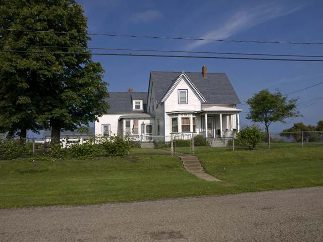
Photo: Ymblanter, via Wikimedia Commons, CC BY-SA 3.0 · Wikimedia Commons
Local history sources: en.wikipedia.org · en.wikipedia.org · conneautohio.us · en.wikipedia.org · en.wikipedia.org · en.wikipedia.org · commons.wikimedia.org
Historic places
6 places in Conneaut on the National Register of Historic Places. Press a pin or a name for its whole record.
-
Cleveland Hotel, TheBuilding · Conneaut · listed 2007
- Address
- 230-238 State St.
- Where
- Conneaut, Ashtabula County · ZIP 44030
- What it is
- Building
- Listed on the National Register
- 2007
- NRIS reference number
- 07001294
- Coordinates
- 41.94621, -80.55523
National Register file (NPS) ↗ Search Wikipedia ↗ Street map and directions ↗ On the Cracked Buckeye map
-
Conneaut Light Station Keeper's DwellingBuilding · Conneaut · listed 1992
- Address
- 1059 Harbor St.
- Where
- Conneaut, Ashtabula County · ZIP 44030
- What it is
- Building
- Listed on the National Register
- 1992
- NRIS reference number
- 92001078
- Coordinates
- 41.96691, -80.55183
National Register file (NPS) ↗ Search Wikipedia ↗ Street map and directions ↗ On the Cracked Buckeye map
-
Cummins, David, Octagon HouseBuilding · Conneaut · listed 1974
- Address
- 301 Liberty St.
- Where
- Conneaut, Ashtabula County · ZIP 44030
- What it is
- Building
- Listed on the National Register
- 1974
- NRIS reference number
- 74001394
- Coordinates
- 41.94117, -80.55695
National Register file (NPS) ↗ Search Wikipedia ↗ Street map and directions ↗ On the Cracked Buckeye map
-
Harwood BlockBuilding · Conneaut · listed 1978
- Address
- 246, 250, 256 Main St.
- Where
- Conneaut, Ashtabula County · ZIP 44030
- What it is
- Building
- Listed on the National Register
- 1978
- NRIS reference number
- 78002002
- Coordinates
- 41.94414, -80.55573
National Register file (NPS) ↗ Search Wikipedia ↗ Street map and directions ↗ On the Cracked Buckeye map
-
Kilpi HallBuilding · Conneaut · listed 1976
- Address
- 1025 Buffalo St.
- Where
- Conneaut, Ashtabula County · ZIP 44030
- What it is
- Building
- Listed on the National Register
- 1976
- NRIS reference number
- 76001365
- Coordinates
- 41.96539, -80.55510
National Register file (NPS) ↗ Search Wikipedia ↗ Street map and directions ↗ On the Cracked Buckeye map
-
Lake Shore And Michigan Southern Passenger DepotBuilding · Conneaut · listed 1975
- Address
- 342 Depot St.
- Where
- Conneaut, Ashtabula County · ZIP 44030
- What it is
- Building
- Listed on the National Register
- 1975
- NRIS reference number
- 75001314
- Coordinates
- 41.94983, -80.55895
National Register file (NPS) ↗ Search Wikipedia ↗ Street map and directions ↗ On the Cracked Buckeye map
Source: National Park Service, National Register of Historic Places point file. The listing year is shown where NPS's certification date agrees with the listing's reference number. Listing recognizes significance; it does not restrict a private owner.
Water
Lake Erie The water here
- Conneaut95% of residentsLake Erie
- Aqua Ohio - Ashtabula5% of residentsLake Erie
Hospitals, fire stations and more
Inside Conneaut's boundary: 1 hospital, 1 nursing home, 2 fire and EMS stations, 4 public schools, 2 poor-rated bridges, 1 library, 2 museums, 1 police station, 1 public charging site, 2 Superfund sites, 12 Toxics Release Inventory facilities and 16 spill cases. Press a pin or a name for its whole record and its source.
Hospitals (1)
-
Uh Conneaut Medical CenterGeneral hospital · Conneaut
- What it is
- General hospital
- Address
- 158 W Main Road, Conneaut, OH 44030
- County
- Ashtabula County
- Beds
- 25
- Helipad
- Yes
- Ownership
- Non-profit
- Medicare overall rating
- 4 of 5 stars
- Emergency department (Medicare)
- Yes
- Medicare reports it as
- University Hospitals Conneaut Medical Center
- Phone
- (440) 593-1131
- Medicare ID
- 361308
Medicare Care Compare ↗ Where HIFLD got this record ↗ HIFLD hospitals (source) ↗ Street map and directions ↗
Source: HIFLD hospitals inventory via FEMA (closed hospitals it still lists left out, hospitals opened since added), with Medicare Care Compare ratings matched by name and address.
Nursing homes (1)
-
Lake Pointe Rehabilitation and Nursing Center3 of 5 stars · Conneaut
- Address
- 22 Parrish Road, Conneaut, OH 44030
- Certified beds
- 74
- Residents on an average day
- 57
- Medicare overall rating
- 3 of 5 stars
- Health inspections
- 3 of 5 stars
- Staffing
- 1 of 5 stars
- Quality measures
- 5 of 5 stars
- Penalties since 2023
- none
- Ownership
- For profit - Corporation
- Chain
- AOM HEALTHCARE
- Takes
- Medicare and Medicaid
- Phone
- (440) 593-6266
- Medicare ID
- 365441
Medicare Care Compare ↗ CMS nursing home data (source) ↗ Street map and directions ↗
Source: CMS Care Compare nursing home provider and penalties files; Medicare star ratings run 1 to 5.
Fire and EMS stations (2)
-
Conneaut Fire Department Station 1Conneaut
- Address
- 294 Main Street, Conneaut, OH 44030
- Coordinates
- 41.94299, -80.55704
USGS National Map structures (source) ↗ Street map and directions ↗
-
Conneaut Fire Department Station 3Conneaut
- Address
- 392 Middle Road, Conneaut, OH 44030
- Coordinates
- 41.93928, -80.54235
USGS National Map structures (source) ↗ Street map and directions ↗
Source: USGS National Map structures (most Ohio records last updated 2019 to 2022), checked against the Columbus and Cleveland station lists. The department that answers a call is set by jurisdiction and mutual aid, not by distance.
Public schools (4)
-
Conneaut High School2.5 of 5 stars · Conneaut
- Address
- 381 Mill St, Conneaut, OH 44030
- School district
- Conneaut Area City School District
- Kind (NCES)
- Regular School
- Students, 2023-24
- 396
- Teachers (full-time equivalent)
- 26.5
- Report card, 2025-26
- 2.5 of 5 stars
- Performance index
- 70.4%
- Four-year graduation rate
- 88.3%
- Ohio building IRN
- 007211
- NCES school ID
- 390438100747
NCES school record ↗ Ohio School Report Card ↗ Street map and directions ↗
-
Conneaut Middle School4 of 5 stars · Conneaut
- Address
- 230 Gateway Avenue, Conneaut, OH 44030
- School district
- Conneaut Area City School District
- Kind (NCES)
- Regular School
- Students, 2023-24
- 367
- Teachers (full-time equivalent)
- 24
- Report card, 2025-26
- 4 of 5 stars
- Performance index
- 73.2%
- Ohio building IRN
- 032813
- NCES school ID
- 390438100750
NCES school record ↗ Ohio School Report Card ↗ Street map and directions ↗
-
Gateway Elementary School4 of 5 stars · Conneaut
- Address
- 229 Gateway Av, Conneaut, OH 44030
- School district
- Conneaut Area City School District
- Kind (NCES)
- Regular School
- Students, 2023-24
- 349
- Teachers (full-time equivalent)
- 21
- Report card, 2025-26
- 4 of 5 stars
- Performance index
- 75.3%
- Ohio building IRN
- 000388
- NCES school ID
- 390438105273
NCES school record ↗ Ohio School Report Card ↗ Street map and directions ↗
-
Lakeshore Primary Elementary School1 of 5 stars · Conneaut
- Address
- 755 Chestnut St, Conneaut, OH 44030
- School district
- Conneaut Area City School District
- Kind (NCES)
- Regular School
- Students, 2023-24
- 458
- Teachers (full-time equivalent)
- 26
- Report card, 2025-26
- 1 of 5 stars
- Ohio building IRN
- 000389
- NCES school ID
- 390438105274
NCES school record ↗ Ohio School Report Card ↗ Street map and directions ↗
Source: NCES EDGE public school locations 2024-25 and Common Core of Data 2023-24 (type, students, teachers); Ohio School Report Cards 2025-26 (Department of Education and Workforce), matched by name within the district.
Bridges rated poor (2)
-
Middle Road over Conneaut CreekPoor · built 1868
- Condition
- Poor: a deck, superstructure, substructure or culvert rated 4 or below on the 0 to 9 scale
- What it is
- Bridge
- Built
- 1868
- Length
- 42 ft
- Owner
- County
- Vehicles a day
- 100
- Coordinates
- 41.90190, -80.54663
National Bridge Inventory (source) ↗ Street map and directions ↗
-
Old Main Road over Conneaut CreekPoor · built 1909
- Condition
- Poor: a deck, superstructure, substructure or culvert rated 4 or below on the 0 to 9 scale
- What it is
- Bridge
- Built
- 1909
- Length
- 43 ft
- Owner
- City
- Vehicles a day
- 600
- Coordinates
- 41.94360, -80.55067
National Bridge Inventory (source) ↗ Street map and directions ↗
Source: FHWA National Bridge Inventory 2025. "Poor" means one major part rated 4 or below on the 0 to 9 scale; it calls for repair, not closing, unless the state posts or closes the bridge.
Public libraries (1)
-
Conneaut Public LibraryCentral library · Conneaut
- Address
- 304 Buffalo Street, Conneaut, OH 44030
- What it is
- Central library
- Library system
- Conneaut Public Library
- Open
- 2,080 hours a year, 52 weeks
- Building
- 16,200 sq ft
- System's visits, FY2024
- 35,100
- System's loans, FY2024
- 79,122
- People the system serves
- 13,950
- Phone
- (440) 795-5026
IMLS Public Libraries Survey (source) ↗ Street map and directions ↗
Source: IMLS Public Libraries Survey FY2024 (outlets and their systems). Any Ohio resident can get a free card at any Ohio public library.
Museums, historical societies, gardens and zoos (2)
-
Conneaut Historical RailroadHistorical society · Conneaut
- What it is
- Historical society
- City
- Conneaut
- Coordinates
- 41.94883, -80.56362
Search Wikipedia ↗ IMLS Museum Data Files (source) ↗ Street map and directions ↗
The museum list is IMLS's 2018 file; a museum may have closed or moved since.
-
Conneaut Historical SocietyHistorical society · Conneaut
- What it is
- Historical society
- City
- Conneaut
- Coordinates
- 41.93201, -80.57918
Search Wikipedia ↗ IMLS Museum Data Files (source) ↗ Street map and directions ↗
The museum list is IMLS's 2018 file; a museum may have closed or moved since.
Source: IMLS Museum Data Files, 2018.
Police stations (1)
-
Conneaut Police DepartmentConneaut
- Address
- 294 Main Street, Conneaut, OH 44030
- Coordinates
- 41.94288, -80.55699
USGS National Map structures (source) ↗ Street map and directions ↗
Source: USGS National Map structures, police stations, corrected and completed by hand (September 2026). The department that answers a call is set by jurisdiction, not by distance.
Public EV charging (1)
-
Conneaut OH 12769649 DC fast6 DC fast · Conneaut
- Address
- 780 OH-7, Conneaut, OH 44030
- Ports
- 6 DC fast
- Plugs
- CCS, CHAdeMO
- Network
- SHELL_RECHARGE
- Hours
- 24 hours daily
- Phone
- 855-900-7584
Station Locator (NREL) ↗ Alternative Fuels Data Center (source) ↗ Street map and directions ↗
Source: NREL Alternative Fuels Data Center station list (May 2026), public and open stations, the posts at one address counted as one site.
Superfund sites (2)
-
Conneaut Drum SiteSuperfund program · Conneaut
- Address
- 506 Gore Road, Conneaut, OH 44068
- County
- Ashtabula County
- Status
- Superfund program site, not on the National Priorities List
- EPA program ID
- OH0001406693
- EPA registry ID
- 110009320430
EPA facility record ↗ EPA Facility Registry Service (source) ↗ Street map and directions ↗
-
North Kingsville LandfillSuperfund program · North Kingsville
- Address
- Off Route #20 at City Boundary, North Kingsville, OH 44068
- County
- Ashtabula County
- Status
- Superfund program site, not on the National Priorities List
- EPA program ID
- OHD980679930
- EPA registry ID
- 110009304528
EPA facility record ↗ EPA Facility Registry Service (source) ↗ Street map and directions ↗
Source: EPA Facility Registry Service, Superfund (SEMS) and National Priorities List sites. Many program sites were assessed and needed no cleanup.
Facilities reporting toxic releases (12)
-
Conneaut Leather IncToxics Release Inventory · Conneaut
- Address
- 525 West Adams Street, Conneaut, OH 44030
- County
- Ashtabula County
- Status
- Reports to the Toxics Release Inventory (active)
- EPA program ID
- 44030CNNTLWADAM
- EPA registry ID
- 110001617910
EPA facility record ↗ EPA Facility Registry Service (source) ↗ Street map and directions ↗
-
Crawford Container CoToxics Release Inventory · Conneaut
- Address
- 394 Whitney Rd., Conneaut, OH 44030
- County
- Ashtabula County
- Status
- Reports to the Toxics Release Inventory (closed)
- EPA program ID
- 44030CRWFR394WH
- EPA registry ID
- 110002110135
EPA facility record ↗ EPA Facility Registry Service (source) ↗ Street map and directions ↗
-
Crawford Container CoToxics Release Inventory · Conneaut
- Address
- 1500 Chamberlain Blvd., Conneaut, OH 44030
- County
- Ashtabula County
- Status
- Reports to the Toxics Release Inventory (active)
- EPA program ID
- 44030CRWFR1500C
- EPA registry ID
- 110002110126
EPA facility record ↗ EPA Facility Registry Service (source) ↗ Street map and directions ↗
-
Csp Innovations IncToxics Release Inventory · Conneaut
- Address
- 333 Gore Rd, Conneaut, OH 44030
- County
- Ashtabula County
- Status
- Reports to the Toxics Release Inventory (active)
- EPA program ID
- 44030TRNSP333GO
- EPA registry ID
- 110041996285
EPA facility record ↗ EPA Facility Registry Service (source) ↗ Street map and directions ↗
-
Cw Ohio, Inc. (0204020069)Toxics Release Inventory · Conneaut
- Address
- 1209 Maple Ave., Conneaut, OH 44030
- County
- Ashtabula County
- Status
- Reports to the Toxics Release Inventory (active)
- EPA program ID
- 44030CWHNC1209M
- EPA registry ID
- 110000385342
EPA facility record ↗ EPA Facility Registry Service (source) ↗ Street map and directions ↗
-
Ge Lighting Inc.Toxics Release Inventory · Conneaut
- Address
- 880 Maple Avenue, Conneaut, OH 44030
- County
- Ashtabula County
- Status
- Reports to the Toxics Release Inventory (active)
- EPA program ID
- 44030GNRLL880MA
- EPA registry ID
- 110000385351
EPA facility record ↗ EPA Facility Registry Service (source) ↗ Street map and directions ↗
-
General Aluminum Manufacturing *Toxics Release Inventory · Conneaut
- Address
- 1370 Chamberlain Blvd, Conneaut, OH 44030
- County
- Ashtabula County
- Status
- Reports to the Toxics Release Inventory
- EPA program ID
- 4403WGNRLL137CH
- EPA registry ID
- 110004725913
EPA facility record ↗ EPA Facility Registry Service (source) ↗ Street map and directions ↗
-
General Aluminum Manufacturing CoToxics Release Inventory · Conneaut
- Address
- 1043 Chamberlain Blvd, Conneaut, OH 44030
- County
- Ashtabula County
- Status
- Reports to the Toxics Release Inventory (active)
- EPA program ID
- 44030GNRLL1043C
- EPA registry ID
- 110004725904
EPA facility record ↗ EPA Facility Registry Service (source) ↗ Street map and directions ↗
-
Independent Can Co.Toxics Release Inventory · Conneaut
- Address
- 1049 Chamberlain Blvd, Conneaut, OH 44030
- County
- Ashtabula County
- Status
- Reports to the Toxics Release Inventory (***unchanged***)
- EPA program ID
- 4403WNDPND149CH
- EPA registry ID
- 110055606278
EPA facility record ↗ EPA Facility Registry Service (source) ↗ Street map and directions ↗
-
Overhead Door Conneaut PlantToxics Release Inventory · Conneaut
- Address
- 1001 Chamberlain Blvd, Conneaut, OH 44030
- County
- Ashtabula County
- Status
- Reports to the Toxics Release Inventory (active)
- EPA program ID
- 4403WVRHDD11CHA
- EPA registry ID
- 110040447521
EPA facility record ↗ EPA Facility Registry Service (source) ↗ Street map and directions ↗
-
Spartech Polycom IncToxics Release Inventory · Conneaut
- Address
- 859 Jackson St., Conneaut, OH 44030
- County
- Ashtabula County
- Status
- Reports to the Toxics Release Inventory (active)
- EPA program ID
- 44030PLYCM859JA
- EPA registry ID
- 110000385360
EPA facility record ↗ EPA Facility Registry Service (source) ↗ Street map and directions ↗
-
Vesuvius Usa Corp. - Conneaut Plant (0204020036)Toxics Release Inventory · Conneaut
- Address
- 1100 Maple Ave, Conneaut, OH 44030
- County
- Ashtabula County
- Status
- Reports to the Toxics Release Inventory (open)
- EPA program ID
- 44030XMTNC1100M
- EPA registry ID
- 110000385388
EPA facility record ↗ EPA Facility Registry Service (source) ↗ Street map and directions ↗
Source: EPA Facility Registry Service, Toxics Release Inventory reporters. Reporting a release is required of large users of listed chemicals; it is not by itself a violation.
Spills reported since 2021 (16)
-
Waste Chemical(S) Nos2025-08-06 · Conneaut
- Reported
- 2025-08-06
- What spilled
- Waste Chemical(S) Nos
- Where
- Conneaut, Ashtabula County
- Ohio EPA district office
- NEDO
- Ohio EPA case number
- 2508EPA0001328
Ohio EPA spill reports (source) ↗ Street map and directions ↗
-
Sheen Rainbow / Hydrocarbon Reached water2025-07-31 · Conneaut
- Reported
- 2025-07-31
- What spilled
- Sheen Rainbow / Hydrocarbon
- Reached a waterway
- 99 - Unnamed
- Where
- Conneaut, Ashtabula County
- Ohio EPA district office
- NEDO
- Ohio EPA case number
- 2507EPA0001289
Ohio EPA spill reports (source) ↗ Street map and directions ↗
-
Fuel Diesel / Diesel Fuel (Vehicle On Or Off Road)2025-05-21 · Conneaut
- Reported
- 2025-05-21
- What spilled
- Fuel Diesel / Diesel Fuel (Vehicle On Or Off Road)
- Where
- Conneaut, Ashtabula County
- Ohio EPA district office
- NEDO
- Ohio EPA case number
- 2505EPA0000809
Ohio EPA spill reports (source) ↗ Street map and directions ↗
-
Storm Water2025-01-18 · Conneaut
- Reported
- 2025-01-18
- What spilled
- Storm Water
- Largest amount reported
- 4,258,027 gallons
- Where
- Conneaut, Ashtabula County
- Ohio EPA district office
- NEDO
- Ohio EPA case number
- 2501EPA0000067
Ohio EPA spill reports (source) ↗ Street map and directions ↗
-
Fuel Gasoline ( 25% Ethanol Not E85)2024-12-03 · Conneaut
- Reported
- 2024-12-03
- What spilled
- Fuel Gasoline ( 25% Ethanol Not E85)
- Where
- Conneaut, Ashtabula County
- Ohio EPA district office
- NEDO
- Ohio EPA case number
- 2412EPA0001965
Ohio EPA spill reports (source) ↗ Street map and directions ↗
-
Fuel Gasoline ( 25% Ethanol Not E85)2024-11-20 · Conneaut
- Reported
- 2024-11-20
- What spilled
- Fuel Gasoline ( 25% Ethanol Not E85)
- Largest amount reported
- 200 gallons
- Where
- Conneaut, Ashtabula County
- Ohio EPA district office
- NEDO
- Ohio EPA case number
- 2411EPA0001912
Ohio EPA spill reports (source) ↗ Street map and directions ↗
-
Waste Water2024-08-04 · Conneaut
- Reported
- 2024-08-04
- What spilled
- Waste Water; Solid Waste Nos (Not Specified)
- Where
- Conneaut, Ashtabula County
- Ohio EPA district office
- NEDO
- Ohio EPA case number
- 2408EPA0001341
Ohio EPA spill reports (source) ↗ Street map and directions ↗
-
Tires2024-03-30 · Conneaut
- Reported
- 2024-03-30
- What spilled
- Tires
- Where
- Conneaut, Ashtabula County
- Ohio EPA district office
- NEDO
- Ohio EPA case number
- 2403EPA0000499
Ohio EPA spill reports (source) ↗ Street map and directions ↗
-
Oil Hydraulic Fluid(S) Reached water2023-07-22 · Conneaut
- Reported
- 2023-07-22
- What spilled
- Oil Hydraulic Fluid(S)
- Reached a waterway
- Lake Erie
- Where
- Conneaut, Ashtabula County
- Ohio EPA district office
- NEDO
- Ohio EPA case number
- 2307EPA0001245
Ohio EPA spill reports (source) ↗ Street map and directions ↗
-
Sheen Rainbow / Hydrocarbon Reached water2023-01-08 · Conneaut
- Reported
- 2023-01-08
- What spilled
- Sheen Rainbow / Hydrocarbon
- Reached a waterway
- Lake Erie
- Where
- Conneaut, Ashtabula County
- Ohio EPA district office
- NEDO
- Ohio EPA case number
- 2301EPA0000046
Ohio EPA spill reports (source) ↗ Street map and directions ↗
-
Oil Hydraulic Fluid(S)2022-08-03 · Conneaut
- Reported
- 2022-08-03
- What spilled
- Oil Hydraulic Fluid(S); Other / All Other / Trade Name / Mixture / Solution Etc
- Largest amount reported
- 100 gallons
- Where
- Conneaut, Ashtabula County
- Ohio EPA district office
- NEDO
- Ohio EPA case number
- 2208EPA0001170
Ohio EPA spill reports (source) ↗ Street map and directions ↗
-
Fuel Diesel / Diesel Fuel (Vehicle On Or Off Road)2022-05-26 · Conneaut
- Reported
- 2022-05-26
- What spilled
- Fuel Diesel / Diesel Fuel (Vehicle On Or Off Road)
- Largest amount reported
- 125 gallons
- Where
- Conneaut, Ashtabula County
- Ohio EPA district office
- NEDO
- Ohio EPA case number
- 2205EPA0000773
Ohio EPA spill reports (source) ↗ Street map and directions ↗
-
Oil Hydraulic Fluid(S)2021-08-30 · Conneaut
- Reported
- 2021-08-30
- What spilled
- Oil Hydraulic Fluid(S); Oil Petroleum Not Otherwise Specified (Nos)
- Largest amount reported
- 250 gallons
- Where
- Conneaut, Ashtabula County
- Ohio EPA district office
- NEDO
- Ohio EPA case number
- 2108EPA0001363
Ohio EPA spill reports (source) ↗ Street map and directions ↗
-
Sheen Rainbow / Hydrocarbon Reached water2021-07-23 · Conneaut
- Reported
- 2021-07-23
- What spilled
- Sheen Rainbow / Hydrocarbon
- Reached a waterway
- 04 - Lake Erie
- Where
- Conneaut, Ashtabula County
- Ohio EPA district office
- NEDO
- Ohio EPA case number
- 2107EPA0001117
Ohio EPA spill reports (source) ↗ Street map and directions ↗
-
Fuel Diesel / Diesel Fuel (Vehicle On Or Off Road)2021-01-20 · Conneaut
- Reported
- 2021-01-20
- What spilled
- Fuel Diesel / Diesel Fuel (Vehicle On Or Off Road)
- Where
- Conneaut, Ashtabula County
- Ohio EPA district office
- NEDO
- Ohio EPA case number
- 2101EPA0000076
Ohio EPA spill reports (source) ↗ Street map and directions ↗
-
Fuel Diesel / Diesel Fuel (Vehicle On Or Off Road) Reached water2021-01-20 · Conneaut
- Reported
- 2021-01-20
- What spilled
- Fuel Diesel / Diesel Fuel (Vehicle On Or Off Road)
- Largest amount reported
- 20 gallons
- Reached a waterway
- 99 - Unnamed
- Where
- Conneaut, Ashtabula County
- Ohio EPA district office
- NEDO
- Ohio EPA case number
- 2101EPA0000075
Ohio EPA spill reports (source) ↗ Street map and directions ↗
Source: Ohio EPA emergency response spill reports, 2021 to September 2026, one point per case where Ohio EPA placed it. A report is what the caller or responder recorded; amounts are often blank or estimated.
Its ZIP codes
Each ZIP code that touches Conneaut, with the share of its residents who live here and the same headline figures as the ZIP page.
| ZIP | Share | Water | Radon | Home value | Schools | Flood |
|---|---|---|---|---|---|---|
| 44030 Conneaut | 78% | Lake Erie | 4.7 pCi/L average radon | Parcel list only | Conneaut Area City · 3 stars overall | 2.9% of residents in the 1% floodplain |
Local government
Who holds office in Conneaut, how its elections and ballot issues came out, and the state auditor's record.
Money issues on the ballot since 2022: 2 of 4 passed.
Ballot issues
| Date | Issue | For | Against | Result |
|---|---|---|---|---|
| 2023-11-07 | 36: 36 Conneaut City 1.9M Library Exp (1.9 mills) | 1,721 | 1,371 | Passed (55.66% for) |
| 2023-11-07 | 37: 37 Conneaut City 2.75M Roads (2.75 mills) | 1,823 | 1,276 | Passed (58.83% for) |
| 2023-05-02 | 17: 17 Conneaut City 4.75M Roads (4.75 mills) | 367 | 518 | Failed (41.47% for) |
| 2022-11-08 | 8: 8 Conneaut City Roads+Bridges 4.75 Mills (4.75 mills) | 1,528 | 1,705 | Failed (47.26% for) |
Elections for office
| Date | Office | Candidates and votes |
|---|---|---|
| 2023-11-07 | President of Council | Terry A. Moisio Jr. 2,512, 100.0% |
| 2023-11-07 | Member of Council, Ward 4 | Nic Church 382, 100.0% |
| 2023-11-07 | Member of Council, Ward 3 | Oakey Emery 751, 100.0% |
| 2023-11-07 | Member of Council, Ward 2 | Chris A. Castrilla 781, 100.0% |
| 2023-11-07 | Member of Council, Ward 1 | Richard Gaugh 496, 100.0% |
| 2023-11-07 | Member of Council at Large | Mariana Branch 1,433, 42.4%; Nicholas Perkoski 1,947, 57.6% |
| 2019-11-05 | President of Council | Jon J. Arcaro 2,081, 100.0% |
| 2019-11-05 | Member of Council, Ward 4 | Thomas E. Kozesky 325, 100.0% |
| 2019-11-05 | Member of Council, Ward 3 | Joseph Emery 678, 100.0% |
| 2019-11-05 | Member of Council, Ward 2 | Terry A. Moisio Jr. 692, 100.0% |
| 2019-11-05 | Member of Council, Ward 1 | Richard L. Gaugh 380, 100.0% |
| 2019-11-05 | Member of Council at Large | Angel McVoy 1,611, 51.75%; Tammy Ledford 1,502, 48.25% |
Winners in bold. Results from the county board of elections' official canvass unless marked.
Auditor of State record
- No fiscal caution, watch or emergency on the Auditor of State's lists.
- Financial Health Indicators (the Auditor of State's 17 measures; critical / cautionary / positive): 2020 1 / 2 / 14; 2021 1 / 5 / 11; 2022 0 / 1 / 16; 2023 1 / 4 / 12; 2024 2 / 4 / 11; 2025 5 / 4 / 7.
- OP&F Examination, 2024, released 2026-05-07
- Financial Audit, 2024, released 2025-12-11
- Financial Audit, 2023, released 2024-08-06
The county
Ashtabula County: 15 ZIP codes, 38 cities, villages and townships, 98,190 people.
Nearby places
Rain and snow
How much has actually fallen on Conneaut, day by day, from 1893 to now. Daily totals, not averages.
- rain, last 30 days
- 0.99 in
- 2026-09-29 to 2026-10-28
- rain so far in 2026
- 32.0 in
- 4.6 in below normal for the date
- snow so far in 2026
- 55.8 in
- a normal year brings 93.5 in
- a normal year
- 44.1 in
- average of 30 years, 1991-2020
| Month | Rain (in) | Snow (in) | Days counted |
|---|---|---|---|
| October 2026 | 0.97 | — | 28 |
| September 2026 | 3.07 | — | 30 |
| August 2026 | 6.00 | — | 31 |
| July 2026 | 2.66 | — | 31 |
| June 2026 | 3.44 | — | 30 |
| May 2026 | 4.02 | — | 31 |
| April 2026 | 4.69 | 0.0 | 30 |
| March 2026 | 4.21 | 5.9 | 31 |
| February 2026 | 0.64 | 12.5 | 28 |
| January 2026 | 2.35 | 37.4 | 31 |
| December 2025 | 3.33 | 29.7 | 31 |
| November 2025 | 2.18 | 12.4 | 30 |
| Wettest year | 2011 — 61.4 in |
|---|---|
| Driest year | 1963 — 27.8 in |
| Snowiest year | 1916 — 142.8 in |
| Wettest day on record | 14 October 1893 — 4.31 in |
| Heaviest snowfall in a day | 12 December 1944 — 17.32 in |
| Deepest snow on the ground | 18 February 1910 — 40.00 in |
Estimated, not measured. No rain gauge has ever stood inside Conneaut, so every figure here is worked out from the gauges around it - the nearest ones weighted most. Treat them as close estimates rather than readings.
48,878 days of records, 1893-01-01 to 2026-10-28. Source: NOAA NCEI GHCN-Daily, 3,240 gauges in and around Ohio. A day is "gauged" when a gauge standing inside the boundary reported it, and the value is the mean of those gauges. Otherwise it is interpolated by inverse distance from every gauge reporting within 50 miles. Nothing is carried forward, back-filled or smoothed. Against NOAA nClimDiv county monthly precipitation over 136,848 complete county-months (checked 2026-10-31): correlation 0.9515, median absolute difference 0.217 in a month. Built 2026-10-31 from the Cracked Buckeye precipitation archive. Snow is the softer number — snowfall is measured by hand with a ruler, no agency publishes a gridded county snowfall series, and blowing snow defeats every observer.
Environmental permits and filings
What Ohio EPA has on file for Conneaut: permits, inspections, violations, cleanups and the state loans behind sewer and water work. Every line links to the agency's own document.
- facilities and sites on file
- 41
- those placed on the map inside Conneaut
| Program | Facilities and sites |
|---|---|
| Hazardous waste | 10 |
| Air pollution | 6 |
| Wastewater and stormwater discharge | 6 |
| Site assessment | 5 |
| Sewer and water-line construction | 4 |
| State sewer loans | 4 |
| Contaminated-site cleanup | 3 |
| Composting | 1 |
| Public drinking water | 1 |
| Underground injection wells | 1 |
| Date | Facility or site | What |
|---|---|---|
| CONNEAUT CITY PWS | Public drinking water inspection | |
| CONNEAUT CITY PWS | Public drinking water monitoring results | |
| CONNEAUT CITY PWS | Public drinking water inspection | |
| CSP OF OHIO LLC | Air pollution permit | |
| CONNEAUT CLARK #1672 | Underground injection wells inspection | |
| CONNEAUT CLARK #1672 | Underground injection wells monitoring results | |
| CSP OF OHIO LLC | Air pollution permit | |
| PITTSBURGH & CONNEAUT DOCK CO | Wastewater and stormwater discharge report | |
| CSP OF OHIO LLC | Air pollution permit | |
| CONNEAUT CITY PWS | Public drinking water monitoring results | |
| CW OHIO, INC. | Air pollution compliance letter | |
| PITTSBURGH & CONNEAUT DOCK CO | Wastewater and stormwater discharge report | |
| CW OHIO INC | Air pollution permit | |
| VESUVIUS USA CORP. - CONNEAUT PLANT | Wastewater and stormwater discharge permit | |
| PITTSBURGH & CONNEAUT DOCK CO | Wastewater and stormwater discharge report | |
| CW OHIO INC | Air pollution permit | |
| CONNEAUT COMPOSTING FACILITY | Composting report | |
| CONNEAUT CITY PWS | Public drinking water monitoring results | |
| CONTINENTAL STRUCTURAL PLASTICS OF OHIO LLC AKA CSP OH | Air pollution compliance letter | |
| FORMER SERVICE STATION | Hazardous waste compliance letter | |
| CONNEAUT CITY PWS | Public drinking water notice of violation | |
| CONNEAUT CITY PWS | Public drinking water compliance letter | |
| CONNEAUT CITY PWS | Public drinking water monitoring results | |
| CW OHIO INC | Air pollution permit | |
| PITTSBURGH & CONNEAUT DOCK CO | Wastewater and stormwater discharge report |
Source: Ohio EPA eDocument portal (edocpub.epa.ohio.gov), indexed 2026-10-14. Facilities are placed on the map from Ohio EPA's own map layers, EPA's Facility Registry, coordinates written in the filings, or a geocoded street address. A permit filed under a private person's name (most are household septic systems) is counted but never named, placed or linked; licenses for individual workers and open-burning notices are left out entirely.
Quick answers
What county is Conneaut, Ohio in?
Conneaut is a city in Ashtabula County, Ohio, with 12,318 residents.
When was Conneaut, Ohio founded?
Conneaut was settled 1796 (survey landing), 1798 (permanent settlement); incorporated 1832 (village), 1898 (city). Founders on record: Connecticut Land Company survey party under Moses Cleaveland. Source
How did Conneaut, Ohio get its name?
Conneaut's name comes from the Seneca language; Wikipedia describes the meaning as disputed, while Henry Howe's 1852 county history gives the confident contemporary gloss "many fish," the same general sense attached to neighboring Ashtabula. Source
What ZIP code is Conneaut, Ohio?
Most of Conneaut is in ZIP code 44030.
Where does Conneaut, Ohio get its water?
The main water source for Conneaut (Conneaut): Lake Erie.
Cite this page
Cite this page as:
Cracked Buckeye, "Conneaut, Ashtabula County", https://crackedbuckeye.com/place/conneaut/, built 2026-10-31, accessed [date].
How to cite · Report a correction · Built 2026-10-31
