Local events in Clay Township, Highland County
Nothing is posted for Clay Township itself yet; here is what is on within 20 miles. All local events in Clay Township, Highland County
Know a calendar we should watch? Send the link
Checked October 20; the events page is refreshed daily.
How Clay Township, Highland County began
Clay Township was organized December 5, 1831 out of parts of Whiteoak and Salem townships, in the southwestern corner of Highland County along the Brown County line. Its only community is Buford, platted in August 1834 by Robert Lindsley and named for the maiden name of a first settler's wife; a second, smaller plat called Sicily was laid out there in June 1848 by John N. Huggins and later faded to a place name. The township's ground lies in the Virginia Military District, drained by the north fork of Whiteoak Creek, and was Shawnee, Wyandot and Miami hunting ground before Ohio settlement. It remains rural today, with a 2020 population of 1,499 centered on Buford.
Platted 1834 (Buford), incorporated December 5, 1831 (township organized), by Township organized from Whiteoak and Salem townships; Buford platted by Robert Lindsley, August 1834.
Where the name comes from
The township was named for the Kentucky statesman Henry Clay, 'Harry of the West,' then the idol of Ohio's Whigs, according to the 1902 county history. Buford, the township's community, was named after the maiden name of the wife of one of its first settlers.
Before the town
No mounds, villages, trails or treaty boundary lines specific to Clay Township are recorded in the sources searched. The 1878 county history describes the whole of Highland County, this township included, as having been common hunting ground for the Shawnee, Wyandot and Miami before white settlement, writing of 'the fierce Shawnee, Wyandot and Miami Indians roaming over the county as their common hunting ground' at the time of the county's 1805 organization. The township lies within the Virginia Military District, land set aside by Virginia for Revolutionary War veterans; Ohio south of the Greenville Treaty line, including this area, was ceded by the Wyandot, Shawnee, Lenape (Delaware), Ottawa, and other nations under the Treaty of Greenville (1795). No specific mound, earthwork, camp, or named village within Clay Township itself is documented in the sources consulted; Fort Hill and other Hopewell-era sites lie elsewhere in the county.
Nations recorded here: Shawnee, Wyandot, Miami.
Timeline
- — The Treaty of Greenville cedes most of southern and central Ohio, including the future Highland County, from the Wyandot, Shawnee, Lenape and other nations to the United States.
- — Highland County is organized, carved from Ross, Adams, and Clermont counties.
- — Clay Township is organized on December 5, formed out of Whiteoak and Salem townships.
- — Buford is platted in August by proprietor Robert Lindsley.
- — Sicily is platted in June by proprietor John N. Huggins, and a post office is established there that month with John N. Huggins as postmaster.
- — John Bell and Jacob Burns are recorded as the sitting justices of the peace for Clay Township, and James Brown and Henry Ruble are named as the township's representatives to gather local history for the county's centennial history.
- — The Hirons-Brown House, southwest of Buford on Buford-Bardwell Road, is listed on the National Register of Historic Places on December 12.
- — The U.S. Census records Clay Township's population at 1,499, with Buford (population 306) its only community.
Stories
Two plats, a generation apart
Clay Township's map carries the marks of two separate town-building efforts. In August 1834, Robert Lindsley laid out Buford at the crossroads that would become the township's center, on ground where routes to Lynchburg, Sardinia, Hillsboro and Mowrystown converge. Fourteen years later, in June 1848, John N. Huggins platted a second small community, Sicily, elsewhere in the township, and the federal government approved a post office there that same month with Huggins as postmaster. Buford grew into the township's lasting hub - it still anchors the 2020 census count of 1,499 - while Sicily faded to little more than a name on old plat and postal records, the fate of many small 19th-century Ohio paper towns that lost the race for a rail line or a county road.
A house that survived the boundary line
The Hirons-Brown House sits southwest of Buford on Buford-Bardwell Road, close enough to the Brown County line that its 45154 mailing ZIP is centered on Mount Orab, a Brown County village. That postal overlap has caused confusion about which county the house belongs to, but the property itself, and the road it sits on, lie inside Clay Township, Highland County, and it was listed on the National Register of Historic Places on December 12, 1976 on that basis. It is one of only a handful of National Register listings in the rural southwestern townships of Highland County, most of the county's register entries clustering instead around Hillsboro, Greenfield and the county's larger villages.
Photographs
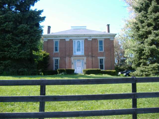
Photo: Aesopposea, via Wikimedia Commons, CC BY-SA 3.0 · Wikimedia Commons
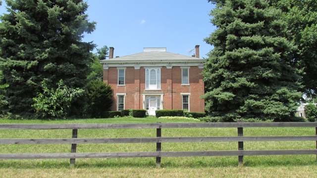
Photo: Aesopposea, via Wikimedia Commons, CC BY-SA 3.0 · Wikimedia Commons
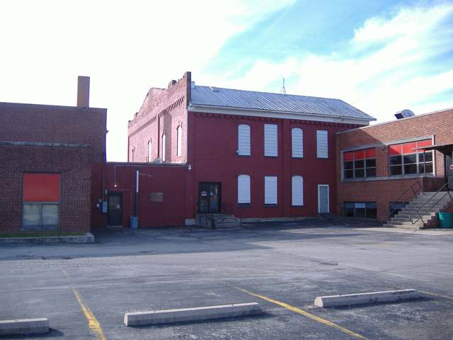
Photo: Aesopposea, via Wikimedia Commons, CC BY-SA 3.0 · Wikimedia Commons
Local history sources: en.wikipedia.org · en.wikipedia.org · en.wikipedia.org · en.wikipedia.org · en.wikipedia.org · en.wikipedia.org · en.wikipedia.org · npgallery.nps.gov · archive.org · archive.org · commons.wikimedia.org · commons.wikimedia.org · commons.wikimedia.org · archive.org
Historic places
1 place in Clay Township, Highland County on the National Register of Historic Places. Press a pin or a name for its whole record.
-
Hirons-Brown HouseBuilding · Buford · listed 1976
- Address
- SW of Buford on Guernsey Rd.
- Where
- Buford, Highland County · ZIP 45154
- What it is
- Building
- Listed on the National Register
- 1976
- NRIS reference number
- 76001455
- Coordinates
- 39.06410, -83.86436
National Register file (NPS) ↗ Search Wikipedia ↗ Street map and directions ↗ On the Cracked Buckeye map
Source: National Park Service, National Register of Historic Places point file. The listing year is shown where NPS's certification date agrees with the listing's reference number. Listing recognizes significance; it does not restrict a private owner.
Water
Mostly private wells The water here
- Mount Orab Village36% of residentsSterling Run (reservoirs)
- Waynoka Regional Water and Sewer Dist29% of residentsLake Waynoka / Sycamore Run reservoirs
- Sardinia Village27% of residentsOhio River Valley Aquifer (wells)
- Western Water Company4% of residentsLittle Miami River valley wells (51%) plus Cincinnati Ohio River water (49%)
- Lynchburg Village3% of residentsGroundwater wells (3 wells)
Hospitals, fire stations and more
Inside Clay Township, Highland County's boundary: 1 fire or EMS station, 2 power plants and 4 spill cases. Press a pin or a name for its whole record and its source.
Fire and EMS stations (1)
-
Mount Orab Fire Department Station 67Mount Orab
- Address
- 2861 State Highway 134, Mount Orab, OH 45154
- Coordinates
- 39.08001, -83.84504
USGS National Map structures (source) ↗ Street map and directions ↗
Source: USGS National Map structures (most Ohio records last updated 2019 to 2022), checked against the Columbus and Cleveland station lists. The department that answers a call is set by jurisdiction and mutual aid, not by distance.
Power plants (2)
-
Hecate Energy Highland LLC 100 MW or moreSolar · 300 MW
- Capacity
- 300 MW
- Main source
- Solar
- Technology
- Solar Photovoltaic
- Operator
- Hecate Energy Highland LLC
- Sector
- IPP Non-CHP
- Where
- Buford, Highland County
- Generating units
- 1
- Built
- 2024
- EIA plant code
- 62670
EIA plant page ↗ EIA-860 (source) ↗ Street map and directions ↗
-
New Market Solar 100 MW or moreSolar · 100 MW
- Capacity
- 100 MW
- Main source
- Solar
- Technology
- Solar Photovoltaic
- Operator
- New Market Solar
- Sector
- IPP Non-CHP
- Where
- Sardinia, Highland County
- Generating units
- 2
- Built
- 2023 (first unit); newest unit 2024
- EIA plant code
- 64853
EIA plant page ↗ EIA-860 (source) ↗ Street map and directions ↗
Source: EIA-860 power plant inventory via HIFLD (February 2025), with plant codes, units and years from EIA-860 2025.
Spills reported since 2021 (4)
-
Bentonite / Drilling Mud2023-06-26 · Clay Twp
- Reported
- 2023-06-26
- What spilled
- Bentonite / Drilling Mud
- Largest amount reported
- 65 gallons
- Where
- Clay Twp, Brown County
- Ohio EPA district office
- SWDO
- Ohio EPA case number
- 2306EPA0001050
Ohio EPA spill reports (source) ↗ Street map and directions ↗
-
Other / All Other / Trade Name / Mixture / Solution Etc2023-06-07 · Clay Twp
- Reported
- 2023-06-07
- What spilled
- Other / All Other / Trade Name / Mixture / Solution Etc
- Where
- Clay Twp, Highland County
- Ohio EPA district office
- SWDO
- Ohio EPA case number
- 2306EPA0000943
Ohio EPA spill reports (source) ↗ Street map and directions ↗
-
Fuel Diesel / Diesel Fuel (Vehicle On Or Off Road) Reached water2021-12-27 · Clay Twp
- Reported
- 2021-12-27
- What spilled
- Fuel Diesel / Diesel Fuel (Vehicle On Or Off Road)
- Reached a waterway
- 99 - Unnamed
- Where
- Clay Twp, Highland County
- Ohio EPA district office
- SWDO
- Ohio EPA case number
- 2112EPA0001913
Ohio EPA spill reports (source) ↗ Street map and directions ↗
-
Material Blue2026-03-25 · Clay Twp
- Reported
- 2026-03-25
- What spilled
- Material Blue
- Where
- Clay Twp, Highland County
- Ohio EPA district office
- SWDO
- Ohio EPA case number
- 2603EPA0000481
Ohio EPA spill reports (source) ↗ Street map and directions ↗
Source: Ohio EPA emergency response spill reports, 2021 to September 2026, one point per case where Ohio EPA placed it. A report is what the caller or responder recorded; amounts are often blank or estimated.
Its ZIP codes
Each ZIP code that touches Clay Township, Highland County, with the share of its residents who live here and the same headline figures as the ZIP page.
| ZIP | Share | Water | Radon | Home value | Schools | Flood |
|---|---|---|---|---|---|---|
| 45171 Sardinia | 16% | Mostly private wells | 3.2 pCi/L average radon | Appraisal records without year built | Eastern Local · 4 stars overall | 1.4% of residents in the 1% floodplain |
| 45154 Mount Orab | 5% | Sterling Run (reservoirs) | 3.2 pCi/L average radon | Appraisal records without year built | Western Brown Local · 3.5 stars overall | 3.4% of residents in the 1% floodplain |
| 45142 Lynchburg | 1% | Mostly private wells | 4.0 pCi/L average radon | Appraisal records without year built | Lynchburg-Clay Local · 4 stars overall | 1.7% of residents in the 1% floodplain |
The county
Brown County: 11 ZIP codes, 25 cities, villages and townships, 39,201 people.
Nearby places
Quick answers
What county is Clay Township, Ohio in?
Clay Township, Highland County is a township in Brown County, Ohio, with 1,499 residents.
When was Clay Township, Ohio founded?
Clay Township, Highland County was laid out 1834 (Buford); incorporated December 5, 1831 (township organized). Founders on record: Township organized from Whiteoak and Salem townships; Buford platted by Robert Lindsley, August 1834. Source
How did Clay Township, Ohio get its name?
The township was named for the Kentucky statesman Henry Clay, 'Harry of the West,' then the idol of Ohio's Whigs, according to the 1902 county history. Source
What ZIP code is Clay Township, Ohio?
Clay Township, Highland County is served by ZIP codes 45171 and 45154; 45171 holds the largest share of its residents.
Where does Clay Township, Ohio get its water?
The main water source for Clay Township, Highland County (Mount Orab Village): Mostly private wells.
Cite this page
Cite this page as:
Cracked Buckeye, "Clay Township, Highland County", https://crackedbuckeye.com/place/clay-township-highland-county/, built 2026-10-31, accessed [date].
How to cite · Report a correction · Built 2026-10-31
