Local events in Bettsville
Nothing is posted for Bettsville itself yet; here is what is on within 10 miles. All local events in Bettsville
Know a calendar we should watch? Send the link
Checked October 20; the events page is refreshed daily.
How Bettsville began
Bettsville was laid out in 1838 by its founder, John Betts, in what became Liberty Township in northwestern Seneca County. Its population peaked at 833 in 1970 and was 595 in 2020. Its best-known native son is James A. Norton, born there in 1843, who went on to serve three terms in the US House of Representatives after careers in medicine, law and Ohio state politics.
Settled 1838, platted 1838-04-12, incorporated 1883-02-20 (petition granted; first election April 21, 1883), by John Betts, surveyed by James Durbin.
Where the name comes from
Named for its founder, John Betts, who laid out the village in 1838.
Before the town
No Native American village, mound, trail, or treaty site specific to Bettsville itself is documented in the sources checked; the village was not laid out until 1838.
Timeline
- — John Betts lays out the village of Bettsville, naming it for himself.
- — Daniel Martin and his brother Peter build the first house in Bettsville, the year John Betts has the village surveyed on the south side of the West Branch of Wolf Creek.
- — James A. Norton is born in Bettsville on November 11; he later practices medicine and law, serves in the Ohio House and as a railroad commissioner, and represents Ohio's 13th district in the US House of Representatives from 1897 to 1903.
- — A Methodist quarterly conference of the Port Clinton District sets off the area around Swope's Corners and Bettsville as a mission; the circuit later takes the Bettsville name and a church is begun there in 1864.
- — Daniel Betts' addition to the village is surveyed, the first of several additions made by members of the founding family through 1873.
- — The Anchor Mills, a brick flour mill with five run of stone, are built at Bettsville by Betts & Miller Brothers at a cost of about $20,000.
- — A great fire destroys one of Bettsville's finest business blocks, owned by John Betts and others; it is never rebuilt.
- — Joseph Powell Post No. 174, Grand Army of the Republic, is organized at Bettsville and named for a soldier of the 101st Ohio Volunteer Infantry who died of wounds received in the Atlanta campaign.
- — The county commissioners grant a petition filed December 11, 1882, to incorporate Bettsville; at the first village election on April 21, 1883, Moses Heffner is chosen mayor.
- — Bettsville's business directory lists a flour mill, a stave and hoop works making about 30,000 staves a day, coopers, a tile works, a limekiln, a weekly newspaper (the Enterprise), physicians and general stores.
- — The village has a bank, a telephone company, a concrete block company, nearby stone quarries, the weekly Bettsville Vidette, and a station on the Pennsylvania railroad; James H. Davidson is mayor.
- — Bettsville's population falls to 451, its low point since the 1880 census count of 515, before rising to 656 in 1930.
- — Bettsville's population peaks at 833 residents.
- — On October 15, Ohio Governor Jim Rhodes visits Bettsville, photographed there by the Fremont News Messenger.
- — The 2020 census counts 595 residents in Bettsville, down from the 833 of 1970.
Stories
A small village's congressman
James A. Norton was born in Bettsville in 1843, in a village barely five years old at the time, and built a career that ranged far beyond it: twelve years practicing medicine, admission to the bar in 1879, six years in the Ohio House of Representatives, a stint chairing the state Democratic committee, and six years as a railroad commissioner. In 1896 he was elected to Congress from Ohio's 13th district, serving three terms in Washington from 1897 to 1903 before losing reelection.
The mills and coopers of Wolf Creek
Bettsville grew up on the south bank of the West Branch of Wolf Creek, and its early trades were the ones the creek and the surrounding hardwoods supplied. By 1885 the Anchor Mills, built about 1876 by Betts and Miller Brothers, ground 125 barrels of flour a day with five run of stone and a 65-horsepower engine, and an elevator stood beside it. Jacob Schuster's planing mill had been converted into a hoop works and then, under Fred Snyder, into a stave factory turning out about 30,000 staves and 7,000 hoops a day from local sycamore, elm and basswood. The first cooperage opened in the early 1870s, a brickyard that added drain tile came next, and a limekiln run by the Dougherty Brothers of Toledo employed about a dozen men. The great fire of August 7, 1880, burned out one business block, which was never rebuilt.
Photographs
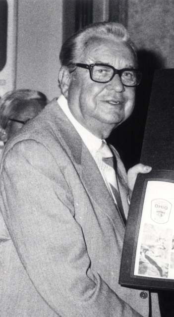
Photo: Fremont News Messenger, via Rutherford B. Hayes Presidential Library collection, public domain · Wikimedia Commons
Local history sources: en.wikipedia.org · en.wikipedia.org · commons.wikimedia.org · en.wikipedia.org · archive.org · archive.org
Water
Groundwater wells (2 wells) The water here
- Bettsville Village100% of residentsGroundwater wells (2 wells)
Hospitals, fire stations and more
Inside Bettsville's boundary: 1 fire or EMS station, 1 public school, 1 library and 1 police station. Press a pin or a name for its whole record and its source.
Fire and EMS stations (1)
-
Bettsville Fire Department and Emergency Medical Services DepartmentBettsville
- Address
- 308 Emma Street, Bettsville, OH 44815
- Coordinates
- 41.24154, -83.23472
USGS National Map structures (source) ↗ Street map and directions ↗
Source: USGS National Map structures (most Ohio records last updated 2019 to 2022), checked against the Columbus and Cleveland station lists. The department that answers a call is set by jurisdiction and mutual aid, not by distance.
Public schools (1)
-
Old Fort Elementary School Bettsville Campus3.5 of 5 stars · Bettsville
- Address
- 118 Washington St, Bettsville, OH 44815
- School district
- Old Fort Local School District
- Kind (NCES)
- Regular School
- Students, 2023-24
- 381
- Teachers (full-time equivalent)
- 23
- Report card, 2025-26
- 3.5 of 5 stars
- Performance index
- 78.2%
- Ohio building IRN
- 028498
- NCES school ID
- 391002103680
NCES school record ↗ Ohio School Report Card ↗ Street map and directions ↗
Source: NCES EDGE public school locations 2024-25 and Common Core of Data 2023-24 (type, students, teachers); Ohio School Report Cards 2025-26 (Department of Education and Workforce), matched by name within the district.
Public libraries (1)
-
Bettsville Public LibraryCentral library · Bettsville
- Address
- 233 State St., Bettsville, OH 44815
- What it is
- Central library
- Library system
- Bettsville Public Library
- Open
- 2,288 hours a year, 44 weeks
- Building
- 4,360 sq ft
- System's visits, FY2024
- 3,380
- System's loans, FY2024
- 14,046
- People the system serves
- 2,049
- Phone
- (419) 986-5198
IMLS Public Libraries Survey (source) ↗ Street map and directions ↗
Source: IMLS Public Libraries Survey FY2024 (outlets and their systems). Any Ohio resident can get a free card at any Ohio public library.
Police stations (1)
-
Bettsville Police DepartmentBettsville
- Address
- 308 Emma Street, Bettsville, OH 44815
- Coordinates
- 41.24170, -83.23461
USGS National Map structures (source) ↗ Street map and directions ↗
Source: USGS National Map structures, police stations, corrected and completed by hand (September 2026). The department that answers a call is set by jurisdiction, not by distance.
Its ZIP codes
Each ZIP code that touches Bettsville, with the share of its residents who live here and the same headline figures as the ZIP page.
| ZIP | Share | Water | Radon | Home value | Schools | Flood |
|---|---|---|---|---|---|---|
| 44815 Bettsville | 88% | Groundwater wells (2 wells) | Too few radon tests | Median year built 1930 | Old Fort Local · 4 stars overall | 10% of residents in the 1% floodplain |
The county
Seneca County: 13 ZIP codes, 26 cities, villages and townships, 61,093 people.
Nearby places
Rain and snow
How much has actually fallen on Bettsville, day by day, from 1893 to now. Daily totals, not averages.
- rain, last 30 days
- 1.56 in
- 2026-09-29 to 2026-10-28
- rain so far in 2026
- 33.6 in
- 1.9 in above normal for the date
- snow so far in 2026
- 15.7 in
- a normal year brings 28.4 in
- a normal year
- 37.2 in
- average of 30 years, 1991-2020
| Month | Rain (in) | Snow (in) | Days counted |
|---|---|---|---|
| October 2026 | 1.55 | — | 28 |
| September 2026 | 2.98 | — | 30 |
| August 2026 | 4.70 | — | 31 |
| July 2026 | 4.26 | — | 31 |
| June 2026 | 4.31 | — | 30 |
| May 2026 | 4.03 | — | 31 |
| April 2026 | 6.68 | — | 30 |
| March 2026 | 3.60 | 0.2 | 31 |
| February 2026 | 0.35 | 2.4 | 28 |
| January 2026 | 1.17 | 13.1 | 31 |
| December 2025 | 1.87 | 6.3 | 31 |
| November 2025 | 1.52 | 3.5 | 30 |
| Wettest year | 2011 — 55.3 in |
|---|---|
| Driest year | 1963 — 21.4 in |
| Snowiest year | 1910 — 72.0 in |
| Wettest day on record | 5 July 1969 — 4.69 in |
| Heaviest snowfall in a day | 23 December 2004 — 12.33 in |
| Deepest snow on the ground | 27 January 1978 — 19.83 in |
Estimated, not measured. No rain gauge has ever stood inside Bettsville, so every figure here is worked out from the gauges around it - the nearest ones weighted most. Treat them as close estimates rather than readings.
48,766 days of records, 1893-04-01 to 2026-10-28. Source: NOAA NCEI GHCN-Daily, 3,240 gauges in and around Ohio. A day is "gauged" when a gauge standing inside the boundary reported it, and the value is the mean of those gauges. Otherwise it is interpolated by inverse distance from every gauge reporting within 50 miles. Nothing is carried forward, back-filled or smoothed. Against NOAA nClimDiv county monthly precipitation over 136,848 complete county-months (checked 2026-10-31): correlation 0.9515, median absolute difference 0.217 in a month. Built 2026-10-31 from the Cracked Buckeye precipitation archive. Snow is the softer number — snowfall is measured by hand with a ruler, no agency publishes a gridded county snowfall series, and blowing snow defeats every observer.
Environmental permits and filings
What Ohio EPA has on file for Bettsville: permits, inspections, violations, cleanups and the state loans behind sewer and water work. Every line links to the agency's own document.
- facilities and sites on file
- 3
- those placed on the map inside Bettsville
| Program | Facilities and sites |
|---|---|
| Contaminated-site cleanup | 1 |
| Hazardous waste | 1 |
| State sewer loans | 1 |
| Date | Facility or site | What |
|---|---|---|
| BETTSVILLE WWTP | State sewer loans | |
| BETTSVILLE WWTP | State sewer loans |
Source: Ohio EPA eDocument portal (edocpub.epa.ohio.gov), indexed 2026-10-14. Facilities are placed on the map from Ohio EPA's own map layers, EPA's Facility Registry, coordinates written in the filings, or a geocoded street address. A permit filed under a private person's name (most are household septic systems) is counted but never named, placed or linked; licenses for individual workers and open-burning notices are left out entirely.
Quick answers
What county is Bettsville, Ohio in?
Bettsville is a village in Seneca County, Ohio, with 595 residents.
When was Bettsville, Ohio founded?
Bettsville was settled 1838; laid out 1838-04-12; incorporated 1883-02-20 (petition granted; first election April 21, 1883). Founders on record: John Betts, surveyed by James Durbin. Source
How did Bettsville, Ohio get its name?
Named for its founder, John Betts, who laid out the village in 1838. Source
What ZIP code is Bettsville, Ohio?
Most of Bettsville is in ZIP code 44815.
Where does Bettsville, Ohio get its water?
The main water source for Bettsville (Bettsville Village): Groundwater wells (2 wells).
Cite this page
Cite this page as:
Cracked Buckeye, "Bettsville, Seneca County", https://crackedbuckeye.com/place/bettsville/, built 2026-10-31, accessed [date].
How to cite · Report a correction · Built 2026-10-31
