Local events in Alger
Nothing is posted for Alger itself yet; here is what is on within 10 miles. All local events in Alger
Know a calendar we should watch? Send the link
Checked October 20; the events page is refreshed daily.
How Alger began
Alger began in 1882 as Jagger, a station laid out by Elias Jagger along the Chicago & Atlantic Railroad in Marion Township, at the edge of the drained Scioto Marsh in northern Hardin County. It was renamed Alger for Russell A. Alger of Michigan, a governor of that state, and was incorporated as a village in 1890 according to the 1910 county history, or in 1896 according to Wikipedia. The railroad and the reclaimed marsh muckland shaped its early economy; today it is a small rural village of under 900 people four miles south of Ada.
Platted 1882-10-23, incorporated 1890-03-03 (1910 county history); 1896 (Wikipedia), by Elias Jagger, on his own land.
Where the name comes from
First platted as Jagger, for founder Elias Jagger. Later renamed Alger in honor of Russell A. Alger, 20th Governor of Michigan.
Before the town
No source specific to Alger or Marion Township, Hardin County, names a Wyandot, Shawnee, or other village, camp, or trail on this ground. Alger sits near the Scioto Marsh, on which a drainage project was begun in 1859; marshland of that kind was Native hunting ground before removal, but no site-specific record was found. The nearby township of Roundhead (elsewhere in Hardin County, not adjoining Alger) is named for the Wyandot chief Roundhead, an associate of Tecumseh who lived in the area in the early 1800s -- a county-level fact, not a Marion Township one. County-wide, the Wyandot and Shawnee held this part of northwestern Ohio until the War of 1812 ended Anglo-Indian resistance, and the last Indian village in the county was abandoned by 1817.
Nations recorded here: Wyandot, Shawnee.
Timeline
- — Elias Jagger lays out the village of Jagger along the newly built Chicago & Atlantic Railroad in Marion Township.
- — The Chicago & Atlantic Railroad is finished across Marion Township; the new town of Jagger, on the southeast corner of Section 8 where the railroad crosses the Ada and Round Head turnpike, already has two saw mills running with acres of logs around them, and hopes to become a shipping point if the marsh is drained.
- — The first onions are raised on the drained Scioto Marsh, of poor quality because the soil is new; about 16,000 acres are eventually reclaimed, of which about 2,000 are put in onions.
- — Alger is incorporated as a village, according to the 1910 county history, which also says the name was changed from Jagger to Alger some years after the town was laid out; Wikipedia gives 1896.
- — The village, by then renamed Alger for Russell A. Alger, is incorporated.
- — The Alger Gazette, a country newspaper, is founded.
- — The Alger Savings Bank is organized under Ohio law with $25,000 in capital stock, $15,000 paid in, and Alex Carmen as president.
- — A disastrous fire in the summer destroys the hotel, the livery stable and most of the business section; the town rebuilds, but with only a few stores.
- — Alger has about 1,000 inhabitants by the county history's count, a large clay works making brick and tile with a planing mill and sash and door factory, onion storage houses holding up to 65,000 bushels, a brick schoolhouse costing about $18,000, and Methodist Episcopal and United Brethren churches.
- — Alger records its highest census population, 1,068.
- — Census population is 837.
Stories
From Jagger to Alger
When the Chicago & Atlantic Railroad was built across the edge of the Scioto Marsh, Elias Jagger laid out a village on his own land on October 23, 1882, and it took his name. The 1910 county history says the name was changed from Jagger to Alger some years after the town was laid out, in honor of Russell A. Alger of Michigan. That history gives March 3, 1890 as the date of incorporation, while Wikipedia gives 1896.
Onions on the drained marsh
Alger was laid out in October 1882 on the northwest edge of the Scioto Marsh, a wet wilderness the 1883 county history said would make the village a place of considerable trade only if the marsh were drained. It was. About 16,000 acres were reclaimed by ditching and by dredging the Scioto, and land that sold for about a dollar an acre wild went for one hundred to one hundred and twenty-five once drained. The first onions were raised in 1886 and tasted rank, but as the water left the muck soil the flavor improved, and by 1910 onions were Alger's business: the villagers were almost all onion farmers or onion shippers, and storage houses beside the railroad held the crop until prices were good. The weeding needed 1,200 to 1,500 workers a season, who camped in little shacks on the marsh, and school boys and college students earned their next year's tuition crawling along the green rows in June.
Photographs
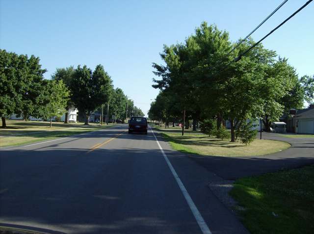
Photo: Nyttend, public domain · Wikimedia Commons
Local history sources: remarkableohio.org · en.wikipedia.org · en.wikipedia.org · en.wikipedia.org · thevillageofalger.gov · hardincountyohio.gov · en.wikipedia.org · ohiogenealogyexpress.com · ohiogenealogyexpress.com · commons.wikimedia.org · archive.org · archive.org
Water
Mostly private wells The water here
- Alger Village99% of residentsGroundwater wells (2 wells)
- Mcguffey Village1% of residentsGroundwater wells (3 wells)
Hospitals, fire stations and more
Inside Alger's boundary: 1 fire or EMS station, 1 library, 1 Toxics Release Inventory facility and 2 spill cases. Press a pin or a name for its whole record and its source.
Fire and EMS stations (1)
-
Alger Community Fire Association - Station 6Alger
- Address
- 102 East Lee Street, Alger, OH 45812
- Coordinates
- 40.70616, -83.84358
USGS National Map structures (source) ↗ Street map and directions ↗
Source: USGS National Map structures (most Ohio records last updated 2019 to 2022), checked against the Columbus and Cleveland station lists. The department that answers a call is set by jurisdiction and mutual aid, not by distance.
Public libraries (1)
-
Alger Public LibraryCentral library · Alger
- Address
- 100 W Wagner St, Alger, OH 45812
- What it is
- Central library
- Library system
- Alger Public Library
- Open
- 2,288 hours a year, 52 weeks
- Building
- 2,300 sq ft
- System's visits, FY2024
- 14,300
- System's loans, FY2024
- 9,683
- People the system serves
- 4,016
- Phone
- (419) 757-7755
IMLS Public Libraries Survey (source) ↗ Street map and directions ↗
Source: IMLS Public Libraries Survey FY2024 (outlets and their systems). Any Ohio resident can get a free card at any Ohio public library.
Facilities reporting toxic releases (1)
-
Horn's Crop Service Center IncToxics Release Inventory · Alger
- Address
- 202 South Mcconnel, Alger, OH 45812
- County
- Hardin County
- Status
- Reports to the Toxics Release Inventory (active)
- EPA program ID
- 45812HRNSC202SM
- EPA registry ID
- 110002114088
EPA facility record ↗ EPA Facility Registry Service (source) ↗ Street map and directions ↗
Source: EPA Facility Registry Service, Toxics Release Inventory reporters. Reporting a release is required of large users of listed chemicals; it is not by itself a violation.
Spills reported since 2021 (2)
-
Oil Petroleum Not Otherwise Specified (Nos)2023-08-30 · Alger
- Reported
- 2023-08-30
- What spilled
- Oil Petroleum Not Otherwise Specified (Nos); Other / All Other / Trade Name / Mixture / Solution Etc
- Where
- Alger, Hardin County
- Ohio EPA district office
- NWDO
- Ohio EPA case number
- 2308EPA0001536
Ohio EPA spill reports (source) ↗ Street map and directions ↗
-
Material Undetermined / Other2026-07-30 · Alger
- Reported
- 2026-07-30
- What spilled
- Material Undetermined / Other
- Where
- Alger, Hardin County
- Ohio EPA district office
- NWDO
- Ohio EPA case number
- 2607EPA0001395
Ohio EPA spill reports (source) ↗ Street map and directions ↗
Source: Ohio EPA emergency response spill reports, 2021 to September 2026, one point per case where Ohio EPA placed it. A report is what the caller or responder recorded; amounts are often blank or estimated.
Its ZIP codes
Each ZIP code that touches Alger, with the share of its residents who live here and the same headline figures as the ZIP page.
| ZIP | Share | Water | Radon | Home value | Schools | Flood |
|---|---|---|---|---|---|---|
| 45812 Alger | 46% | Mostly private wells | Too few radon tests | Median year built 1974 | Upper Scioto Valley Local · 3.5 stars overall | 15% of residents in the 1% floodplain |
Local government
Who holds office in Alger, how its elections and ballot issues came out, and the state auditor's record.
Ballot issues
| Date | Issue | For | Against | Result |
|---|---|---|---|---|
| 2019-11-05 | Issue: 12-Village of Alger | 107 | 43 | Passed (71.33% for) |
Elections for office
| Date | Office | Candidates and votes |
|---|---|---|
| 2021-11-02 | Council | Craig A. Decker 71, 18.83%; Jodi Gibson 71, 18.83%; Lori L. Hunt 61, 16.18%; Johnny W. Manns 50, 13.26%; Rick Onions 69, 18.3%; Write-In: Larry Hattery 32, 8.49%; Write-In: Steve Hunt 23, 6.1% |
| 2019-11-05 | Mayor | Donald Hensley 57, 37.01%; James H. Summa 97, 62.99% |
| 2019-11-05 | Council | Linda S. Dienstberger 75, 25.6%; John J.P. Hunt 67, 22.87%; Lori L. Hunt 70, 23.89%; Michael Miller 81, 27.65% |
Winners in bold. Results from the county board of elections' official canvass unless marked.
Auditor of State record
- Fiscal emergency: declared 2005-08-09, released 2011-12-20. source
The county
Hardin County: 10 ZIP codes, 23 cities, villages and townships, 31,735 people.
Nearby places
Rain and snow
How much has actually fallen on Alger, day by day, from 1893 to now. Daily totals, not averages.
- rain, last 30 days
- 0.87 in
- 2026-09-30 to 2026-10-29
- rain so far in 2026
- 39.1 in
- 6.0 in above normal for the date
- snow so far in 2026
- 14.4 in
- a normal year brings 24.7 in
- a normal year
- 38.9 in
- average of 30 years, 1991-2020
| Month | Rain (in) | Snow (in) | Days counted |
|---|---|---|---|
| October 2026 | 0.87 | — | 29 |
| September 2026 | 6.09 | — | 30 |
| August 2026 | 7.35 | — | 31 |
| July 2026 | 3.21 | — | 31 |
| June 2026 | 4.75 | — | 30 |
| May 2026 | 4.89 | — | 31 |
| April 2026 | 5.90 | — | 30 |
| March 2026 | 4.40 | 0.5 | 31 |
| February 2026 | 0.57 | 3.7 | 28 |
| January 2026 | 1.11 | 10.1 | 31 |
| December 2025 | 1.98 | 7.8 | 31 |
| November 2025 | 1.45 | 4.8 | 30 |
| Wettest year | 2011 — 54.3 in |
|---|---|
| Driest year | 1934 — 22.8 in |
| Snowiest year | 1895 — 56.2 in |
| Wettest day on record | 2 June 1980 — 3.02 in |
| Heaviest snowfall in a day | 13 January 1964 — 9.64 in |
| Deepest snow on the ground | 2 March 1912 — 29.47 in |
Estimated, not measured. No rain gauge has ever stood inside Alger, so every figure here is worked out from the gauges around it - the nearest ones weighted most. Treat them as close estimates rather than readings.
48,879 days of records, 1893-01-01 to 2026-10-29. Source: NOAA NCEI GHCN-Daily, 3,240 gauges in and around Ohio. A day is "gauged" when a gauge standing inside the boundary reported it, and the value is the mean of those gauges. Otherwise it is interpolated by inverse distance from every gauge reporting within 50 miles. Nothing is carried forward, back-filled or smoothed. Against NOAA nClimDiv county monthly precipitation over 136,848 complete county-months (checked 2026-10-31): correlation 0.9515, median absolute difference 0.217 in a month. Built 2026-10-31 from the Cracked Buckeye precipitation archive. Snow is the softer number — snowfall is measured by hand with a ruler, no agency publishes a gridded county snowfall series, and blowing snow defeats every observer.
Quick answers
What county is Alger, Ohio in?
Alger is a village in Hardin County, Ohio, with 837 residents.
When was Alger, Ohio founded?
Alger was laid out 1882-10-23; incorporated 1890-03-03 (1910 county history); 1896 (Wikipedia). Founders on record: Elias Jagger, on his own land. Source
How did Alger, Ohio get its name?
First platted as Jagger, for founder Elias Jagger. Source
What ZIP code is Alger, Ohio?
Most of Alger is in ZIP code 45812.
Where does Alger, Ohio get its water?
The main water source for Alger (Alger Village): Mostly private wells.
Cite this page
Cite this page as:
Cracked Buckeye, "Alger, Hardin County", https://crackedbuckeye.com/place/alger/, built 2026-10-31, accessed [date].
How to cite · Report a correction · Built 2026-10-31
