Water system
Brown County Rural Water
EPA ID OH0802012 · Brown County · 32,090 people served · owned by a local government
Brown County Rural Water treats its own water from Ohio River Valley Aquifer (wells).
The system's record
- Aquifer
- Ohio River Aquifer (sand-and-gravel river-valley aquifer)
- Active wells
- 13
- Serves
- 32,090 people · Brown County
- EPA ID
- OH0802012
13 wells draw from the Ohio River Aquifer, a sand-and-gravel river-valley aquifer; Brown County's shale bedrock yields little groundwater elsewhere, making this the only viable aquifer for the area.
About this area's water
Did you know
- BCRWA exists because two separate citizen groups, one around Feesburg and one around Sardinia, merged so the new nonprofit could qualify for federal Farmers Home Administration loans.
- The plant uses lime softening rather than the coagulation-filtration typical of surface water plants, pushing pH to about 10.3 and then recarbonating it back down to about 9.5.
- Because most of Brown County sits on shale that yields only a few gallons a minute, the buried-valley Ohio River Aquifer - good for over 500 gpm - is the area's only significant groundwater source.
- In the 2023 UCMR 5 national monitoring round, none of the listed unregulated contaminants were detected in BCRWA's water; a 2020 state PFAS screen also came back clean.
History5
- early 1970sCitizen groups in Feesburg and Sardinia, whose outlying areas still relied on wells and cisterns, merged to form BCRWA as a private nonprofit.
- early 1970sBCRWA organized as a nonprofit association specifically to qualify for Farmers Home Administration loans to build rural water lines.
- 1999BCRWA formed its Wellhead Protection Committee and adopted a Wellhead Protection Plan for the Ohio River Aquifer well field.
- 2020Sampled under Ohio's statewide PFAS initiative; six PFAS compounds tested and none detected in finished drinking water.
- 2023Participated in the fifth Unregulated Contaminant Monitoring Rule round (UCMR 5); no UCMR 5 contaminants were detected.
Treatment & pressure
How it is treated
13 wells (3-6 at a time, up to 450 gpm each) feed aeration, then lime softening in a clarifier to pH ~10.3 with alum, recarbonation back to pH ~9.5, four anthracite-over-sand filters, then chlorine (~1.0 mg/L) and fluoride into a 450,000-gallon clear well.
Water pressure
not published as psi; five 750-gpm high-service pumps and 13 elevated storage towers hold pressure across the rural distribution area
What it costs
$11.00 per 1,000 gallons
2026 schedule: 5/8-inch residential minimum $28.00/month including 2,000 gallons; next 48,000 gallons $11.00 per 1,000; above 50,000 gallons $10.00.
Water quality & impurities8
| Contaminant | Level | Limit | Year |
|---|---|---|---|
| Total Trihalomethanes (TTHM) Disinfection byproduct; range 20.6-30.6 ppb; well under the MCL. | 25.6 ppb | 80 | 2025 |
| Haloacetic Acids (HAA5) Disinfection byproduct; range ND-2.9 ppb. | 2.9 ppb | 60 | 2025 |
| Nitrate Fertilizer runoff and natural deposits; about a seventh of the MCL. | 1.41 ppm | 10 | 2025 |
| Fluoride Added as required by Ohio EPA; range 0.77-1.1 ppm. | 1.0 ppm | 4 | 2025 |
| Total Chlorine (residual disinfectant) Residual disinfectant; range roughly 0.87-1.0 ppm. | 0.96 ppm | 4 (MRDL) | 2025 |
| Lead (90th percentile) 30 sites sampled, none above the action level; detections ND-3.3 ppb. | 0.0 ppb | 15 (action… | 2023 |
| Copper (90th percentile) 30 sites sampled, none above the action level; detections ND-0.019 ppm. | 0.009 ppm | 1.3 (action… | 2023 |
| Barium Naturally occurring; far below the MCL. | 0.0065 ppm | 2 | 2023 |
EPA compliance record
Lead at the tap: 90th-percentile result 0.7 ppb in 2023 (action level 15 ppb).
EPA record: no health-based violations since 2015.
Supply stress
Ohio EPA rates this aquifer HIGH susceptibility to contamination: a thin protective clay layer, a water table less than 40 feet down, significant potential contaminant sources nearby, and periodic serious Ohio River flooding. It is the county's only significant aquifer, since Brown County shale yields little water.
Sewers
Sanitary
Not documented. BCRWA is a drinking-water-only association; its materials describe no sanitary sewer service, and no source reviewed confirmed how its rural customers dispose of wastewater.
Storm
not documented in sources reviewed
Main supplier in 1 ZIP code
Serves
Main water supplier in 2 ZIP codes
- 45101 · Aberdeen72% of residents
- 45167 · Ripley46% of residents
Also present in 1 more ZIP code
- 45130 · Clark Township and Hamersville4% of residents
Population-weighted resident shares; a ZIP code can have more than one system on record. Recomputed from each ZIP's own system list, not from the map's cached footprint.
Buys from · Sells to
Brown County Rural Water does not buy water from another system on record; it treats its own source water.
3 systems on record buy water from Brown County Rural Water: Georgetown Village, Hamersville Village, Sardinia Village.
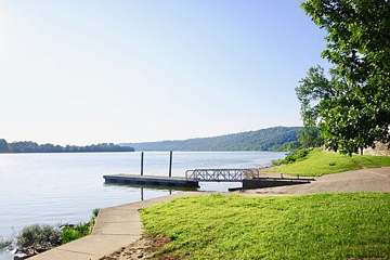
Photograph
On the map
Show this system's territory on the map — 3 ZIP codes in all.
Sources
U.S. EPA SDWIS and Community Water System Service Area Boundaries (v3, 2026), Ohio EPA primacy data, 2020 census blocks: the system serving most residents, traced through purchases to the treating utility; Ohio EPA 2023 Sewer and Water Rate Survey (Ohio State, May 2025) for household bills; Ohio EPA DEFA loan awards since 2016 for the loans paragraph · EPA SDWIS · EPA service area boundaries · Ohio EPA drinking water · Ohio EPA rate survey