Local events in Tarlton
3 events in the next 90 days from 1 public calendar. All local events in Tarlton
Checked October 20; the events page is refreshed daily.
How Tarlton began
Tarlton was laid out about 1801 by Benjamin Newell as Newellstown, on Salt Creek near the Fairfield County line, on ground where a settler's log cabin was the first building anyone put up. Renamed Tarlton for reasons no source consulted explains, it grew into a trading and church village on the old road from Kentucky to the eastern seaboard, remembered locally for General Jackson and Henry Clay stopping there on their way to and from the seat of government. It sits within a mile or two of two different prehistoric earthworks, the Adena-era Horn Mound in Pickaway County's own Salt Creek Township and the far more unusual cross-shaped Tarlton Cross Mound just over the line in Fairfield County, and it was the birthplace, in 1830, of Civil War general and pioneering steel-bridge engineer William Sooy Smith.
Settled by 1800 (the log cabin of Christopher Myers, the first building on the site), platted about 1801, as Newellstown, by Benjamin Newell.
Where the name comes from
Neither the 1880 nor the 1906 Pickaway County history explains why Newellstown was renamed Tarlton, and neither lists any settler family named Tarlton among the township's early residents. Some present-day tourism sites offer competing, unsourced claims: that it honors Banastre Tarleton, a British cavalry officer of the American Revolution, or that it honors an early settler family surnamed Tarlton. Neither claim could be traced to a primary source, so the true origin of the name is left unconfirmed here.
Before the town
No source consulted names a Native village, camp, or trail directly on the site of Tarlton itself, but the village stands close to two documented prehistoric earthworks. The Horn Mound, a roughly one-acre Adena culture burial mound near the junction of Armstrong and Moccasin roads southeast of Tarlton, sits within Pickaway County's own Salt Creek Township, at what Wikipedia's National Register summary calls "a significant distance from any other prehistoric site," apparently undisturbed by excavation; it was listed on the National Register of Historic Places on August 7, 1974. A short distance northwest of the village, but across the county line in Clear Creek Township, Fairfield County, stands the Tarlton Cross Mound, a low earthwork built in the shape of a Greek cross about ninety feet from end to end, with a circular depression at its center and a small stone-and-earth "altar" behind it; the 1880 Pickaway County history describes it in its general survey of the region's ancient works, and it was surveyed as early as 1848 by Ephraim Squier and Edwin Davis. Its builders remain disputed: the National Park Service has suggested a Hopewell origin, while other archaeologists have proposed the Fort Ancient culture or, for its cross shape and possible use as a sun symbol, a Mississippian connection; a 2014 assessment by archaeologist Jarrod Burks found insufficient evidence to confirm any of these and favored only a general Middle Woodland date. It was listed on the National Register on November 10, 1970, and is maintained today as a park by Fairfield County.
Nations recorded here: Adena culture, Hopewell culture, Fort Ancient culture.
- Horn Mound (mound) — junction of Armstrong and Moccasin roads, southeast of Tarlton, Salt Creek Township, Pickaway County, Adena culture (about 800 BC-AD 100) (en.wikipedia.org)
- Tarlton Cross Mound (earthwork) — Cross Mound Park, Clear Creek Township, Fairfield County, immediately northwest of Tarlton village, prehistoric, culture disputed (Hopewell, Fort Ancient, or Mississippian proposed) (en.wikipedia.org)
Timeline
- — Christopher Myers builds a log cabin on the brow of a hill on the future village site, the first building later settlers remembered there.
- — Benjamin Newell lays out the village as Newellstown; it is later renamed Tarlton for reasons no source explains.
- — A German Reformed congregation is organized at Tarlton by Rev. George Wise of Lancaster, Ohio; a German Lutheran society forms around the same time, and the two jointly build a log meeting-house.
- — Dr. Otis Ballard settles at Tarlton and begins a long medical practice in the village.
- — A Methodist Episcopal class is known to already exist at Tarlton, then part of the Adelphi circuit, Chillicothe district.
- — The Tarlton circuit is formed out of the Adelphi circuit, with Tarlton and Haller's Chapel its only two appointments in Pickaway County.
- — William Sooy Smith, later a Union Army general and a pioneer of steel bridge construction, is born in Tarlton.
- — A joint-stock company builds the Tarlton steam saw-mill.
- — The Tarlton Cross Mound, just outside the village in Fairfield County, is listed on the National Register of Historic Places.
- — The Horn Mound, southeast of the village in Pickaway County's Salt Creek Township, is listed on the National Register of Historic Places.
Stories
From Newellstown to a Stop for Presidents
The village that became Tarlton began as little more than Christopher Myers's log cabin on a hillside above Salt Creek, until Benjamin Newell laid out lots around it about 1801 and called the place Newellstown. Trade followed quickly: a storekeeper named McLane opened the first shop, Jacob Sayler kept the next one on the same lot where Myers's cabin had stood, and John Shoemaker ran the first tavern out of his own log dwelling. The road running through the young village, the 1880 county history recalls, was for years the principal route from Kentucky to the eastern seaboard, well-traveled enough that General Andrew Jackson and Henry Clay were both remembered stopping there on their way to and from the seat of government, an unlikely brush with national politics for a settlement that had started as one man's cabin.
A Cross in the Valley
A short walk from Tarlton, in the narrow valley of Salt Creek, surveyors Ephraim Squier and Edwin Davis documented one of Ohio's strangest earthworks for their 1848 survey of the region's ancient monuments: a low mound built in the shape of a Greek cross, its four arms meeting almost exactly on the cardinal directions, ninety feet from end to end and ringed by a shallow ditch. At its center sat a circular depression, and immediately behind it a small mound of stone and earth that early observers called an altar. Squier and Davis found smaller mounds scattered nearby and larger ones on the hills above the valley, evidence, they thought, of a site that mattered to its builders beyond the cross itself. More than a century and a half later, archaeologists still cannot agree on who built it or exactly when, though most now favor some point in the Middle Woodland period, contemporary with the Hopewell earthworks elsewhere in the state.
From a Village Store to the Union Army and the First Steel Bridge
William Sooy Smith was born in Tarlton on July 22, 1830, and went on to a career that carried the village's name into national history twice over. He graduated from Ohio University and then West Point, sixth in his class of 1853, and during the Civil War rose to brigadier general, commanding troops through the Vicksburg campaign before a defeat by Nathan Bedford Forrest at the Battle of Okolona in 1864 led him to resign his commission. He then returned to the civil engineering he had trained for, and in 1878-79 helped build the Glasgow Bridge over the Missouri River, the first bridge in the country built entirely of steel rather than iron, a project that helped establish steel as the material of the coming age of American bridge-building.
Photographs
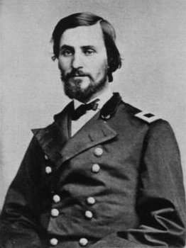
Photo: generalsandbrevets.com, via Wikimedia Commons, public domain · Wikimedia Commons
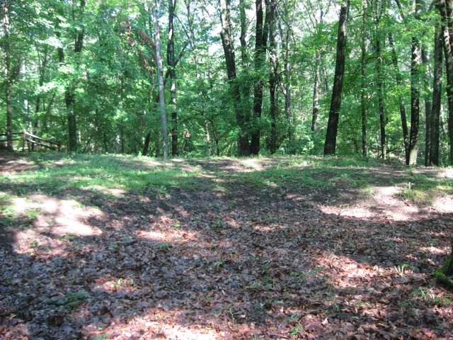
Photo: Nyttend, via Wikimedia Commons, public domain · Wikimedia Commons
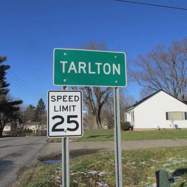
Photo: Aesopposea, via Wikimedia Commons, CC BY-SA 3.0 · Wikimedia Commons
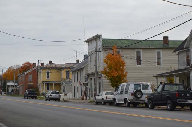
Photo: Nyttend, via Wikimedia Commons, public domain · Wikimedia Commons
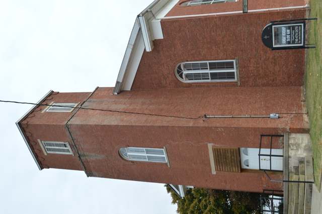
Photo: Nyttend, via Wikimedia Commons, public domain · Wikimedia Commons
Local history sources: archive.org · archive.org · en.wikipedia.org · en.wikipedia.org · en.wikipedia.org · en.wikipedia.org · en.wikipedia.org · ohiovisitor.com · commons.wikimedia.org · commons.wikimedia.org · commons.wikimedia.org · commons.wikimedia.org · commons.wikimedia.org
Water
No water-system data is linked to Tarlton's ZIP codes yet.
Hospitals, fire stations and more
Inside Tarlton's boundary: 1 fire or EMS station, 1 poor-rated bridge and 1 museum. Press a pin or a name for its whole record and its source.
Fire and EMS stations (1)
-
Saltcreek - Tarlton Volunteer Fire Department Station 1Tarlton
- Address
- 180 West Main Street, Tarlton, OH 43156
- Coordinates
- 39.55614, -82.77808
USGS National Map structures (source) ↗ Street map and directions ↗
Source: USGS National Map structures (most Ohio records last updated 2019 to 2022), checked against the Columbus and Cleveland station lists. The department that answers a call is set by jurisdiction and mutual aid, not by distance.
Bridges rated poor (1)
-
SR 159 over Salt CreekPoor · built 1932
- Condition
- Poor: a deck, superstructure, substructure or culvert rated 4 or below on the 0 to 9 scale
- What it is
- Bridge
- Built
- 1932
- Length
- 24 ft
- Owner
- State
- Vehicles a day
- 2,649
- Coordinates
- 39.55549, -82.78129
National Bridge Inventory (source) ↗ Street map and directions ↗
Source: FHWA National Bridge Inventory 2025. "Poor" means one major part rated 4 or below on the 0 to 9 scale; it calls for repair, not closing, unless the state posts or closes the bridge.
Museums, historical societies, gardens and zoos (1)
-
Soldiers Monumental AssociationHistorical society · Circleville
- What it is
- Historical society
- City
- Circleville
- Coordinates
- 39.55553, -82.77767
Search Wikipedia ↗ IMLS Museum Data Files (source) ↗ Street map and directions ↗
The museum list is IMLS's 2018 file; a museum may have closed or moved since.
Source: IMLS Museum Data Files, 2018.
Its ZIP codes
Each ZIP code that touches Tarlton, with the share of its residents who live here and the same headline figures as the ZIP page.
| ZIP | Share | Water | Radon | Home value | Schools | Flood |
|---|---|---|---|---|---|---|
| 43156 Tarlton | 100% | Mostly private wells | Too few radon tests | Median year built 1916 | Logan Elm Local · 3.5 stars overall | 0.0% of residents in the 1% floodplain |
Local government
Who holds office in Tarlton, how its elections and ballot issues came out, and the state auditor's record.
Money issues on the ballot since 2023: 1 of 1 passed; of those asking for new or higher taxes, 1 of 1.
Ballot issues
| Date | Issue | For | Against | Result |
|---|---|---|---|---|
| 2023-11-07 | Issue: Proposed Tax Levy (Additional), Streets, 1 mill Tarlton Village (1.0 mills, additional) | 37 | 32 | Passed (53.62% for) |
Auditor of State record
- No fiscal caution, watch or emergency on the Auditor of State's lists.
- Basic Audit, 2022 to 2023, released 2024-10-08
The county
Pickaway County: 8 ZIP codes, 22 cities, villages and townships, 56,176 people.
Nearby places
No nearby place shares a ZIP code with Tarlton in the atlas yet.
Rain and snow
How much has actually fallen on Tarlton, day by day, from 1893 to now. Daily totals, not averages.
- rain, last 30 days
- 0.91 in
- 2026-09-30 to 2026-10-29
- rain so far in 2026
- 46.5 in
- 11.5 in above normal for the date
- snow so far in 2026
- 13.9 in
- a normal year brings 15.8 in
- a normal year
- 41.2 in
- average of 30 years, 1991-2020
| Month | Rain (in) | Snow (in) | Days counted |
|---|---|---|---|
| October 2026 | 0.91 | — | 29 |
| September 2026 | 8.62 | — | 30 |
| August 2026 | 8.75 | — | 31 |
| July 2026 | 6.99 | — | 31 |
| June 2026 | 2.59 | — | 30 |
| May 2026 | 5.42 | — | 31 |
| April 2026 | 2.97 | — | 30 |
| March 2026 | 7.53 | 0.5 | 31 |
| February 2026 | 1.20 | 3.5 | 28 |
| January 2026 | 1.57 | 9.9 | 31 |
| December 2025 | 2.07 | 8.8 | 31 |
| November 2025 | 2.92 | 1.4 | 30 |
| Wettest year | 2011 — 59.6 in |
|---|---|
| Driest year | 1930 — 24.1 in |
| Snowiest year | 1910 — 48.0 in |
| Wettest day on record | 24 May 1968 — 4.07 in |
| Heaviest snowfall in a day | 17 February 1910 — 10.88 in |
| Deepest snow on the ground | 29 November 1950 — 20.11 in |
Estimated, not measured. No rain gauge has ever stood inside Tarlton, so every figure here is worked out from the gauges around it - the nearest ones weighted most. Treat them as close estimates rather than readings.
48,662 days of records, 1893-01-01 to 2026-10-29. Source: NOAA NCEI GHCN-Daily, 3,240 gauges in and around Ohio. A day is "gauged" when a gauge standing inside the boundary reported it, and the value is the mean of those gauges. Otherwise it is interpolated by inverse distance from every gauge reporting within 50 miles. Nothing is carried forward, back-filled or smoothed. Against NOAA nClimDiv county monthly precipitation over 136,848 complete county-months (checked 2026-10-31): correlation 0.9515, median absolute difference 0.217 in a month. Built 2026-10-31 from the Cracked Buckeye precipitation archive. Snow is the softer number — snowfall is measured by hand with a ruler, no agency publishes a gridded county snowfall series, and blowing snow defeats every observer.
Quick answers
What county is Tarlton, Ohio in?
Tarlton is a village in Pickaway County, Ohio, with 254 residents.
When was Tarlton, Ohio founded?
Tarlton was settled by 1800 (the log cabin of Christopher Myers, the first building on the site); laid out about 1801, as Newellstown. Founders on record: Benjamin Newell. Source
How did Tarlton, Ohio get its name?
Neither the 1880 nor the 1906 Pickaway County history explains why Newellstown was renamed Tarlton, and neither lists any settler family named Tarlton among the township's early residents. Source
What ZIP code is Tarlton, Ohio?
Most of Tarlton is in ZIP code 43156.
Where does Tarlton, Ohio get its water?
The main water source for Tarlton: Mostly private wells.
Cite this page
Cite this page as:
Cracked Buckeye, "Tarlton, Pickaway County", https://crackedbuckeye.com/place/tarlton/, built 2026-10-31, accessed [date].
How to cite · Report a correction · Built 2026-10-31
