Local events in South Vienna
Nothing is posted for South Vienna itself yet; here is what is on within 10 miles. All local events in South Vienna
Know a calendar we should watch? Send the link
Checked October 20; the events page is refreshed daily.
How South Vienna began
South Vienna sits in Harmony Township in eastern Clark County, on the old National Road about ten miles east of Springfield and roughly midway between Dayton and Columbus. John H. Dynes founded and laid out the village in 1833, just before the National Road reached it in 1837; a post office opened in 1838 as Vienna Cross Roads, and the settlement was called Vienna, then Vienna Cross Roads, before finally taking the name South Vienna in 1909. It grew as a National Road trade village with hotels, a tannery, churches, and an Odd Fellows lodge, survived an 1850 cholera outbreak and repeated fires, and today is a small farm-country village of 402 residents (2020) that still holds an annual Corn Festival.
Platted 1833, by John H. Dynes, who founded and laid out the village in 1833 on the National Road, nearly half a mile west of the Ludlow survey line.
Where the name comes from
The village was first called simply Vienna. No source found records who chose that name or why; there is no local Vienna family or founder surname it derives from in the 1881 county history, which only credits John H. Dynes with laying out the plat. A post office named Vienna Cross Roads was established in 1838, and the place went by Vienna / Vienna Cross Roads for roughly seventy years until the post office and village were renamed South Vienna in 1909, apparently to distinguish it from other Ohio places named Vienna (there is a Vienna in Trumbull County) — but no source found states that reasoning explicitly, so it is left open rather than asserted as fact.
Before the town
Nothing specific to South Vienna village or Harmony Township itself is recorded in the sources checked: no named village, mound, trail, or treaty cession tied to this exact spot. At the county level, Clark County lies on and near the Mad River, home to the historic Shawnee town the Shawnee called Piqua (also written Pickaway or Picawey), located roughly seven miles west of present Springfield in what is now Bethel Township. Piqua was the Shawnee capital and the birthplace claimed by Tecumseh; on August 8, 1780, some 970 Kentucky militia under Gen. George Rogers Clark, retaliating for raids on Kentucky settlements, defeated Shawnee warriors led by Black Hoof (with Lenape, Wyandot, and Mingo allies) at Piqua, burned the town, and destroyed roughly 500 acres of standing corn; the Shawnee then resettled on the Great Miami River at a new town also called Piqua (Peckuwe), giving today's city of Piqua its name. Harmony Township, in the eastern part of Clark County, is roughly 20 miles east of that battle site — on the opposite side of the county from the heart of Mad River Shawnee settlement — and no source found places a specific Native village, camp, or trail inside Harmony Township's boundaries.
Nations recorded here: Shawnee.
- Piqua (Shawnee town, also Pickaway/Picawey) (village) — Mad River, about 7 miles west of Springfield, now Bethel Township, Clark County, destroyed August 8, 1780 (en.wikipedia.org)
Timeline
- — Clark County's commissioners organize Harmony Township in the eastern part of the new county.
- — John H. Dynes founds and lays out the village of Vienna on the surveyed but not-yet-built National Road, ten miles from Springfield.
- — Caleb Barrett opens as the village's first merchant, a business he continues for about twenty-three years.
- — Vienna's first schoolhouse, a frame building, is erected near the residence of F. V. Hartman; it is replaced by a brick schoolhouse north of the village in 1845.
- — Construction of the National Road through the village is completed, several years after it was surveyed at the time of Vienna's founding.
- — The Vienna Cross Roads post office is established with Caleb Barrett as first postmaster, a post he holds until 1858.
- — Cholera strikes the village of Vienna; among those who die are Mary Ann Barret, John Pemberton, Dr. Cyrus Dulan, John Coverdell, William Barnes, two children of James Kelley, Charles Warren, John Chilson, Mary A. Tottan, a child of David Stansbury, and a son of Jacob Williams.
- — Vienna Lodge No. 345, Independent Order of Odd Fellows, is chartered May 10 and instituted June 15, with charter members James Sprague, George Johnson, William Simpson, Nathan T. Brooks, James Wallingford, A. H. Spencer, and Joseph Wallingford.
- — Fire destroys a cluster of village buildings including a store built by Emanuel Wayne and the dwellings of W. T. Harris, James McCafferty, and James E. Johnson.
- — The village and post office are renamed from Vienna Cross Roads to South Vienna.
- — The U.S. Census records 402 residents.
Stories
Cholera on the National Road
In August 1850, cholera swept through Vienna, then a young trade village of a few hundred people strung along the National Road. The 1881 county history lists the dead by name: Mary Ann Barret, John Pemberton, the village's own Dr. Cyrus Dulan, John Coverdell, William Barnes, two children of James Kelley, Charles Warren, John Chilson, Mary A. Tottan, a child of David Stansbury, and a son of Jacob Williams. The road that had brought the village its trade and travelers also carried the disease to it; cholera moved along the National Road corridor that summer the way it moved along rivers and canals elsewhere in Ohio. The losses of a doctor and several children in one small settlement give a sense of how hard the epidemic hit a place this size.
A campaign canoe cut from a cottonwood tree
Ahead of the February 22, 1840 Whig convention that nominated Tom Corwin for governor, Harmony Township's Whigs built a thirty-four-foot canoe at Vienna, carved from a single huge cottonwood tree that had grown on the edge of the village. Ephraim Davidson spent two weeks shaping the log into a craft wide enough to seat two people to a bench. A crew of local men — Caleb Barnett, Emanuel Mayne, Thomas C. Busbey, Dr. J. B. Lingle, William Osborn, Col. William Foreman, Daniel Waddle, and others — then loaded the canoe onto a wagon behind the best team in the county, with John McClintock driving, and hauled it off to the convention as a piece of political theater. The 1840 log-cabin-and-hard-cider campaign produced this kind of frontier showmanship all over Ohio, and Harmony Township's contribution survived as a named anecdote in the county history four decades later.
Photographs
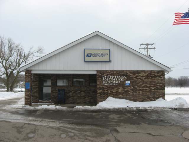
Photo: Nyttend, public domain · Wikimedia Commons
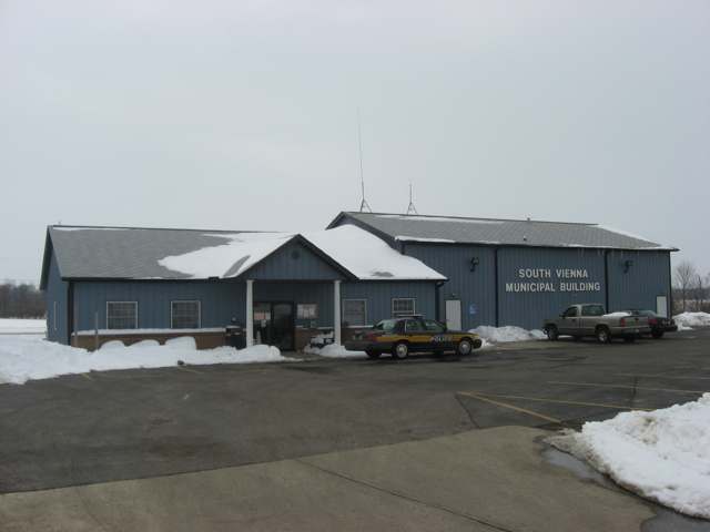
Photo: Nyttend, public domain · Wikimedia Commons
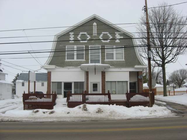
Photo: Nyttend, public domain · Wikimedia Commons
Local history sources: en.wikipedia.org · en.wikipedia.org · archive.org · en.wikipedia.org · southvienna.org · commons.wikimedia.org · commons.wikimedia.org · commons.wikimedia.org
Water
Mostly private wells The water here
- South Vienna Village67% of residentsGroundwater wells (2 wells)
- Brookside Village MHP33% of residentsGroundwater wells (2 wells)
Hospitals, fire stations and more
Inside South Vienna's boundary: 2 public schools and 1 spill case. Press a pin or a name for its whole record and its source.
Public schools (2)
-
Northeastern Elementary School3.5 of 5 stars · South Vienna
- Address
- 140 W Main St, South Vienna, OH 45369
- School district
- Northeastern Local School District
- Kind (NCES)
- Regular School
- Students, 2023-24
- 552
- Teachers (full-time equivalent)
- 26
- Report card, 2025-26
- 3.5 of 5 stars
- Performance index
- 77%
- Ohio building IRN
- 061713
- NCES school ID
- 390462502493
NCES school record ↗ Ohio School Report Card ↗ Street map and directions ↗
-
Northeastern Middle/High School3.5 of 5 stars · South Vienna
- Address
- 140 W Main St, South Vienna, OH 45369
- School district
- Northeastern Local School District
- Kind (NCES)
- Regular School
- Students, 2023-24
- 426
- Teachers (full-time equivalent)
- 33
- Report card, 2025-26
- 3.5 of 5 stars
- Performance index
- 73.6%
- Four-year graduation rate
- 99%
- Ohio building IRN
- 027656
- NCES school ID
- 390462502490
NCES school record ↗ Ohio School Report Card ↗ Street map and directions ↗
Source: NCES EDGE public school locations 2024-25 and Common Core of Data 2023-24 (type, students, teachers); Ohio School Report Cards 2025-26 (Department of Education and Workforce), matched by name within the district.
Spills reported since 2021 (1)
-
Fuel Diesel / Diesel Fuel (Vehicle On Or Off Road)2023-09-30 · South Vienna
- Reported
- 2023-09-30
- What spilled
- Fuel Diesel / Diesel Fuel (Vehicle On Or Off Road)
- Largest amount reported
- 50 gallons
- Where
- South Vienna, Clark County
- Ohio EPA district office
- SWDO
- Ohio EPA case number
- 2309EPA0001703
Ohio EPA spill reports (source) ↗ Street map and directions ↗
Source: Ohio EPA emergency response spill reports, 2021 to September 2026, one point per case where Ohio EPA placed it. A report is what the caller or responder recorded; amounts are often blank or estimated.
Its ZIP codes
Each ZIP code that touches South Vienna, with the share of its residents who live here and the same headline figures as the ZIP page.
| ZIP | Share | Water | Radon | Home value | Schools | Flood |
|---|---|---|---|---|---|---|
| 45369 Pleasant Township and South Vienna | 11% | Mostly private wells | 8.3 pCi/L average radon | Median year built 1973 | Northeastern Local · 3.5 stars overall | 0.0% of residents in the 1% floodplain |
Local government
Who holds office in South Vienna, how its elections and ballot issues came out, and the state auditor's record.
Elections for office
| Date | Office | Candidates and votes |
|---|---|---|
| 2019-11-05 | Member of Council | Donna J. Smith 48, 51.06%; John F. Blanton 46, 48.94% |
| 2019-11-05 | Mayor | Toni Keller 53, 100.0% |
| 2019-11-05 | Board of Public Affairs | Jacqueline Miller 48, 50.0%; Walter A. Newman 48, 50.0% |
Winners in bold. Results from the county board of elections' official canvass unless marked.
Auditor of State record
- No fiscal caution, watch or emergency on the Auditor of State's lists.
- Financial Audit, 2022 to 2023, released 2025-02-11
The county
Clark County: 15 ZIP codes, 19 cities, villages and townships, 135,514 people.
Nearby places
Rain and snow
How much has actually fallen on South Vienna, day by day, from 1893 to now. Daily totals, not averages.
- rain, last 30 days
- 1.07 in
- 2026-09-30 to 2026-10-29
- rain so far in 2026
- 42.4 in
- 6.5 in above normal for the date
- snow so far in 2026
- 16.8 in
- a normal year brings 18.7 in
- a normal year
- 42.0 in
- average of 30 years, 1991-2020
| Month | Rain (in) | Snow (in) | Days counted |
|---|---|---|---|
| October 2026 | 1.07 | — | 29 |
| September 2026 | 4.70 | — | 30 |
| August 2026 | 7.52 | — | 31 |
| July 2026 | 2.65 | — | 31 |
| June 2026 | 3.71 | — | 30 |
| May 2026 | 9.40 | — | 31 |
| April 2026 | 3.09 | — | 30 |
| March 2026 | 6.67 | 0.9 | 31 |
| February 2026 | 2.18 | 3.0 | 28 |
| January 2026 | 1.36 | 12.9 | 31 |
| December 2025 | 2.33 | 8.3 | 31 |
| November 2025 | 2.14 | 1.0 | 30 |
| Wettest year | 2011 — 58.1 in |
|---|---|
| Driest year | 1934 — 23.6 in |
| Snowiest year | 1910 — 56.3 in |
| Wettest day on record | 14 September 1979 — 4.58 in |
| Heaviest snowfall in a day | 19 March 1896 — 12.01 in |
| Deepest snow on the ground | 12 January 1996 — 21.69 in |
Estimated, not measured. No rain gauge has ever stood inside South Vienna, so every figure here is worked out from the gauges around it - the nearest ones weighted most. Treat them as close estimates rather than readings.
47,936 days of records, 1893-01-01 to 2026-10-29. Source: NOAA NCEI GHCN-Daily, 3,240 gauges in and around Ohio. A day is "gauged" when a gauge standing inside the boundary reported it, and the value is the mean of those gauges. Otherwise it is interpolated by inverse distance from every gauge reporting within 50 miles. Nothing is carried forward, back-filled or smoothed. Against NOAA nClimDiv county monthly precipitation over 136,848 complete county-months (checked 2026-10-31): correlation 0.9515, median absolute difference 0.217 in a month. Built 2026-10-31 from the Cracked Buckeye precipitation archive. Snow is the softer number — snowfall is measured by hand with a ruler, no agency publishes a gridded county snowfall series, and blowing snow defeats every observer.
Environmental permits and filings
What Ohio EPA has on file for South Vienna: permits, inspections, violations, cleanups and the state loans behind sewer and water work. Every line links to the agency's own document.
- facilities and sites on file
- 8
- those placed on the map inside South Vienna
| Program | Facilities and sites |
|---|---|
| Air pollution | 3 |
| Public drinking water | 2 |
| State water loans | 2 |
| Hazardous waste | 1 |
| Date | Facility or site | What |
|---|---|---|
| SOUTH VIENNA, VILLAGE OF PWS | Public drinking water notice of violation | |
| SOUTH VIENNA, VILLAGE OF PWS | Public drinking water compliance letter | |
| SOUTH VIENNA, VILLAGE OF PWS | Public drinking water compliance letter | |
| SOUTH VIENNA, VILLAGE OF PWS | Public drinking water compliance letter | |
| SOUTH VIENNA, VILLAGE OF PWS | Public drinking water notice of violation | |
| SOUTH VIENNA, VILLAGE OF PWS | Public drinking water report | |
| SOUTH VIENNA, VILLAGE OF PWS | Public drinking water inspection | |
| SOUTH VIENNA, VILLAGE OF PWS | Public drinking water plan | |
| SOUTH VIENNA, VILLAGE OF PWS | Public drinking water plan | |
| SOUTH VIENNA, VILLAGE OF PWS | Public drinking water inspection | |
| SOUTH VIENNA, VILLAGE OF PWS | Public drinking water inspection | |
| SOUTH VIENNA, VILLAGE OF PWS | Public drinking water permit | |
| SOUTH VIENNA, VILLAGE OF PWS | Public drinking water inspection | |
| SOUTH VIENNA, VILLAGE OF PWS | Public drinking water plan | |
| SOUTH VIENNA, VILLAGE OF PWS | Public drinking water warning letter | |
| SOUTH VIENNA, VILLAGE OF PWS | Public drinking water compliance letter | |
| SOUTH VIENNA, VILLAGE OF PWS | Public drinking water compliance letter | |
| SOUTH VIENNA, VILLAGE OF PWS | Public drinking water report | |
| SOUTH VIENNA, VILLAGE OF PWS | Public drinking water plan | |
| SOUTH VIENNA, VILLAGE OF PWS | Public drinking water notice of violation | |
| SOUTH VIENNA, VILLAGE OF PWS | Public drinking water compliance letter | |
| SOUTH VIENNA, VILLAGE OF PWS | Public drinking water permit | |
| SOUTH VIENNA, VILLAGE OF PWS | Public drinking water notice of violation | |
| SOUTH VIENNA, VILLAGE OF PWS | Public drinking water violation resolved | |
| SOUTH VIENNA, VILLAGE OF PWS | Public drinking water notice of violation |
Source: Ohio EPA eDocument portal (edocpub.epa.ohio.gov), indexed 2026-10-14. Facilities are placed on the map from Ohio EPA's own map layers, EPA's Facility Registry, coordinates written in the filings, or a geocoded street address. A permit filed under a private person's name (most are household septic systems) is counted but never named, placed or linked; licenses for individual workers and open-burning notices are left out entirely.
Quick answers
What county is South Vienna, Ohio in?
South Vienna is a village in Clark County, Ohio, with 402 residents.
When was South Vienna, Ohio founded?
South Vienna was laid out 1833. Founders on record: John H. Dynes, who founded and laid out the village in 1833 on the National Road, nearly half a mile west of the Ludlow survey line. Source
How did South Vienna, Ohio get its name?
The village was first called simply Vienna. Source
What ZIP code is South Vienna, Ohio?
Most of South Vienna is in ZIP code 45369.
Where does South Vienna, Ohio get its water?
The main water source for South Vienna (South Vienna Village): Mostly private wells.
Cite this page
Cite this page as:
Cracked Buckeye, "South Vienna, Clark County", https://crackedbuckeye.com/place/south-vienna/, built 2026-10-31, accessed [date].
How to cite · Report a correction · Built 2026-10-31
