South Charleston
Village · Clark County · 1,706 residents · 1.25% municipal income tax
Local events in South Charleston
30 events in the next 90 days from 1 public calendar. All local events in South Charleston
Checked October 20; the events page is refreshed daily.
How South Charleston began
South Charleston was platted as "Charleston" on November 1, 1815 by Conrad Critz, on land that was then part of Madison County (the plat was recorded at the Madison County seat in London in February 1816, three years before Clark County itself existed). It was named for Charles Paist, the village's first merchant, but the name was changed to South Charleston to stop mail from being misrouted to other Charlestons. Two railroads reached the village by the mid-1800s and turned it into a grain-shipping and passenger stop with closer commercial ties to Columbus than to Springfield, and one architect, Edward Edwards, is credited with designing most of the buildings that still stand downtown. It is now a village of roughly 1,700 people anchored by a National Register historic district along Jamestown and Chillicothe Streets.
Settled 1815, platted 1815-11-01, incorporated 1818 (first village election held September 19, 1818), by Conrad Critz, who laid out the original plat of eight squares of four lots each, surveyed by John T. Stewart.
Where the name comes from
The village was first platted and recorded as "Charleston," named for Charles Paist, its first merchant, who later served as an associate judge. The name was changed to South Charleston because mail addressed to the village kept being sent to other places named Charleston instead.
Before the town
No Native American site, village, trail, or mound specific to South Charleston itself is recorded in the sources consulted, including the 1881 county history's chapter on Madison Township. The nearest documented Native site is county-level: the Shawnee capital town of Piqua (also recorded as Peckuwe), a village of roughly 3,000 people with 500 acres of cornfields, stood on the Mad River in what is now Bethel Township, several miles northwest of South Charleston. On August 8, 1780, George Rogers Clark led about 970 Kentucky militia against it in retaliation for that summer's raids into Kentucky; the Shawnee, led by Black Hoof and joined by Lenape, Wyandot, and Mingo warriors, were driven off and the town and cornfields burned, after which the Shawnee resettled the Piqua name on the Great Miami River. It is described as the largest battle of the Revolutionary War fought west of the Allegheny Mountains. The land that became Clark County, including South Charleston, was ceded by the Treaty of Greenville in 1795. This is general county background, not a claim of a Shawnee presence at the South Charleston town site itself.
Nations recorded here: Shawnee.
- Piqua (Peckuwe), Shawnee town (battle) — Mad River, Bethel Township, Clark County, roughly 7 miles west of Springfield and northwest of South Charleston, occupied until destroyed August 8, 1780 (en.wikipedia.org)
Timeline
- — Conrad Critz plats the village of "Charleston," eight squares of four lots each, surveyed by John T. Stewart.
- — The plat is officially recorded at the Madison County seat in London; Clark County had not yet been formed.
- — Clark County is organized from parts of Madison, Champaign, and Greene counties, placing the village in the new Madison Township; the village holds its first election on September 19.
- — The Green Plain Monthly Meeting of Friends (Quakers) is established near the village.
- — After the Hicksite Quakers split over slavery, the conservative faction builds the brick Greek Revival meetinghouse still standing on South Charleston-Clifton Road.
- — The railroad later known as the Pittsburgh, Cincinnati and St. Louis is built through South Charleston, giving the village its first rail outlet for grain and passengers.
- — The village purchases 8 acres for $800 to establish its cemetery.
- — The First National Bank of South Charleston is chartered (later reorganized as the Bank of South Charleston).
- — The Ackley House hotel is built in the village.
- — Women of South Charleston, led by Virginia Holmes, conduct an eight-week winter campaign of prayer, marches, and saloon patrols during the statewide Woman's Crusade, and every saloon in town signs a pledge to close.
- — The South Charleston Historic District, centered on Jamestown and Chillicothe Streets, is listed on the National Register of Historic Places.
- — The Green Plain Monthly Meetinghouse, southwest of the village on Clifton Road, is listed on the National Register of Historic Places.
- — The village celebrates its bicentennial.
Stories
A village renamed because of the mail
When Conrad Critz laid out his new town in November 1815, he called it Charleston, after Charles Paist, the settlement's first merchant, who went on to serve as an associate judge. The name did not last. Letters and freight kept being sent to the wrong Charleston, since Ohio and its neighboring states already had towns by that name, and postal confusion became a running problem for the young village. The fix was simple: add South to the name to distinguish it, which is how a village platted for one man's name ended up known instead for its compass direction. The change happened early enough that South Charleston has carried the name through more than two centuries, long after the postal problem that caused it was forgotten by most residents.
The Woman's Crusade of 1873
In February and March 1873, in the dead of an Ohio winter, the women of South Charleston joined the statewide Woman's Crusade against liquor. Led by Virginia Holmes, who later wrote down the story, they crossed denominational and political lines to organize daily marches through the streets, prayer meetings held in two churches, and round-the-clock patrols of the saloons, "watching inside and out" so that no sale could go unobserved. Pledges were carried to saloonkeepers, property owners, druggists, and known drinkers alike. The pressure worked: every saloon in the village eventually signed a pledge and closed, and the emptied buildings were swept out and turned into grocery stores. The campaign did not stop at the village line. When a saloon three miles out in the country refused to close, the women set up an outdoor encampment to keep up the pressure. Holmes's own postscript was clear-eyed about how long it lasted: "the same old serpent lifted his head again" once the crusade's momentum passed.
One architect's town
Much of the historic district that earned South Charleston its National Register listing in 1978 came from the hand of a single builder. Edward Edwards, a local architect who died in 1897, was credited in his own obituary with designing roughly 95 percent of the village's buildings, and a village historian has since traced 40 of his structures still standing today. That concentration of one man's work, built up over the railroad-driven growth of the mid-to-late 1800s, is a large part of why the downtown reads today as a coherent 19th-century streetscape rather than a patchwork of eras.
Photographs
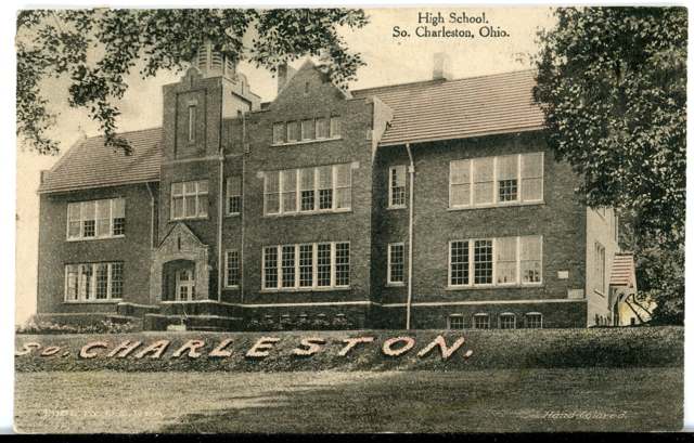
Photo: Columbus Metropolitan Library, via Ohio Digital Network / Digital Public Library of America, public domain · Wikimedia Commons
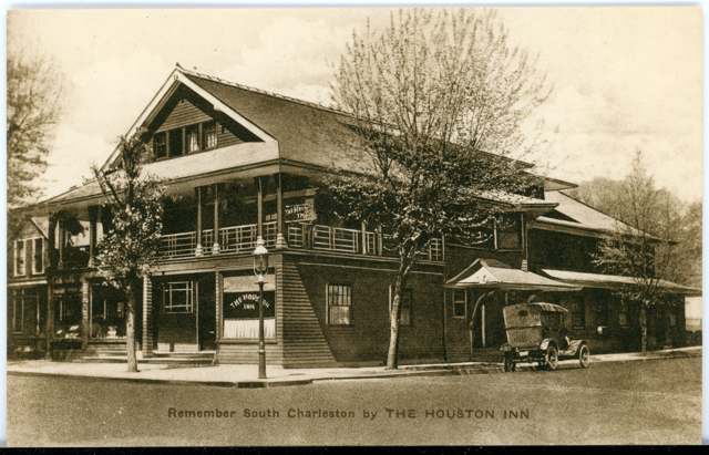
Photo: Columbus Metropolitan Library, via Ohio Digital Network / Digital Public Library of America, no known copyright restrictions · Wikimedia Commons
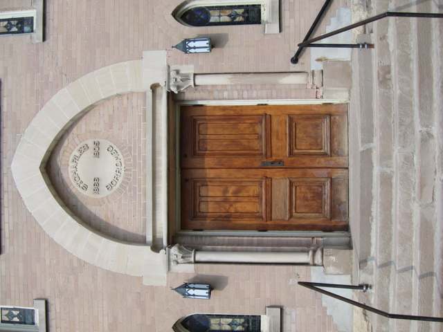
Photo: Photograph by Nheyob, Wikimedia Commons, CC BY-SA 3.0 · Wikimedia Commons
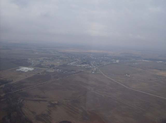
Photo: Photograph by Nyttend, Wikimedia Commons, public domain · Wikimedia Commons
Local history sources: en.wikipedia.org · ohiogenealogyexpress.com · en.wikipedia.org · en.wikipedia.org · en.wikipedia.org · prohibition.osu.edu · hubspringfield.com · commons.wikimedia.org · commons.wikimedia.org · commons.wikimedia.org · commons.wikimedia.org
Water
Mostly private wells The water here
- South Charleston Village90% of residentsGroundwater wells (2 wells)
- Harmony Estates Mobile Home Park10% of residentsGroundwater wells (2 wells)
Hospitals, fire stations and more
Inside South Charleston's boundary: 1 fire or EMS station, 3 public schools, 1 library, 1 police station and 4 spill cases. Press a pin or a name for its whole record and its source.
Fire and EMS stations (1)
-
Madison Township Fire Department and Emergency Medical ServicesSouth Charleston
- Address
- 222 West Columbus Road, South Charleston, OH 45368
- Coordinates
- 39.82598, -83.63955
USGS National Map structures (source) ↗ Street map and directions ↗
Source: USGS National Map structures (most Ohio records last updated 2019 to 2022), checked against the Columbus and Cleveland station lists. The department that answers a call is set by jurisdiction and mutual aid, not by distance.
Public schools (3)
-
Miami View Elementary School3.5 of 5 stars · South Charleston
- Address
- 230 Clifton Rd, South Charleston, OH 45368
- School district
- Southeastern Local School District
- Kind (NCES)
- Regular School
- Students, 2023-24
- 424
- Teachers (full-time equivalent)
- 24
- Report card, 2025-26
- 3.5 of 5 stars
- Performance index
- 76.9%
- Ohio building IRN
- 030106
- NCES school ID
- 390462702497
NCES school record ↗ Ohio School Report Card ↗ Street map and directions ↗
-
Southeastern Sr. High School3.5 of 5 stars · South Charleston
- Address
- 195 E Jamestown St, South Charleston, OH 45368
- School district
- Southeastern Local School District
- Kind (NCES)
- Regular School
- Students, 2023-24
- 180
- Teachers (full-time equivalent)
- 14.48
- Report card, 2025-26
- 3.5 of 5 stars
- Performance index
- 79%
- Four-year graduation rate
- 100%
- Ohio building IRN
- 035196
- NCES school ID
- 390462702498
NCES school record ↗ Ohio School Report Card ↗ Street map and directions ↗
-
Southeastern Jr. High School3.5 of 5 stars · South Charleston
- Address
- 195 E Jamestown St, South Charleston, OH 45368
- School district
- Southeastern Local School District
- Kind (NCES)
- Regular School
- Students, 2023-24
- 84
- Teachers (full-time equivalent)
- 8.72
- Report card, 2025-26
- 3.5 of 5 stars
- Performance index
- 77.1%
- Ohio building IRN
- 139022
- NCES school ID
- 390462703556
NCES school record ↗ Ohio School Report Card ↗ Street map and directions ↗
Source: NCES EDGE public school locations 2024-25 and Common Core of Data 2023-24 (type, students, teachers); Ohio School Report Cards 2025-26 (Department of Education and Workforce), matched by name within the district.
Public libraries (1)
-
Houston BranchBranch · South Charleston
- Address
- 5 W. Jamestown St., South Charleston, OH 45368
- What it is
- Branch
- Library system
- Clark County Public Library
- Open
- 2,808 hours a year, 52 weeks
- Building
- 6,000 sq ft
- System's visits, FY2024
- 348,868
- System's loans, FY2024
- 747,099
- People the system serves
- 129,685
- Phone
- (937) 462-8047
IMLS Public Libraries Survey (source) ↗ Street map and directions ↗
Source: IMLS Public Libraries Survey FY2024 (outlets and their systems). Any Ohio resident can get a free card at any Ohio public library.
Police stations (1)
-
South Charleston Police DepartmentSouth Charleston
- Address
- 35 South Chillicothe Street, South Charleston, OH 45368
- Coordinates
- 39.82450, -83.63490
USGS National Map structures (source) ↗ Street map and directions ↗
Source: USGS National Map structures, police stations, corrected and completed by hand (September 2026). The department that answers a call is set by jurisdiction, not by distance.
Spills reported since 2021 (4)
-
Ammonium Nitrate ((Nh4)(No3)) (H4N2O3)2022-06-18 · South Charleston
- Reported
- 2022-06-18
- What spilled
- Ammonium Nitrate ((Nh4)(No3)) (H4N2O3)
- Where
- South Charleston, Clark County
- Ohio EPA district office
- SWDO
- Ohio EPA case number
- 2206EPA0000914
Ohio EPA spill reports (source) ↗ Street map and directions ↗
-
Grain (All Types) Agricultural2022-03-30 · Null
- Reported
- 2022-03-30
- What spilled
- Grain (All Types) Agricultural
- Where
- Null, Clark County
- Ohio EPA district office
- SWDO
- Ohio EPA case number
- 2203EPA0000429
Ohio EPA spill reports (source) ↗ Street map and directions ↗
-
Oil Transformer Non Pcb2021-12-13 · South Charleston
- Reported
- 2021-12-13
- What spilled
- Oil Transformer Non Pcb
- Largest amount reported
- 30 gallons
- Where
- South Charleston, Clark County
- Ohio EPA district office
- SWDO
- Ohio EPA case number
- 2112EPA0001852
Ohio EPA spill reports (source) ↗ Street map and directions ↗
-
Oil Transformer Non Pcb2021-04-09 · South Charleston
- Reported
- 2021-04-09
- What spilled
- Oil Transformer Non Pcb
- Largest amount reported
- 30 gallons
- Where
- South Charleston, Clark County
- Ohio EPA district office
- SWDO
- Ohio EPA case number
- 2104EPA0000492
Ohio EPA spill reports (source) ↗ Street map and directions ↗
Source: Ohio EPA emergency response spill reports, 2021 to September 2026, one point per case where Ohio EPA placed it. A report is what the caller or responder recorded; amounts are often blank or estimated.
Its ZIP codes
Each ZIP code that touches South Charleston, with the share of its residents who live here and the same headline figures as the ZIP page.
| ZIP | Share | Water | Radon | Home value | Schools | Flood |
|---|---|---|---|---|---|---|
| 45368 Harmony Township and South Charleston | 35% | Mostly private wells | 5.9 pCi/L average radon | Median year built 1965 | Southeastern Local · 3.5 stars overall | 2.4% of residents in the 1% floodplain |
Local government
Who holds office in South Charleston, how its elections and ballot issues came out, and the state auditor's record.
Elections for office
| Date | Office | Candidates and votes |
|---|---|---|
| 2019-11-05 | Member of Commission | Samuel D. Stucky 125, 100.0% |
Winners in bold. Results from the county board of elections' official canvass unless marked.
The county
Clark County: 15 ZIP codes, 19 cities, villages and townships, 135,514 people.
Nearby places
Rain and snow
How much has actually fallen on South Charleston, day by day, from 1893 to now. Daily totals, not averages.
- rain, last 30 days
- 1.06 in
- 2026-09-30 to 2026-10-29
- rain so far in 2026
- 41.9 in
- 5.9 in above normal for the date
- snow so far in 2026
- 16.6 in
- a normal year brings 19.7 in
- a normal year
- 42.1 in
- average of 30 years, 1991-2020
| Month | Rain (in) | Snow (in) | Days counted |
|---|---|---|---|
| October 2026 | 1.05 | — | 29 |
| September 2026 | 4.46 | — | 30 |
| August 2026 | 7.55 | — | 31 |
| July 2026 | 2.25 | — | 31 |
| June 2026 | 3.65 | — | 30 |
| May 2026 | 9.57 | — | 31 |
| April 2026 | 3.25 | — | 30 |
| March 2026 | 6.63 | 0.7 | 31 |
| February 2026 | 2.23 | 3.1 | 28 |
| January 2026 | 1.26 | 12.8 | 31 |
| December 2025 | 2.36 | 8.1 | 31 |
| November 2025 | 2.16 | 0.8 | 30 |
| Wettest year | 2011 — 58.3 in |
|---|---|
| Driest year | 1934 — 23.9 in |
| Snowiest year | 1910 — 53.6 in |
| Wettest day on record | 14 September 1979 — 4.10 in |
| Heaviest snowfall in a day | 19 March 1896 — 12.01 in |
| Deepest snow on the ground | 12 January 1996 — 19.75 in |
Mostly estimated. Only 3% of these days come from a gauge standing inside South Charleston - the rest are worked out from the nearest gauges around it, so read them as close estimates rather than readings.
47,936 days of records, 1893-01-01 to 2026-10-29. Source: NOAA NCEI GHCN-Daily, 3,240 gauges in and around Ohio. A day is "gauged" when a gauge standing inside the boundary reported it, and the value is the mean of those gauges. Otherwise it is interpolated by inverse distance from every gauge reporting within 50 miles. Nothing is carried forward, back-filled or smoothed. Against NOAA nClimDiv county monthly precipitation over 136,848 complete county-months (checked 2026-10-31): correlation 0.9515, median absolute difference 0.217 in a month. Built 2026-10-31 from the Cracked Buckeye precipitation archive. Snow is the softer number — snowfall is measured by hand with a ruler, no agency publishes a gridded county snowfall series, and blowing snow defeats every observer.
Environmental permits and filings
What Ohio EPA has on file for South Charleston: permits, inspections, violations, cleanups and the state loans behind sewer and water work. Every line links to the agency's own document.
- facilities and sites on file
- 6
- those placed on the map inside South Charleston
| Program | Facilities and sites |
|---|---|
| State water loans | 2 |
| Air pollution | 1 |
| Hazardous waste | 1 |
| Public drinking water | 1 |
| Wastewater and stormwater discharge | 1 |
| Date | Facility or site | What |
|---|---|---|
| SOUTH CHARLESTON VILLAGE PWS | Public drinking water compliance letter | |
| SOUTH CHARLESTON VILLAGE PWS | Public drinking water compliance letter | |
| SOUTH CHARLESTON VILLAGE PWS | Public drinking water report | |
| SOUTH CHARLESTON VILLAGE PWS | State water loans | |
| SOUTH CHARLESTON VLG | Public drinking water | |
| SOUTH CHARLESTON VILLAGE PWS | Public drinking water plan | |
| SOUTH CHARLESTON VILLAGE PWS | State water loans | |
| SOUTH CHARLESTON VILLAGE PWS | State water loans | |
| SOUTH CHARLESTON VILLAGE PWS | Public drinking water inspection | |
| SIMPLOT GROWER SOLUTIONS - SOUTH CHARLESTON | Wastewater and stormwater discharge inspection | |
| SOUTH CHARLESTON VILLAGE PWS | Public drinking water inspection | |
| SOUTH CHARLESTON VILLAGE PWS | State water loans | |
| SOUTH CHARLESTON VILLAGE PWS | Public drinking water inspection | |
| SOUTH CHARLESTON VILLAGE PWS | Public drinking water inspection | |
| SOUTH CHARLESTON VILLAGE PWS | Public drinking water warning letter | |
| SOUTH CHARLESTON VILLAGE PWS | State water loans | |
| SOUTH CHARLESTON VILLAGE PWS | Public drinking water compliance letter | |
| SOUTH CHARLESTON VILLAGE PWS | Public drinking water report | |
| SOUTH CHARLESTON VILLAGE PWS | Public drinking water inspection | |
| SOUTH CHARLESTON VILLAGE PWS | Public drinking water notice of violation | |
| SOUTH CHARLESTON VILLAGE PWS | Public drinking water compliance letter | |
| SUNRISE COOPERATIVE-SOUTH CHARLESTON GRAIN | Air pollution inspection | |
| SOUTH CHARLESTON VILLAGE PWS | Public drinking water compliance letter | |
| SOUTH CHARLESTON VILLAGE PWS | Public drinking water inspection | |
| SOUTH CHARLESTON VILLAGE PWS | Public drinking water compliance letter |
Source: Ohio EPA eDocument portal (edocpub.epa.ohio.gov), indexed 2026-10-14. Facilities are placed on the map from Ohio EPA's own map layers, EPA's Facility Registry, coordinates written in the filings, or a geocoded street address. A permit filed under a private person's name (most are household septic systems) is counted but never named, placed or linked; licenses for individual workers and open-burning notices are left out entirely.
Quick answers
What county is South Charleston, Ohio in?
South Charleston is a village in Clark County, Ohio, with 1,706 residents.
When was South Charleston, Ohio founded?
South Charleston was settled 1815; laid out 1815-11-01; incorporated 1818 (first village election held September 19, 1818). Founders on record: Conrad Critz, who laid out the original plat of eight squares of four lots each, surveyed by John T. Stewart. Source
How did South Charleston, Ohio get its name?
The village was first platted and recorded as "Charleston," named for Charles Paist, its first merchant, who later served as an associate judge. Source
What ZIP code is South Charleston, Ohio?
Most of South Charleston is in ZIP code 45368.
Where does South Charleston, Ohio get its water?
The main water source for South Charleston (South Charleston Village): Mostly private wells.
Cite this page
Cite this page as:
Cracked Buckeye, "South Charleston, Clark County", https://crackedbuckeye.com/place/south-charleston/, built 2026-10-31, accessed [date].
How to cite · Report a correction · Built 2026-10-31
