Local events in Port William
Nothing is posted for Port William itself yet; here is what is on within 10 miles. All local events in Port William
Know a calendar we should watch? Send the link
Checked October 20; the events page is refreshed daily.
How Port William began
Port William sits in the northern part of Liberty Township. John Unthank began the village in 1816, west of Todd's Fork where he had built a gristmill in 1807, and called it West Liberty; it was platted on October 18, 1832 for Michael Jenkins, and a post office named Port William opened in 1834, a name that replaced West Liberty. Garland Johnson started its first store in 1829, a woolen factory was built in 1846, and the Dayton, Toledo and Ironton railroad arrived in 1878, making the village the chief town of the northern county and a grain market. Its population peaked at 360 in 1960 and was 229 in 2020.
Settled 1807 (John Unthank's mill); village begun 1816, platted 1832-10-18 (as West Liberty, for Michael Jenkins), by John Unthank began the village in 1816; Michael Jenkins was the proprietor at the 1832 plat.
Where the name comes from
The village was first platted in 1832 under the name West Liberty, matching Liberty Township, which had been organized in 1817. A post office called Port William began operating in 1834, and that name — its origin not established by any source consulted — came to be used for the village itself in place of West Liberty.
Before the town
Two archaeological mounds in Liberty Township, the Keiter Mound and the Hurley Mound, are listed on the National Register of Historic Places (1975 and 1978); no Native village or site at Port William itself is recorded in the sources checked. The 1915 county history says Stephen Mendenhall had only Indians for neighbors in Liberty Township in his first summer of 1803; see the Liberty Township file. The land lies in the Virginia Military District, opened after the Treaty of Greenville (1795).
Nations recorded here: Shawnee, Myaamia (Miami), Lenape (Delaware).
Timeline
- — John Unthank builds a gristmill where Port William now stands, the first mill in that section; township elections are held at the mill for several years.
- — John Unthank starts a village on the west side of Todd's Fork, first called West Liberty; few houses are built before 1829.
- — Liberty Township, in which Port William sits, is organized.
- — Steel Taylor builds a fulling mill below and across the creek from the later woolen factory.
- — The first blacksmith shop is built in the hamlet.
- — Garland Johnson builds a log house and starts the first store in the town.
- — The village is platted as West Liberty.
- — The town is platted for Michael Jenkins, proprietor, as parts of surveys Nos. 4,366 and 1,728.
- — Liberty Township's industrial base is recorded as a flouring mill, two saw mills, a fulling mill, a distillery, and one store.
- — A post office named Port William begins operating in the village; the name eventually supersedes West Liberty.
- — Jonathan Perkins starts the first saloon.
- — Lewis Clark builds a woolen factory, later owned by Moon & Crooper.
- — The Dayton, Toledo and Ironton railroad opens to Port William.
- — Port William has 181 residents in the 1880 census, in a township of 1,201.
- — Port William has about 300 people, a bank, flour mill, elevator, garage, hardware store, hotel and general stores.
- — Port William's population peaks at 360.
- — The U.S. Census records Port William's population at 229, a 9.8 percent decline from 2010.
Stories
Two names for one village
When surveyors platted the village in 1832, they called it West Liberty, a plain echo of the township that held it. But two years later, when the federal government approved a post office for the settlement, it went into the record as Port William instead — a name with no obvious tie to the township, the county, or any local landmark that surviving sources explain. Small Ohio villages often carried two names for a stretch in the nineteenth century, one for the plat map and one for the mail; here, the post-office name won out, and West Liberty faded from use while Port William stuck. By 1833 the place had enough going on to justify the post office and more: a flouring mill grinding local grain, two sawmills cutting the timber being cleared off surrounding farms, a fulling mill finishing homespun wool cloth, a distillery, and a general store — a self-sufficient little industrial cluster typical of a Virginia Military District township filling in with settlers in its second generation.
Photographs
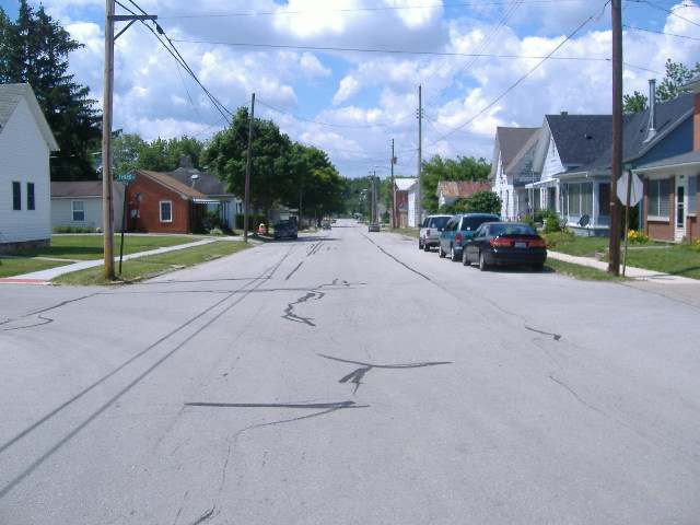
Photo: Aesopposea, CC BY-SA 3.0 · Wikimedia Commons
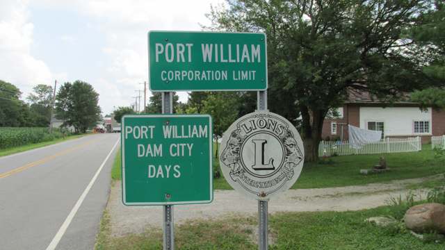
Photo: Aesopposea, CC BY-SA 3.0 · Wikimedia Commons
Local history sources: en.wikipedia.org · en.wikipedia.org · en.wikipedia.org · en.wikipedia.org · remarkableohio.org · hmdb.org · commons.wikimedia.org · commons.wikimedia.org · archive.org · archive.org · en.wikipedia.org
Water
No water-system data is linked to Port William's ZIP codes yet.
Hospitals, fire stations and more
Inside Port William's boundary: 1 fire or EMS station. Press a pin or a name for its whole record and its source.
Fire and EMS stations (1)
-
Port William Fire DepartmentPort William
- Address
- 220 2nd Street, Port William, OH 45164
- Coordinates
- 39.55132, -83.78610
USGS National Map structures (source) ↗ Street map and directions ↗
Source: USGS National Map structures (most Ohio records last updated 2019 to 2022), checked against the Columbus and Cleveland station lists. The department that answers a call is set by jurisdiction and mutual aid, not by distance.
Its ZIP codes
Each ZIP code that touches Port William, with the share of its residents who live here and the same headline figures as the ZIP page.
| ZIP | Share | Water | Radon | Home value | Schools | Flood |
|---|---|---|---|---|---|---|
| 45164 Port William | 98% | Mostly private wells | Too few radon tests | Median year built 1952 | Wilmington City · 3 stars overall | 0.0% of residents in the 1% floodplain |
Local government
Who holds office in Port William, how its elections and ballot issues came out, and the state auditor's record.
Money issues on the ballot since 2021: 1 of 1 passed.
Ballot issues
| Date | Issue | For | Against | Result |
|---|---|---|---|---|
| 2021-11-02 | Issue: Port William Operating Expenses | 19 | 10 | Passed (65.52% for) |
Elections for office
| Date | Office | Candidates and votes |
|---|---|---|
| 2021-11-02 | Member of Council | Greg Adams 19, 25.68%; Robert Collins 19, 25.68%; Gene Powers 19, 25.68%; Dan Thompson 17, 22.97% |
Winners in bold. Results from the county board of elections' official canvass unless marked.
The county
Clinton County: 9 ZIP codes, 21 cities, villages and townships, 47,594 people.
Nearby places
Rain and snow
How much has actually fallen on Port William, day by day, from 1893 to now. Daily totals, not averages.
- rain, last 30 days
- 0.73 in
- 2026-09-30 to 2026-10-29
- rain so far in 2026
- 45.4 in
- 8.3 in above normal for the date
- snow so far in 2026
- 20.4 in
- a normal year brings 23.3 in
- a normal year
- 43.8 in
- average of 30 years, 1991-2020
| Month | Rain (in) | Snow (in) | Days counted |
|---|---|---|---|
| October 2026 | 0.73 | — | 29 |
| September 2026 | 6.59 | — | 30 |
| August 2026 | 8.21 | — | 31 |
| July 2026 | 3.39 | — | 31 |
| June 2026 | 4.32 | — | 30 |
| May 2026 | 6.32 | — | 31 |
| April 2026 | 4.18 | — | 30 |
| March 2026 | 8.10 | 0.8 | 31 |
| February 2026 | 2.05 | 6.9 | 28 |
| January 2026 | 1.52 | 12.7 | 31 |
| December 2025 | 2.66 | 10.9 | 31 |
| November 2025 | 3.55 | 4.6 | 30 |
| Wettest year | 1929 — 60.5 in |
|---|---|
| Driest year | 1930 — 24.6 in |
| Snowiest year | 1951 — 55.2 in |
| Wettest day on record | 4 July 1975 — 4.82 in |
| Heaviest snowfall in a day | 26 November 1950 — 14.02 in |
| Deepest snow on the ground | 21 January 1978 — 21.91 in |
Estimated, not measured. No rain gauge has ever stood inside Port William, so every figure here is worked out from the gauges around it - the nearest ones weighted most. Treat them as close estimates rather than readings.
48,873 days of records, 1893-01-01 to 2026-10-29. Source: NOAA NCEI GHCN-Daily, 3,240 gauges in and around Ohio. A day is "gauged" when a gauge standing inside the boundary reported it, and the value is the mean of those gauges. Otherwise it is interpolated by inverse distance from every gauge reporting within 50 miles. Nothing is carried forward, back-filled or smoothed. Against NOAA nClimDiv county monthly precipitation over 136,848 complete county-months (checked 2026-10-31): correlation 0.9515, median absolute difference 0.217 in a month. Built 2026-10-31 from the Cracked Buckeye precipitation archive. Snow is the softer number — snowfall is measured by hand with a ruler, no agency publishes a gridded county snowfall series, and blowing snow defeats every observer.
Quick answers
What county is Port William, Ohio in?
Port William is a village in Clinton County, Ohio, with 229 residents.
When was Port William, Ohio founded?
Port William was settled 1807 (John Unthank's mill); village begun 1816; laid out 1832-10-18 (as West Liberty, for Michael Jenkins). Founders on record: John Unthank began the village in 1816; Michael Jenkins was the proprietor at the 1832 plat. Source
How did Port William, Ohio get its name?
The village was first platted in 1832 under the name West Liberty, matching Liberty Township, which had been organized in 1817. Source
What ZIP code is Port William, Ohio?
Most of Port William is in ZIP code 45164.
Where does Port William, Ohio get its water?
The main water source for Port William: Mostly private wells.
Cite this page
Cite this page as:
Cracked Buckeye, "Port William, Clinton County", https://crackedbuckeye.com/place/port-william/, built 2026-10-31, accessed [date].
How to cite · Report a correction · Built 2026-10-31
