How Harrisburg began
Harrisburg grew up at a Big Darby Creek crossroads first settled in 1799 by Elijah and Rachel Chenoweth, who bought land from Franklinton founder Lucas Sullivant; their son Joseph Chenoweth had the village surveyed by Frederick Cole in June 1836 on the site of the old Darby Cross Roads post office. It was named for Harrisburg, Pennsylvania, and incorporated in 1851 under first mayor Dr. J. Helmick. A plank turnpike to Columbus (1848-49), two hotels serving stagecoach traffic, a roller mill, and a Methodist church anchored the village through the nineteenth century. It remains a small farm-country village straddling the Franklin-Pickaway county line, with its own elementary school having closed in 2008.
Settled 1799, platted 1836, incorporated 1851, by Elijah and Rachel Chenoweth settled the site in 1799; their son Joseph Chenoweth had it surveyed and platted by Frederick Cole in June 1836.
Where the name comes from
Named for Harrisburg, Pennsylvania. Wikipedia's article on the village (citing Overman's 'Ohio Town Names', 1958, and other place-name references) gives this as the source of the name but no fuller explanation of why that city was chosen; the settlement's earlier, informal names were 'Darby Cross Roads' (for its post office, established 1834) and 'Mudsock.' The 'h' at the end of 'Harrisburgh' was dropped in an official spelling change on March 30, 1893.
Before the town
No mound, earthwork, treaty line, or named Indian village is recorded specifically at Harrisburg or in Pleasant Township in the sources checked; the 1880 county history's Pleasant Township chapter, which recounts local settlement in detail, does not mention a Native site there. The Southwest Franklin County Historical Society states more broadly that 'the Shawnee and Wyandot nations maintained settlements along Darby Creek before white colonization' and that Wyandot people 'joined the white settlers every six weeks for a worship service' in the Pleasant Township area, though it cites no original source for this and it could not be independently verified here. A few miles south on the same Darby Creek, in Jackson Township, Pickaway County, the 1880 county history records a specific, named Shawnee presence: a camp belonging to a man called Captain Johnny, who fought and buried a fellow Shawnee, Cherokee Tom, there after a knife duel. Closer to Harrisburg, at Miller's Station on the Franklin-Pickaway county line (in the ZIP area Harrisburg's water and mail service shares), a Cherokee man named John B. Whitehawk lived with his family of eight -- described as the only Native American household then recorded in that part of Jackson Township -- after nine years as a U.S. Army scout and interpreter during the Indian Wars of 1892-94; he worked afterward as a medicine man and died in 1930. For the fuller, county-wide picture -- prehistoric mound-builder cultures, the historic nations, the treaties that ceded this land, and removal -- see the Franklin County file.
Nations recorded here: Wyandot, Shawnee, Cherokee.
- Captain Johnny's Camp (camp) — on Darby Creek, Jackson Township, Pickaway County, a few miles south of Harrisburg, late 1700s-early 1800s (archive.org)
- Miller's Station (John B. Whitehawk household) (other) — southernmost Jackson Township, Franklin County, near the Franklin-Pickaway line and Harrisburg's ZIP 43146 service area, 1890s-1930 (swfchs.org)
Timeline
- — Elijah and Rachel Chenoweth, with brother Thomas, arrive from Maryland by way of Pike County and buy 200 acres each from Lucas Sullivant at the Big Darby Creek crossroads that becomes known as Darby Cross Roads.
- — Cassandra Chenoweth, daughter of Elijah and Rachel, is born December 9 -- the first white child born in Pleasant Township.
- — Pleasant Township, embracing several times its later area, is formally organized; it is reduced to its present bounds by the formation of Jackson Township (1815) and Prairie Township (1819).
- — A log schoolhouse is built in what is now the southwest corner of Harrisburg village, replacing an even earlier log-cabin school taught from 1811 by Thomas Miller.
- — Dr. Lemuel Boyd begins practicing medicine at Harrisburgh, the settlement's earliest recorded physician.
- — The Big Darby post office is established at the crossroads; it is renamed the Harrisburgh post office the following year.
- — Joseph Chenoweth has Frederick Cole survey and plat the village of Harrisburgh, on the site of the Darby Cross Roads post office, in June.
- — Dr. Thomas Thompson arrives from Philadelphia and becomes the village's leading physician until his death around 1840; George Geiger and William Foresman open the first store on March 24.
- — The growing Methodist class, meeting since about 1810 in the Chenoweth family's log house, builds its first church, a 40-by-50-foot brick building.
- — A wood-plank 'corduroy' turnpike, the Harrisburg Pike, is completed between Columbus and Harrisburg, with tolls of ten cents each way.
- — The village of Harrisburgh incorporates, one year before neighboring Grove City; Dr. J. Helmick serves as first mayor.
- — A larger brick Methodist church, 41 by 61 feet and costing $2,800, replaces the 1842 building.
- — A new two-story brick schoolhouse, 30 by 60 feet and costing $5,000, is completed for the village school district organized in 1870.
- — The village's spelling is officially changed from 'Harrisburgh' to 'Harrisburg' on March 30.
- — Harrisburg Elementary School closes after a failed levy; students merge into Darbydale Elementary and the vacant building is demolished six years later.
Stories
The Chenoweths at Darby Cross Roads
In 1799 Elijah and Rachel Chenoweth left Pike County with their two children and came to the forks of Big Darby Creek, where Elijah and his brother Thomas each bought 200 acres from Lucas Sullivant, the founder of Franklinton. They built log cabins that same fall, planted an orchard around 1800, and buried their dead on the family farm -- the first burials in what became Pleasant Township. Their daughter Cassandra, born December 9, 1800, was the township's first recorded white child; she grew up, married John Morgan, and eventually moved west. Meetings of Methodist settlers were held in Thomas Chenoweth's log house as early as 1810, and the crossroads where the family settled -- first called Darby Cross Roads -- would carry the Chenoweth name in local memory long after it was platted as Harrisburg.
Joseph Chenoweth Plats a Village
Elijah's son Joseph Chenoweth built the family's early trading success -- livestock drives and land dealing that grew his holdings to 1,600 acres and routes to Chillicothe and Baltimore -- into local political standing, serving two terms as a state representative starting in 1841. In June 1836 he hired surveyor Frederick Cole to lay out a village on the old post-office crossroads, naming it Harrisburgh. George Geiger and William Foresman opened the first store the following spring in a small building in what is now the village's southwest corner; Chenoweth himself later bought into the business. By the time the 1880 county history was written, Harrisburgh's business row -- descended from that first store -- held dry-goods dealers, grocers, and a druggist, all doing business a few hundred feet from where the Chenoweth brothers had cut their first logs.
Stagecoach Days on the Harrisburg Pike
Before the railroad reached this part of Franklin County, Harrisburg's business came from the road. A mail route between Columbus and Cincinnati that passed through the area once ran in 9.5 hours, a record that stood until steam power replaced horses. In 1848-49 a wood-plank 'corduroy' turnpike -- logs laid crosswise and covered with planking -- was built connecting Harrisburg to Columbus, with tollgates charging ten cents each way; the state did not take over the road until 1915. White Hall, later renamed the United States Hotel, served as a coach stop where teams were changed, and the rival Swysgood House, run by hotel-and-saloon keeper Samuel Swysgood (who also served as village marshal in 1854), gave travelers a second choice. The village supported its own ten-piece band under C. V. Sheeders, a detail that suggests a livelier crossroads than its small size today would imply.
Miller's Station and a Cherokee Scout
A short way south of Harrisburg, where the Grove City Electric Interurban ran between Columbus, Grove City, and Orient, a stop called Miller's Station grew up on land owned by Charles C. Miller and his wife Wilhelmina Kropp Miller, who allowed the tracks to cross their property. Among its residents in the early twentieth century was John B. Whitehawk, a Cherokee man who had served nine years as a U.S. Army scout and interpreter during the Indian Wars of 1892 to 1894 and who worked afterward as a medicine man; he died in 1930. His household of eight is recorded as the only Native American family then living in that part of the township -- a reminder that Native presence in this corner of Ohio did not end with eighteenth-century removals, even where, as at Harrisburg itself, no earlier village or treaty site is recorded.
A Schoolhouse a Few Miles South, and a Lost Name Nearby
Two of the leads in Harrisburg's own records point just outside the village. The Scioto Township District No. 2 Schoolhouse, an 1888 one-room school built by Ater & Kern and listed on the National Register in 1987, stands on Snyder Road between Commercial Point and Orient -- inside Scioto Township, Pickaway County, several miles from Harrisburg, though within the rural ZIP code the village's water and mail service shares. And the place name 'Millers,' recorded in that same ZIP area, most likely refers not to a distinct village but to Miller's Station, the interurban stop described above. Neither site is part of Harrisburg's own history, but both sat inside the same rural crossroads world the Chenoweth family's descendants farmed and traded in for a century after 1799.
Photographs
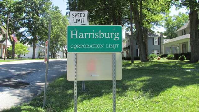
Photo: Aesopposea, CC BY-SA 3.0 · Wikimedia Commons
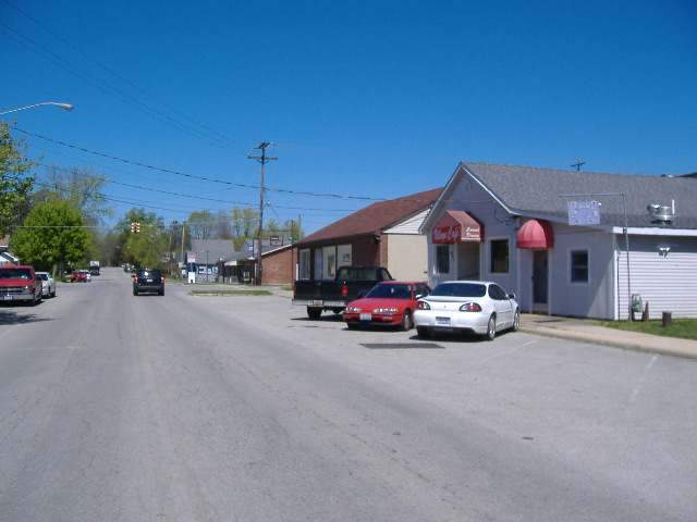
Photo: Aesopposea, CC BY-SA 3.0 · Wikimedia Commons
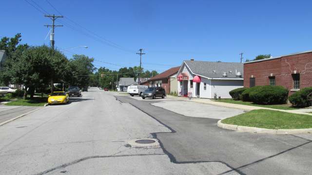
Photo: Aesopposea, CC BY-SA 3.0 · Wikimedia Commons
Local history sources: en.wikipedia.org · harrisburgohio.gov · swfchs.org · swfchs.org · genealogybug.net · archive.org · ohioexploration.com · commons.wikimedia.org · commons.wikimedia.org · commons.wikimedia.org
Water
No water-system data is linked to Harrisburg's ZIP codes yet.
Its ZIP codes
Each ZIP code that touches Harrisburg, with the share of its residents who live here and the same headline figures as the ZIP page.
| ZIP | Share | Water | Radon | Home value | Schools | Flood |
|---|---|---|---|---|---|---|
| 43126 Harrisburg | 100% | Mostly private wells | 5.7 pCi/L average radon | Median year built 1920 | South-Western City · 3 stars overall | 7.1% of residents in the 1% floodplain |
The county
Franklin County: 45 ZIP codes, 42 cities, villages and townships, 1,356,733 people.
Nearby places
No nearby place shares a ZIP code with Harrisburg in the atlas yet.
Cite this page
Cite this page as:
Cracked Buckeye (Open Shower Co), "Harrisburg, Franklin County", https://crackedbuckeye.com/place/harrisburg/, built 2026-09-16, accessed [date].
Machine-readable: /api/place/harrisburg.json (open JSON, CC BY 4.0 for the compilation; the underlying records keep their own terms) · How to cite · Report a correction · Built 2026-09-16