Local events in Georgetown
3 events in the next 90 days from 2 public calendars. All local events in Georgetown
Checked October 20; the events page is refreshed daily.
Notable people from Georgetown
Ohioans tied to this place, each with a sourced profile. All notable Ohioans
How Georgetown began
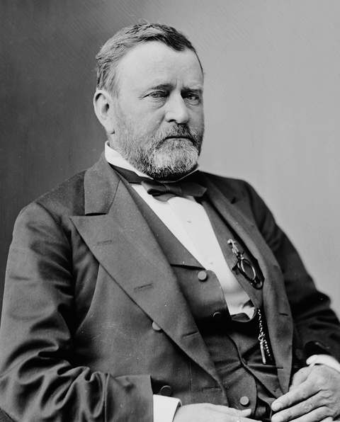
Georgetown was platted in 1819 and named for Georgetown, Kentucky, becoming county seat the same year Brown County was organized. It is nationally known as the boyhood home of Ulysses S. Grant, whose father Jesse built a brick house there in 1823 where the future general and president lived until he left for West Point in 1839. Seventeen acres of the village, including the Grant house and schoolhouse, form the Georgetown Historic District on the National Register of Historic Places.
Platted 1819, incorporated 1818.
Where the name comes from
Named for Georgetown, Kentucky, by early settlers.
Before the town
No Native American village, mound or trail specific to Georgetown is recorded in the sources checked. The site lies within the 1795 Treaty of Greenville cession and the Virginia Military District, land that was Shawnee and Miami hunting ground before American survey and settlement began in the county in the early 1800s.
Nations recorded here: Shawnee, Miami.
Timeline
- — March 1: Brown County is organized with Georgetown as its seat.
- — Georgetown is platted.
- — A post office is established at Georgetown.
- — Jesse and Hannah Grant build the brick house at what is now 219 Grant Avenue; their son Hiram Ulysses Grant, one year old when the family arrived from Point Pleasant, lives there until 1839.
- — Jesse Root Grant, the president's father, serves as mayor of Georgetown.
- — The Grant Boyhood Home is listed on the National Register of Historic Places; it is designated a National Historic Landmark in 1985.
- — The seventeen-acre Georgetown Historic District, including the Grant home and schoolhouse, is added to the National Register of Historic Places.
Stories
A tannery boy who became a general
When Jesse and Hannah Grant moved from Point Pleasant to Georgetown in 1823, their one-year-old son Hiram Ulysses came with them, and it was in this brick house on what is now Grant Avenue that he grew up. Jesse ran a tannery in town and served as Georgetown's mayor in 1837, while young Ulysses attended the local subscription school and worked hauling wood and hides, developing a skill with horses that stayed with him for life. He left Georgetown in 1839 at age seventeen for the United States Military Academy at West Point, where a congressman's clerical error changed his name to Ulysses S. Grant, and went on to command the Union armies in the Civil War and serve as the eighteenth president. The Georgetown house, schoolhouse, and the surrounding seventeen-acre historic district are preserved today as the U.S. Grant Boyhood Home, a National Historic Landmark.
Local history sources: en.wikipedia.org · en.wikipedia.org · loc.gov · en.wikipedia.org · ohiohistory.org · en.wikipedia.org
Historic places
4 places in Georgetown on the National Register of Historic Places, 1 of them National Historic Landmark. Press a pin or a name for its whole record.
-
Grant, Ulysses S., Boyhood Home LandmarkBuilding · Georgetown · listed 1976
- Address
- 219 E. Grant Ave.
- Where
- Georgetown, Brown County · ZIP 45121
- What it is
- Building
- Listed on the National Register
- 1976
- National Historic Landmark
- Yes
- NRIS reference number
- 76001374
- Coordinates
- 38.86614, -83.90202
National Register file (NPS) ↗ Search Wikipedia ↗ Street map and directions ↗ On the Cracked Buckeye map
-
Bailey-Thompson HouseBuilding · Georgetown · listed 1976
- Address
- 112 N. Water St.
- Where
- Georgetown, Brown County · ZIP 45121
- What it is
- Building
- Listed on the National Register
- 1976
- NRIS reference number
- 76001373
- Coordinates
- 38.86642, -83.90134
National Register file (NPS) ↗ Search Wikipedia ↗ Street map and directions ↗ On the Cracked Buckeye map
-
Buckner, Dr. Philip, House And BarnBuilding · Georgetown · listed 1978
- Address
- 610 S. Main St.
- Where
- Georgetown, Brown County · ZIP 45121
- What it is
- Building
- Listed on the National Register
- 1978
- NRIS reference number
- 78002010
- Coordinates
- 38.86093, -83.90481
National Register file (NPS) ↗ Search Wikipedia ↗ Street map and directions ↗ On the Cracked Buckeye map
-
Georgetown Public SchoolBuilding · Georgetown · listed 1991
- Address
- 307 W. Grant Ave.
- Where
- Georgetown, Brown County · ZIP 45121
- What it is
- Building
- Listed on the National Register
- 1991
- NRIS reference number
- 90002215
- Coordinates
- 38.86579, -83.90708
National Register file (NPS) ↗ Search Wikipedia ↗ Street map and directions ↗ On the Cracked Buckeye map
Source: National Park Service, National Register of Historic Places point file. The listing year is shown where NPS's certification date agrees with the listing's reference number. Listing recognizes significance; it does not restrict a private owner.
Water
Mostly private wells The water here
- Georgetown Village95% of residentsOhio River Valley Aquifer (wells)
- Tate-monroe Water Association5% of residentsOhio River valley aquifer (collector/vertical wells)
Hospitals, fire stations and more
Inside Georgetown's boundary: 1 hospital, 1 health center, 1 dialysis center, 1 nursing home, 1 fire or EMS station, 3 public schools, 1 library, 2 museums, 2 police stations, 1 Toxics Release Inventory facility and 3 spill cases. Press a pin or a name for its whole record and its source.
Hospitals (1)
-
Georgetown Behavioral HospitalPsychiatric hospital · Georgetown
- What it is
- Psychiatric hospital
- Address
- 425 Home Street, Georgetown, OH 45121
- County
- Brown County
- Beds
- 49
- Helipad
- Yes
- Ownership
- Proprietary
- Phone
- (813) 559-9870
Where HIFLD got this record ↗ HIFLD hospitals (source) ↗ Street map and directions ↗
Source: HIFLD hospitals inventory via FEMA (closed hospitals it still lists left out, hospitals opened since added), with Medicare Care Compare ratings matched by name and address.
Community health centers (1)
-
HealthSource GeorgetownHealth center · Georgetown
- Run by
- a federally qualified health center
- Setting
- Clinic
- City
- Georgetown
- Coordinates
- 38.86399, -83.89483
Find a Health Center (HRSA) ↗ HRSA data (source) ↗ Street map and directions ↗
Source: HRSA health center service delivery sites, active, September 2026 (school-based sites left out). Health centers see patients whether or not they have insurance, with fees on a sliding scale.
Dialysis centers (1)
-
Davita Us Grant DialysisDialysis · Georgetown
- Address
- 458 Home Street, Georgetown, OH 45121
- Dialysis stations
- 12
- Medicare star rating
- 2 of 5 stars
- Services
- in-center hemodialysis
- Ownership
- for profit
- Chain
- DaVita
- Medicare certified since
- 2009-02-04
- Phone
- (937) 378-1323
- Medicare ID
- 362735
Medicare Care Compare ↗ CMS dialysis facility list (source) ↗ Street map and directions ↗
Source: CMS dialysis facility list, September 2026, geocoded with the Census Bureau batch geocoder (an address it could not place sits at its ZIP center).
Nursing homes (1)
-
Ohio Veterans Home - Georgetown5 of 5 stars · Georgetown
- Address
- 2003 Veterans Blvd, Georgetown, OH 45121
- Certified beds
- 168
- Residents on an average day
- 98
- Medicare overall rating
- 5 of 5 stars
- Health inspections
- 5 of 5 stars
- Staffing
- 5 of 5 stars
- Quality measures
- 4 of 5 stars
- Penalties since 2023
- none
- Ownership
- Government - State
- Takes
- Medicare and Medicaid
- Phone
- (937) 378-2900
- Medicare ID
- 366351
Medicare Care Compare ↗ CMS nursing home data (source) ↗ Street map and directions ↗
Source: CMS Care Compare nursing home provider and penalties files; Medicare star ratings run 1 to 5.
Fire and EMS stations (1)
-
Georgetown Fire DepartmentGeorgetown
- Address
- 831 Mount Orab Pike, Georgetown, OH 45121
- Coordinates
- 38.87593, -83.90185
USGS National Map structures (source) ↗ Street map and directions ↗
Source: USGS National Map structures (most Ohio records last updated 2019 to 2022), checked against the Columbus and Cleveland station lists. The department that answers a call is set by jurisdiction and mutual aid, not by distance.
Public schools (3)
-
Georgetown Elementary School4 of 5 stars · Georgetown
- Address
- 935 Mt. Orab Pike, Georgetown, OH 45121
- School district
- Georgetown Ex Vill School District
- Kind (NCES)
- Regular School
- Students, 2023-24
- 550
- Teachers (full-time equivalent)
- 31
- Report card, 2025-26
- 4 of 5 stars
- Performance index
- 81.2%
- Ohio building IRN
- 031252
- NCES school ID
- 390453702194
NCES school record ↗ Ohio School Report Card ↗ Street map and directions ↗
-
Georgetown Jr/Sr High School4.5 of 5 stars · Georgetown
- Address
- 987 Mount Orab Pike, Georgetown, OH 45121
- School district
- Georgetown Ex Vill School District
- Kind (NCES)
- Regular School
- Students, 2023-24
- 429
- Teachers (full-time equivalent)
- 26
- Report card, 2025-26
- 4.5 of 5 stars
- Performance index
- 80.7%
- Four-year graduation rate
- 98.6%
- Ohio building IRN
- 013326
- NCES school ID
- 390453702192
NCES school record ↗ Ohio School Report Card ↗ Street map and directions ↗
-
Southern Hills Career Technical CenterGeorgetown
- Address
- 9193 Hamer Rd, Georgetown, OH 45121
- Kind (NCES)
- Career and Technical School
- Students, 2023-24
- 449
- Teachers (full-time equivalent)
- 23
- NCES school ID
- 390507904052
Source: NCES EDGE public school locations 2024-25 and Common Core of Data 2023-24 (type, students, teachers); Ohio School Report Cards 2025-26 (Department of Education and Workforce), matched by name within the district.
Public libraries (1)
-
Mary P. Shelton Public LibraryCentral library · Georgetown
- Address
- 200 W. Grant Ave., Georgetown, OH 45121
- What it is
- Central library
- Library system
- Brown County Public Library
- Open
- 1,872 hours a year, 52 weeks
- Building
- 8,000 sq ft
- System's visits, FY2024
- 87,880
- System's loans, FY2024
- 257,017
- People the system serves
- 29,902
- Phone
- (937) 378-3197
IMLS Public Libraries Survey (source) ↗ Street map and directions ↗
Source: IMLS Public Libraries Survey FY2024 (outlets and their systems). Any Ohio resident can get a free card at any Ohio public library.
Museums, historical societies, gardens and zoos (2)
-
Brown County Historical SocietyHistorical society · Georgetown
- What it is
- Historical society
- City
- Georgetown
- Coordinates
- 38.87045, -83.90380
Search Wikipedia ↗ IMLS Museum Data Files (source) ↗ Street map and directions ↗
The museum list is IMLS's 2018 file; a museum may have closed or moved since.
-
U.S. Grant Homestead AssociationHistorical society · Georgetown
- What it is
- Historical society
- City
- Georgetown
- Coordinates
- 38.86489, -83.90716
Search Wikipedia ↗ IMLS Museum Data Files (source) ↗ Street map and directions ↗
The museum list is IMLS's 2018 file; a museum may have closed or moved since.
Source: IMLS Museum Data Files, 2018.
Police stations (2)
-
Brown County Sheriff's OfficeGeorgetown
- Address
- 750 Mount Orab Pike, Georgetown, OH 45121
- Coordinates
- 38.87469, -83.89972
USGS National Map structures (source) ↗ Street map and directions ↗
-
Georgetown Police DepartmentGeorgetown
- Address
- 108 East State Street, Georgetown, OH 45121
- Coordinates
- 38.86442, -83.90433
USGS National Map structures (source) ↗ Street map and directions ↗
Source: USGS National Map structures, police stations, corrected and completed by hand (September 2026). The department that answers a call is set by jurisdiction, not by distance.
Facilities reporting toxic releases (1)
-
Stanley Black & DeckerToxics Release Inventory · Georgetown
- Address
- 9301 Hamer Road, Georgetown, OH 45121
- County
- Brown County
- Status
- Reports to the Toxics Release Inventory (closed)
- EPA program ID
- 45121MCTLS9301H
- EPA registry ID
- 110001629907
EPA facility record ↗ EPA Facility Registry Service (source) ↗ Street map and directions ↗
Source: EPA Facility Registry Service, Toxics Release Inventory reporters. Reporting a release is required of large users of listed chemicals; it is not by itself a violation.
Spills reported since 2021 (3)
-
Herbicide(S) Nos (Not Specified)2021-07-06 · Georgetown
- Reported
- 2021-07-06
- What spilled
- Herbicide(S) Nos (Not Specified)
- Where
- Georgetown, Brown County
- Ohio EPA district office
- SWDO
- Ohio EPA case number
- 2107EPA0000992
Ohio EPA spill reports (source) ↗ Street map and directions ↗
-
Sewage Human Reached water2021-06-24 · Georgetown
- Reported
- 2021-06-24
- What spilled
- Sewage Human
- Reached a waterway
- 99 - Unnamed
- Where
- Georgetown, Brown County
- Ohio EPA district office
- SWDO
- Ohio EPA case number
- 2106EPA0000923
Ohio EPA spill reports (source) ↗ Street map and directions ↗
-
Fuel Diesel / Diesel Fuel (Vehicle On Or Off Road)2026-09-02 · Georgetown
- Reported
- 2026-09-02
- What spilled
- Fuel Diesel / Diesel Fuel (Vehicle On Or Off Road); Oil Hydraulic Fluid(S)
- Largest amount reported
- 100 gallons
- Where
- Georgetown, Brown County
- Ohio EPA district office
- SWDO
- Ohio EPA case number
- 2609EPA0001642
Ohio EPA spill reports (source) ↗ Street map and directions ↗
Source: Ohio EPA emergency response spill reports, 2021 to September 2026, one point per case where Ohio EPA placed it. A report is what the caller or responder recorded; amounts are often blank or estimated.
Its ZIP codes
Each ZIP code that touches Georgetown, with the share of its residents who live here and the same headline figures as the ZIP page.
| ZIP | Share | Water | Radon | Home value | Schools | Flood |
|---|---|---|---|---|---|---|
| 45121 Georgetown | 50% | Mostly private wells | 2.9 pCi/L average radon | Appraisal records without year built | Georgetown Exempted Village · 4.5 stars overall | 1.8% of residents in the 1% floodplain |
Local government
Who holds office in Georgetown, how its elections and ballot issues came out, and the state auditor's record.
Elections for office
| Date | Office | Candidates and votes |
|---|---|---|
| 2021-11-02 | Member of Council | Mike D. Mays 352, 18.24%; Nancy Montgomery 308, 15.96%; Kelly L. Cornette 307, 15.91%; Mark Robert Anderson 274, 14.2%; Jeremy Jones 260, 13.47%; David M. Guenther 232, 12.02%; Andrew Clift 197, 10.21% |
| 2021-11-02 | Member of Council | Steve Wolfe 459, 56.88%; Jeremy Varner 348, 43.12% |
Winners in bold. Results from the county board of elections' official canvass unless marked.
Auditor of State record
- No fiscal caution, watch or emergency on the Auditor of State's lists.
- Financial Audit, 2020 to 2021, released 2024-10-08
The county
Brown County: 11 ZIP codes, 25 cities, villages and townships, 39,201 people.
Nearby places
Rain and snow
How much has actually fallen on Georgetown, day by day, from 1887 to now. Daily totals, not averages.
- rain, last 30 days
- 2.40 in
- 2026-10-01 to 2026-10-30
- rain so far in 2026
- 34.5 in
- 5.7 in below normal for the date
- snow so far in 2026
- 13.8 in
- a normal year brings 15.5 in
- a normal year
- 47.2 in
- average of 30 years, 1991-2020
| Month | Rain (in) | Snow (in) | Days counted |
|---|---|---|---|
| October 2026 | 2.40 | — | 30 |
| September 2026 | 2.67 | — | 30 |
| August 2026 | 3.51 | — | 31 |
| July 2026 | 4.53 | — | 31 |
| June 2026 | 4.00 | — | 30 |
| May 2026 | 5.88 | — | 31 |
| April 2026 | 2.76 | — | 30 |
| March 2026 | 5.99 | 0.2 | 31 |
| February 2026 | 0.82 | 5.7 | 28 |
| January 2026 | 1.98 | 8.0 | 31 |
| December 2025 | 3.02 | 8.4 | 31 |
| November 2025 | 3.20 | 1.6 | 30 |
| Wettest year | 2011 — 61.4 in |
|---|---|
| Driest year | 1930 — 23.8 in |
| Snowiest year | 1917 — 54.0 in |
| Wettest day on record | 2 March 1997 — 6.34 in |
| Heaviest snowfall in a day | 17 January 1994 — 15.70 in |
| Deepest snow on the ground | 21 January 1994 — 19.06 in |
Mostly estimated. Only 3% of these days come from a gauge standing inside Georgetown - the rest are worked out from the nearest gauges around it, so read them as close estimates rather than readings.
50,410 days of records, 1887-09-01 to 2026-10-30. Source: NOAA NCEI GHCN-Daily, 3,240 gauges in and around Ohio. A day is "gauged" when a gauge standing inside the boundary reported it, and the value is the mean of those gauges. Otherwise it is interpolated by inverse distance from every gauge reporting within 50 miles. Nothing is carried forward, back-filled or smoothed. Against NOAA nClimDiv county monthly precipitation over 136,848 complete county-months (checked 2026-11-01): correlation 0.9515, median absolute difference 0.217 in a month. Built 2026-11-01 from the Cracked Buckeye precipitation archive. Snow is the softer number — snowfall is measured by hand with a ruler, no agency publishes a gridded county snowfall series, and blowing snow defeats every observer.
Environmental permits and filings
What Ohio EPA has on file for Georgetown: permits, inspections, violations, cleanups and the state loans behind sewer and water work. Every line links to the agency's own document.
- facilities and sites on file
- 18
- those placed on the map inside Georgetown
Data centers, power and big tech here. Ohio EPA files that name a data-center company, a power plant or substation, or a large technology firm:
- BROWN COUNTY LANDFILL GAS POWER STATION (air pollution, latest Sep 8, 2026)
| Program | Facilities and sites |
|---|---|
| Air pollution | 3 |
| Hazardous waste | 3 |
| State sewer loans | 3 |
| Wastewater and stormwater discharge | 3 |
| State water loans | 2 |
| Industrial landfills | 1 |
| Landfills | 1 |
| Public drinking water | 1 |
| Site assessment | 1 |
Source: Ohio EPA eDocument portal (edocpub.epa.ohio.gov), indexed 2026-10-14. Facilities are placed on the map from Ohio EPA's own map layers, EPA's Facility Registry, coordinates written in the filings, or a geocoded street address. A permit filed under a private person's name (most are household septic systems) is counted but never named, placed or linked; licenses for individual workers and open-burning notices are left out entirely.
Quick answers
What county is Georgetown, Ohio in?
Georgetown is a village in Brown County, Ohio, with 4,492 residents.
When was Georgetown, Ohio founded?
Georgetown was laid out 1819; incorporated 1818. Source
How did Georgetown, Ohio get its name?
Named for Georgetown, Kentucky, by early settlers. Source
What ZIP code is Georgetown, Ohio?
Most of Georgetown is in ZIP code 45121.
Where does Georgetown, Ohio get its water?
The main water source for Georgetown (Georgetown Village): Mostly private wells.
Cite this page
Cite this page as:
Cracked Buckeye, "Georgetown, Brown County", https://crackedbuckeye.com/place/georgetown/, built 2026-10-31, accessed [date].
How to cite · Report a correction · Built 2026-10-31