Plays from YouTube when you press play.
Then and now · 2026-09-26
Ohio, then and now: 14 places from the air, 1887 to today
Old aerial photos and fire-insurance maps of 14 Ohio places, swiped to the same ground today: a prison that became an arena district, a village that was bought out and erased, a downtown mall that became a park, and farm fields that became suburbs. Every picture is a real one, credited below, and every old map and aerial photo of your own town is free to look at on Cracked Buckeye.
Chapters:
0:00 Columbus: the Ohio Penitentiary in 1995
0:18 North Randall: race track, mall, Amazon warehouse
0:36 Cleveland: the old Stadium in 1993
0:52 New Burlington: the village that was bought out
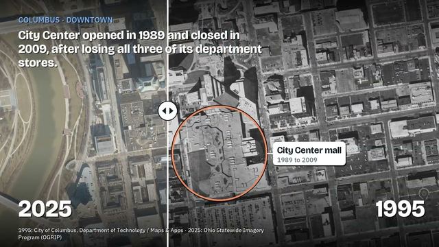
1:06 Columbus: City Center mall in 1995
1:20 Columbus: the Crew stadium site in 1995
1:33 Cleveland: Gateway under construction, 1993
1:48 Forest Park: farmland to a city, 1950 to today
2:05 Downtown Columbus in 1887
2:22 Perry: the nuclear plant site in 1937
2:35 Easton: farm fields in 1995
2:50 Westlake: before Crocker Park
3:04 Mentor: 1937 to today
3:18 Gahanna in 1922
3:31 Which place should we do next?
Sources and credits, by place:
- Columbus, Arena District: Wikipedia; Columbus Downtown Development Corp. (Scioto Greenways). Aerials: City of Columbus (1995), Ohio Statewide Imagery Program, OGRIP (2025)
- North Randall: Encyclopedia of Cleveland History (Case Western Reserve Univ.); Wikipedia; WKYC (2018). USGS topo (1963); Cuyahoga County GIS (1993); OGRIP (2025)
- Cleveland lakefront: Encyclopedia of Cleveland History; Wikipedia. Cuyahoga County GIS (1993, 2002); OGRIP (2025)
- New Burlington: Wikipedia; Fairborn Daily Herald (2016). USGS New Burlington quadrangle (1968); OGRIP (2022-25)
- Columbus City Center: Wikipedia. City of Columbus (1995); OGRIP (2025)
- Crew stadium site, Astor Park: WOSU (2019); Wikipedia. City of Columbus (1995); OGRIP (2025)
- Cleveland, Gateway: Wikipedia; Encyclopedia of Cleveland History. Cuyahoga County GIS (1993, 2002); OGRIP (2025)
- Forest Park: Wikipedia. CAGIS, Hamilton County (1950, 1962, 1977); OGRIP (2018)
- Downtown Columbus, 1887: Sanborn Map Company, Library of Congress (map colors: LoC, "Interpreting Sanborn Maps"); Wikipedia. OGRIP (2025)
- Perry: Wikipedia; Center for Land Use Interpretation. Lake County GIS (1937, 1973); OGRIP (2025)
- Easton: Wikipedia; USA Today Network (2019). City of Columbus (1995, 2000); OGRIP (2025)
- Westlake, Crocker Park: Wikipedia. Cuyahoga County GIS (1993, 2002); OGRIP (2025)
- Mentor: Lake County GIS (1937, 1973); OGRIP (2025)
- Gahanna, Mill Street: Sanborn Map Company, Library of Congress (1922); OGRIP (2025)
Watch on YouTube. Follow us on YouTube, TikTok, Facebook, Instagram.
More videos
 Big Muskie: The Biggest Machine That Ever Walked Ohio (and What Killed It)
 Siamese: None. The Story of Asian Ohio
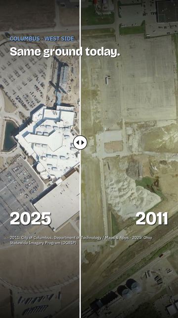 The Columbus casino that used to be a GM plant
 Ohio Senate Attack Ads, Fact-Checked: Part 2 (Husted vs. Brown)
 Ohio Senate Attack Ads, Fact-Checked: Part 1 (Husted vs. Brown)
 Ohio Governor Attack Ads, Fact-Checked (Both Sides)
Cite this page
Cite this page as:
Cracked Buckeye, "Ohio, then and now: 14 places from the air, 1887 to today", https://crackedbuckeye.com/videos/ohio-then-and-now/, built 2026-10-04, accessed [date].
How to cite · Report a correction · Built 2026-10-04